Mapmakers
Your search for Anderson, James returned 63 records.
Ordered chronologically (undated items first).
| Field | Content | |
|---|---|---|
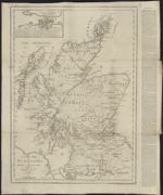
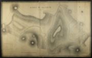
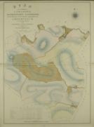
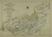
| Name: | Anderson, James | |
| Title: | A new map of Scotland; : the Hebrides and western coasts in particular being laid down from the best authorities corrected by late observations. | |
| Imprint: | [Edinburgh : Printed for C Elliot and GGJ and J Robinson London, 1785. | |
| Zoom Into Map: | Click on the map to view in greater detail. | |
| Field | Content | |
|---|---|---|
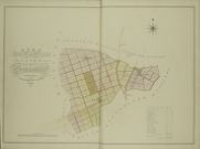
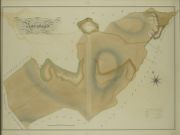
| Name: | Anderson, James (fl. 1804-1856) | |
| Title: | Plans of the Property of William Forbes Esq. of Callendar: Plans of the Farms of Strangassill, Todston, Mosscroft, The Barleas, Ardock, Earlstoun, Barskeoch-Mains, Waterside, Cavan, Greenloop, Hannastoun, Barchoak, Over-Barskeoch, Knocksheen. | |
| Subtitle: | 1 | |
| Imprint: | 1800 | |
| Zoom Into Map: | Click on the map to view in greater detail. | |
| Field | Content | |
|---|---|---|
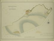
| Name: | Anderson, James (fl. 1804-1856) | |
| Title: | Part of plan & section of the principal common sewer [in Edinburgh] from St. Cuthberts Church to Croftangry Lane / surveyed by James Anderson under the direction of James Jardine ... 1813. 100 ft. to an inch. | |
| Imprint: | [Edinburgh] : s.n., 1813 | |
| Zoom Into Map: | Click on the map to view in greater detail. | |
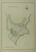
| Field | Content | |
|---|---|---|
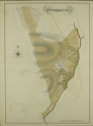
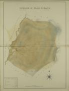
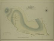
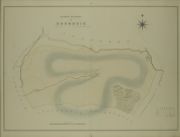
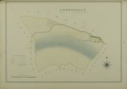
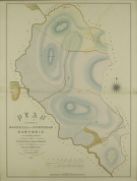
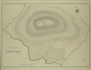
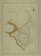
| Name: | Anderson, James (fl. 1804-1856) | |
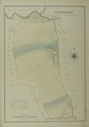
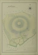
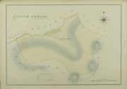
| Title: | Toddston & Mosscroft | |
| Imprint: | 1815 | |
| Zoom Into Map: | Click on the map to view in greater detail. | |
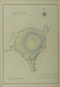
| Field | Content | |
|---|---|---|
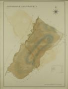
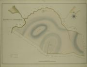
| Name: | Anderson, James (fl. 1804-1856) | |
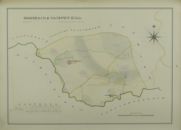
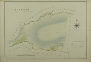
| Title: | Auchrae & Polchaskie | |
| Imprint: | 1815 | |
| Zoom Into Map: | Click on the map to view in greater detail. | |
| Field | Content | |
|---|---|---|
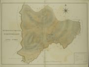
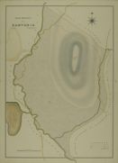
| Name: | Anderson, James (fl. 1804-1856) | |
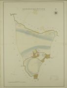
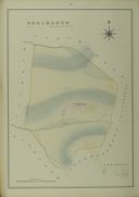
| Title: | Stronpatrick, Stronfreggan and Little Auchrae | |
| Imprint: | 1815 | |
| Zoom Into Map: | Click on the map to view in greater detail. | |
| Field | Content | |
|---|---|---|
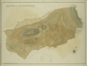
| Name: | Anderson, James (fl. 1804-1856) | |
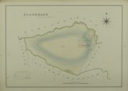
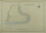
| Title: | Curlae & Blackcraig | |
| Imprint: | 1815 | |
| Zoom Into Map: | Click on the map to view in greater detail. | |
| Field | Content | |
|---|---|---|
| Name: | Anderson, James (fl. 1804-1856) | |
| Title: | Manwhill & Benbreck | |
| Imprint: | 1815 | |
| Zoom Into Map: | Click on the map to view in greater detail. | |
| Field | Content | |
|---|---|---|
| Name: | Anderson, James (fl. 1804-1856) | |
| Title: | Lorg & Altrye | |
| Imprint: | 1815 | |
| Zoom Into Map: | Click on the map to view in greater detail. | |
| Field | Content | |
|---|---|---|
| Name: | Anderson, James (fl. 1804-1856) | |
| Title: | Plans of the Property of William Forbes Esq. of Callendar: Auchenstroan | |
| Subtitle: | 46 | |
| Imprint: | Surveyed 1800, Delineated 1816 | |
| Zoom Into Map: | Click on the map to view in greater detail. | |
| Field | Content | |
|---|---|---|
| Name: | Anderson, James (fl. 1804-1856) | |
| Title: | Plans of the Property of William Forbes Esq. of Callendar: Stranshalloch | |
| Subtitle: | 47 | |
| Imprint: | Surveyed 1800, Delineated 1816 | |
| Zoom Into Map: | Click on the map to view in greater detail. | |
| Field | Content | |
|---|---|---|
| Name: | Anderson, James (fl. 1804-1856) | |
| Title: | Plans of the Property of William Forbes Esq. of Callendar: Niess and Ballinnie | |
| Subtitle: | 48 | |
| Imprint: | Surveyed 1800, Delineated 1816 | |
| Zoom Into Map: | Click on the map to view in greater detail. | |
| Field | Content | |
|---|---|---|
| Name: | Anderson, James (fl. 1804-1856) | |
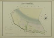
| Title: | Plans of the Property of William Forbes Esq. of Callendar: Castlefairn | |
| Subtitle: | 49 | |
| Imprint: | Surveyed 1800, Delineated 1816 | |
| Zoom Into Map: | Click on the map to view in greater detail. | |
| Field | Content | |
|---|---|---|
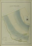
| Name: | Anderson, James (fl. 1804-1856) | |
| Title: | Plans of the Property of William Forbes Esq. of Callendar: Sanquhar Lands | |
| Subtitle: | 50 | |
| Imprint: | Surveyed 1800, Delineated 1816 | |
| Zoom Into Map: | Click on the map to view in greater detail. | |
| Field | Content | |
|---|---|---|
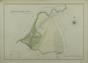
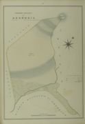
| Name: | Anderson, James (fl. 1804-1856) | |
| Title: | Plans of the Property of William Forbes Esq. of Callendar: Arndarroch | |
| Subtitle: | 12 | |
| Imprint: | Surveyed 1800, Delineated 1816 | |
| Zoom Into Map: | Click on the map to view in greater detail. | |
| Field | Content | |
|---|---|---|
| Name: | Anderson, James (fl. 1804-1856) | |
| Title: | Plans of the Property of William Forbes Esq. of Callendar: Bridgemark, Garriard and New Mill | |
| Subtitle: | 13 | |
| Imprint: | Surveyed 1800, Delineated 1816 | |
| Zoom Into Map: | Click on the map to view in greater detail. | |
| Field | Content | |
|---|---|---|
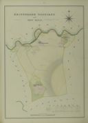
| Name: | Anderson, James (fl. 1804-1856) | |
| Title: | Plans of the Property of William Forbes Esq. of Callendar: Culmark | |
| Subtitle: | 14 | |
| Imprint: | Surveyed 1800, Delineated 1816 | |
| Zoom Into Map: | Click on the map to view in greater detail. | |
| Field | Content | |
|---|---|---|
| Name: | Anderson, James (fl. 1804-1856) | |
| Title: | Plans of the Property of William Forbes Esq. of Callendar: Marskaig & Cairney-Hill | |
| Subtitle: | 15 | |
| Imprint: | Surveyed 1800, Delineated 1816 | |
| Zoom Into Map: | Click on the map to view in greater detail. | |
| Field | Content | |
|---|---|---|
| Name: | Anderson, James (fl. 1804-1856) | |
| Title: | Plans of the Property of William Forbes Esq. of Callendar: Blackmark | |
| Subtitle: | 16 | |
| Imprint: | Surveyed 1800, Delineated 1816 | |
| Zoom Into Map: | Click on the map to view in greater detail. | |
| Field | Content | |
|---|---|---|
| Name: | Anderson, James (fl. 1804-1856) | |
| Title: | Plans of the Property of William Forbes Esq. of Callendar: Auchenshinnoch | |
| Subtitle: | 17 | |
| Imprint: | Surveyed 1800, Delineated 1816 | |
| Zoom Into Map: | Click on the map to view in greater detail. | |
| Field | Content | |
|---|---|---|
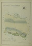
| Name: | Anderson, James (fl. 1804-1856) | |
| Title: | Plans of the Property of William Forbes Esq. of Callendar: Strangassill | |
| Subtitle: | 2 | |
| Imprint: | Surveyed 1800, Delineated 1816 | |
| Zoom Into Map: | Click on the map to view in greater detail. | |
| Field | Content | |
|---|---|---|
| Name: | Anderson, James (fl. 1804-1856) | |
| Title: | Plans of the Property of William Forbes Esq. of Callendar: Knocksheen & Over Barskeoch | |
| Subtitle: | 3 | |
| Imprint: | Surveyed 1800, Delineated 1816 | |
| Zoom Into Map: | Click on the map to view in greater detail. | |
| Field | Content | |
|---|---|---|
| Name: | Anderson, James (fl. 1804-1856) | |
| Title: | Plans of the Property of William Forbes Esq. of Callendar: Barchoak, Greenloop and Hannistoun | |
| Subtitle: | 4 | |
| Imprint: | Surveyed 1800, Delineated 1816 | |
| Zoom Into Map: | Click on the map to view in greater detail. | |
| Field | Content | |
|---|---|---|
| Name: | Anderson, James (fl. 1804-1856) | |
| Title: | Plans of the Property of William Forbes Esq. of Callendar: Cavan and Barskeoch Mains | |
| Subtitle: | 5 | |
| Imprint: | Surveyed 1800, Delineated 1816 | |
| Zoom Into Map: | Click on the map to view in greater detail. | |
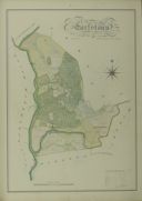
| Field | Content | |
|---|---|---|
| Name: | Anderson, James (fl. 1804-1856) | |
| Title: | Plans of the Property of William Forbes Esq. of Callendar: Waterside | |
| Subtitle: | 6 | |
| Imprint: | Surveyed 1800, Delineated 1816 | |
| Zoom Into Map: | Click on the map to view in greater detail. | |
| Field | Content | |
|---|---|---|
| Name: | Anderson, James (fl. 1804-1856) | |
| Title: | Plans of the Property of William Forbes Esq. of Callendar: Earlstoun | |
| Subtitle: | 7 | |
| Imprint: | Surveyed 1800, Delineated 1816 | |
| Zoom Into Map: | Click on the map to view in greater detail. | |
| Field | Content | |
|---|---|---|
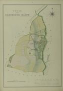
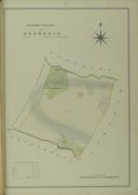
| Name: | Anderson, James (fl. 1804-1856) | |
| Title: | Plans of the Property of William Forbes Esq. of Callendar: Ardoch | |
| Subtitle: | 8 | |
| Imprint: | Surveyed 1800, Delineated 1816 | |
| Zoom Into Map: | Click on the map to view in greater detail. | |
| Field | Content | |
|---|---|---|
| Name: | Anderson, James (fl. 1804-1856) | |
| Title: | Plans of the Property of William Forbes Esq. of Callendar: Todston & Mosscroft | |
| Subtitle: | 9 | |
| Imprint: | Surveyed 1800, Delineated 1816 | |
| Zoom Into Map: | Click on the map to view in greater detail. | |
| Field | Content | |
|---|---|---|
| Name: | Anderson, James (fl. 1804-1856) | |
| Title: | Plans of the Property of William Forbes Esq. of Callendar: The Barlae's | |
| Subtitle: | 10 | |
| Imprint: | Surveyed 1800, Delineated 1816 | |
| Zoom Into Map: | Click on the map to view in greater detail. | |
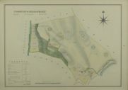
| Field | Content | |
|---|---|---|
| Name: | Anderson, James (fl. 1804-1856) | |
| Title: | Plans of the Property of William Forbes Esq. of Callendar: Cairoch | |
| Subtitle: | 19 | |
| Imprint: | Surveyed 1800, Delineated 1816 | |
| Zoom Into Map: | Click on the map to view in greater detail. | |
| Field | Content | |
|---|---|---|
| Name: | Anderson, James (fl. 1804-1856) | |
| Title: | Plans of the Property of William Forbes Esq. of Callendar: Craiglour | |
| Subtitle: | 20 | |
| Imprint: | Surveyed 1800, Delineated 1816 | |
| Zoom Into Map: | Click on the map to view in greater detail. | |
| Field | Content | |
|---|---|---|
| Name: | Anderson, James (fl. 1804-1856) | |
| Title: | Plans of the Property of William Forbes Esq. of Callendar: Cornharrow | |
| Subtitle: | 21 | |
| Imprint: | Surveyed 1800, Delineated 1816 | |
| Zoom Into Map: | Click on the map to view in greater detail. | |
| Field | Content | |
|---|---|---|
| Name: | Anderson, James (fl. 1804-1856) | |
| Title: | Plans of the Property of William Forbes Esq. of Callendar: Little Curlae | |
| Subtitle: | 22 | |
| Imprint: | Surveyed 1800, Delineated 1816 | |
| Zoom Into Map: | Click on the map to view in greater detail. | |
| Field | Content | |
|---|---|---|
| Name: | Anderson, James (fl. 1804-1856) | |
| Title: | Plans of the Property of William Forbes Esq. of Callendar: General Plan of the Farms Lorg & Altrye, Curlae & Blackcraig, Auchrae & Polchaskie, Manwhill & Benbrack, Stronpatrick Stronfreggan & Little Auchrae | |
| Subtitle: | 23 | |
| Imprint: | Surveyed 1815, Delineated 1816 | |
| Zoom Into Map: | Click on the map to view in greater detail. | |
| Field | Content | |
|---|---|---|
| Name: | Anderson, James (fl. 1804-1856) | |
| Title: | Plans of the Property of William Forbes Esq. of Callendar: Lorg | |
| Subtitle: | 24 | |
| Imprint: | Surveyed 1815, Delineated 1816 | |
| Zoom Into Map: | Click on the map to view in greater detail. | |
| Field | Content | |
|---|---|---|
| Name: | Anderson, James (fl. 1804-1856) | |
| Title: | Plans of the Property of William Forbes Esq. of Callendar: Altrye | |
| Subtitle: | 25 | |
| Imprint: | Surveyed 1815, Delineated 1816 | |
| Zoom Into Map: | Click on the map to view in greater detail. | |
| Field | Content | |
|---|---|---|
| Name: | Anderson, James (fl. 1804-1856) | |
| Title: | Plans of the Property of William Forbes Esq. of Callendar: Curlae & Blackcraig | |
| Subtitle: | 26 | |
| Imprint: | Surveyed 1815, Delineated 1816 | |
| Zoom Into Map: | Click on the map to view in greater detail. | |
| Field | Content | |
|---|---|---|
| Name: | Anderson, James (fl. 1804-1856) | |
| Title: | Plans of the Property of William Forbes Esq. of Callendar: Auchrae & Polchaskie | |
| Subtitle: | 27 | |
| Imprint: | Surveyed 1815, Delineated 1816 | |
| Zoom Into Map: | Click on the map to view in greater detail. | |
| Field | Content | |
|---|---|---|
| Name: | Anderson, James (fl. 1804-1856) | |
| Title: | Plans of the Property of William Forbes Esq. of Callendar: Manwhill & Banbreck | |
| Subtitle: | 28 | |
| Imprint: | Surveyed 1815, Delineated 1816 | |
| Zoom Into Map: | Click on the map to view in greater detail. | |
| Field | Content | |
|---|---|---|
| Name: | Anderson, James (fl. 1804-1856) | |
| Title: | Plans of the Property of William Forbes Esq. of Callendar: Stronpatrick Stronfreggan and Little Auchrae | |
| Subtitle: | 29 | |
| Imprint: | Surveyed 1815, Delineated 1816 | |
| Zoom Into Map: | Click on the map to view in greater detail. | |
| Field | Content | |
|---|---|---|
| Name: | Anderson, James (fl. 1804-1856) | |
| Title: | Plans of the Property of William Forbes Esq. of Callendar: Plan of the Farms of Largmore, Duckiestoun, Ringreoch, Burnhead, Clannery, Drumbuie, Lochspraig | |
| Subtitle: | 30 | |
| Imprint: | Surveyed 1800, Delineated 1817 | |
| Zoom Into Map: | Click on the map to view in greater detail. | |
| Field | Content | |
|---|---|---|
| Name: | Anderson, James (fl. 1804-1856) | |
| Title: | Plans of the Property of William Forbes Esq. of Callendar: Burnhead | |
| Subtitle: | 31 | |
| Imprint: | Surveyed 1800, Delineated 1817 | |
| Zoom Into Map: | Click on the map to view in greater detail. | |
| Field | Content | |
|---|---|---|
| Name: | Anderson, James (fl. 1804-1856) | |
| Title: | Plans of the Property of William Forbes Esq. of Callendar: Duckiestoun and Ringreoch | |
| Subtitle: | 32 | |
| Imprint: | Surveyed 1800, Delineated 1817 | |
| Zoom Into Map: | Click on the map to view in greater detail. | |
| Field | Content | |
|---|---|---|
| Name: | Anderson, James (fl. 1804-1856) | |
| Title: | Plans of the Property of William Forbes Esq. of Callendar: Clannery | |
| Subtitle: | 33 | |
| Imprint: | Surveyed 1800, Delineated 1817 | |
| Zoom Into Map: | Click on the map to view in greater detail. | |
| Field | Content | |
|---|---|---|
| Name: | Anderson, James (fl. 1804-1856) | |
| Title: | Plans of the Property of William Forbes Esq. of Callendar: Largmore | |
| Subtitle: | 34 | |
| Imprint: | Surveyed 1800, Delineated 1817 | |
| Zoom Into Map: | Click on the map to view in greater detail. | |
| Field | Content | |
|---|---|---|
| Name: | Anderson, James (fl. 1804-1856) | |
| Title: | Plans of the Property of William Forbes Esq. of Callendar: Western Division of Drumbuie | |
| Subtitle: | 35 | |
| Imprint: | Surveyed 1800, Delineated 1817 | |
| Zoom Into Map: | Click on the map to view in greater detail. | |
| Field | Content | |
|---|---|---|
| Name: | Anderson, James (fl. 1804-1856) | |
| Title: | Plans of the Property of William Forbes Esq. of Callendar: Middle Division of Drumbuie | |
| Subtitle: | 36 | |
| Imprint: | Surveyed 1800, Delineated 1817 | |
| Zoom Into Map: | Click on the map to view in greater detail. | |
| Field | Content | |
|---|---|---|
| Name: | Anderson, James (fl. 1804-1856) | |
| Title: | Plans of the Property of William Forbes Esq. of Callendar: Eastern Division of Drumbuie | |
| Subtitle: | 37 | |
| Imprint: | Surveyed 1800, Delineated 1817 | |
| Zoom Into Map: | Click on the map to view in greater detail. | |
| Field | Content | |
|---|---|---|
| Name: | Anderson, James (fl. 1804-1856) | |
| Title: | Plans of the Property of William Forbes Esq. of Callendar: Lochspraig | |
| Subtitle: | 38 | |
| Imprint: | Surveyed 1800, Delineated 1817 | |
| Zoom Into Map: | Click on the map to view in greater detail. | |
| Field | Content | |
|---|---|---|
| Name: | Anderson, James (fl. 1804-1856) | |
| Title: | Plans of the Property of William Forbes Esq. of Callendar: Plans of the farms of Backhill of Burnhead Garvorie | |
| Subtitle: | 39 | |
| Imprint: | Surveyed 1800, Delineated 1817 | |
| Zoom Into Map: | Click on the map to view in greater detail. | |
| Field | Content | |
|---|---|---|
| Name: | Anderson, James (fl. 1804-1856) | |
| Title: | Plans of the Property of William Forbes Esq. of Callendar: Backhill of Burnhead | |
| Subtitle: | 40 | |
| Imprint: | Surveyed 1800, Delineated 1817 | |
| Zoom Into Map: | Click on the map to view in greater detail. | |
| Field | Content | |
|---|---|---|
| Name: | Anderson, James (fl. 1804-1856) | |
| Title: | Plans of the Property of William Forbes Esq. of Callendar: West Division of Garvorie | |
| Subtitle: | 41 | |
| Imprint: | Surveyed 1800, Delineated 1817 | |
| Zoom Into Map: | Click on the map to view in greater detail. | |
| Field | Content | |
|---|---|---|
| Name: | Anderson, James (fl. 1804-1856) | |
| Title: | Plans of the Property of William Forbes Esq. of Callendar: Middle Division of Garvorie | |
| Subtitle: | 42 | |
| Imprint: | Surveyed 1800, Delineated 1817 | |
| Zoom Into Map: | Click on the map to view in greater detail. | |
| Field | Content | |
|---|---|---|
| Name: | Anderson, James (fl. 1804-1856) | |
| Title: | Plans of the Property of William Forbes Esq. of Callendar: East Division | |
| Subtitle: | 43 | |
| Imprint: | Surveyed 1800, Delineated 1817 | |
| Zoom Into Map: | Click on the map to view in greater detail. | |
| Field | Content | |
|---|---|---|
| Name: | Anderson, James (fl. 1804-1856) | |
| Title: | Plans of the Property of William Forbes Esq. of Callendar: South Division of Garvorie | |
| Subtitle: | 44 | |
| Imprint: | Surveyed 1800, Delineated 1817 | |
| Zoom Into Map: | Click on the map to view in greater detail. | |
| Field | Content | |
|---|---|---|
| Name: | Anderson, James (fl. 1804-1856) | |
| Title: | Plans of the Property of William Forbes Esq. of Callendar: Plan of the Farms of Auchenstroan, Stranshalloch, Niess, Ballinie, Castlefairn | |
| Subtitle: | 45 | |
| Imprint: | Surveyed 1800, Delineated 1817 | |
| Zoom Into Map: | Click on the map to view in greater detail. | |
| Field | Content | |
|---|---|---|
| Name: | Anderson, James (fl. 1804-1856) | |
| Title: | Plans of the Property of William Forbes Esq. of Callendar: Plans of the Farms of Arndarroch, Bridgemark, Garriard, Culmark, New Mill, Marskaig, Cairneyhill, Blackmark, Auchenshinnoch, Fingland, Cornharrow, Little-Corlea, Cairoch, Craiglour | |
| Subtitle: | 11 | |
| Imprint: | Surveyed 1800, Delineated 1817 | |
| Zoom Into Map: | Click on the map to view in greater detail. | |
| Field | Content | |
|---|---|---|
| Name: | Anderson, James (fl. 1804-1856) | |
| Title: | Plans of the Property of William Forbes Esq. of Callendar: Fingland | |
| Subtitle: | 18 | |
| Imprint: | Surveyed 1800, Delineated 1817 | |
| Zoom Into Map: | Click on the map to view in greater detail. | |
| Field | Content | |
|---|---|---|
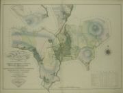
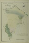
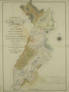
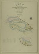
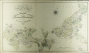
| Name: | Anderson, James (fl. 1804-1856) | |
| Title: | Plans of the Property of William Forbes Esq. of Callendar: Principal Plan of the Property of William Forbes Esqre. Of Callendar Situate in the Stewartry of Kirkcudbright and County of Dumfries | |
| Imprint: | 1817 | |
| Zoom Into Map: | Click on the map to view in greater detail. | |
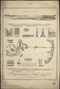
| Field | Content | |
|---|---|---|
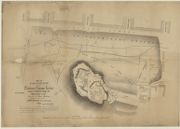
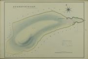
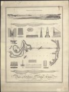
| Name: | Anderson, James (fl. 1804-1856) Lizars, W. H. (William Home), 1788-1859 | |
| Title: | Plans and Sections of a Bridge of Chains proposed to be thrown over the Frith of Forth at Queensferry / by James Anderson... (Engraved by W. & D. Lizars). | |
| Imprint: | Edinburgh, 1818. | |
| Zoom Into Map: | Click on the map to view in greater detail. | |
| Field | Content | |
|---|---|---|
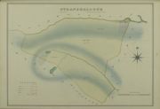
| Name: | Anderson, James (fl. 1804-1856) Lizars, W. H. (William Home), 1788-1859 | |
| Title: | Plans and sections of a Bridge of Chains proposed to be thrown over the Frith of Forth at Queensferry / by James Anderson... (Engraved by W. & D. Lizars). | |
| Imprint: | Edinburgh, 1818. | |
| Zoom Into Map: | Click on the map to view in greater detail. | |
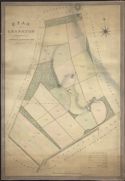
| Field | Content | |
|---|---|---|
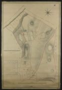
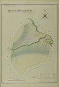
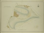
| Name: | Anderson, James (fl. 1804-1856) | |
| Title: | Plan of Granaton, the property of Norman Lockhart Esqr. | |
| Imprint: | 1822 | |
| Zoom Into Map: | Click on the map to view in greater detail. | |
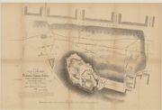
| Field | Content | |
|---|---|---|
| Name: | Anderson, James (fl. 1804-1856) | |
| Title: | Part of plan & section of the principal common sewer [in Edinburgh] from St. Cuthberts Church to Croftangry Lane / surveyed by James Anderson under the direction of James Jardine...1813. | |
| Imprint: | [Edinburgh] : s.n., 1859 | |
| Zoom Into Map: | Click on the map to view in greater detail. | |