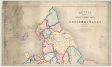
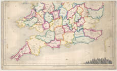
Maps of England and Wales
| Title: | Betts's intermediate size interrogatory maps. England & Wales. |
| Imprint: | [London, 1852?] |
| Pagination: | 1 map on 2 sheets. |
| Shelfmark: | Map.l.26.7 |
| Notes: | Scale 1:696,960 |
| Zoom Into Map: | Click on the maps below to order image or view in greater detail. |
 |
 |