Estate Maps, 1750s-1900s

| Name: | Tait, James, fl. ca 1739-1797 |
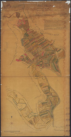
| Title: | No. 1. Plan of Run-rigg Lands of Hightae, Bush, Smallholm and Parkend &c. |
| Imprint: | 3 December 1789 |
| Pagination: | 1 maunscript map: col.; 225 x 116 cm. |
| Shelfmark: | MP201 |
| Notes: | Courtesy of the Ewart Library through the Dumfries Archival Mapping Project. View georeferenced map. |
| Zoom Into Map: | Click on the map to view in greater detail. |