Maxwell of Monreith Estate Maps and Plans, 1777-1778
A set of 133 detailed estate maps and accompanying schedules of land and extents, relating to the Maxwell of Monreith estate in Wigtownshire. The estate maps were all surveyed by John Gillone (1767-1809) in 1777-78. The maps were scanned by the National Library of Scotland and accessioned as Acc.13374. The original maps are held privately. For other family and estate papers of the Maxwells of Monreith see Dep.299, Acc.7043, Acc.7111, Acc.8816 and Acc.13262 in our Manuscripts Department. This material is available for consultation in the Special Collections Reading Room. For enquiries about the papers please contact the Manuscripts Division. We are very grateful to Monreith Estate for allowing us to scan these maps and make them available online.
The estate maps are divided into three groups. There are two volumes, including maps and accompanying written extents and details, and then a set of individual estate maps:
- Book of Plans. A volume entitled Plans of Monreith Estate, lying in the parishes of Mochrum, Glasserton and Kirkinner - the property of Sir William Maxwell of Monreith. Surveyed 1777 & 1778 by John Gilone. This book contains reductions of the Estate Plans (3. below), with on the facing page a summary of the details found in the Book of Description (2. Below). It was probably used as an easy reference tool and/or for use in the field.
- Book of Description. A volume entitled Scheme extent and soil of Monreith Estate belonging to Sir William Maxwell of Monreith. Each Estate Plan (3. below) has a corresponding record in this volume, in which the acreage and land use of each field or other area is noted and cross-referenced to the plans.
- A set of individual estate maps (incomplete)
Plans of Monreith Estate, lying in the parishes of Mochrum, Glasserton and Kirkinner - the property of Sir William Maxwell of Monreith:
- Title page
- Index
- 1 - Carlton
- 2 - Meikle Craiglemine
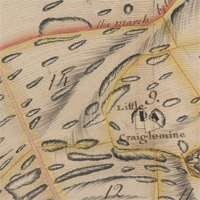
- 3 - Little Craiglemine
- 4 - East Appleby
- 5 - West Appleby
- 6 - Appleby Mill
- 7 - Cairndoon
- 8 - Knock
- 9 - Garrire
- 10 - Barmeal
- 11 - Fey of the Moor Dowis
- 12 - Barhullion
- 13 - Larroch
- 14 - Stelloch
- 15 - Longmaiden; Barmeal Fey
- 16 - Blairboy
- 17 - Drumfad
- 18 - Barwannock
- 19 - Drummoddie
- 20 - Balcraig Whitefields
- 21 - Balcraig Moor
- 22 - Boreland
- 23 - Camford
- 24 - Cairnfield
- 25 - Kirkland
- 26 - Airyhassan
- 27 - Blairshinnoch
- 28 - Culgary
- 29 - Mill of Airies
- 30 - West Barsalloch
- 31 - East Barsalloch
- 32 - Monreith Crofts
- 33 - Airlour
- 34 - Port William. Dourie & Moormains
- 35 - Merton Policy
- 36 - Drumtroddan
- 37 - Burntland
- 38 - Meikle Killantrae
- 39 - Landberrick
- 40 - North Part of Glentriplock
- 41 - South Glentriplock
- 42 - Carsduchan
- 43 - Boghouse
- 44 - Drumskeog Crofts
- 45 - Drumskeog
- 46 - Clone
- 47 - Little Killantrae
- 48 - Curhulloch
- 49 - Droughtag
- 50 - North Barr
- 51 - South Barr
- 52 - Milltown
- 53 - Airoland
- 54 - Eldrig
- 55 - Skate
- 56 - Backpark
Scheme extent and soil of Monreith Estate belonging to Sir William Maxwell of Monreith:
- Title page
- Index
- 1 - Barr
- 2 - Airlour
- 3 - Boghouse
- 4 - Little Killantrae
- 5 - Droughtag
- 6 - West Barsalloch
- 7 - East Barsalloch
- 8 - Landberrick
- 9 - Airyhassan
- 10 - Blairshinnoch
- 11 - Clone: Drumskeog: Drumskeog Crofts
- 12 - Curhulloch
- 13 - Kirkland
- 14 - Cairnfield
- 15 - Meikle Killantrae
- 16 - Culgary
- 17 - Carsduchan
- 18 - Skate
- 19 - Glentriplock
- 20 - Blairboy
- 21 - Blairhullion; Stellok
- 22 - Drumtroddan
- 23 - Crofts
- 24 - Burntland; Back Park
- 25 - Drumfad; Balcraig-Moor
- 26 - Arioland
- 27 - Larroch; Longmaiden; Fey of Barmeal
- 28 - Camford; Little Airies
- 29 - Drummoddie
- 30 - Barwannock
- 31 - Balcraig Whitefields
- 32 - Millton
- 33 - Eldrig
- 34 - Boreland
- 35 - Barmeal
- 36 - Garrire
- 37 - Fey of the Moors & Dowis
- 38 - Little Craiglemine; Meikle Craiglemine
- 39 - Appleby; Appleby Mill Croft
- 40 - Carlton
- 41 - Cairndoon
- 42 - Knock
- 43 - Merton
- 44 - Crofts, in Dourie & Moor-mains
- 45 - General Abstract
A set of individual estate maps:
- No. 1 Carlton survey’d 1778 by John Gilone
- No. 2 Meikle & Little Craiglemines survey’d by John Gilone
- No. 4 Cairndoon survey’d 1778 by John Gilone
- No. 6 Garrire survey’d 1778 by John Gilone
- No. 7 Barmeal survey’d 1778 by John Gilone
- No. 10 Stellock, Larroch, Longmaiden and the Fey of Barmeal survey’d 1778 by John Gilone
- No. 11 Blairboy survey’d 1777 by John Gilone
- No. 13 Barwannock survey’d 1778 by John Gilone
- No. 14 Drummoddie survey’d 1778 by John Gilone
- No. 15 Balcraig, Whitefields and Moor survey’d 1778 by John Gilone
- No. 17 Camford survey’d 1778 by John Gilone
- No. 18 Cairnfield survey’d 1777 by John Gilone
- No. 19 Kirkland, of Longcastle survey’s 1777 by John Gilone
- No. 20 Airyhassan surey’d 1777 by John Gilone
- No. 21 Blairshinnoch survey’d 1777 by John Gilone
- No. 22 Culgory survey’d 1777 by John Gilone
- No. 23 Mill lands of Airies survey’d 1778 by John Gilone
- No. 29 Meikle Killantrae survey’d 1777 by John Gilone
- No. 30 Landberrick survey’d 1777 by John Gilone
- No. 31 Glentriplock survey’d 1777 by John Gilone
- No. 34 Drumskeog Crofts survey’d 1778 by John Gilone
- No. 35 Drumskeog survey’d 1777 by John Gilone
- No. 36 Clone survey’d 1777 by John Gilone
- No. 37 Killantrae survey’d 1777 by John Gilone
- No. 38 Curhulloch survey’d 1777 by John Gilone
- No. 39 Droughtag survey’d 1777 by John Gilone
- No. 40 Farm of Barr lying in Mochrum Parish, belonging yo Sir William Maxwell Bart. survey’d Summer 1777 by John Gilone
- No. 41 Milltown survey’d 1778 by John Gilone
- No. 42 Arioland survey’s 1778 by John Gilone
- No. 43 Eldrig survey’d 1778 by John Gilone
- No. 44 Skate survey’d 1777 by John Gilone
- No. 53 Carsduchan survey’d 1777 by John Gilone