Map details:
| Field | Content |
|---|
| Name: | Philip, George, 1870-1937. |
| Title: | Philips' Single-Feature Wall Atlas: British Isles / edited by George Philip & C.E. Clowser. |
| Imprint: | London, [1953-] |
| Pagination: | 1 map on 8 sheets. |
| Shelfmark: | Map.l.7.31 |
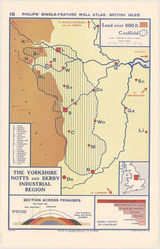
| Notes: | sh. 10 The Yorkshire, Notts and Derby Industrial Region [1953];sh. 11 The Lancashire Industrial Region [1953];sh. 12 The Midland Industrial Region [1953];sh. 13 South Wales Industrial Region [1953];sh. 14 South-East England [1953];sh. 15 Scottish Industrial Region [1953];sh. 16 The Northern Island Industrial Region [1953];sh. 9 North-East Industrial Region [1953];The sheets are numbered 9-16. |
| Volume Title: | Sheet 10. The Yorkshire, Notts and Derby Industrial Region |
| Zoom Into Map: | Click on the map to view in greater detail. |