County maps, 1580s-1950s
| Name: | Adair, John, ca. 1650-1722 |
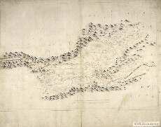
| Title: | The Mappe of Straithern, Stormont, & Cars of Gourie with the rivers Tay and Ern / surveighed & designed [by] John Adair. |
| Imprint: | 1683. |
| Pagination: | 1 manuscript map ; 450 x 670 mm., on sheet, 572 x 705 mm. |
| Shelfmark: | Adv.MS.70.2.11 (Adair 2) |
| Notes: | An engraved version of this map was published in ca. 1720. |
| Zoom Into Map: | Click on the map to view in greater detail. |