Admiralty Charts of Scotland, 1795-1904
| Name: | Great Britain. Hydrographic Office |
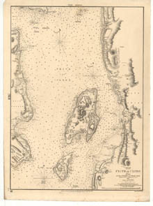
| Title: | Firth of Clyde, between Little Cumbrae and Toward Point |
| Imprint: | [London] : Hydrographic Office, surveyed 1846, published 1852. |
| Pagination: | 1 map ; 682 x 500 mm. |
| Shelfmark: | Admiralty Chart 2131 |
| Notes: | View georeferenced chart |
| Zoom Into Map: | Click on the map to view in greater detail. |