Admiralty Charts of Scotland, 1795-1904
| Field | Content |
|---|---|
| Name: | Great Britain. Hydrographic Office |
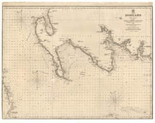
| Title: | Firth of Solway to Loch Ryan. |
| Imprint: | [London : Hydrographic Office], surveyed 1846. |
| Pagination: | 1 map ; 494 x 642 mm. |
| Shelfmark: | Admiralty Chart 1971 |
| Notes: | View georeferenced chart |
| Zoom Into Map: | Click on the map to view in greater detail. |