Plans and profiles of bridges, 18th-20th centuries
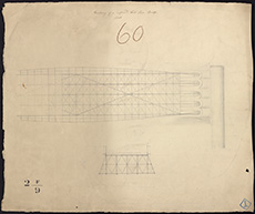
| Title: | Roadway of proposed Cast Iron Bridge [unidentified]. 1820 |
| Imprint: | 1820 |
| Pagination: | 1 map ; 54 x 64 cm. |
| Shelfmark: | MS.5896, No.18 |
| Notes: | This map is from our Stevenson civil engineering plans collection. |
| Zoom Into Map: | Click on the map to view in greater detail. |