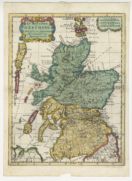
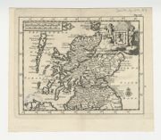
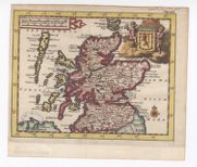
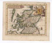
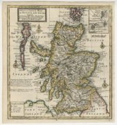
Maps of Scotland, 1560-1947
Maps covering the whole of Scotland. For more detailed maps of parts of Scotland, view county maps, town plans, or Ordnance Survey maps.
- Further information on this group of maps
- View separate list of thematic / subject maps of Scotland
- Browse Maps of Scotland using a graphic index
View Maps of Scotland without thumbnail images.
733 maps of Scotland.
Ordered chronologically (undated items first).
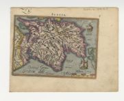
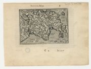
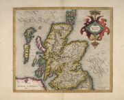
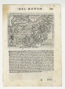
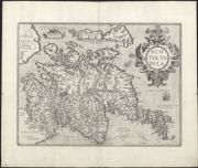
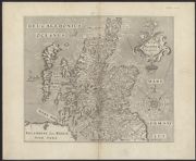
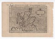
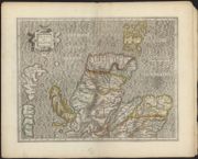
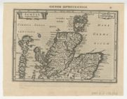
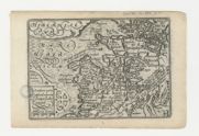
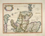
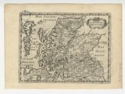
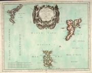
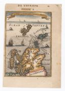
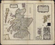
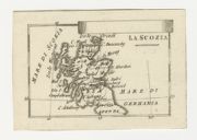
| Name: | Forlani, Paolo? | |
| Title: |
Scotia. Regno di Scotia. | |
| Imprint: | [S.l. : s.n., between 1558 and 1566] | |
| Zoom Into Map: | Click on the map to view in greater detail. | |
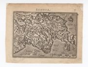
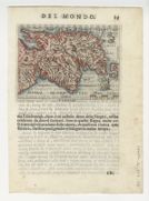
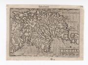
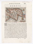
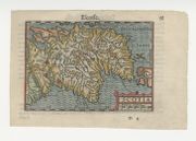
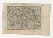
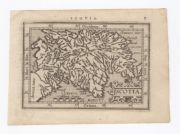
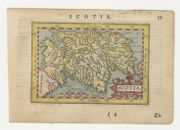
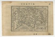
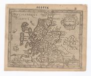
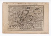
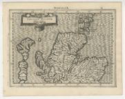
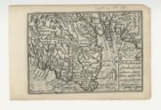
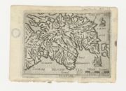
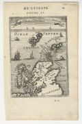
| Name: | Porcacchi, Thomaso, ca. 1530-1585? | |
| Title: | Scotia. | |
| Imprint: | [Venetia : Galignani & Porro, 1572] | |
| Zoom Into Map: | Click on the map to view in greater detail. | |
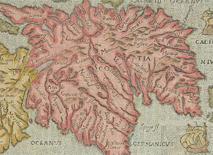
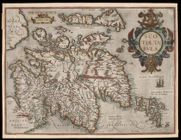
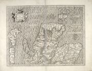
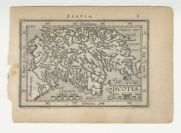
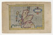
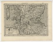
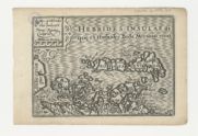
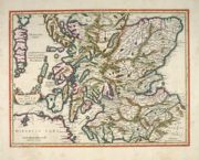
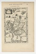
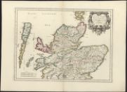
| Name: | Leslie, John, 1527-1596 | |
| Title: |
Scotiae Regni Antiqvissimi Accvrata Descriptio / Io Leslavs, Epus Rossen. Scotiae Regni Antiquissimi Accurata Descriptio. | |
| Imprint: | [Rome : Leslie, 1578] | |
| Zoom Into Map: | Click on the map to view in greater detail. | |
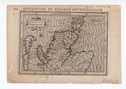
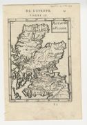
| Name: | Galle, Philippe, 1537-1612 | |
| Title: | Scotiae descriptio. | |
| Imprint: | Antwerp : Heyns, 1579. | |
| Zoom Into Map: | Click on the map to view in greater detail. | |
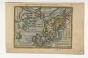
| Name: | Galle, Philippe, 1537-1612 | |
| Title: | Septentrionalium regionum descriptio. | |
| Imprint: | Antwerp : Heyns, 1579. | |
| Zoom Into Map: | Click on the map to view in greater detail. | |
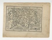
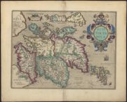
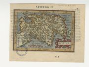
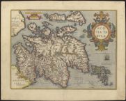
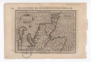
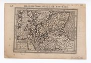
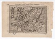
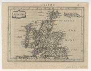
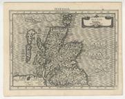
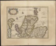
| Name: | Ortelius, Abraham, 1527-1598 | |
| Title: | Scotiae tabula / Abraham Ortelius. | |
| Imprint: | Antwerp : Ortelius, [originally engraved 1573, this map ca. 1580] | |
| Zoom Into Map: | Click on the map to view in greater detail. | |
| Name: | Sequanus, Johann Natalius Metellus. | |
| Title: | Scotia = Schotlandt = Escosse. | |
| Imprint: | [Cologne : Metellus, 1580] | |
| Zoom Into Map: | Click on the map to view in greater detail. | |
| Name: | Galle, Philippe, 1537-1612 | |
| Title: | Scotiae descriptio. | |
| Imprint: | Antwerp : Heyns, ca. 1583. | |
| Zoom Into Map: | Click on the map to view in greater detail. | |
| Name: | Galle, Philippe, 1537-1612 | |
| Title: | Scotiae descriptio. | |
| Imprint: | [Antwerp? : Heyns?, ca. 1585?]. | |
| Zoom Into Map: | Click on the map to view in greater detail. | |
| Title: | Scotiae nova et accurata descriptio. | |
| Imprint: | [S.l. : sn 1590?] | |
| Zoom Into Map: | Click on the map to view in greater detail. | |
| Name: | Nagel, Henricus. | |
| Title: | Scotiae Tabula / Henricus Nagel fecit. | |
| Imprint: | [Cologne : Bussemacher, 1592]. | |
| Zoom Into Map: | Click on the map to view in greater detail. | |
| Name: | Mercator, Gerhard, 1512-1594 | |
| Title: | Scotia Regnum / Per Gerardum Mercatorem … | |
| Imprint: | [Duisberg : Mercator, ca. 1595] | |
| Zoom Into Map: | Click on the map to view in greater detail. | |
| Name: | Mercator, Gerhard, 1512-1594 | |
| Title: | [Scotiae Regnum south sheet] / per Gerardum Mercatorem per privilegio. | |
| Imprint: | [Duisberg : Mercator, 1595] | |
| Zoom Into Map: | Click on the map to view in greater detail. | |
| Name: | Mercator, Gerhard, 1512-1594 | |
| Title: | Scotiae Regnum [north sheet] / per Gerardum Mercatorem. | |
| Imprint: | [Duisberg : Mercator, 1595] | |
| Zoom Into Map: | Click on the map to view in greater detail. | |
| Name: | Marchetti, P.M. | |
| Title: | Scotiae descriptio. | |
| Imprint: | Brescia : PM Marchetti, 1598. | |
| Zoom Into Map: | Click on the map to view in greater detail. | |
| Name: | Marchetti, P.M. | |
| Title: | Scotiae descriptio. | |
| Imprint: | Brescia : PM Marchetti, 1598. | |
| Zoom Into Map: | Click on the map to view in greater detail. | |
| Name: | Marchetti, P.M. | |
| Title: | Septentrionalium regionum descriptio. | |
| Imprint: | Brescia : PM Marchetti, 1598. | |
| Zoom Into Map: | Click on the map to view in greater detail. | |
| Name: | Langenes, Barent. | |
| Title: | Scotia. | |
| Imprint: | [Middelburg, Netherlands : Langenes, 1598]. | |
| Zoom Into Map: | Click on the map to view in greater detail. | |
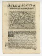
| Name: | Botero, Giovanni, 1540-1617 | |
| Title: | Scotiae descriptio. | |
| Imprint: | Brescia : appresso la Compagnia Bresciana, 1599. | |
| Zoom Into Map: | Click on the map to view in greater detail. | |
| Name: | Botero, Giovanni, 1540-1617 | |
| Title: | Scotiae descriptio. | |
| Imprint: | Brescia : appresso la Compagnia Bresciana, 1599. | |
| Zoom Into Map: | Click on the map to view in greater detail. | |
| Title: | Von Schotlandt | |
| Date: | 1600 | |
| Zoom Into Map: | Click on the map to view in greater detail. | |
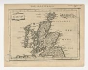
| Title: | Scotia | |
| Date: | 1600 | |
| Zoom Into Map: | Click on the map to view in greater detail. | |
| Title: | Scotia | |
| Date: | 1600 | |
| Zoom Into Map: | Click on the map to view in greater detail. | |
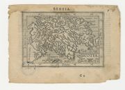
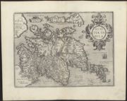
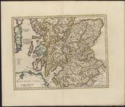
| Name: | Ortelius, Abraham, 1527-1598 | |
| Title: | Scotiae tabula / Abraham Ortelius. | |
| Imprint: | Antwerp : Ortelius [ca. 1600] | |
| Zoom Into Map: | Click on the map to view in greater detail. | |
| Name: | Ortelius, Abraham, 1527-1598 | |
| Title: | Scotia. | |
| Imprint: | [Antwerp : van Keerbergen, 1601] | |
| Zoom Into Map: | Click on the map to view in greater detail. | |
| Name: | Galle, Philippe, 1537-1612 | |
| Title: | Scotia. | |
| Imprint: | [Antwerp : JB Vrients, 1602] | |
| Zoom Into Map: | Click on the map to view in greater detail. | |
| Name: | Ortelius, Abraham, 1527-1598 | |
| Title: | Scotia. | |
| Imprint: | Antwerp : van Keerbergen, 1602 | |
| Zoom Into Map: | Click on the map to view in greater detail. | |
| Name: | Ortelius, Abraham, 1527-1598 | |
| Title: | Scotia. | |
| Imprint: | Frankfurt am Main : Levinus Hulsius, 1604 | |
| Zoom Into Map: | Click on the map to view in greater detail. | |
| Name: | Ortelius, Abraham, 1527-1598 | |
| Title: | Scotia. | |
| Imprint: | [Frankfurt am Main : Levinus Hulsius, 1604] | |
| Zoom Into Map: | Click on the map to view in greater detail. | |
| Name: | Ortelius, Abraham, 1527-1598 | |
| Title: | Scotiae tabula. | |
| Imprint: | [London : Ortelius, 1606]. | |
| Zoom Into Map: | Click on the map to view in greater detail. | |
| Name: | Hole, William, d. 1624 | |
| Title: | Scotia Regnum / Gule Hole sculp. | |
| Imprint: | [London : Camden, 1607] | |
| Zoom Into Map: | Click on the map to view in greater detail. | |
| Name: | Hole, William, d. 1624 | |
| Title: | Scotia regnum / Gule Hole sculp. | |
| Imprint: | [London : Camden, 1607]. | |
| Zoom Into Map: | Click on the map to view in greater detail. | |
| Name: | Hondius, Jodocus, 1563-1612 | |
| Title: | Scotia. | |
| Imprint: | [Amsterdam : Hondius, 1607] | |
| Zoom Into Map: | Click on the map to view in greater detail. | |
| Name: | Ortelius, Abraham, 1527-1598 | |
| Title: | Scotia. | |
| Imprint: | Antwerp : Vrients, 1609 | |
| Zoom Into Map: | Click on the map to view in greater detail. | |
| Name: | Ortelius, Abraham, 1527-1598 | |
| Title: | Scotia. | |
| Imprint: | Antwerp : Vrients, 1609 | |
| Zoom Into Map: | Click on the map to view in greater detail. | |

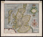
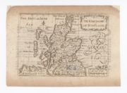
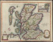
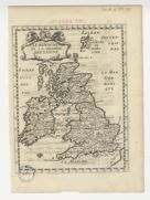
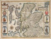
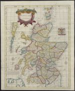
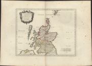
| Name: | Speed, John, 1552?-1629 | |
| Title: | The Kingdome of Scotland / performed by Iohn Speed. | |
| Imprint: | [S.l.] : ... Iohn Sudbury and George Humbell, 1610 [1627 issue?] | |
| Zoom Into Map: | Click on the map to view in greater detail. | |
| Name: | Ortelius, Abraham, 1527-1598 | |
| Title: | Scotiae tabula. | |
| Imprint: | [Antwerp : Ortelius, 1612]. | |
| Zoom Into Map: | Click on the map to view in greater detail. | |
| Name: | Ortelius, Abraham, 1527-1598 | |
| Title: | Scotiae tabula. | |
| Imprint: | [Antwerp : Ortelius, 1612]. | |
| Zoom Into Map: | Click on the map to view in greater detail. | |
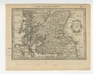
| Name: | Bertius, Petrus, 1565-1629 | |
| Title: | Scotia. | |
| Imprint: | [Frankfurt Main : Matthaeus Becker II for Hendrick Laurensz, 1612]. | |
| Zoom Into Map: | Click on the map to view in greater detail. | |
| Name: | Mercator, Gerhard, 1512-1594 | |
| Title: | Scotia regnum. / per Gerardum Mercatorem. | |
| Imprint: | [Amsterdam : J Hondius, 1613]. | |
| Zoom Into Map: | Click on the map to view in greater detail. | |
| Name: | Bertius, Petrus, 1565-1629 | |
| Title: | Scotia. | |
| Imprint: | [Amsterdam : Jodocus Hondius jr, 1616?] | |
| Zoom Into Map: | Click on the map to view in greater detail. | |
| Name: | Hondius, Jodocus, 1563-1612 | |
| Title: | Scotia / Salomon Rogiers caelavit. | |
| Imprint: | Amsterdam : Jodocus Hondius, 1618 | |
| Zoom Into Map: | Click on the map to view in greater detail. | |
| Name: | Hondius, Jodocus, 1563-1612 | |
| Title: | Scotia / Salomon Rogiers caelavit. | |
| Imprint: | Amsterdam : Jodocus Hondius, 1618 | |
| Zoom Into Map: | Click on the map to view in greater detail. | |
| Name: | Hondius, Jodocus, 1563-1612 | |
| Title: | Scotia septentrion[al]. | |
| Imprint: | Amsterdam : Jodocus Hondius, 1618 | |
| Zoom Into Map: | Click on the map to view in greater detail. | |
| Name: | Hondius, Jodocus, 1563-1612 | |
| Title: | Scotia septentrion[al]. | |
| Imprint: | Amsterdam : Jodocus Hondius, 1618 | |
| Zoom Into Map: | Click on the map to view in greater detail. | |
| Name: | Hondius, Jodocus, 1563-1612 | |
| Title: | Scotia australis. | |
| Imprint: | Amsterdam : Jodocus Hondius, 1618 | |
| Zoom Into Map: | Click on the map to view in greater detail. | |
| Name: | Hondius, Jodocus, 1563-1612 | |
| Title: | Scotia australis. | |
| Imprint: | Amsterdam : Jodocus Hondius, 1618 | |
| Zoom Into Map: | Click on the map to view in greater detail. | |
| Name: | Doglioni, Giovanni Nicolò. | |
| Title: | Scotia | |
| Imprint: | [Venice : Giovanni Doglioni, 1623]. | |
| Zoom Into Map: | Click on the map to view in greater detail. | |
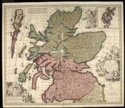
| Name: | Speed, John, 1552?-1629 | |
| Title: | The Kingdome of Scotland. | |
| Imprint: | [London : G Humble, 1627]. | |
| Zoom Into Map: | Click on the map to view in greater detail. | |
| Name: | Keere, Pieter van den, 1571-ca. 1646 | |
| Title: | The South pt of Scotland wherin are contayned Edinbrough, St. Andrew and Glasco Archbisho / Petrus Kaerius caelavit. | |
| Imprint: | [London : G Humble, 1627]. | |
| Zoom Into Map: | Click on the map to view in greater detail. | |
| Name: | Keere, Pieter van den, 1571-ca. 1646 | |
| Title: | The Eastern part of Scotland wherin ther [sic] are diuers Shires and the Vniversity of Aberdyn / Petrus Kaerius caelavit. | |
| Imprint: | [London : George Humble, ca. 1627] | |
| Zoom Into Map: | Click on the map to view in greater detail. | |
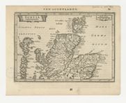
| Name: | Jansson, Jan, 1588-1664 | |
| Title: | Schotia. | |
| Imprint: | Amsterdam : J. Jansson, 1628 | |
| Zoom Into Map: | Click on the map to view in greater detail. | |
| Name: | Jansson, Jan, 1588-1664 | |
| Title: | Scotia meridionalis | |
| Imprint: | Amsterdam : J. Jansson, 1628 | |
| Zoom Into Map: | Click on the map to view in greater detail. | |
| Name: | Jansson, Jan, 1588-1664 | |
| Title: | Scotia septentrionalis. | |
| Imprint: | Amsterdam : J. Jansson, 1628 | |
| Zoom Into Map: | Click on the map to view in greater detail. | |
| Name: | Mercator, Gerhard, 1512-1594 | |
| Title: | Scotia regnum. / Per Gerardum Mercatorem. | |
| Imprint: | [Amsterdam : H Hondius, 1630]. | |
| Zoom Into Map: | Click on the map to view in greater detail. | |
| Name: | Mercator, Gerhard, 1512-1594 | |
| Title: | [Scotiae Regnum : Meridionalis] / Per Gerardum Mercatorem. | |
| Imprint: | [Amsterdam : H Hondius, 1630]. | |
| Zoom Into Map: | Click on the map to view in greater detail. | |
| Name: | Mercator, Gerhard, 1512-1594 | |
| Title: | Scotiae Regnum / Per Gerardum Mercatorem. | |
| Imprint: | [Amsterdam : H Hondius, 1630]. | |
| Zoom Into Map: | Click on the map to view in greater detail. | |
| Title: | The Kingdome of Scotland. | |
| Imprint: | [S.l. : sn ca. 1630] | |
| Zoom Into Map: | Click on the map to view in greater detail. | |
| Name: | Jansson, Jan, 1588-1664 | |
| Title: | Schotia. | |
| Imprint: | [Amsterdam : J. Jansson, 1630] | |
| Zoom Into Map: | Click on the map to view in greater detail. | |
| Name: | Goos, Abraham. | |
| Title: | Scotia meridionalis. | |
| Imprint: | [Amsterdam : Jansson, ca. 1630]. | |
| Zoom Into Map: | Click on the map to view in greater detail. | |
| Name: | Goos, Abraham. | |
| Title: | Scotia septentrionalis. | |
| Imprint: | [Amsterdam : Jansson, ca. 1630]. | |
| Zoom Into Map: | Click on the map to view in greater detail. | |
| Name: | Cloppenburg, Johannes, 1592-1652 | |
| Title: | Scotiae Regnum. | |
| Imprint: | [Amsterdam : Cloppenburg, 1630]. | |
| Zoom Into Map: | Click on the map to view in greater detail. | |
| Name: | Cloppenburg, Johannes, 1592-1652 | |
| Title: | [Scotiae Regnum Meridionalis]. | |
| Imprint: | [Amsterdam : Iohannis Cloppenburg, 1630]. | |
| Zoom Into Map: | Click on the map to view in greater detail. | |
| Name: | Cloppenburg, Johannes, 1592-1652 | |
| Title: | Scotia regnum. | |
| Imprint: | [Amsterdam : Cloppenburg, 1630]. | |
| Zoom Into Map: | Click on the map to view in greater detail. | |
| Name: | Jansson, Jan, 1588-1664 | |
| Title: | Scotia Septentrionalis. | |
| Imprint: | [Amsterdam : Jansson, 1631] | |
| Zoom Into Map: | Click on the map to view in greater detail. | |
| Name: | Jansson, Jan, 1588-1664 | |
| Title: | Scotia Meridionalis. | |
| Imprint: | [Amsterdam : Janssonius, 1631]. | |
| Zoom Into Map: | Click on the map to view in greater detail. | |
| Name: | Speed, John, 1552?-1629 | |
| Title: | The Kingdome of Scotland. | |
| Imprint: | London : George Humble, 1632 | |
| Zoom Into Map: | Click on the map to view in greater detail. | |
| Name: | Keere, Pieter van den, 1571-ca. 1646 | |
| Title: | The South pt of Scotland wherin are contayned Edinbrough, St. Andrew and Glasco Archbisho / Petrus Kaerius caelavit. | |
| Imprint: | London : George Humble, 1632 | |
| Zoom Into Map: | Click on the map to view in greater detail. | |
| Name: | Keere, Pieter van den, 1571-ca. 1646 | |
| Title: | The Southren parte of Scotland, wherin is ye Strange Lake Lomund / Petrus Kaerius caelavit. | |
| Imprint: | London : George Humble, 1632 | |
| Zoom Into Map: | Click on the map to view in greater detail. | |
| Name: | Keere, Pieter van den, 1571-ca. 1646 | |
| Title: | The Eastern part of Scotland wherin ther are divers Shires and the Vniversity of Aberdyn / Petrus Kaerius caelavit. | |
| Imprint: | London : George Humble, 1632 | |
| Zoom Into Map: | Click on the map to view in greater detail. | |

| Name: | Keere, Pieter van den, 1571-ca. 1646 | |
| Title: | Part of Scotland, it is called of the inhabitance of Stranauerre with his borderers / Petrus Kaerius caelavit 1599. | |
| Imprint: | London : George Humble, 1632 | |
| Zoom Into Map: | Click on the map to view in greater detail. | |
| Name: | Keere, Pieter van den, 1571-ca. 1646 | |
| Title: | The Iles of Hebrides wiz ther borderers / Petrus Kaerius Caelavit. | |
| Imprint: | London : George Humble, 1632 | |
| Zoom Into Map: | Click on the map to view in greater detail. | |
| Name: | Blaeu, Willem Janszoon, 1571-1638 | |
| Title: | Scotia Regnum. | |
| Imprint: | [Amsterdam : Willem Blaeu, 1635] | |
| Zoom Into Map: | Click on the map to view in greater detail. | |
| Name: | Hondius, Hendrik, 1597-1651 | |
| Title: | Scotiae pars septentrionalis. | |
| Imprint: | [Amsterdam : Hondius, 1662]. (Originally engraved in 1636) | |
| Zoom Into Map: | Click on the map to view in greater detail. | |
| Name: | Hondius, Hendrik, 1597-1651 | |
| Title: | [Scotiae pars australis] | |
| Imprint: | [Amsterdam : Hondius, 1662]. (Originally engraved in 1636) | |
| Zoom Into Map: | Click on the map to view in greater detail. | |
| Name: | Hondius, Hendrik, 1597-1651 | |
| Title: | Scotiae pars septentrionalis. | |
| Imprint: | [Amsterdam : chez Henry Hondius, 1641] | |
| Zoom Into Map: | Click on the map to view in greater detail. | |
| Name: | Mercator, Gerhard, 1512-1594 | |
| Title: | [Scotiae Regnum : Meridionalis] | |
| Imprint: | Amstelodami : apud Henricum Hondium, [1641] | |
| Zoom Into Map: | Click on the map to view in greater detail. | |
| Name: | Hollar, W | |
| Title: | The North = part of England and the South = part of Scotland ca. 1644 [part of Quartermasters’ map] | |
| Imprint: | 1644 | |
| Zoom Into Map: | Click on the map to view in greater detail. | |
| Name: | Speed, John, 1552?-1629 | |
| Title: | The Kingdome of Scotland. | |
| Imprint: | London : George Humble, 1646 | |
| Zoom Into Map: | Click on the map to view in greater detail. | |
| Name: | Speed, John, 1552?-1629 | |
| Title: | The Kingdome of Scotland. | |
| Imprint: | London : George Humble, 1646 | |
| Zoom Into Map: | Click on the map to view in greater detail. | |
| Name: | Briet, Philippe | |
| Title: | Le Royaume Descosse. | |
| Imprint: | Parisiis, sumptibus Sebastiani Cramoisy et Gabrielis Cramoisy, 1648-1649. | |
| Zoom Into Map: | Click on the map to view in greater detail. | |
| Name: | Briet, Philippe | |
| Title: | Le Royaume Descosse. | |
| Imprint: | Parisiis, sumptibus Sebastiani Cramoisy et Gabrielis Cramoisy, 1648-1649. | |
| Zoom Into Map: | Click on the map to view in greater detail. | |
| Name: | Briet, Philippe | |
| Title: | Le Royaume de la Grande Bretaigne | |
| Imprint: | Parisiis, sumptibus Sebastiani Cramoisy et Gabrielis Cramoisy, 1648-1649. | |
| Zoom Into Map: | Click on the map to view in greater detail. | |
| Name: | Jansson, Jan, 1588-1664 | |
| Title: | Scotia meridionalis | |
| Imprint: | Amsterdam : J. Jansson, 1648 | |
| Zoom Into Map: | Click on the map to view in greater detail. | |
| Name: | Jansson, Jan, 1588-1664 | |
| Title: | Scotia septentrionalis. | |
| Imprint: | Amsterdam : J. Jansson, 1648 | |
| Zoom Into Map: | Click on the map to view in greater detail. | |
| Name: | Sanson, Nicolas, 1600-1667 | |
| Title: | Escosse Royaume / par N. Sanson ... | |
| Imprint: | Paris : Sanson, [1648] | |
| Zoom Into Map: | Click on the map to view in greater detail. | |
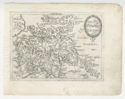
| Name: | Gordon, Robert, 1580-1661 Blaeu, Joan, 1596-1673 | |
| Title: | Scotia antiqua : qualis priscis temporibus, Romanis praesertim, cognita fuit quam in lucem eruere conabatur | |
| Imprint: | Amsterdam : Blaeu, 1654 | |
| Zoom Into Map: | Click on the map to view in greater detail. | |
| Name: | Turrini, G.M. | |
| Title: | Scotiae descriptio. | |
| Imprint: | Venice : GM Turrini, 1655. | |
| Zoom Into Map: | Click on the map to view in greater detail. | |
| Name: | Turrini, G.M. | |
| Title: | Scotiae descriptio. | |
| Imprint: | [Venice : GM Turrini, 1655]. | |
| Zoom Into Map: | Click on the map to view in greater detail. | |
| Name: | Jansson, Jan, 1588-1664 | |
| Title: | Lorna, Knapdalia, Cantire, Jura, Ila, Glota, et Buthe insulae. | |
| Imprint: | [Amsterdam : Jansson, 1659] | |
| Zoom Into Map: | Click on the map to view in greater detail. | |
| Name: | Jansson, Jan, 1588-1664 | |
| Title: | Scotia Provinciae intra Flumen Taum, et Murra fyrth sitae, utpote Moravia, Badenocha, Atholia, Aberdonia, Baneia, et Mernis. | |
| Imprint: | [Amsterdam : Jansson, 1659] | |
| Zoom Into Map: | Click on the map to view in greater detail. | |
| Name: | Jansson, Jan, 1588-1664 | |
| Title: | Scotiae provintiae inter Taum Fluvium, et Septentrionales oras Angliae. | |
| Imprint: | [Amsterdam : Jansson, 1659] | |
| Zoom Into Map: | Click on the map to view in greater detail. | |
| Name: | Jansson, Jan, 1588-1664 | |
| Title: | Tabula Leogi et Haraiae ac Skiae vel Skianae Insularum. | |
| Imprint: | [Amsterdam : Jansson, 1659] | |
| Zoom Into Map: | Click on the map to view in greater detail. | |
| Name: | Jansson, Jan, 1588-1664 | |
| Title: | Lochabria, omnesq, Insulae versus Occidentem sitae, ut Visto, Mulla, aliaeque. | |
| Imprint: | [Amsterdam : Jansson, 1659] | |
| Zoom Into Map: | Click on the map to view in greater detail. | |
| Name: | Jansson, Jan, 1588-1664 | |
| Title: | Extimae Scotiae pars septentrionalis in qua provinciae Rossia, Sutherlandia, Cathenesia, et Strath-Naverniae. | |
| Imprint: | [Amsterdam : Jansson, 1659] | |
| Zoom Into Map: | Click on the map to view in greater detail. | |
| Title: | Scotia. | |
| Imprint: | [S.l. : sn., ca. 1660] | |
| Zoom Into Map: | Click on the map to view in greater detail. | |
| Name: | Duval, Pierre, 1619-1682 | |
| Title: | Escosse / par P. Du Val. | |
| Imprint: | [Paris? : sn., ca. 1661] | |
| Zoom Into Map: | Click on the map to view in greater detail. | |
| Name: | Duval, Pierre, 1619-1682 | |
| Title: | Escosse / par P. Du Val. | |
| Imprint: | [Paris : Duval, 1661] | |
| Zoom Into Map: | Click on the map to view in greater detail. | |
| Name: | Duval, Pierre, 1619-1682 | |
| Title: | Escosse / par P. Du Val. | |
| Imprint: | Paris : Duval, 1661 | |
| Zoom Into Map: | Click on the map to view in greater detail. | |
| Name: | Speed, John, 1552?-1629 | |
| Title: | The Kingdome of Scotland / performed by Iohn Speed. | |
| Imprint: | [London] : sold by Roger Rea the Elder and Younger, [1662]. | |
| Zoom Into Map: | Click on the map to view in greater detail. | |
| Name: | Blaeu, Willem Janszoon, 1571-1638 Santen, Dirck Jansz van 1637 or 8-1708 | |
| Title: | Scotia regnum cum insulis adjacentibus / Robertus Gordonius a Straloch descripsit. | |
| Imprint: | [Amsterdam : Blaeu, 1662] | |
| Zoom Into Map: | Click on the map to view in greater detail. | |
| Name: | Speed, John, 1552?-1629 | |
| Title: | The Kingdome of Scotland / performed by Iohn Speed. | |
| Imprint: | [London] : sold by Roger Rea the Elder and Younger, [1662] | |
| Zoom Into Map: | Click on the map to view in greater detail. | |
| Name: | Sanson, Nicolas, 1600-1667 | |
| Title: | L' Escosse decà le Taý, divisée en ses Provinces &c. tirées de toutes les Cartes particulieres qu'en ont faict Timothée Pont, Robert Gordon a Straloch / par Sanson d'Abbev[ille]. | |
| Imprint: | Paris : Pierre Mariette, 1665. | |
| Zoom Into Map: | Click on the map to view in greater detail. | |
| Name: | Sanson, Nicolas, 1600-1667 | |
| Title: | L' Escosse delà le Taý, divisée en ses Provinces &c. tirées de toutes les Cartes particulieres de Timot Pont, de R. Gordon a Straloch / par Sanson d'Abbev[ille]. | |
| Imprint: | Paris : Pierre Mariette, 1665. | |
| Zoom Into Map: | Click on the map to view in greater detail. | |
| Name: | Sanson, Nicolas, 1600-1667 | |
| Title: | L' Escosse Royaume en ses deux Principales Parties ; qui sont Decà, et Del à le Taý, et Chaque Partie Subdivisée et leures Provinces qu'ils appellent Shirif-domes, Stewarties &c. / par Sanson d'Abbev[ille]. | |
| Imprint: | Paris : Pierre Mariette, 1665. | |
| Zoom Into Map: | Click on the map to view in greater detail. | |
| Name: | Sanson, Nicolas, 1600-1667 | |
| Title: | Les Isles Orcadney, ou Orkney ; Schetland, ou Hetland ; et de Fero, ou Farre, tirées de divers memoirs / par Sanson d'Abbev. | |
| Imprint: | Paris : Pierre Mariette, 1665. | |
| Zoom Into Map: | Click on the map to view in greater detail. | |
| Name: | Banca, Scipion. | |
| Title: | Scotiae descriptio. | |
| Imprint: | Venice : Scipion Banca, 1667. | |
| Zoom Into Map: | Click on the map to view in greater detail. | |
| Name: | Blome, Richard, d. 1705 | |
| Title: | A Mapp of the Kingdome of Scotland / by Ric. Blome ; R. Palmer, sculp. | |
| Imprint: | [London : Printed by Roycroft for ... Blome, 1673] | |
| Zoom Into Map: | Click on the map to view in greater detail. | |
| Name: | Speed, John, 1552?-1629 | |
| Title: | The Kingdome of Scotland / performed by John Speed. | |
| Imprint: | [London] : sold by Thomas Bassett and Ric Chiswell, [1676]. | |
| Zoom Into Map: | Click on the map to view in greater detail. | |
| Name: | Speed, John, 1552?-1629 | |
| Title: | The Kingdome of Scotland / performed by John Speed. | |
| Imprint: | [London] : sold by Thomas Bassett and Ric Chiswell, [1676]. | |
| Zoom Into Map: | Click on the map to view in greater detail. | |
| Name: | Pfann, Wilhelm | |
| Title: | Scotia. | |
| Imprint: | [Nuremberg : Johann Hoffman, 1678]. | |
| Zoom Into Map: | Click on the map to view in greater detail. | |
| Name: | Greene, Robert, 1678?-1730. | |
| Title: | New map of Scotland with the roads. / By Rob: Greene ... and by W. Berry .... | |
| Imprint: | [London : Greene & Berry, 1679] | |
| Zoom Into Map: | Click on the map to view in greater detail. | |
| Name: | Duval, Pierre, 1619-1682 | |
| Title: | Scotia / par P. du Val geogr[aphe]. D[u].R[oi]. | |
| Imprint: | Nuremberg : Christoff Gerhard for Johann Hoffman, 1679. | |
| Zoom Into Map: | Click on the map to view in greater detail. | |
| Name: | Garrett, John | |
| Title: | The Kingdome of Scotland. | |
| Imprint: | [London] : Printed coloured and sold by John Garrett [1680]. | |
| Zoom Into Map: | Click on the map to view in greater detail. | |
| Name: | Wit, Frederik de. | |
| Title: | Scotia Regnum divisum in Partem Septentrionalem et Meridionalem Subdivisas in Comitatus, Vice comitatus Provincias Praefecturas Dominia et Insulas / per F. de Wit. | |
| Imprint: | [London : de Wit, ca. 1680] | |
| Zoom Into Map: | Click on the map to view in greater detail. | |
| Name: | Moore, Jonas | |
| Title: | Scotland. | |
| Imprint: | [London : Robert Scott, 1681] | |
| Zoom Into Map: | Click on the map to view in greater detail. | |
| Name: | Manesson-Mallet, Allain, 1630?-1706? | |
| Title: | Escosse. | |
| Imprint: | [Paris : Thierry, 1683] | |
| Zoom Into Map: | Click on the map to view in greater detail. | |
| Name: | Manesson-Mallet, Allain, 1630?-1706? | |
| Title: | Is de Fero de Scheland, Orknay et Hebrides. | |
| Imprint: | [Paris : Thierry, ca. 1683]. | |
| Zoom Into Map: | Click on the map to view in greater detail. | |
| Name: | Manesson-Mallet, Allain | |
| Title: | Is de Fero de Scheland, Orknay et Hebrides. | |
| Imprint: | [Paris : Thierry ca. 1683]. | |
| Zoom Into Map: | Click on the map to view in greater detail. | |
| Name: | Manesson-Mallet, Allain, 1630?-1706? | |
| Title: | Escosse. | |
| Imprint: | Paris : Thierry, 1683 | |
| Zoom Into Map: | Click on the map to view in greater detail. | |
| Name: | Manesson-Mallet, Allain, 1630?-1706? | |
| Title: | Royaume d'Ecosse. | |
| Imprint: | Paris : Thierry, 1683. | |
| Zoom Into Map: | Click on the map to view in greater detail. | |
| Name: | Manesson-Mallet, Allain, 1630?-1706? | |
| Title: | Is de Fero de Scheland, Orknay et Hebrides. | |
| Imprint: | Paris : Thierry, ca. 1683. | |
| Zoom Into Map: | Click on the map to view in greater detail. | |
| Title: | Royaume d'Esosse. | |
| Imprint: | [Frankfurt : Mallet, 1684] | |
| Zoom Into Map: | Click on the map to view in greater detail. | |
| Name: | Duval, Pierre, 1619-1682 | |
| Title: | Les Isles Britaniques, ou sont les Royaumes d'Angleterre et d'Escosse que nous appellons La Grande Bretagne et celui d'Irlande avec les Isles Voisines et les Costes de France, de Flandre et de Hollande qui en sont proches / par le Sieur Du-Val ... | |
| Imprint: | Paris : Chez Madlle Du-Val fille de l'Auteur, 1687. | |
| Zoom Into Map: | Click on the map to view in greater detail. | |
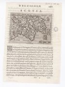
| Name: | Morden, Robert d. 1703. | |
| Title: | A Mapp of Scotland : made by R. Gordon, Author of Blaeu's Atlas of Scotland / corrected and Improved by Rob. Morden. To which is added Alphabetical Tables For the Ready finding out any Place in the Mapp. | |
| Imprint: | London : Sold by Rob. Walton ... and by Rob. Morden, [1687] | |
| Zoom Into Map: | Click on the map to view in greater detail. | |
| Name: | Morden, Robert d. 1703 | |
| Title: | Scotiae Nova Descriptio / per Robert Morden. | |
| Imprint: | [London : Morden, ca. 1688]. | |
| Zoom Into Map: | Click on the map to view in greater detail. | |
| Name: | Coronelli, Vincenzo, 1650-1718 Nolin, Jean Baptiste | |
| Title: | Le Royaume d'Escosse divisé en deux parties ... dressé par le P. Coronelli ... / corrigé et augmenté sur les Mémoires du Sr. Tillemon ... Dedié à le Prince de Galles, fils de Jacques II. | |
| Imprint: | Paris : Nolin, 1689. | |
| Zoom Into Map: | Click on the map to view in greater detail. | |
| Name: | Visscher, Nicolaes, 1649-1702 | |
| Title: | Exactissima Regni Scotiae Tabula tam in septentrionalem et meriodionalem quam in minores earundem provincias insulesq, et undique praetensas accurate divisa / per Nicolaum Visscher. | |
| Imprint: | Amst[erdam : s.n., 1689]. | |
| Zoom Into Map: | Click on the map to view in greater detail. | |
| Name: | Visscher, Nicolaes, 1649-1702 | |
| Title: | Exactissima Regni Scotiae tabula tam in septentrionalem et meriodionalem quam in minores earundem provincias, insulasq, ei undique praetensas accurate divisa / per Nicolaum Visscher. | |
| Imprint: | Amst[erdam : sn 1689]. | |
| Zoom Into Map: | Click on the map to view in greater detail. | |
| Name: | Visscher, Nicolaes, 1649-1702 | |
| Title: | Exactissima Regni Scotiae Tabula cam in septentrionalam et meridionalem quam in minores earumdem provincias, insulasqz ... / accurate divisa per Nicolaum Visscher. | |
| Imprint: | [Amsterdam, 1690] | |
| Zoom Into Map: | Click on the map to view in greater detail. | |
| Name: | Duval, Pierre, 1619-1682 | |
| Title: | Scotia / par P. du Val geogr[aphe]. D[u].R[oi]. | |
| Imprint: | Nuremberg : Christoff Gerhard for Johann Hoffman, 1690. | |
| Zoom Into Map: | Click on the map to view in greater detail. | |
| Name: | Homann, Johann Baptist, 1663-1724 | |
| Title: | Scotiae Regnum = Königreich Schottland. / J.B. Homan scul. | |
| Imprint: | [Nürnberg : In Verlegung J A Endters Seel Söhne, 1690] | |
| Zoom Into Map: | Click on the map to view in greater detail. | |
| Name: | Nolin, Jean Baptiste, 1648-1708. | |
| Title: | Royaume d'Ecosse divise en provinces : suivant les nouvelles observations / par J.B. Nolin. | |
| Imprint: | [Paris] : L.J. Mondhare, 1690 | |
| Zoom Into Map: | Click on the map to view in greater detail. | |
| Name: | Gordon, Robert, 1580-1661 | |
| Title: | Scotia regnum cum insulis adjacentibus / Robertus Gordonius a Straloch descripsit.. | |
| Imprint: | [London : Philip Lea, 1693]. | |
| Zoom Into Map: | Click on the map to view in greater detail. | |
| Name: | Morden, Robert d. 1703 | |
| Title: | Scotland / by Robt. Morden. | |
| Imprint: | [London : Morden 1695]. | |
| Zoom Into Map: | Click on the map to view in greater detail. | |
| Name: | Morden, Robert d. 1703 | |
| Title: | Scotland / by Robt. Morden. | |
| Imprint: | [London : Morden, ca. 1695] | |
| Zoom Into Map: | Click on the map to view in greater detail. | |
| Name: | Morden, Robert d. 1703 | |
| Title: | Scotland / by Robt. Morden. | |
| Imprint: | [London : Morden, ca. 1695] | |
| Zoom Into Map: | Click on the map to view in greater detail. | |
| Name: | Morden, Robert d. 1703 | |
| Title: | Scotland / by Robt. Morden. | |
| Imprint: | [London : Edmund Gibson, 1695] | |
| Zoom Into Map: | Click on the map to view in greater detail. | |
| Name: | Coronelli, Vincenzo, 1650-1718 | |
| Title: | Scotia : parte settentrionale ; parte meridionale /_x000d_ descritta, e dedicata dal P. Cosmgrafo Coronelli, Al Reuereudissimo Padre Maestro Tomaso Maria Peire Teo logo di S.A.R. dela Duca di Sauoia. | |
| Imprint: | [Venice : Coronelli, 1696] | |
| Zoom Into Map: | Click on the map to view in greater detail. | |
| Name: | Allard, Carel, 1648-ca. 1709 | |
| Title: | Novissima Regni Scotiae septentrionalis et meridionalis tabula, divisae in ducatus, comitatus, vice-comitatus, provincias, praefecturas, dominia et insulas / auctore Carolo Allard. | |
| Imprint: | Amsteldam : Allard, [1697] | |
| Zoom Into Map: | Click on the map to view in greater detail. | |
| Name: | Coronelli, Vincenzo, 1650-1718 | |
| Title: | Scotia : parte settentrionale = Scotia parte meridionale / Descritta, e Dedicata dal P. Cosmografo Coronelli, Al Reuerendissimo Padre Maestro Tomaso Maria Peire Teologo di S.A.R. dela Duca di Sauoia. | |
| Imprint: | [Venice : Coronelli, 1697] | |
| Zoom Into Map: | Click on the map to view in greater detail. | |
| Title: | T Koningryk van Schotlandt, in zyne Zuider, en Noorder deelen verdeelt. | |
| Imprint: | [S.l. : sn., ca. 17--?] | |
| Zoom Into Map: | Click on the map to view in greater detail. | |
| Name: | Cooper, Richard, 1705-1764 | |
| Title: | A Skitch [sic] of part of the Highlands of Scotland. | |
| Imprint: | [ca. 170-?]. | |
| Zoom Into Map: | Click on the map to view in greater detail. | |
| Title: | [Ecosse] | |
| Imprint: | [S.l. : sn., 1700?] | |
| Zoom Into Map: | Click on the map to view in greater detail. | |
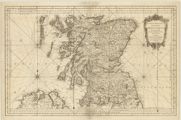
| Name: | Moll, Herman, d. 1732 | |
| Title: | Scotland. | |
| Imprint: | [London: Moll, 1701] | |
| Zoom Into Map: | Click on the map to view in greater detail. | |
| Name: | Muller, Johann Ulrich | |
| Title: | Scotia. | |
| Imprint: | [Ulm : Georg W Kühnen, 1702] | |
| Zoom Into Map: | Click on the map to view in greater detail. | |
| Name: | Schenk, Peter | |
| Title: | Regnum Scotiae : seu pars septent ; Magnae Britanniae, divisa in Scotiam septent et australem porro autem incomit ; Rossiam, Moraviam, Argathelium et Gallovidiam vicecomit ; Banfam et Marriam praefect ; Laudoniam, Renfroviam et Anandiam, una insulis Ebuda | |
| Imprint: | Amstelodami : Apud Petrum Schenk et Gerardum Valk, [1705] | |
| Zoom Into Map: | Click on the map to view in greater detail. | |
| Name: | Morden, Robert d. 1703 | |
| Title: | A New Mapp of Scotland, the Western, Orkney, and Shetland Islands / Begun by appointment of Robt. Morden, Finished at ye Charge and by direction of C. Browne. | |
| Imprint: | London : Sold by Christop Browne, [ca. 1705] | |
| Zoom Into Map: | Click on the map to view in greater detail. | |
| Name: | Jansson, Jan, 1588-1664 | |
| Title: | Scotiae provinciae inter Taum Fluvium, et septentrionalis oras Angliae. | |
| Imprint: | Amstelodami : Apud Petrum Schenk et Gerardum Valk, [ca. 1705] | |
| Zoom Into Map: | Click on the map to view in greater detail. | |
| Name: | Jansson, Jan, 1588-1664 | |
| Title: | Extimae Scotiae pars Septentrionalis in qua Provinciae Rossia, Sutherlandia, Cathenesia, et Strath-Naverniae. | |
| Imprint: | Amstelodami : Petrus Schenk et Geradum Valk, [1705?] | |
| Zoom Into Map: | Click on the map to view in greater detail. | |
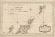
| Name: | Coronelli, Vincenzo, 1650-1718 | |
| Title: | L'Isole Ebridi. | |
| Imprint: | [Venice : Coronelli, 1706] | |
| Zoom Into Map: | Click on the map to view in greater detail. | |
| Name: | Aa, Pieter van der, 1659-1733 | |
| Title: | Scotia. | |
| Imprint: | Leyden : Pieter van der Aa, 1707. | |
| Zoom Into Map: | Click on the map to view in greater detail. | |
| Name: | Schenk, Peter | |
| Title: | Novissima Regni Scotiae septentrionalis et meridionalis tabula : divisae in ducatus, comitat., vice-comitat., prov., praefecturas, dominia et insulas / autore Petro Schenk cum privil. | |
| Imprint: | [Amsterdam : Petrus Schenk, 1708. | |
| Zoom Into Map: | Click on the map to view in greater detail. | |
| Name: | Châtelain, Zacharias. | |
| Title: | Nouvelle Carte d'Ecosse, où l'on fait observer l'Etat de la Noblesse : les Villes, et les Bourgs qui deputent au Parlement, et Diverses autres remarques propres à Conduire à l'Inteligence de l'Histoire de ce Royaume. | |
| Imprint: | [Amsterdam : Châtelain, 1708] | |
| Zoom Into Map: | Click on the map to view in greater detail. | |
| Name: | Moll, Herman, d. 1732. | |
| Title: | The North Part of Great Britain / by Hermann Moll. | |
| Imprint: | [London : Rhodes, Nicholson and Bell, 1708] | |
| Zoom Into Map: | Click on the map to view in greater detail. | |
| Name: | Homann, Johann Baptist, 1663-1724 | |
| Title: | Magnae Britannia : pars septentrionalis qua regnum Scotiae in suas partes et subja centes insulas divisum / Accurata tabula ex archetypo Vischeriano desumta exhibetur imatatore Iohan. Bapt. Homanno, Noribergae. | |
| Imprint: | Noribergae [Nürnberg] : Homanni, [originally engraved ca. 1710, this map 1759] | |
| Zoom Into Map: | Click on the map to view in greater detail. | |
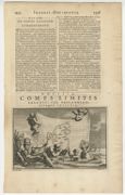
| Name: | Goeree, Jan | |
| Title: | Comes limitis Saxonici per Britanniam ejusque insigniae / I. Goeree, dilin ; P. Sluyter, fec. | |
| Imprint: | [Amsterdam : sn ca. 1710] | |
| Zoom Into Map: | Click on the map to view in greater detail. | |
| Name: | Sanson, Nicolas, 1600-1667 | |
| Title: | Le Royaume de Escosse divisée en ses parties meridionale et septentrionale. | |
| Imprint: | [Paris : Sanson ca.1710] | |
| Zoom Into Map: | Click on the map to view in greater detail. | |
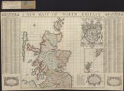
| Name: | Nicholls, Sutton. | |
| Title: | A new map of North Britain or Scotland containing all the cities and market towns / delinea'd and engraved by Sutton Nicholls. | |
| Imprint: | [London : William Knight, ca. 1710] | |
| Zoom Into Map: | Click on the map to view in greater detail. | |
| Name: | Moll, Herman, d. 1732 | |
| Title: | The north part of Great Britain called Scotland : with considerable inprovements [sic] and many remarks not extant in any map. / According to the newest and exact observations by Hermann Moll. | |
| Imprint: | [London] : printed for H Moll and D Midwinter 1714. | |
| Zoom Into Map: | Click on the map to view in greater detail. | |
| Name: | Moll, Herman, d. 1732. | |
| Title: | The north part of Great Britain called Scotland : with considerable inprovements [sic] and many remarks not extant in any map. / According to the newest and exact observations by Hermann Moll. | |
| Imprint: | [London] : H. Moll, I. Bowles and T. Bowles, [originally published 1714, this edition ca. 1726?]. | |
| Zoom Into Map: | Click on the map to view in greater detail. | |
| Name: | Sanson, Nicolas, 1600-1667 | |
| Title: | A new and exact mapp of Scotland, or North Britain / described by N. Sanson ... ; translated into English at the expence of Henry Overton of London ; Sutton Nicholls, sculp. | |
| Imprint: | London : Overton, 1715]. | |
| Zoom Into Map: | Click on the map to view in greater detail. | |
| Name: | Weigel, Christoph. | |
| Title: | Scotia Cambdeni et Sibbaldi / per Chr. Weigelium; M.K. [ie. Michael Kauffer] scul. | |
| Imprint: | [Nürnberg : Kohler, ca. 1718] | |
| Zoom Into Map: | Click on the map to view in greater detail. | |
| Name: | Visscher, Nicolaes, 1649-1702 | |
| Title: | Exactissima Regni Scotiae tabula tam in septentrionalem et meridionalem quam in minores earumden provincias, insulasq, et undique praetensas accurate divisa / per Nicolaum Visscher ... nunc apud P. Schenk Junior. | |
| Imprint: | [Amsterdam : Covens & Mortier, 1718-1759]. | |
| Zoom Into Map: | Click on the map to view in greater detail. | |
| Name: | Moll, Herman, d. 1732 | |
| Title: | A pocket companion of ye roads of ye North part of Great Britain called Scotland ... / by Herman Moll. | |
| Imprint: | [London], 1718. | |
| Zoom Into Map: | Click on the map to view in greater detail. | |
| Name: | Johnston, Andrew. | |
| Title: | New map of the north (south) part of Scotland / And. Johnston delin: & sculpt. North | |
| Imprint: | [London, 1722] | |
| Zoom Into Map: | Click on the map to view in greater detail. | |
| Title: | New map of the north (south) part of Scotland / And. Johnston delin: & sculpt. South | |
| Imprint: | [London, 1722] | |
| Zoom Into Map: | Click on the map to view in greater detail. | |
| Name: | Wit, Frederik de. | |
| Title: | Scotia Regnum divisum in partem septentrionalem et meridionalem subdivisas in comitatus, vice comitatus, provincias, praefecturas, dominia et insulas / per F. de Wit. | |
| Imprint: | [Amstelodami : J Covens & C Mortier, 1725]. | |
| Zoom Into Map: | Click on the map to view in greater detail. | |
| Name: | Aa, Pieter van der, 1659-1733 | |
| Title: | Scotia. | |
| Imprint: | Leyden : Pieter van der Aa, 1727. | |
| Zoom Into Map: | Click on the map to view in greater detail. | |
| Name: | Aa, Pieter van der, 1659-1733 | |
| Title: | Scotia. | |
| Imprint: | Leyden : Pieter van der Aa, 1727. | |
| Zoom Into Map: | Click on the map to view in greater detail. | |
| Name: | Aa, Pieter van der, 1659-1733 | |
| Title: | Scotia. | |
| Imprint: | Leyden : Pieter van der Aa, 1727. | |
| Zoom Into Map: | Click on the map to view in greater detail. | |
| Name: | Moll, Herman, d. 1732 | |
| Title: | A new and correct map of Scotland & the Isles, containing all ye cities, market towns, boroughs, &c. / by Herman Moll. | |
| Imprint: | Dublin. : printed and sold by Geo Grierson [1730?] | |
| Zoom Into Map: | Click on the map to view in greater detail. | |
| Name: | Moll, Herman, d. 1732 | |
| Title: | The north part of Great Britain called Scotland : with considerable inprovements [sic] and many remarks not extant in any map / According to the newest and exact observations by Hermann Moll. | |
| Imprint: | [London] : printed for H Moll J Bowles Tho Bowles and John King, [ca. 1730] | |
| Zoom Into Map: | Click on the map to view in greater detail. | |
| Name: | Bowles, Thomas | |
| Title: | A new mapp of Scotland or North Britain with considerable improvements according to the newest observations. | |
| Imprint: | London : Printed and sold by Tho Bowles print and map seller next the Chapter House in St Pauls Church yard and John Bowles print and map seller at the Black Horse in Cornhill, 1731. | |
| Zoom Into Map: | Click on the map to view in greater detail. | |
| Name: | Bakewell, Thomas | |
| Title: | The North Part of Great Britain called Scotland / Tho. Bakervell [sic.] | |
| Imprint: | [S.l. : sn 1731] | |
| Zoom Into Map: | Click on the map to view in greater detail. | |
| Name: | Lempriere, C. fl. ca. 1731. | |
| Title: | A description of the Highlands of Scotland, the situation of the several clans and the number of men able to bear arms, as also ye forts lately erected and roads of communication or military ways carried on by His Majesty's command ... / C. Lempriere. | |
| Imprint: | [1731] | |
| Zoom Into Map: | Click on the map to view in greater detail. | |
| Name: | Cowley, J. (John) Seale, R. W., fl. 1734 | |
| Title: | A New Map of North Britain with the Islands thereunto belonging ; / done from some late Surveys of part of the East and West Coasts, and from Modern Accounts of the Country and other Authorities mentioned in the Explanation annexed Fol. (9), by J. Cowley | |
| Imprint: | [S.l. : Cowley], 1734 | |
| Zoom Into Map: | Click on the map to view in greater detail. | |

| Name: | Cowley, J. (John) | |
| Title: | A Display of the Coasting Lines of six several maps of North Britain [Adair, Moll, Gordon of Straloch, Senex, Inselin, Sanson] / by I. Cowley. | |
| Imprint: | London : Cowley, 1734. | |
| Zoom Into Map: | Click on the map to view in greater detail. | |
| Name: | Cowley, J. (John) | |
| Title: | A new map of north Britain with the islands thereunto belonging ... / by J. Cowley ... (R.W. Seale sculp.). | |
| Imprint: | [London], 1734. | |
| Zoom Into Map: | Click on the map to view in greater detail. | |
| Name: | Du Sauzet, Henri. | |
| Title: | Ecosse meridionale. | |
| Imprint: | [Amsterdam : du Sauzet 1734, i.e.1735] | |
| Zoom Into Map: | Click on the map to view in greater detail. | |
| Name: | Du Sauzet, Henri. | |
| Title: | Escosse septentrionale. | |
| Imprint: | [Amsterdam : du Sauzet 1734 i.e.1735] | |
| Zoom Into Map: | Click on the map to view in greater detail. | |
| Name: | Cowley, J. | |
| Title: | A new map of north Britain with the islands thereunto belonging ... / by J. Cowley ... (R.W. Seale sculp.). | |
| Imprint: | [London], 1734. | |
| Zoom Into Map: | Click on the map to view in greater detail. | |
| Name: | Cowley, J. (John) | |
| Title: | Display of the coasting lines of six several maps of North Britain ….. London, 1734. | |
| Imprint: | 1734 | |
| Zoom Into Map: | Click on the map to view in greater detail. | |
| Name: | Seutter, Matthaeus | |
| Title: | Nova et accurata totius Regni Scotiae : secundum omnes provincias et adjacentes insulas, esquisito studio determinatae / Delineatio cura et sumtibus Matth. Seutteri ; And. Silbereysen, sculp. | |
| Imprint: | [Augsburg : sn ca. 1735]. | |
| Zoom Into Map: | Click on the map to view in greater detail. | |
| Name: | Cóvens, Johannes. | |
| Title: | Novissima Regni Scotiae septentrionalis et meridionalis tabula : divisae in ducatus, comitatus, vice-comitatus, provincias, praefecturas, dominia et insulas / auctore I. Cóvens et C. Mortier. | |
| Imprint: | Amsteldam : I Cóvens en C Mortier [1740] | |
| Zoom Into Map: | Click on the map to view in greater detail. | |
| Title: | La Scozia | |
| Imprint: | [S.l. : sn., ca. 1740] | |
| Zoom Into Map: | Click on the map to view in greater detail. | |
| Name: | Sanson, Nicolas, 1600-1667 | |
| Title: | L'Escosse delà le Tay : divisée en toutes ses provinces : tirées des cartes particulieres de Timot. Pont, de R. Gordon a Straloch etc. / par le Sr. Sanson [Nicolas Sanson]. | |
| Imprint: | Paris : chez le Sr Robert, 1741. | |
| Zoom Into Map: | Click on the map to view in greater detail. | |
| Name: | Sanson, Nicolas, 1600-1667 | |
| Title: | L'Escosse royaume en ses principales parties, qui sont decà et delà le Tay et chaque partie subdivisée en leurs provinces qu'ils appellant shirif-domes, stewarties &c. / Par le Sr. Sanson d'Abbeville ... | |
| Imprint: | A Paris : chéz le Sr Robert, 1741. | |
| Zoom Into Map: | Click on the map to view in greater detail. | |
| Name: | Bryce, Alexander fl. ca. 1744 Cooper, Richard, 1705-1764 | |
| Title: | A Map of the North Coast of Britain, from Row Stoir of Assynt, to Wick in Caithness : By a Geometrical Survey with the Harbours, Rocks, & an Account of the Tides in the Pentland Firth, done at the Philosophical Society at Edinburgh / R. Cooper sculpt. | |
| Imprint: | [Edinburgh : s.n., 1744] | |
| Zoom Into Map: | Click on the map to view in greater detail. | |
| Name: | Seale, Richard William. | |
| Title: | A Map of the Kingdom of Scotland from the latest and best observations, for Mr. Tindal's Continuation of Mr. Rapin's History / R.W. Seale del. et sculp. | |
| Imprint: | [London : sn., 1744]. | |
| Zoom Into Map: | Click on the map to view in greater detail. | |
| Name: | Bowen, Emanuel | |
| Title: | A new and accurate map of Scotland / compiled ... by Emanl. Bowen. | |
| Imprint: | [London : Printed for W Innys etc, 1744] | |
| Zoom Into Map: | Click on the map to view in greater detail. | |
| Name: | Elphinstone, John, 1706-1753 | |
| Title: | A new & correct map of North Britain. | |
| Imprint: | London : And. Millar, 1745. | |
| Zoom Into Map: | Click on the map to view in greater detail. | |
| Name: | Moll, Herman, d. 1732 | |
| Title: | Scotland divided into its Shires / by H. Moll. | |
| Imprint: | [London : Bowles and Bowles, 1745] | |
| Zoom Into Map: | Click on the map to view in greater detail. | |
| Name: | Elphinstone, John, 1706-1753 | |
| Title: | A new & correct Mercator's map of North Britain ... / by Ino. Elphinstone. | |
| Imprint: | London : A Millar 1745 [ie 1746] | |
| Zoom Into Map: | Click on the map to view in greater detail. | |
| Name: | Overton, Henry | |
| Title: | The kingdom of Scotland divided into the North and South parts ... / printed and sold by Henry Overton, etc. | |
| Imprint: | [London] : H Overton, 1745. | |
| Zoom Into Map: | Click on the map to view in greater detail. | |
| Name: | Sanson, Nicolas, 1600-1667 | |
| Title: | A new and exact mapp of Scotland or North-Britain / described by N. Sanson ... translated into English at the expense of Henry Overton ... (Sutton Nicholls sculp.). | |
| Imprint: | London, 1745. | |
| Zoom Into Map: | Click on the map to view in greater detail. | |
| Name: | Bowen, Emanuel | |
| Title: | A new & accurate map of Scotland or North Britain. Drawn from surveys & most approved maps & charts; exhibiting the King's Roads, &c. / by Eman. Bowen. | |
| Imprint: | London : T Bakewell, 1746. | |
| Zoom Into Map: | Click on the map to view in greater detail. | |
| Name: | Cooper, Richard, c. 1705-1764 | |
| Title: | A map of His Majesty's roads from Edinburgh to Inverness, Fort Augustus & Fort William and of the countries adjacent thereto ... dedicated to ... William Augustus, Duke of Cumberland ... / by ... Richd. Cooper. (R. Cooper sculpt.). | |
| Imprint: | [Edinburgh, 1746] | |
| Zoom Into Map: | Click on the map to view in greater detail. | |
| Name: | Le Rouge, Georges-Louis | |
| Title: | L'Ecosse suivant les nouvelles observations publiés à Londres en 1735 par Bowles. | |
| Imprint: | Paris : chez le Sr le Rouge, 1746. | |
| Zoom Into Map: | Click on the map to view in greater detail. | |
| Name: | Le Rouge, George Louis, fl. 1740-1780 | |
| Title: | L'Eccosse suivant les nouvelles observations publies a Londres en 1735 par Bowles. | |
| Imprint: | Paris : chez le Sr Le Rouge, 1746. | |
| Zoom Into Map: | Click on the map to view in greater detail. | |
| Title: | New mapp of Scotland or North Britain with considerable improvements according to the newest observations. | |
| Imprint: | London : Printed and sold by Tho. Bowles print and map seller next the Chapter House in St Pauls Church yard and John Bowles print and map seller at the Black Horse in Cornhill, 1746 | |
| Zoom Into Map: | Click on the map to view in greater detail. | |
| Name: | Kitchin, Thomas | |
| Title: | A map of the King's roads, made by his Excellency General Wade in the Highlands of Scotland: from Sterling to Inverness with the adjacent counties &c. / (T. Kitchin sculp.). | |
| Imprint: | London : T Willdey 1746. | |
| Zoom Into Map: | Click on the map to view in greater detail. | |
| Name: | Le Rouge, Georges-Louis | |
| Title: | Le Royaume d'Ecosse : Divisé en ses parties Meridionale et Septentrionale. | |
| Imprint: | [Paris : chez Sr Desnos, 1748] | |
| Zoom Into Map: | Click on the map to view in greater detail. | |
| Name: | Bickham, George. | |
| Title: | A map of the North part of Great Britain, called Scotland / G. Bickham fecit. | |
| Imprint: | [London, 1748-1754] | |
| Zoom Into Map: | Click on the map to view in greater detail. | |
| Name: | Robert de Vaugondy, Gilles | |
| Title: | Royaume d'Ecosse divisé en provinces / par le Sr. Robert. | |
| Imprint: | [Paris : Robert de Vaugondy, 1748. | |
| Zoom Into Map: | Click on the map to view in greater detail. | |
| Name: | Kitchin, Thomas | |
| Title: | A map of the King's roads, made by his Excellency General Wade in the Highlands of Scotland: from Sterling to Inverness with the adjacent counties &c. / T. Kitchin sculp. | |
| Imprint: | London : sn Jany. 4th 1746 [i.e. ca. 1749?]. | |
| Zoom Into Map: | Click on the map to view in greater detail. | |
| Name: | Jefferys, Thomas | |
| Title: | Scotland / T. Jefferys, sculp. | |
| Imprint: | [London : Salmon, 1749]. | |
| Zoom Into Map: | Click on the map to view in greater detail. | |
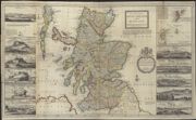
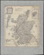
| Name: | Dorret, James, fl. 1744-1761 | |
| Title: | A general map of Scotland and islands thereto belonging. | |
| Imprint: | London : s.n., 1750. | |
| Zoom Into Map: | Click on the map to view in greater detail. | |
| Name: | Dorret, James, fl. 1744-1761 | |
| Title: | A correct map of Scotland from new surveys. | |
| Imprint: | [London?] : s.n., 1751. | |
| Zoom Into Map: | Click on the map to view in greater detail. | |
| Name: | de Vaugondy, Gilles Robert | |
| Title: | Le Royaume d'Ecosse divisé en shires ou comtes. | |
| Imprint: | Paris : s.n., 1751. | |
| Zoom Into Map: | Click on the map to view in greater detail. | |
| Name: | Dorret, James, fl. 1744-1761 | |
| Title: | [North] A correct map of Scotland from new surveys.In two sheets (North and South) with W part S sheet missing.1751. | |
| Imprint: | 1751 | |
| Zoom Into Map: | Click on the map to view in greater detail. | |
| Name: | Dorret, James, fl. 1744-1761 | |
| Title: | [South] A correct map of Scotland from new surveys.In two sheets (North and South) with W part S sheet missing.1751. | |
| Imprint: | 1751 | |
| Zoom Into Map: | Click on the map to view in greater detail. | |
| Name: | Dorret, James, fl. 1744-1761 | |
| Title: | A correct map of Scotland from new surveys / by James Dorret. | |
| Imprint: | [London?], 1751. | |
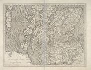
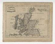
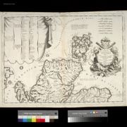
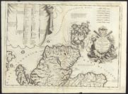
| Zoom Into Map: | Click on the map to view in greater detail. | |
| Name: | Jenner, Thomas, fl. 1618-1673 Hollar, Wenceslaus, 1607-1677 | |
| Title: |
The north-part of England and the south-part of Scotland. Quartermaster's map. | |
| Imprint: | [London : Jean Rocque, originally engraved ca. 1644, this map ca. 1752] | |
| Zoom Into Map: | Click on the map to view in greater detail. | |
| Title: | Tabula Geographica Scotiae, etc. | |
| Imprint: | [S.l., ca. 1753-1760] | |
| Zoom Into Map: | Click on the map to view in greater detail. | |
| Name: | Tirion, Isaak | |
| Title: | Nieuwe Kaart van't Noorder Gedellte van Grootbritannie behelzende Het Koningryk Schotland. | |
| Imprint: | Te Amsterdam : Isaac Tirion [ca. 1755?] | |
| Zoom Into Map: | Click on the map to view in greater detail. | |
| Name: | Euler, Leonhard | |
| Title: | Tabula Geographica Scotiae ... / [by L. Euler]. | |
| Imprint: | [Berlin, ca. 1756] | |
| Zoom Into Map: | Click on the map to view in greater detail. | |
| Name: | Bellin, J.N. | |
| Title: | Carte reduite des Isle Britanniques - North | |
| Imprint: | [Paris : J.N. Bellin, 1757] | |
| Zoom Into Map: | Click on the map to view in greater detail. | |
| Name: | Bellin, J.N. | |
| Title: | Carte reduite des Isle Britanniques - South | |
| Imprint: | [Paris : J.N. Bellin, 1757] | |
| Zoom Into Map: | Click on the map to view in greater detail. | |
| Name: | Phinn, Thomas | |
| Title: | A new and accurate map of Scotland : drawn from surveys and the most approved maps & charts and regulated by Astron[omical] observations in which are delineated the routes of the several armies in 1745 & 1746 and the Pr[ince]s secret course by land and wa | |
| Imprint: | [Edinburgh : Printed by Sands Brymer Murray and Cochran, 1758] | |
| Zoom Into Map: | Click on the map to view in greater detail. | |
| Name: | Le Rouge, Georges-Louis | |
| Title: | L'Ecosse suivant les nouvelles observdtiont.[sic] / Par le Sr. Le Rouge ingenieur geographe du Roi. | |
| Imprint: | A Paris : Cheś Daumont rue Saint Martin, [1760?]. | |
| Zoom Into Map: | Click on the map to view in greater detail. | |
| Name: | Bowles, Thomas | |
| Title: | A new mapp of Scotland or North Britain with considerable improvements according to the newest observations. | |
| Imprint: | London : Printed and sold by Tho Bowles print and map seller next the Chapter House in St Paul's Church yard and John Bowles & Son print & map sellers at the Black Horse in Cornhill [ca. 1760] | |
| Zoom Into Map: | Click on the map to view in greater detail. | |
| Name: | Dorret, James, fl. 1744-1761 | |
| Title: | An accurate map of Scotland / drawn ... with many additional improvements, by James Dorret. | |
| Imprint: | London : Printed for R Sayer, 1761. | |
| Zoom Into Map: | Click on the map to view in greater detail. | |
| Name: | Dorret, James, fl. 1744-1761 | |
| Title: | An accurate map of Scotland drawn from all the particular surveys… | |
| Imprint: | London : printed for… R. Sayer, 1761. | |
| Zoom Into Map: | Click on the map to view in greater detail. | |
| Name: | de Vaugondy, Gilles Robert | |
| Title: | L'Ecosse. | |
| Imprint: | A Paris : chés l'auteur ..., 1762 | |
| Zoom Into Map: | Click on the map to view in greater detail. | |
| Name: | Bellin, J.N. | |
| Title: | Carte de l'Ecosse. | |
| Imprint: | [Paris : J.N. Bellin, 1764] | |
| Zoom Into Map: | Click on the map to view in greater detail. | |
| Name: | Dury, Andrew | |
| Title: | A map of Scotland / T. Kitchin sculp. | |
| Imprint: | [London : A Dury, 1764]. | |
| Zoom Into Map: | Click on the map to view in greater detail. | |
| Name: | Dury, Andrew | |
| Title: | [Map of northern Scotland with Orkney]. | |
| Imprint: | [London : Andrew Dury, 1764]. | |
| Zoom Into Map: | Click on the map to view in greater detail. | |
| Name: | Dury, Andrew | |
| Title: | [Map of Inner and Outer Hebrides]. | |
| Imprint: | [London : Andrew Dury, 1764]. | |
| Zoom Into Map: | Click on the map to view in greater detail. | |
| Name: | Dury, Andrew | |
| Title: | [Map of south west Scotland]. | |
| Imprint: | [London : Andrew Dury, 1764]. | |
| Zoom Into Map: | Click on the map to view in greater detail. | |
| Name: | Lotter, Tobias Conrad. | |
| Title: | Nova et Accurata totius Regni Scotiae, secundum omnes provincias et adjacentes insulas ... / delineatio, cura et sumtibus Tobiae Conradi Lotteri ... (And. Silbereÿsen sculps.). | |
| Imprint: | Aug. Vind., [1765] | |
| Zoom Into Map: | Click on the map to view in greater detail. | |

| Name: | Brion de la Tour, Louis, 1743-1803 | |
| Title: | L'Ecosse, dressée conformément aux observations astronomiques et aux itinéraires / par M. Brion, etc. | |
| Imprint: | [Paris] : Desnos, 1765 [ie 1766] | |
| Zoom Into Map: | Click on the map to view in greater detail. | |
| Name: | Brion de la Tour, Louis, 1743-1803 | |
| Title: | L'Ecosse, dressée conformément aux observations astronomiques et aux itinéraires / par M. Brion, etc. | |
| Imprint: | [Paris] : Desnos, 1766. | |
| Zoom Into Map: | Click on the map to view in greater detail. | |
| Name: | Brion de la Tour, Louis, 1743-1803 | |
| Title: | L'Ecosse, dressée conformément aux observations astronomiques et aux itinéraires | |
| Imprint: | [Paris] : Desnos, 1766 | |
| Zoom Into Map: | Click on the map to view in greater detail. | |
| Name: | Palmer, William. | |
| Title: | A new and accurate map of Scotland, divided into shires from the most authentick surveys. / [Palmer sc.]. | |
| Imprint: | [London : printed by A Hamilton, 1767] | |
| Zoom Into Map: | Click on the map to view in greater detail. | |
| Name: | Jefferys, Thomas | |
| Title: | Scotland. | |
| Imprint: | [Edinburgh : H Gavin, ca. 1767] | |
| Zoom Into Map: | Click on the map to view in greater detail. | |
| Name: | Bowen, Emanuel | |
| Title: | Naauwkeurige Kaart van Schotland. Volgens de Klootachtige gedaante der Aarde / entworpen door E. Bowen. | |
| Imprint: | Te Amstel. : Pieter Meijer, 1768. | |
| Zoom Into Map: | Click on the map to view in greater detail. | |
| Name: | Bowen, Emanuel | |
| Title: | A map of North Britain or Scotland, from the newest surveys & observations | |
| Imprint: | [London] : J. Bowles, C. Bowles, R. Sayer, 1769 | |
| Zoom Into Map: | Click on the map to view in greater detail. | |
| Name: | Philippe de Prétot, Etienne André | |
| Title: | L'Ecosse, conforme aux itinéraires et assujettie aux observations astronomique les plus récentes | |
| Imprint: | [Paris : Nyon l'ainé, 1770] | |
| Zoom Into Map: | Click on the map to view in greater detail. | |
| Name: | Bonne, Rigobert, 1727-1795 | |
| Title: | Carte du Royaume d'Ecosse. | |
| Imprint: | Paris : Lattre, 1771 | |
| Zoom Into Map: | Click on the map to view in greater detail. | |
| Name: | Kitchin, Thomas | |
| Title: | Scotland with the roads, from the latest surveys | |
| Imprint: | [Edinburgh, 1771] | |
| Zoom Into Map: | Click on the map to view in greater detail. | |
| Name: | Bonne, Rigobert, 1727-1795 | |
| Title: | Carte du Royaume d'Ecosse ... / par M. Bonne ... (Arrivet inv. & sculp.). | |
| Imprint: | Paris : Lattré 1771. | |
| Zoom Into Map: | Click on the map to view in greater detail. | |
| Name: | Kitchin, Thomas? Bowles, Carrington? | |
| Title: | A new and complete map of Scotland and islands thereto belonging. | |
| Imprint: | London : R. Sayer & J. Bennet, [1773] | |
| Zoom Into Map: | Click on the map to view in greater detail. | |
| Name: | Dunn, Samuel | |
| Title: | Scotland, and its islands; : or the North part of Great Britain, divided into shires / by Samuel Dunn, mathematician. | |
| Imprint: | London : Printed for Rob Sayer as the Act directs, 10 January 1774. | |
| Zoom Into Map: | Click on the map to view in greater detail. | |
| Name: | Ricardus, de Cirencestria. | |
| Title: | Mappa Britanniae Septentrionalis Faciei Romanae, secundum fidem monumentorum / per veterum depicta, ex Ricardo Cominense ... emendata et in recentionibus geometricis atque astronomicis observationibus accommodata a Gmo. Roy. (J. Cheevers sculpt.). | |
| Imprint: | Londini, 1774. | |
| Zoom Into Map: | Click on the map to view in greater detail. | |
| Name: | Palairet, Jean. | |
| Title: | Scotland / [by Jean Palairet.] | |
| Imprint: | [London, 1775] | |
| Zoom Into Map: | Click on the map to view in greater detail. | |
| Name: | Armstrong, Andrew, 1700-1794 | |
| Title: | A new map of Scotland, with the distances on the post, & other roads in measured miles, laid down from actual surveys ... / by Captain Armstrong. | |
| Imprint: | London : Printed for C Bowles, 1775. | |
| Zoom Into Map: | Click on the map to view in greater detail. | |
| Name: | Zatta, Antonio, fl. 1757-1797 | |
| Title: | Il Regno di Scozia ... / ([by] Antonio Zatta). | |
| Imprint: | Venezia : A Zatta, 1776. | |
| Zoom Into Map: | Click on the map to view in greater detail. | |
| Name: | Zatta, Antonio, fl. 1757-1797 | |
| Title: | Il Regno di Scozia ... | |
| Imprint: | Venezia : A. Zatta, 1776 | |
| Zoom Into Map: | Click on the map to view in greater detail. | |
| Name: | Pennant, Thomas, 1726-1798. Bayly, J. | |
| Title: | A Map of Scotland, the Hebrides and Part of England adapted to Mr Pennant's Tours | |
| Imprint: | [London] : B. White, 1777. | |
| Zoom Into Map: | Click on the map to view in greater detail. | |
| Name: | de Vaugondy, Gilles Robert | |
| Title: | L'Ecosse. | |
| Imprint: | [Paris : Didier Robert de Vaugondy], 1778 | |
| Zoom Into Map: | Click on the map to view in greater detail. | |
| Name: | Robert de Vaugondy, Gilles | |
| Title: | L'Écosse divisée en Shires ou Comtés / par le Sr. Robert. | |
| Imprint: | A Venise : par P Santini 1778. | |
| Zoom Into Map: | Click on the map to view in greater detail. | |
| Name: | Kitchin, Thomas | |
| Title: | North Britain or Scotland divided into its countries : Corrected from the best surveys & astronomical observations / by Thos. Kitchin. | |
| Imprint: | London : W Faden 1778. | |
| Zoom Into Map: | Click on the map to view in greater detail. | |
| Name: | Marshall, Richard. | |
| Title: | A new mapp of North Britain or Scotland. Containing all the cities and market towns, with the roads from town to town ... 1778. | |
| Imprint: | London : Printed and sold by R Marshall, 1778. | |
| Zoom Into Map: | Click on the map to view in greater detail. | |
| Name: | Zatta, Antonio, fl. 1757-1797 | |
| Title: | La Scozia Settentrionale, divisa nelle sue contee particolari ... / ([by] Antonio Zatta. G. Zuliani inc. G. Pitteri scr.). | |
| Imprint: | Venezia : A Zatta 1779. | |
| Zoom Into Map: | Click on the map to view in greater detail. | |
| Name: | Rabatta, Augusto. | |
| Title: | Scozia meridionale anticamente Codanonia. | |
| Imprint: | [Florence : Rabatta & Bailou, 1779] | |
| Zoom Into Map: | Click on the map to view in greater detail. | |
| Name: | Rabatta, Augusto. | |
| Title: | Scozia settentrionale anticamente Codanonia. | |
| Imprint: | [Florence : Rabatta & Bailou, 1779] | |
| Zoom Into Map: | Click on the map to view in greater detail. | |
| Name: | Porte, Joseph de la | |
| Title: | Carte du Royaume d'Ecosse / [by Abbé Joseph de la Porte.] | |
| Imprint: | [Paris, 1780] | |
| Zoom Into Map: | Click on the map to view in greater detail. | |
| Name: | Meuros, James | |
| Title: | A new and accurate map of Scotland divided into shires from the most authentick surveys. | |
| Imprint: | [Kilmarnock] : James Meuros, [ca. 1780] | |
| Zoom Into Map: | Click on the map to view in greater detail. | |
| Name: | Knox, John, 1720-1790 | |
| Title: | A commercial map of Scotland. | |
| Imprint: | London : J. Knox, 1782. | |
| Zoom Into Map: | Click on the map to view in greater detail. | |
| Name: | Lizars, Daniel, 1760-1812 | |
| Title: | Map of Scotland, with the principal roads ... / (D. Lizars sculpt.). | |
| Imprint: | [Edinburgh, 1782] | |
| Zoom Into Map: | Click on the map to view in greater detail. | |
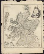
| Name: | Ainslie, John, 1745-1828 | |
| Title: | Ainslie's travelling map of Scotland shewing the distances from one stage to another. | |
| Imprint: | Edinburgh : J. Ainslie, 1783. | |
| Zoom Into Map: | Click on the map to view in greater detail. | |
| Name: | Andrews, John, fl. ca. 1766-1800 | |
| Title: | Andrews's new and accurate travelling map of the roads of Scotland | |
| Imprint: | London : J. Andrews and J. Harris, 1782, 1783. | |
| Zoom Into Map: | Click on the map to view in greater detail. | |
| Name: | Ainslie, John, 1745-1828 | |
| Title: | Ainslie's travelling map of Scotland shewing the distances from one stage to another. | |
| Imprint: | Edinburgh : JAinslie, 1783. | |
| Zoom Into Map: | Click on the map to view in greater detail. | |
| Title: | A commercial map of Scotland; with the roads, stages, and distances brought down to the present time. | |
| Imprint: | London : J Knox, 1784. | |
| Zoom Into Map: | Click on the map to view in greater detail. | |
| Name: | Kitchin, Thomas | |
| Title: | Scotland. Divided into its counties from the latest surveys / by T. Kitchin. | |
| Imprint: | London : Alexander Hogg, 1784. | |
| Zoom Into Map: | Click on the map to view in greater detail. | |
| Name: | Anderson, James | |
| Title: | A new map of Scotland; : the Hebrides and western coasts in particular being laid down from the best authorities corrected by late observations. | |
| Imprint: | [Edinburgh : Printed for C Elliot and GGJ and J Robinson London, 1785. | |
| Zoom Into Map: | Click on the map to view in greater detail. | |
| Name: | Dunn, Samuel | |
| Title: | Scotland, and its islands; : or the North part of Great Britain, divided into shires / by Samuel Dunn, mathematician. | |
| Imprint: | London : Printed for Rob Sayer as the Act directs, 10 January 1786. | |
| Zoom Into Map: | Click on the map to view in greater detail. | |
| Name: | Conder, Thomas. | |
| Title: | A new map of the Southern part of Scotland ... drawn from the best authorities / (T. Conder sculpt.). | |
| Imprint: | [London] : A Hogg, [1786] | |
| Zoom Into Map: | Click on the map to view in greater detail. | |
| Name: | Conder, Thomas. | |
| Title: | A new map of the middle part of Scotland ... drawn from the best authorities / (T. Conder sculpt.). | |
| Imprint: | [London] : A Hogg, [1786] | |
| Zoom Into Map: | Click on the map to view in greater detail. | |
| Name: | Schraembl, Franz Anton. | |
| Title: | Karte von Scotland / verfasst von ... J. Dorret. Neu herausgegeben von ... F.A. Schraembl ... (Gestochen von J. Stenger.). | |
| Imprint: | Wien, 1787. | |
| Zoom Into Map: | Click on the map to view in greater detail. | |
| Name: | Bonne, Rigobert, 1727-1795 | |
| Title: | Carte de l'Ecosse / par M. Bonne, Ingr. Hydrographe de la Marine. (Herisson del. André sculp.). | |
| Imprint: | [Paris, 1787] | |
| Zoom Into Map: | Click on the map to view in greater detail. | |
| Name: | Bonne, Rigobert, 1727-1795 | |
| Title: | Carte de l'Ecosse. | |
| Imprint: | [Paris, ca. 1787] | |
| Zoom Into Map: | Click on the map to view in greater detail. | |
| Name: | Knox, John, 1720-1790 | |
| Title: | A commercial map of Scotland. | |
| Imprint: | London : J. Knox, 1788. | |
| Zoom Into Map: | Click on the map to view in greater detail. | |
| Name: | Ainslie, John, 1745-1828 | |
| Title: | Scotland, drawn from a series of angles and astronomical observations… | |
| Imprint: | Edinburgh : J. & J. Ainslie & W Faden, 1789. | |
| Zoom Into Map: | Click on the map to view in greater detail. | |
| Name: | Reilly, Franz Johann Joseph von. | |
| Title: | Das Irische und Kaledonische Meer mit seinen Inseln. | |
| Imprint: | [Vienna : FJJ von Reilly, 1789-1791] | |
| Zoom Into Map: | Click on the map to view in greater detail. | |
| Title: | A new and correct map of Scotland, drawn from the latest surveys of that part of Great Britain. | |
| Imprint: | [S.l., 1789] | |
| Zoom Into Map: | Click on the map to view in greater detail. | |
| Name: | Reilly, Franz Johann Joseph von. | |
| Title: | Das Königreich Scotland, etc. / [by F.J.J. von Reilly.] | |
| Imprint: | [Vienna, 1789-1791] | |
| Zoom Into Map: | Click on the map to view in greater detail. | |
| Title: | [Scotland and Orkney, Shetland and Faeroe Islands] | |
| Imprint: | [St Petersburg, 1790] | |
| Zoom Into Map: | Click on the map to view in greater detail. | |
| Name: | Macintyre, Archibald. | |
| Title: | A new & accurate travelling map of Scotland with the distances marked between each stage in measured miles ... / McIntyre sculp. | |
| Imprint: | Edinburgh : T Brown, [ca. 1790] | |
| Zoom Into Map: | Click on the map to view in greater detail. | |
| Name: | Campbell, Robert | |
| Title: | A new and correct map of Scotland or North Britain …. London, Robert Sayer, 1790.In 2 sheets. | |
| Imprint: | 1790 | |
| Zoom Into Map: | Click on the map to view in greater detail. | |
| Name: | Campbell, Robert | |
| Title: | A new and correct map of Scotland or North Britain …. London, Robert Sayer, 1790.In 2 sheets. | |
| Imprint: | 1790 | |
| Zoom Into Map: | Click on the map to view in greater detail. | |
| Name: | Campbell, Robert | |
| Title: | A new and correct map of Scotland or North Britain, with all the post and military roads. | |
| Imprint: | London : R. Sayer, 1790. | |
| Zoom Into Map: | Click on the map to view in greater detail. | |
| Name: | Barbie du Bocage, Jean Denis, 1760-1825. | |
| Title: | L'Écosse avec ses isles / par J.D. Barbie du Bocage. | |
| Imprint: | [Paris, ca. 1790] | |
| Zoom Into Map: | Click on the map to view in greater detail. | |
| Name: | Campbell, Robert | |
| Title: | A new and correct map of Scotland or North Britain with all the post and military roads, divisions &ca. / Drawn from the most approved surveys illustrated with many additional improvements and regulated by the latest astronomical observations by Lieutenan | |
| Imprint: | London : Printed for Robt Sayer No 53 Fleet Street, 10th Jan. 1790. | |
| Zoom Into Map: | Click on the map to view in greater detail. | |
| Name: | Reilly, Franz Johann Joseph von | |
| Title: | Des Konigreichs Scotland Nordlicher Theil oder Das Hochland | |
| Imprint: | Vienna, 1789-91 | |
| Zoom Into Map: | Click on the map to view in greater detail. | |
| Name: | Reilly, Franz Johann Joseph von | |
| Title: | Des Konigreichs Scotland Sudlicher Theil oder Das Hochland | |
| Imprint: | Vienna, 1789-91 | |
| Zoom Into Map: | Click on the map to view in greater detail. | |
| Name: | Neele, Samuel John | |
| Title: | A new geographical game exhibiting a complete tour through Scotland and the Western Isles / (Neele sculpt.). | |
| Imprint: | London : J Wallis, 1792. | |
| Zoom Into Map: | Click on the map to view in greater detail. | |
| Name: | Dunn, Samuel | |
| Title: | Scotland, and its islands; : or the North part of Great Britain, divided into shires / by Samuel Dunn, mathematician. | |
| Imprint: | [London] : Published by Laurie & Whittle London as the Act directs 12th May 1794.. | |
| Zoom Into Map: | Click on the map to view in greater detail. | |
| Name: | Sayer, Robert | |
| Title: | A new and exact mapp of Scotland or North Britain / described by N. Sanson ... translated into English at the expense of Robert Sayer ... (Sutton Nicholls sculp.). | |
| Imprint: | London : Laurie & Whittle, 1794. | |
| Zoom Into Map: | Click on the map to view in greater detail. | |
| Name: | Wilkinson, Robert | |
| Title: | A new and accurate map of Scotland from the latest surveys. | |
| Imprint: | [S.l. : sn ca. 1794] | |
| Zoom Into Map: | Click on the map to view in greater detail. | |
| Name: | de Vaugondy, Gilles Robert | |
| Title: | L'Ecosse. | |
| Imprint: | [Paris : C. Lamarche], L'An 3.m de la République Française [ie. 1794] | |
| Zoom Into Map: | Click on the map to view in greater detail. | |
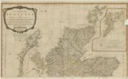
| Name: | Campbell, Robert | |
| Title: | A new and correct map of Scotland or North Britain with all the post and military roads, divisions &ca. : North | |
| Imprint: | London : Laurie & Whittle, 1794 | |
| Zoom Into Map: | Click on the map to view in greater detail. | |
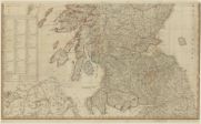
| Name: | Campbell, Robert | |
| Title: | A new and correct map of Scotland or North Britain with all the post and military roads, divisions &ca. : South | |
| Date: | 1794 | |
| Zoom Into Map: | Click on the map to view in greater detail. | |
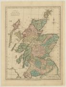
| Name: | Wilkinson, Robert | |
| Title: | A new and accurate map of Scotland from the latest surveys | |
| Imprint: | London : Robert Wilkinson, 1794 | |
| Zoom Into Map: | Click on the map to view in greater detail. | |
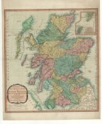
| Name: | Campbell, Robert | |
| Title: | A new and correct map of Scotland or North Britain, drawn from the most approved surveys. | |
| Imprint: | London : Laurie & Whittle, 1794. | |
| Zoom Into Map: | Click on the map to view in greater detail. | |
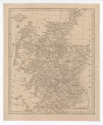
| Name: | Wilkinson, Robert | |
| Title: | A new and accurate map of Scotland from the latest surveys. | |
| Imprint: | [S.l. : sn ca. 1794] | |
| Zoom Into Map: | Click on the map to view in greater detail. | |
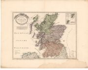
| Name: | Reilly, Franz Johann Joseph von. | |
| Title: | Karte von Scotland nach Dorret. | |
| Imprint: | Wien : s.n., 1795. | |
| Zoom Into Map: | Click on the map to view in greater detail. | |
| Name: | Dighton, Robert | |
| Title: | Geography bewitched!, or, a droll caricature map of Scotland. | |
| Imprint: | London : Printed for Bowles & Carver, No.69 St. Paul's Church Yard, [ca. 1795] | |
| Zoom Into Map: | Click on the map to view in greater detail. | |
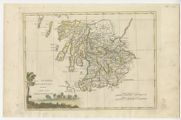
| Name: | Carli, Pazzini, 1707 or 8-1769 | |
| Title: | La Scozia Meridionale. | |
| Imprint: | Siena : Presso Pozzini Carli, 1795. | |
| Zoom Into Map: | Click on the map to view in greater detail. | |
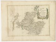
| Name: | Carli, Pazzini, 1707 or 8-1769 | |
| Title: | Parte settentrionale della Scozia. | |
| Imprint: | Siena : Presso Pazzini Carli, 1795. | |
| Zoom Into Map: | Click on the map to view in greater detail. | |
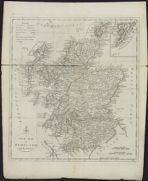
| Name: | Lodge, John | |
| Title: | A new map of Scotland, : with the roads. | |
| Imprint: | [London] : sn [1795]. | |
| Zoom Into Map: | Click on the map to view in greater detail. | |
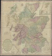
| Name: | Bowles & Carver. | |
| Title: | Bowles's new one-sheet map of Scotland ... with the addition of new roads, and other modern improvements, from the best authorities. | |
| Imprint: | London, 1796. | |
| Zoom Into Map: | Click on the map to view in greater detail. | |
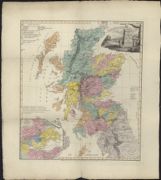
| Name: | Macpherson, David. | |
| Title: | An historical map of Scotland with the North part of England, adapted to the year 1400 / (by David Macpherson. T. Foot sculp.). | |
| Imprint: | London : D Macpherson, 1796. | |
| Zoom Into Map: | Click on the map to view in greater detail. | |
| Name: | Halliday, J. | |
| Title: | The atlas of Scotland.. | |
| Imprint: | Edinburgh, : May 18 1797 - Designed by J Halliday Caledonian Mercury Office, [1797] | |
| Zoom Into Map: | Click on the map to view in greater detail. | |
| Name: | Whittle, James Laurie, Robert | |
| Title: | A new map of Scotland for ladies needlework. | |
| Imprint: | London : Laurie & Whittle, 1797. | |
| Zoom Into Map: | Click on the map to view in greater detail. | |
| Name: | Hérisson, Eustache. | |
| Title: | Carte du Royaume d'Ecosse / dressee par Herisson, elève du Cen. Bonne, ancien Ingenieur-Hydrographe de la Marine. (Gravé par perrier.). | |
| Imprint: | Paris : Basset [1798-1799] | |
| Zoom Into Map: | Click on the map to view in greater detail. | |
| Name: | Tardieu, Antoine François. | |
| Title: | Isles Britanniques. Quatrieme carte. Ecosse / (P.F. Tardieu sculp.). | |
| Imprint: | [Paris, ca. 1798] | |
| Zoom Into Map: | Click on the map to view in greater detail. | |
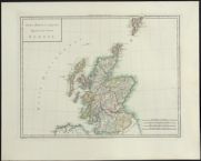
| Name: | Tardieu, Antoine François. | |
| Title: | Isles Britanniques. Quatrieme carte. Ecosse / (P.F. Tardieu sculp.). | |
| Imprint: | [Paris, ca. 1798] | |
| Zoom Into Map: | Click on the map to view in greater detail. | |
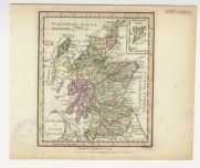
| Name: | Palmer, William | |
| Title: | Scotland or North Britain / (W. Palmer sculp.). | |
| Imprint: | [London] : W Faden, 1798. | |
| Zoom Into Map: | Click on the map to view in greater detail. | |
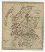
| Name: | Menzies, J. | |
| Title: | Map of Scotland with the roads &c. / (J. Menzies sc.). | |
| Imprint: | [Edinburgh : printed by John Moir for T Brown, ca. 1799?] | |
| Zoom Into Map: | Click on the map to view in greater detail. | |
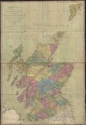
| Name: | Andrews, John, fl. ca. 1766-1800 | |
| Title: | Andrews's new and accurate travelling map of the roads of Scotland. Shewing the distances between the towns &c. ... 1799. | |
| Imprint: | London : J Harris, 1799. | |
| Zoom Into Map: | Click on the map to view in greater detail. | |
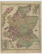
| Name: | Gavin and Son. | |
| Title: | A new and accurate map of Scotland, with the roads / (Gavin & Son sculpt.). | |
| Imprint: | Edinburgh : T Brown, [ca. 1800] | |
| Zoom Into Map: | Click on the map to view in greater detail. | |
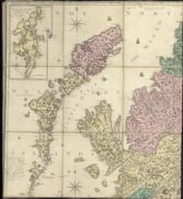
| Name: | Ainslie, John, 1745-1828 | |
| Title: | Scotland drawn and engrav'd from a series of angles and astronomical observations / by John Ainslie, land surveyor. | |
| Imprint: | Edinburgh : T Brown & W Faden, 1800. | |
| Zoom Into Map: | Click on the map to view in greater detail. | |
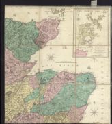
| Title: | Scotland drawn and engrav'd from a series of angles and astronomical observations / by John Ainslie, land surveyor. | |
| Imprint: | Edinburgh : T Brown & W Faden, 1800. | |
| Zoom Into Map: | Click on the map to view in greater detail. | |
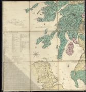
| Title: | Scotland drawn and engrav'd from a series of angles and astronomical observations / by John Ainslie, land surveyor. | |
| Imprint: | Edinburgh : T Brown & W Faden, 1800. | |
| Zoom Into Map: | Click on the map to view in greater detail. | |
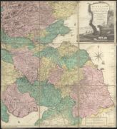
| Title: | Scotland drawn and engrav'd from a series of angles and astronomical observations / by John Ainslie, land surveyor. | |
| Imprint: | Edinburgh : T Brown & W Faden, 1800. | |
| Zoom Into Map: | Click on the map to view in greater detail. | |
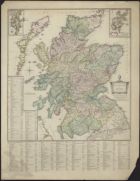
| Name: | Ainslie, John, 1745-1828 | |
| Title: | Scotland / by John Ainslie. | |
| Imprint: | [Edinburgh] : Published according to act of parliament by Thomas Brown Edinburgh, [ca. 1800] | |
| Zoom Into Map: | Click on the map to view in greater detail. | |
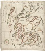
| Name: | Montgomery, Margaret | |
| Title: | A map of Scotland. [Stitched by] Margaret Montgomery | |
| Imprint: | [1800] | |
| Zoom Into Map: | Click on the map to view in greater detail. | |
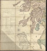
| Name: | Ainslie, John, 1745-1828 | |
| Title: | Scotland drawn and engrav'd from a series of angles and astronomical observations (South-west sheet only) | |
| Imprint: | Edinburgh : T Brown & W Faden 1800. | |
| Zoom Into Map: | Click on the map to view in greater detail. | |
| Name: | Cary, John, 1755-1835 | |
| Title: | A new map of Scotland from the latest authorities - North sheet | |
| Imprint: | London, 1801 | |
| Zoom Into Map: | Click on the map to view in greater detail. | |
| Name: | Cary, John, 1755-1835 | |
| Title: | A new map of Scotland from the latest authorities - South sheet | |
| Date: | 1801 | |
| Zoom Into Map: | Click on the map to view in greater detail. | |
| Name: | Cary, John, 1755-1835 | |
| Title: | A new map of Scotland, from the latest authorities. | |
| Imprint: | London : J. Cary, 1801. | |
| Zoom Into Map: | Click on the map to view in greater detail. | |
| Title: | A map of Scotland with the roads from the best authorities. | |
| Imprint: | London, 1801. | |
| Zoom Into Map: | Click on the map to view in greater detail. | |
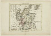
| Name: | Blondeau, Alexandre, fl.1798-1828. engraver | |
| Title: | Ecosse. | |
| Imprint: | [Paris? : s.n., 1802] | |
| Zoom Into Map: | Click on the map to view in greater detail. | |
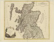
| Name: | Delamarche, Charles Francois, 1740-1817. | |
| Title: | Rojaume de Ecosse : dresse sur les meilleurs cartes modernes / par la Marche geog. | |
| Imprint: | Venise : [la Societè Chalcografique], 1803 | |
| Zoom Into Map: | Click on the map to view in greater detail. | |
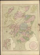
| Name: | Enouy, Joseph. | |
| Title: | A new map of Scotland compiled from actual surveys & regulated by the latest astronomical observations / by Joseph Enouy. | |
| Imprint: | [London] : Published September 12th 1803 by Laurie & Whittle No 53 Fleet Street London, [1803] | |
| Zoom Into Map: | Click on the map to view in greater detail. | |
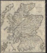
| Name: | Richardson, Thomas, fl. 1772-1829 | |
| Title: | New travelling map of Scotland, shewing the principal direct & cross roads ... / by Thos. Richardson, etc. | |
| Imprint: | Glasgow, 1804. | |
| Zoom Into Map: | Click on the map to view in greater detail. | |
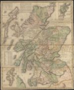
| Name: | Kirkwood, James, 1745/6-1827 & Sons | |
| Title: | This map of Scotland / constructed ... by J. Kirkwood & Sons ... [showing the routes of Pennant, Garnett, Lettice and Campbell.] | |
| Imprint: | Edinburgh, 1804. | |
| Zoom Into Map: | Click on the map to view in greater detail. | |
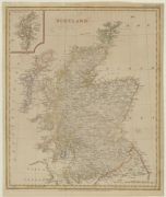
| Name: | Russell, J. | |
| Title: | Scotland / J. Russell delin. et sculp. | |
| Imprint: | London : J. Stratford, 1804 | |
| Zoom Into Map: | Click on the map to view in greater detail. | |
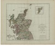
| Name: | Stieler, August | |
| Title: | Charte von Scotland. | |
| Imprint: | Weimar : Geographischen Intituts, 1804. | |
| Zoom Into Map: | Click on the map to view in greater detail. | |
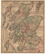
| Name: | Kirkwood, James, 1745/6-1827 & Sons | |
| Title: | This map of Scotland, constructed and engraved from the best authorities… | |
| Imprint: | Edinburgh : J. Kirkwood & Sons, and London : W. Faden, 1804. | |
| Zoom Into Map: | Click on the map to view in greater detail. | |
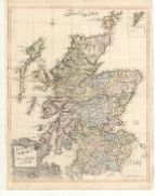
| Name: | Raif, Mahmoud Abdurrhaman | |
| Title: | Ascozia. | |
| Imprint: | [Uksküdar : Muhenduishame Press, 1803-4] | |
| Zoom Into Map: | Click on the map to view in greater detail. | |
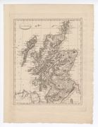
| Name: | Pinkerton, John | |
| Title: | Écosse. | |
| Imprint: | [Paris : Dentu, 1804] | |
| Zoom Into Map: | Click on the map to view in greater detail. | |
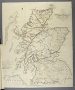
| Name: | Telford, Thomas, 1757-1834 Downie, Murdo | |
| Title: | Map of intended roads and bridges in the Highlands of Scotland | |
| Imprint: | [London], 1805 | |
| Zoom Into Map: | Click on the map to view in greater detail. | |
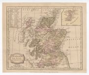
| Name: | Barlow Blomfield, Ezekiel Brightly, C Kinnersley, E | |
| Title: | Scotland from the best authorities. | |
| Imprint: | Bungay, Suffolk : C Brightly & E Kinnersley, June 1st, 1806. | |
| Zoom Into Map: | Click on the map to view in greater detail. | |
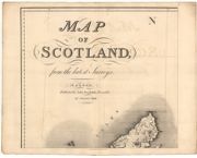
| Name: | Stockdale, John | |
| Title: | Map of Scotland from the latest surveys. | |
| Imprint: | London : John Stockdale, 1806. | |
| Zoom Into Map: | Click on the map to view in greater detail. | |
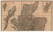
| Name: | Faden, William, 1750-1836 | |
| Title: | A map of Scotland drawn chiefly from the topographical surveys of John Ainslie… | |
| Imprint: | [London : W. Faden, 1807] | |
| Zoom Into Map: | Click on the map to view in greater detail. | |
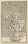
| Title: | Scotland. | |
| Imprint: | [Philadelphia : S. Bradford, 1806] | |
| Zoom Into Map: | Click on the map to view in greater detail. | |
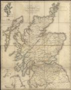
| Name: | Lizars, Daniel, 1760-1812 | |
| Title: | A travelling map of Scotland, including all the new and intended roads; bridges & canals ... / (D. Lizars sculpt.). | |
| Imprint: | Edinburgh : T Brown, 1806. | |
| Zoom Into Map: | Click on the map to view in greater detail. | |
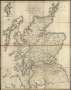
| Name: | Lizars, Daniel, 1760-1812 | |
| Title: | A travelling map of Scotland, including all the new and intended roads; bridges & canals ... / (D. Lizars sculpt.). | |
| Imprint: | Edinburgh : T Brown, 1806. | |
| Zoom Into Map: | Click on the map to view in greater detail. | |
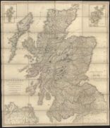
| Name: | Faden, William, 1750-1836 | |
| Title: | A map of Scotland : drawn chiefly from the topographical surveys of Mr. John Ainslie and from those of the late General Roy &c. &c. / by William Faden, Geographer to His Majesty and to His Royal Highness the Prince of Wales. | |
| Imprint: | London : W Faden, 1807. | |
| Zoom Into Map: | Click on the map to view in greater detail. | |
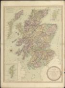
| Name: | Enouy, Joseph. | |
| Title: | A new map of Scotland, compiled from actual surveys, & regulated by the latest astronomical observations / by Joseph Enouy. | |
| Imprint: | London : Laurie & Whittle, 1807. | |
| Zoom Into Map: | Click on the map to view in greater detail. | |
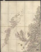
| Name: | Arrowsmith, Aaron, 1750-1824 | |
| Title: | Map of Scotland constructed from original materials obtained under the authority of the Parliamentary Commissioners for making roads and building bridges in the Highlands of Scotland ... / by ... A. Arrowsmith. Additions to 1810. | |
| Imprint: | London : A Arrowsmith, 1807 [ie 1810] | |
| Zoom Into Map: | Click on the map to view in greater detail. | |
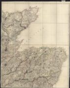
| Title: | [North-east] Map of Scotland constructed from original materials obtained under the authority of the Parliamentary Commissioners for making roads and building bridges in the Highlands of Scotland ... / by ... A. Arrowsmith. Additions to 1810. | |
| Imprint: | London : A Arrowsmith, 1807 [ie 1810] | |
| Zoom Into Map: | Click on the map to view in greater detail. | |
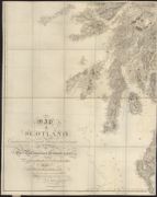
| Title: | [South-west] Map of Scotland constructed from original materials obtained under the authority of the Parliamentary Commissioners for making roads and building bridges in the Highlands of Scotland ... / by ... A. Arrowsmith. Additions to 1810. | |
| Imprint: | London : A Arrowsmith, 1807 [ie 1810] | |
| Zoom Into Map: | Click on the map to view in greater detail. | |
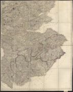
| Title: | [South-east] Map of Scotland constructed from original materials obtained under the authority of the Parliamentary Commissioners for making roads and building bridges in the Highlands of Scotland ... / by ... A. Arrowsmith. Additions to 1810. | |
| Imprint: | London : A Arrowsmith, 1807 [ie 1810] | |
| Zoom Into Map: | Click on the map to view in greater detail. | |
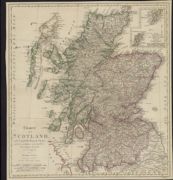
| Name: | Homann Erben (Firm) | |
| Title: | Charte von Scotland, nach Campbells Original-Charte und den zuverlässigern astronomischen / beobachtungen bearbeitet und herausgegeben von Homanns Erben. (I. Rausch sc.). | |
| Imprint: | Nürnberg, 1807. | |
| Zoom Into Map: | Click on the map to view in greater detail. | |
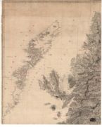
| Name: | Arrowsmith, Aaron, 1750-1828 | |
| Title: | Map of Scotland constructed from original materials. | |
| Imprint: | London : Arrowsmith, 1807. | |
| Zoom Into Map: | Click on the map to view in greater detail. | |
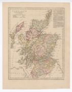
| Name: | Smith, Benjamin. | |
| Title: | Scotland / (B. Smith sculp.). | |
| Imprint: | London : Robert Wilkinson 1807. | |
| Zoom Into Map: | Click on the map to view in greater detail. | |
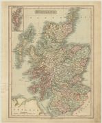
| Name: | Smith, Benjamin | |
| Title: | Scotland | |
| Imprint: | London : C. Smith, 1808 | |
| Zoom Into Map: | Click on the map to view in greater detail. | |
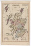
| Name: | Laurie & Whittle | |
| Title: | Scotland. | |
| Imprint: | London : R Laurie & J Whittle, 1808. | |
| Zoom Into Map: | Click on the map to view in greater detail. | |
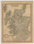
| Name: | Smith, Benjamin. | |
| Title: | Scotland / (B. Smith sculpsit.). | |
| Imprint: | London : C Smith, 1808. | |
| Zoom Into Map: | Click on the map to view in greater detail. | |
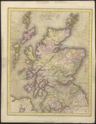
| Name: | Lizars, Daniel, 1760-1812 | |
| Title: | Scotland with the great roads and canals from the latest and best surveys / (D. Lizars sculpt.). | |
| Imprint: | Edinburgh : D Lizars, 1808. | |
| Zoom Into Map: | Click on the map to view in greater detail. | |
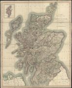
| Name: | Cary, John, 1755-1835 | |
| Title: | Cary's new sheet map of Scotland, from the latest authorities. | |
| Imprint: | London, 1809. | |
| Zoom Into Map: | Click on the map to view in greater detail. | |
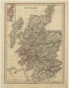
| Name: | Smith, Benjamin | |
| Title: | Scotland. | |
| Imprint: | London : C. Smith, [1809] | |
| Zoom Into Map: | Click on the map to view in greater detail. | |
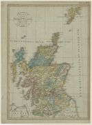
| Title: | Charte von Schottland. | |
| Imprint: | Weimar : Verlag der Geographs Instituts, 1809 | |
| Zoom Into Map: | Click on the map to view in greater detail. | |
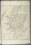
| Name: | Arrowsmith, Aaron, 1750-1830 | |
| Title: | Map of Scotland, from original materials obtained by the Parliamentary Commissioners for Highland roads and bridges: and exhibiting the roads, bridges and harbours, made, contracted for or under consideration / (drawn by A. Arrowsmith.). | |
| Imprint: | [London], 1809 | |
| Zoom Into Map: | Click on the map to view in greater detail. | |
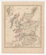
| Name: | Russell, John C. | |
| Title: | Scotland / J.C. Russell jun. execudit. | |
| Imprint: | [London : Cradock & Joy, 1810] | |
| Zoom Into Map: | Click on the map to view in greater detail. | |
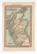
| Name: | Miller, Robert. | |
| Title: | Scotland. | |
| Imprint: | London : Published by R Miller 24 Old Fish St Doctors Commons, [1810] | |
| Zoom Into Map: | Click on the map to view in greater detail. | |
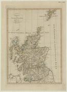
| Title: | Charte von Schottland. | |
| Imprint: | Prag : [s.n.], 1810 | |
| Zoom Into Map: | Click on the map to view in greater detail. | |
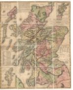
| Name: | Kirkwood, James, 1745/6-1827 & Sons | |
| Title: | This map of Scotland, constructed and engraved from the best authorities… | |
| Imprint: | 1810 | |
| Zoom Into Map: | Click on the map to view in greater detail. | |
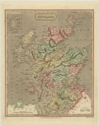
| Name: | Wallis, James | |
| Title: | Scotland . | |
| Imprint: | London : Published by S.A. Oddy ..., 1811 | |
| Zoom Into Map: | Click on the map to view in greater detail. | |
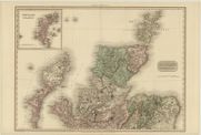
| Name: | Neele, Samuel John | |
| Title: | Scotland : northern part. | |
| Imprint: | London : Cadell & Davies ; Longman, Hurst, Rees & Orme, 15 March 1811 | |
| Zoom Into Map: | Click on the map to view in greater detail. | |
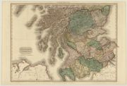
| Name: | Neele, Samuel John | |
| Title: | Scotland : southern part. | |
| Date: | 1811 | |
| Zoom Into Map: | Click on the map to view in greater detail. | |
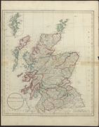
| Name: | Russell, John. | |
| Title: | Scotland / drawn from the best authorities by J. Russell. | |
| Imprint: | London : Wilkie & Robinson J Mawman &c, 1811. | |
| Zoom Into Map: | Click on the map to view in greater detail. | |
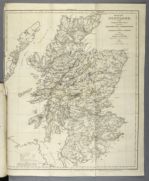
| Name: | Arrowsmith, Aaron, 1750-1830 | |
| Title: | Map of Scotland, from original materials obtained by the Parliamentary Commissioners for Highland roads and bridges: and exhibiting the roads, bridges and harbours, made, contracted for or under consideration / (drawn by A. Arrowsmith.). | |
| Imprint: | [London], 1811 | |
| Zoom Into Map: | Click on the map to view in greater detail. | |
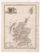
| Name: | Tardieu, Jean Baptiste. | |
| Title: | Écosse. | |
| Imprint: | [Paris : F Buisson, 1812]. | |
| Zoom Into Map: | Click on the map to view in greater detail. | |
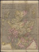
| Name: | Walker | |
| Title: | Walkers' geographical tour through Scotland. (An instructive pastime.). | |
| Imprint: | London : W Darton, 1812. | |
| Zoom Into Map: | Click on the map to view in greater detail. | |
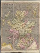
| Name: | Walker | |
| Title: | Walkers' geographical tour through Scotland. (An instructive pastime.). | |
| Imprint: | London : W Darton, 1812. | |
| Zoom Into Map: | Click on the map to view in greater detail. | |
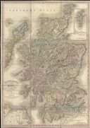
| Name: | Ainslie, John, 1745-1828 | |
| Title: | Scotland with its islands / drawn from the topographical surveys of John Ainslie &c. | |
| Imprint: | London : W Faden, 1813. | |
| Zoom Into Map: | Click on the map to view in greater detail. | |
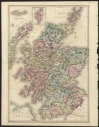
| Name: | Neele, Samuel John | |
| Title: | Scotland. | |
| Imprint: | [London] : S & G Neele, 1813. | |
| Zoom Into Map: | Click on the map to view in greater detail. | |
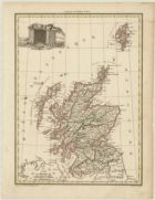
| Name: | Luffman, John | |
| Title: | Scotland. | |
| Imprint: | London : J. Luffman, 1813 | |
| Zoom Into Map: | Click on the map to view in greater detail. | |
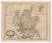
| Name: | Barlow Blomfield, Ezekiel Brightly, C Kinnersley, E | |
| Title: | Scotland from the best authorities. | |
| Imprint: | Bungay, Suffolk : C Brightly & E Kinnersley, June 1st, 1806 [i.e. 1813]. | |
| Zoom Into Map: | Click on the map to view in greater detail. | |
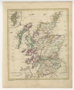
| Name: | Russell, John C. | |
| Title: | Scotland / J.C. Russell jun. execudit. | |
| Imprint: | [London : Cradock & Joy, 1813] | |
| Zoom Into Map: | Click on the map to view in greater detail. | |
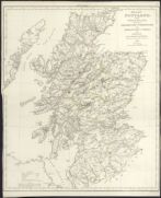
| Name: | Arrowsmith, Aaron, 1750-1830 | |
| Title: | Map of Scotland, from original materials obtained by the Parliamentary Commissioners for Highland roads and bridges: and exhibiting the roads, bridges and harbours, made, contracted for or under consideration / (drawn by A. Arrowsmith.). | |
| Imprint: | [London], 1813. | |
| Zoom Into Map: | Click on the map to view in greater detail. | |
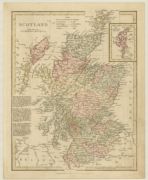
| Name: | Wilkinson, Robert | |
| Title: | Scotland. | |
| Imprint: | London : Robert Wilkinson, 1814 | |
| Zoom Into Map: | Click on the map to view in greater detail. | |
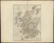
| Name: | Carey, Mathew | |
| Title: | Scotland : with the principal roads from the best authorities. | |
| Imprint: | [Philadelphia : Mathew Carey, 1814]. | |
| Zoom Into Map: | Click on the map to view in greater detail. | |
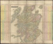
| Name: | Hewitt, N. R. | |
| Title: | Scotland / drawn & engraved by Hewitt. | |
| Imprint: | [Edinburgh : Published by John Thomson & Co Baldwin Cradock and Joy and John Cumming, 1815. | |
| Zoom Into Map: | Click on the map to view in greater detail. | |
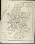
| Name: | Arrowsmith, Aaron, 1750-1830 | |
| Title: | Map of Scotland, from original materials obtained by the Parliamentary Commissioners for Highland roads and bridges: and exhibiting the roads, bridges and harbours, made, contracted for or under consideration / (drawn by A. Arrowsmith.). | |
| Imprint: | [London], 1815 | |
| Zoom Into Map: | Click on the map to view in greater detail. | |
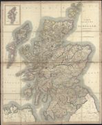
| Name: | Cary, John, 1755-1835 | |
| Title: | Cary's new sheet map of Scotland from the latest authorities. | |
| Imprint: | London, 1816. | |
| Zoom Into Map: | Click on the map to view in greater detail. | |
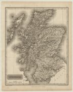
| Name: | Arrowsmith, Aaron, 1750-1823 | |
| Title: | Scotland. | |
| Imprint: | Edinburgh : A. Constable & Co., 1817 | |
| Zoom Into Map: | Click on the map to view in greater detail. | |
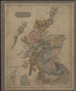
| Name: | Lizars, W. H. (William Home), 1788-1859 | |
| Title: | Scotland / (drawn & engraved for Ewing's general atlas, by W. & D. Lizars.). | |
| Date: | 1817 | |
| Zoom Into Map: | Click on the map to view in greater detail. | |
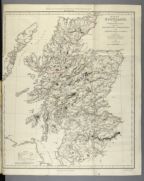
| Name: | Arrowsmith, Aaron, 1750-1830 | |
| Title: | Map of Scotland, from original materials obtained by the Parliamentary Commissioners for Highland roads and bridges: and exhibiting the roads, bridges and harbours, made, contracted for or under consideration / (drawn by A. Arrowsmith.). | |
| Imprint: | [London], 1817 | |
| Zoom Into Map: | Click on the map to view in greater detail. | |
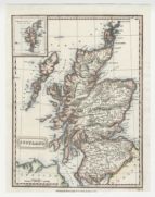
| Name: | Wallis, James. | |
| Title: | Scotland / Wallis sculp. | |
| Imprint: | London : Thomas Kelly, [1818] | |
| Zoom Into Map: | Click on the map to view in greater detail. | |
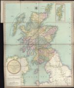
| Name: | Rowe, Robert. | |
| Title: | A new map of Scotland, describing all the direct and principal cross roads ... / by Robert Rowe. | |
| Imprint: | London : R Rowe, [1818] | |
| Zoom Into Map: | Click on the map to view in greater detail. | |
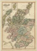
| Name: | Neele, Samuel John | |
| Title: | Scotland. | |
| Imprint: | [London] : Pinnock & Maunder, 1819 | |
| Zoom Into Map: | Click on the map to view in greater detail. | |
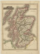
| Name: | Thomson, John, 1777- ca. 1840 | |
| Title: | Scotland. | |
| Imprint: | Edinburgh : John Thomson & Co., [1819]. | |
| Zoom Into Map: | Click on the map to view in greater detail. | |
| Name: | Rossi, Luigi. | |
| Title: | Scozia. | |
| Imprint: | [Milano : Batelli & Fanfani, 1820] | |
| Zoom Into Map: | Click on the map to view in greater detail. | |
| Name: | Swinton, William. | |
| Title: | Scotland. | |
| Imprint: | Edinburgh : W Swinton, [ca. 1821] | |
| Zoom Into Map: | Click on the map to view in greater detail. | |
| Name: | Hewitt, N. R. | |
| Title: | Scotland. | |
| Imprint: | [Edinburgh : Published by John Thomson & Co Baldwin Cradock & Joy and John Cumming, ca. 1821. | |
| Zoom Into Map: | Click on the map to view in greater detail. | |
| Name: | Playfair, James | |
| Title: | Scotland. | |
| Imprint: | Edinburgh : Macredie, Skelly & Co., 1821. | |
| Zoom Into Map: | Click on the map to view in greater detail. | |
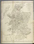
| Name: | Arrowsmith, Aaron, 1750-1830 | |
| Title: | Map of Scotland, from original materials obtained by the Parliamentary Commissioners for Highland roads and bridges: and exhibiting the roads, bridges and harbours, made, contracted for or under consideration / (drawn by A. Arrowsmith.). | |
| Imprint: | [London], 1821 | |
| Zoom Into Map: | Click on the map to view in greater detail. | |
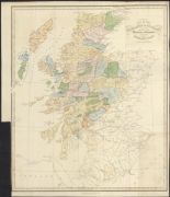
| Name: | Lizars, W. H. (William Home), 1788-1859 | |
| Title: | Map of the Highlands of Scotland denoting the districts or counties inhabited by the Highland Clans / drawn & engraved by W.H. Lizars. | |
| Imprint: | Edinburgh : A Constable & Co 1822. | |
| Zoom Into Map: | Click on the map to view in greater detail. | |
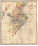
| Name: | Lizars, W. H. (William Home), 1788-1859 | |
| Title: | Map of the Highlands of Scotland denoting the districts or counties inhabited by the Highland Clans. | |
| Imprint: | Edinburgh : A. Constable & Co., 1822. | |
| Zoom Into Map: | Click on the map to view in greater detail. | |

| Name: | Craig, J. | |
| Title: | Guide to the picturesque scenery of Scotland / Accurately delineated by J. Craig Edinburgh, Eng. by R. Scott. | |
| Imprint: | Glasgow : published by Wardlaw & Cunninghame, 20th August 1822. | |
| Zoom Into Map: | Click on the map to view in greater detail. | |
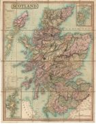
| Name: | Hebert, Lewis | |
| Title: | Scotland. | |
| Imprint: | London : R. H. Laurie, 1823. | |
| Zoom Into Map: | Click on the map to view in greater detail. | |
| Name: | Faden, William, 1750-1836 | |
| Title: | [North] A map of Scotland : drawn chiefly from the topographical surveys of Mr. John Ainslie and from those of the late General Roy &c. &c. shewing the great and cross roads, and the distances between the towns / by William Faden, Geographer to the King. | |
| Imprint: | London : J Wyld, 1824. | |
| Zoom Into Map: | Click on the map to view in greater detail. | |
| Title: | [South] A map of Scotland : drawn chiefly from the topographical surveys of Mr. John Ainslie and from those of the late General Roy &c. &c. shewing the great and cross roads, and the distances between the towns / by William Faden, Geographer to the King. | |
| Imprint: | London : J Wyld, 1824. | |
| Zoom Into Map: | Click on the map to view in greater detail. | |
| Name: | Hewitt, N. R. | |
| Title: | Northern (Southern) part of Scotland / Hewitt &c. | |
| Imprint: | [Edinburgh : J Thomson & Co &c, 1824] | |
| Zoom Into Map: | Click on the map to view in greater detail. | |
| Title: | Map of the circulation of letters in Scotland. 1825. | |
| Imprint: | [S.l., 1825] | |
| Zoom Into Map: | Click on the map to view in greater detail. | |
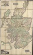
| Name: | Thomson, John, 1777- ca. 1840 | |
| Title: | Northern (Southern) part of Scotland. Drawn & engraved for Thomson's new general atlas. | |
| Imprint: | Edinburgh, 1825. | |
| Zoom Into Map: | Click on the map to view in greater detail. | |
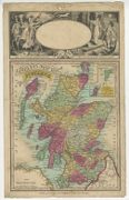
| Name: | Langley, Edward. | |
| Title: | Langley's new map of Scotland. | |
| Imprint: | Borough : E Langley [ca. 1825] | |
| Zoom Into Map: | Click on the map to view in greater detail. | |
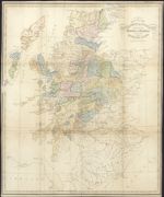
| Name: | Lizars, W. H. (William Home), 1788-1859 | |
| Title: | Map of the Highlands of Scotland denoting the districts or countries inhabited by the Highland Clans / drawn & engraved by W.H. Lizars. | |
| Imprint: | Edinburgh, [1825] | |
| Zoom Into Map: | Click on the map to view in greater detail. | |
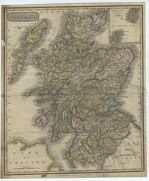
| Name: | Scott, Robert | |
| Title: | Scotland / (engd. ... by R. Scott.). | |
| Imprint: | Glasgow : Khull Blackie & Co &c, [1825?] | |
| Zoom Into Map: | Click on the map to view in greater detail. | |
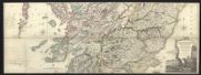
| Name: | Ainslie, John, 1745-1828 | |
| Title: | Scotland ... / brought down to 1825 by John Ainslie. | |
| Imprint: | Edinburgh : D Lizars & J Gardner, 1825. | |
| Zoom Into Map: | Click on the map to view in greater detail. | |
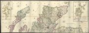
| Title: | Scotland ... / brought down to 1825 by John Ainslie. | |
| Imprint: | Edinburgh : D Lizars & J Gardner, 1825. | |
| Zoom Into Map: | Click on the map to view in greater detail. | |
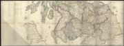
| Title: | Scotland ... / brought down to 1825 by John Ainslie. | |
| Imprint: | Edinburgh : D Lizars & J Gardner, 1825. | |
| Zoom Into Map: | Click on the map to view in greater detail. | |
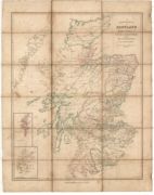
| Name: | Arrowsmith, Aaron, 1750-1829 | |
| Title: | Ecclesiastical map of Scotland. | |
| Imprint: | Edinburgh : P. Brown, 1825. | |
| Zoom Into Map: | Click on the map to view in greater detail. | |
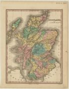
| Title: | Scotland. | |
| Imprint: | Philadelphia : Published by A. Finley, [1827] | |
| Zoom Into Map: | Click on the map to view in greater detail. | |
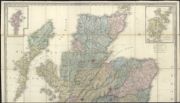
| Name: | Faden, William, 1750-1836 | |
| Title: | [North] A map of Scotland : drawn chiefly from the topographical surveys of Mr. John Ainslie and from those of the late General Roy &c. &c. shewing the great and cross roads, and the distances between the towns / by William Faden, Geographer to the King. | |
| Imprint: | London : J Wyld, 1827. | |
| Zoom Into Map: | Click on the map to view in greater detail. | |
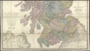
| Title: | [South] A map of Scotland : drawn chiefly from the topographical surveys of Mr. John Ainslie and from those of the late General Roy &c. &c. shewing the great and cross roads, and the distances between the towns / by William Faden, Geographer to the King. | |
| Imprint: | London : J Wyld, 1827. | |
| Zoom Into Map: | Click on the map to view in greater detail. | |
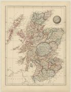
| Name: | Arrowsmith, Sam | |
| Title: | Scotland. | |
| Imprint: | London : Sam. Arrowsmith, 1828 | |
| Zoom Into Map: | Click on the map to view in greater detail. | |
| Name: | Walker, John, 1759-1830 | |
| Title: | Geographical and statistical map of Scotland. | |
| Imprint: | [London] : Printed by J. Barfield, 1828. | |
| Zoom Into Map: | Click on the map to view in greater detail. | |
| Name: | Cary, John, 1755-1835 | |
| Title: | A new map of Scotland, from the latest authorities / by John Cary. | |
| Imprint: | London : J Cary, 1828. | |
| Zoom Into Map: | Click on the map to view in greater detail. | |
| Name: | Cary, John, 1755-1835 | |
| Title: | Cary's new sheet map of Scotland from the latest authorities. | |
| Imprint: | London, 1828. | |
| Zoom Into Map: | Click on the map to view in greater detail. | |
| Name: | Laurie, Richard Holmes. | |
| Title: | Scotland : Ant. Alba, Alban or Albin, Ghaeldoch, Caledonia, Scotia. | |
| Imprint: | London : Richard Holmes Laurie, 1st Feb.1828. | |
| Zoom Into Map: | Click on the map to view in greater detail. | |
| Name: | Gardner, W. R. | |
| Title: | New & improved map of Scotland including its islands ... / compiled from the various trigonometrical surveys ... by W.R. Gardner. | |
| Imprint: | London : W Darton, [1830?] | |
| Zoom Into Map: | Click on the map to view in greater detail. | |
| Name: | Gardner, W. R. | |
| Title: | New & improved map of Scotland including its islands ... / compiled from the various trigonometrical surveys ... by W.R. Gardner. | |
| Imprint: | London : W Darton, [1830?] | |
| Zoom Into Map: | Click on the map to view in greater detail. | |
| Name: | Murray, T.L. | |
| Title: | Scotland. | |
| Imprint: | London : T.L. Murray, May 1st 1830 | |
| Zoom Into Map: | Click on the map to view in greater detail. | |
| Name: | Weiland, Carl Ferdinand | |
| Title: | Scotland, entworfen und gezeichnet. | |
| Imprint: | Weimar : Geographischen Instituts, 1830. | |
| Zoom Into Map: | Click on the map to view in greater detail. | |
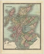
| Title: | Scotland. | |
| Imprint: | London : Henry Teesdale & Co., March 1831. | |
| Zoom Into Map: | Click on the map to view in greater detail. | |
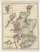
| Title: | Scotland. [Copied from an atlas.] | |
| Imprint: | [S.l., ca. 1831] | |
| Zoom Into Map: | Click on the map to view in greater detail. | |
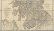
| Name: | Faden, William, 1750-1836 | |
| Title: | A map of Scotland : drawn chiefly from the topographical surveys of Mr. John Ainslie and from those of the late General Roy &c. &c. shewing the great and cross roads, and the distances between the towns / by William Faden, Geographer to the King. | |
| Imprint: | London : J Wyld, 1832. | |
| Zoom Into Map: | Click on the map to view in greater detail. | |
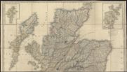
| Name: | Laurie, Richard Holmes. | |
| Title: | Scotland : Ant. Alba, Alban or Albin, Ghaeldoch, Caledonia, Scotia. | |
| Imprint: | London : Richard Holmes Laurie, 5th Jan. 1833. | |
| Zoom Into Map: | Click on the map to view in greater detail. | |
| Title: | Scotland : engraved for Dr. Playfairs atlas. | |
| Imprint: | Edinburgh : Published by Alex Macredie [1833?] | |
| Zoom Into Map: | Click on the map to view in greater detail. | |
| Name: | Cary, John, 1755-1835 | |
| Title: | Cary's new sheet map of Scotland from the latest authorities. | |
| Imprint: | London, 1834. | |
| Zoom Into Map: | Click on the map to view in greater detail. | |
| Name: | J. & C. Walker (Firm) | |
| Title: | Scotland, in three parts, with a plan of Edinburgh. | |
| Imprint: | [London] : Baldwin & Cradock under the superintendance of the Society for the Diffusion of Useful Knowledge 1834. | |
| Zoom Into Map: | Click on the map to view in greater detail. | |
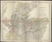
| Title: | Scotland, in three parts, with a plan of Edinburgh. | |
| Imprint: | [London] : Baldwin & Cradock under the superintendance of the Society for the Diffusion of Useful Knowledge, 1834. | |
| Zoom Into Map: | Click on the map to view in greater detail. | |
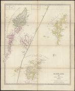
| Title: | Scotland, in three parts, with a plan of Edinburgh. | |
| Imprint: | [London] : Baldwin & Cradock under the superintendance of the Society for the Diffusion of Useful Knowledge, 1834. | |
| Zoom Into Map: | Click on the map to view in greater detail. | |
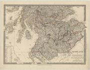
| Name: | Baldwin & Cradock, | |
| Title: | Scotland, in three parts, with a plan of Edinburgh - South | |
| Imprint: | [London] : Baldwin & Cradock, under the superintendance of the Society for the Diffusion of Useful Knowledge, 1834 | |
| Zoom Into Map: | Click on the map to view in greater detail. | |
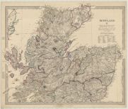
| Title: | Scotland, in three parts, with a plan of Edinburgh | |
| Imprint: | [London] : Baldwin & Cradock, under the superintendance of the Society for the Diffusion of Useful Knowledge, 1834 | |
| Zoom Into Map: | Click on the map to view in greater detail. | |
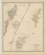
| Title: | Scotland. III : Orkneys, Shetlands and Hebrides | |
| Date: | 1834 | |
| Zoom Into Map: | Click on the map to view in greater detail. | |
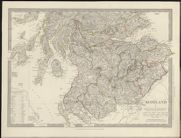
| Name: | J. & C. Walker (Firm) | |
| Title: | Scotland, in three parts, with a plan of Edinburgh: Scotland II [North] | |
| Imprint: | [London] : Baldwin & Cradock under the superintendance of the Society for the Diffusion of Useful Knowledge, 1834. | |
| Zoom Into Map: | Click on the map to view in greater detail. | |
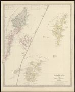
| Name: | J. & C. Walker (Firm) | |
| Title: | Scotland, in three parts, with a plan of Edinburgh: Scotland III Orkneys, Shetlands and Hebrides | |
| Imprint: | [London] : Baldwin & Cradock under the superintendance of the Society for the Diffusion of Useful Knowledge, 1834. | |
| Zoom Into Map: | Click on the map to view in greater detail. | |
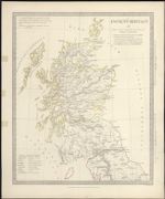
| Name: | J. & C. Walker (Firm) | |
| Title: | Ancient Britain II. | |
| Imprint: | [London] : Baldwin & Cradock under the superintendance of the Society for the Diffusion of Useful Knowledge, Oct. 1st 1834. | |
| Zoom Into Map: | Click on the map to view in greater detail. | |
| Name: | Levasseur, V. | |
| Title: | Ecosse / V. Levasseur. | |
| Imprint: | [Paris ? : Levasseur, 1835] | |
| Zoom Into Map: | Click on the map to view in greater detail. | |
| Name: | Faden, William, 1750-1836 | |
| Title: | A map of Scotland : drawn chiefly from the topographical surveys of Mr. John Ainslie and from those of the late General Roy &c. &c. shewing the great and cross roads, and the distances between the towns / by William Faden, Geographer to the King. | |
| Imprint: | London : J Wyld, 1835. | |
| Zoom Into Map: | Click on the map to view in greater detail. | |
| Title: | [South] A map of Scotland : drawn chiefly from the topographical surveys of Mr. John Ainslie and from those of the late General Roy &c. &c. shewing the great and cross roads, and the distances between the towns / by William Faden, Geographer to the King. | |
| Imprint: | London : J Wyld, 1835. | |
| Zoom Into Map: | Click on the map to view in greater detail. | |
| Name: | Lothian, John, ca. 1805-1846 | |
| Title: | Modern Scotland. | |
| Imprint: | Edinburgh : J Lothian, 1835. | |
| Zoom Into Map: | Click on the map to view in greater detail. | |
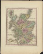
| Name: | Tanner, Henry Schenck | |
| Title: | Scotland. | |
| Imprint: | Philadelphia : Published by HS Tanner, [1836]. | |
| Zoom Into Map: | Click on the map to view in greater detail. | |
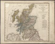
| Name: | Stuelpnagel, Friedrich von. | |
| Title: | Schotland mit der nördlichen Spitze von England ... / von F. v. Stülpnagel ... (Ad. Gottschalck sc.). | |
| Imprint: | [Gotha], 1837. | |
| Zoom Into Map: | Click on the map to view in greater detail. | |
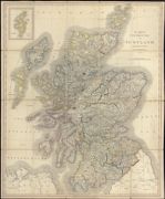
| Name: | Cary, John, 1755-1835 | |
| Title: | Cary's new sheet map of Scotland from the latest authorities. | |
| Imprint: | London, 1837. | |
| Zoom Into Map: | Click on the map to view in greater detail. | |
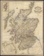
| Name: | J. Pigot & Co. | |
| Title: | Pigot & Co.'s new map of Scotland. With the latest improvements. | |
| Imprint: | London, 1837. | |
| Zoom Into Map: | Click on the map to view in greater detail. | |
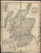
| Title: | Pigot & Co.'s new map of Scotland. With the latest improvements. | |
| Imprint: | London, 1837. | |
| Zoom Into Map: | Click on the map to view in greater detail. | |
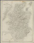
| Name: | Starling, Thomas. | |
| Title: | A map of Scotland = Carte physique et routière de l'Ecosse / drawn & engraved by Thos. Starling. | |
| Imprint: | London : G Virtue, 1837. | |
| Zoom Into Map: | Click on the map to view in greater detail. | |
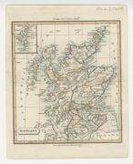
| Name: | Clark, T. | |
| Title: | Scotland. | |
| Imprint: | London : published by J Souter, 1838. | |
| Zoom Into Map: | Click on the map to view in greater detail. | |
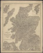
| Name: | Knox, James, fl. 1800-1856 | |
| Title: | Map of Scotland / constructed by James Knox, 1838. | |
| Imprint: | Edinburgh : J Anderson & W Hunter, 1838. | |
| Zoom Into Map: | Click on the map to view in greater detail. | |
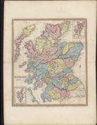
| Name: | Allan Bell & Co. | |
| Title: | Scotland. | |
| Imprint: | London : Allan Bell & Co, 1839. | |
| Zoom Into Map: | Click on the map to view in greater detail. | |
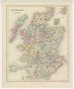
| Name: | Archer, John W. | |
| Title: | Scotland / (drawn & engraved by J. Archer.). | |
| Imprint: | London : Grattan & Gilbert [ca. 1839] | |
| Zoom Into Map: | Click on the map to view in greater detail. | |
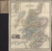
| Name: | Macredie, Alexander. | |
| Title: | Scotland. | |
| Imprint: | Edinburgh : Thos Kerr & Co, [1839]. | |
| Zoom Into Map: | Click on the map to view in greater detail. | |
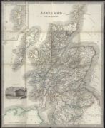
| Name: | Hicks, John. | |
| Title: | Scotland with the railways. | |
| Imprint: | Glasgow : Sold by John Hicks, [ca. 1840] | |
| Zoom Into Map: | Click on the map to view in greater detail. | |
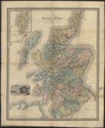
| Name: | Playfair, James | |
| Title: | Scotland. | |
| Imprint: | [Edinburgh : sn 1840] | |
| Zoom Into Map: | Click on the map to view in greater detail. | |
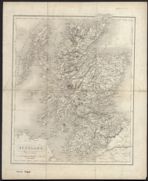
| Name: | J. & C. Walker (Firm) | |
| Title: | Scotland / by J. & C. Walker. | |
| Imprint: | [S.l., ca. 1840?] | |
| Zoom Into Map: | Click on the map to view in greater detail. | |
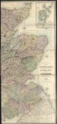
| Name: | Ainslie, John, 1745-1828 | |
| Title: | Scotland ... / by the late John Ainslie with the railways and other additions to 1840. | |
| Imprint: | Edinburgh : W & AK Johnston, 1840. | |
| Zoom Into Map: | Click on the map to view in greater detail. | |
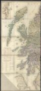
| Title: | Scotland ... / by the late John Ainslie with the railways and other additions to 1840. | |
| Imprint: | Edinburgh : W & AK Johnston, 1840. | |
| Zoom Into Map: | Click on the map to view in greater detail. | |
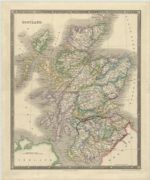
| Title: | Scotland. | |
| Imprint: | London : Henry Teesdale & Co., [ca. 1840]. | |
| Zoom Into Map: | Click on the map to view in greater detail. | |

| Name: | Lizars, W. H. (William Home), 1788-1859 | |
| Title: | Scotland with all the railways - North. | |
| Imprint: | Edinburgh : W. Lizars, [1841] | |
| Zoom Into Map: | Click on the map to view in greater detail. | |
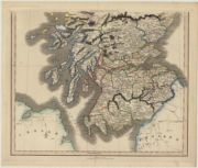
| Title: | Scotland with all the railways - South. | |
| Date: | 1841 | |
| Zoom Into Map: | Click on the map to view in greater detail. | |
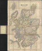
| Name: | Lizars, W. H. (William Home), 1788-1859 | |
| Title: | Scotland with all the railways. | |
| Imprint: | Edinburgh : W Lizars, [1841] | |
| Zoom Into Map: | Click on the map to view in greater detail. | |
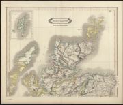
| Name: | Lizars, W. H. (William Home), 1788-1859 | |
| Title: | [North] Scotland with all the railways. | |
| Imprint: | Edinburgh : W Lizars, [1841] | |
| Zoom Into Map: | Click on the map to view in greater detail. | |
| Name: | Lizars, W. H. (William Home), 1788-1859 | |
| Title: | [South] Scotland with all the railways. | |
| Imprint: | Edinburgh : W Lizars, [1841] | |
| Zoom Into Map: | Click on the map to view in greater detail. | |
| Name: | Lizars, W. H. (William Home), 1788-1859 | |
| Title: | New road map of Scotland. With all the lines of railway, canals, &c., &c. | |
| Imprint: | Edinburgh : WH Lizars, 1842. | |
| Zoom Into Map: | Click on the map to view in greater detail. | |
| Name: | Lizars, W. H. (William Home), 1788-1859 | |
| Title: | New road map of Scotland. With all the lines of railway, canals, &c., &c. | |
| Imprint: | Edinburgh : WH Lizars, 1842. | |
| Zoom Into Map: | Click on the map to view in greater detail. | |
| Name: | Scott, Robert | |
| Title: | A map of Scotland distinguishing particularly the districts or countries inhabited by the Highland Clans / (engd. by R. Scott.). | |
| Imprint: | Glasgow : A Fullarton & Co, [1842] | |
| Zoom Into Map: | Click on the map to view in greater detail. | |
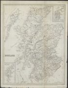
| Name: | Lizars, W. H. (William Home), 1788-1859 | |
| Title: | Scotland / (constructed under the direction of James Findlay, Inspector of Letter Carriers ... engraved by W.H. Lizars.). | |
| Imprint: | [Edinburgh : WP Kennedy, 1843] | |
| Zoom Into Map: | Click on the map to view in greater detail. | |
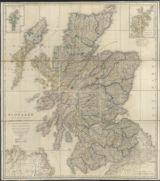
| Name: | Faden, William, 1750-1836 | |
| Title: | A map of Scotland : drawn chiefly from the topographical surveys of Mr. John Ainslie and from those of the late General Roy &c. &c. shewing the great and cross roads, and the distances between the towns / by William Faden, Geographer to the King. | |
| Imprint: | London : J Wyld, 1843. | |
| Zoom Into Map: | Click on the map to view in greater detail. | |
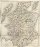
| Name: | Betts, John, active 1844-1863 | |
| Title: | Betts's new map of Scotland, embracing all the principal objects of interest to the tourist, and shewing the various lines of railroad, the turnpike and principal cross roads, canals, lakes, rivers &c. &c. | |
| Imprint: | London, [1844] | |
| Zoom Into Map: | Click on the map to view in greater detail. | |
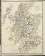
| Name: | J. & C. Walker (Firm) | |
| Title: | Scotland / (J. & C. Walker sculpt.). | |
| Imprint: | London : C Knight & Co, 1844. | |
| Zoom Into Map: | Click on the map to view in greater detail. | |
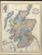
| Name: | J. Pigot & Co. | |
| Title: | Pigot & Co.'s new map of Scotland, with the latest improvements. | |
| Imprint: | London, 1844. | |
| Zoom Into Map: | Click on the map to view in greater detail. | |
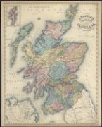
| Name: | Slater, Isaac. | |
| Title: | I. Slater's new map of Scotland, with the latest improvements. | |
| Imprint: | Manchester : Isaac Slater, 1845. | |
| Zoom Into Map: | Click on the map to view in greater detail. | |
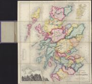
| Name: | Betts, John, active 1844-1863 | |
| Title: | Betts's tour through Scotland. | |
| Imprint: | London : John Betts 115 Strand [ca. 1845]. | |
| Zoom Into Map: | Click on the map to view in greater detail. | |
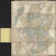
| Name: | Brown, J. | |
| Title: | Scotland exhibiting the principal roads, railways, rivers, canals, &c. / (drawn & engraved by J. Brown.). | |
| Imprint: | Edinburgh, [ca. 1845?] | |
| Zoom Into Map: | Click on the map to view in greater detail. | |
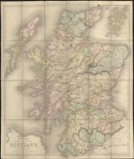
| Name: | Betts, John, active 1844-1863 | |
| Title: | Betts's new map of Scotland ... shewing the various lines of railroad, the turnpike and principal cross roads, etc. | |
| Imprint: | London, 1845. | |
| Zoom Into Map: | Click on the map to view in greater detail. | |
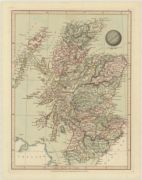
| Name: | Cruchley, G.F. | |
| Title: | Scotland. | |
| Imprint: | London : G.F. Cruchley, 1845 | |
| Zoom Into Map: | Click on the map to view in greater detail. | |
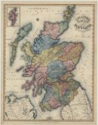
| Name: | Slater, Isaac. | |
| Title: | New Map of Scotland. | |
| Imprint: | Manchester : Isaac Slater, 1845 | |
| Zoom Into Map: | Click on the map to view in greater detail. | |
| Name: | Lizars, W. H. (William Home), 1788-1859 | |
| Title: | Tourist's guide to the picturesque scenery of Scotland / drawn & engraved on steel for the Scottish Tourist by W.H. Lizars. | |
| Imprint: | [Edinburgh : Lizars, 1845] | |
| Zoom Into Map: | Click on the map to view in greater detail. | |
| Title: | Tourist's guide to the picturesque scenery of Scotland / drawn & engraved on steel for the Scottish Tourist by W.H. Lizars. | |
| Imprint: | [Edinburgh : Lizars, 1845] | |
| Zoom Into Map: | Click on the map to view in greater detail. | |
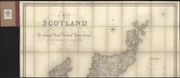
| Name: | Carrington, Frederick Augustus. | |
| Title: | A map of Scotland divided into counties shewing the principal roads, railways, rivers, canals ... on a scale of five miles to an inch | |
| Imprint: | London : S Lewis, [1846] | |
| Zoom Into Map: | Click on the map to view in greater detail. | |
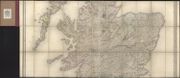
| Title: | A map of Scotland divided into counties shewing the principal roads, railways, rivers, canals ... on a scale of five miles to an inch. | |
| Imprint: | London : S Lewis, [1846] | |
| Zoom Into Map: | Click on the map to view in greater detail. | |
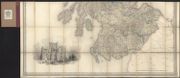
| Title: | A map of Scotland divided into counties shewing the principal roads, railways, rivers, canals ... on a scale of five miles to an inch. | |
| Imprint: | London : S Lewis, [1846] | |
| Zoom Into Map: | Click on the map to view in greater detail. | |
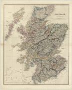
| Name: | Arrowsmith, John, 1790-1873 | |
| Title: | Scotland. | |
| Imprint: | London : J. Arrowsmith, 1846 | |
| Zoom Into Map: | Click on the map to view in greater detail. | |
| Name: | Carrington, Frederick Augustus Carrington, G.W. | |
| Title: | A map of Scotland divided into counties shewing the principal roads, railways, rivers, canals... on a scale of five miles to an inch. | |
| Imprint: | London : S. Lewis [1846] | |
| Zoom Into Map: | Click on the map to view in greater detail. | |
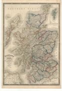
| Name: | Wyld, James, 1790-1836 | |
| Title: | Scotland with its islands… | |
| Imprint: | [London : Wyld, 1846] | |
| Zoom Into Map: | Click on the map to view in greater detail. | |
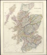
| Name: | Arrowsmith, John, 1790-1873 | |
| Title: | Scotland / by J. Arrowsmith. | |
| Imprint: | London : J Arrowsmith, 1846. | |
| Zoom Into Map: | Click on the map to view in greater detail. | |
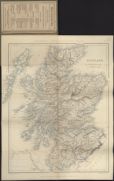
| Name: | Lowry, Joseph Wilson | |
| Title: | Scotland / engraved by J. Wilson Lowry. | |
| Imprint: | London : Chapman and Hall, 1847. | |
| Zoom Into Map: | Click on the map to view in greater detail. | |
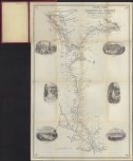
| Name: | Lizars, W. H. (William Home), 1788-1859 | |
| Title: | Lizars' guide to the Caledonian Railway from Edinburgh & Glasgow to Carlisle: commenced 1845, opened 1847. | |
| Imprint: | [Edinburgh, ca. 1847] | |
| Zoom Into Map: | Click on the map to view in greater detail. | |
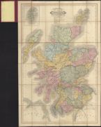
| Name: | Lizars, W. H. (William Home), 1788-1859 | |
| Title: | New road map of Scotland. With all the lines of railway, canals, &c., &c. | |
| Imprint: | Edinburgh : W Lizars [1847] | |
| Zoom Into Map: | Click on the map to view in greater detail. | |
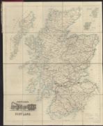
| Name: | W. & A.K. Johnston Limited | |
| Title: | Johnston's railway map of Scotland. | |
| Date: | 1847 | |
| Zoom Into Map: | Click on the map to view in greater detail. | |
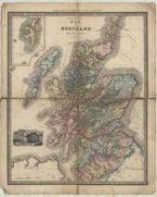
| Name: | B.F. Lloyd & Co. | |
| Title: | B.F. Lloyd & Co.s Map of Scotland with the railways. | |
| Imprint: | [Edinburgh] : B.F. Lloyd & Co., 1848 | |
| Zoom Into Map: | Click on the map to view in greater detail. | |
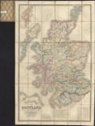
| Title: | New road map of Scotland with distances from Edinburgh and from port to port. Shewing the lines of railway, canals, &c. | |
| Imprint: | Edinburgh : J Johnstone &c [ca. 1848] | |
| Zoom Into Map: | Click on the map to view in greater detail. | |
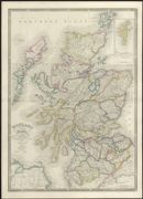
| Name: | Wyld, James, 1790-1836 | |
| Title: | Scotland with its islands, drawn from the topographical surveys / by James Wyld. | |
| Imprint: | London, [ca. 1848] | |
| Zoom Into Map: | Click on the map to view in greater detail. | |
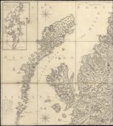
| Name: | Ainslie, John, 1745-1828 | |
| Title: | Scotland ... / by the late John Ainslie with the railways and other additions to the present time. | |
| Imprint: | Edinburgh : J Johnstone W & AK Johnston and Cowan & Co [ca. 1848] | |
| Zoom Into Map: | Click on the map to view in greater detail. | |
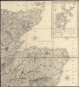
| Title: | Scotland ... / by the late John Ainslie with the railways and other additions to the present time. | |
| Imprint: | Edinburgh : J Johnstone W & AK Johnston and Cowan & Co [ca. 1848] | |
| Zoom Into Map: | Click on the map to view in greater detail. | |
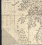
| Title: | Scotland ... / by the late John Ainslie with the railways and other additions to the present time. | |
| Imprint: | Edinburgh : J Johnstone W & AK Johnston and Cowan & Co, [ca. 1848] | |
| Zoom Into Map: | Click on the map to view in greater detail. | |
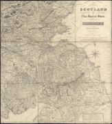
| Title: | Scotland ... / by the late John Ainslie with the railways and other additions to the present time. | |
| Imprint: | Edinburgh : J Johnstone W & AK Johnston and Cowan & Co, [ca. 1848] | |
| Zoom Into Map: | Click on the map to view in greater detail. | |
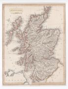
| Name: | Virtue, George | |
| Title: | Scotland. | |
| Imprint: | London : George Virtue, [1848]. | |
| Zoom Into Map: | Click on the map to view in greater detail. | |
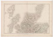
| Name: | Hall, Sidney. | |
| Title: | Scotland. | |
| Imprint: | Edinburgh : A & C Black, [1848] | |
| Zoom Into Map: | Click on the map to view in greater detail. | |
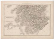
| Name: | Hall, Sidney. | |
| Title: | Scotland. | |
| Imprint: | Edinburgh : A & C Black, [1848] | |
| Zoom Into Map: | Click on the map to view in greater detail. | |
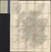
| Name: | Hall, Sidney | |
| Title: | Scotland | |
| Imprint: | Edinburgh : A. & C. Black, ca. 1849 | |
| Zoom Into Map: | Click on the map to view in greater detail. | |
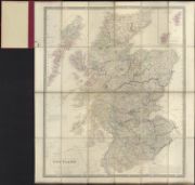
| Title: | Scotland. | |
| Imprint: | Edinburgh : W & AK Johnston &c, [ca. 1850] | |
| Zoom Into Map: | Click on the map to view in greater detail. | |
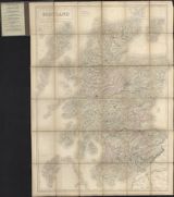
| Name: | Adam and Charles Black (Firm) | |
| Title: | Scotland. / engraved by S. Hall. | |
| Imprint: | Edinburgh : A & C Black, [ca. 1850] | |
| Zoom Into Map: | Click on the map to view in greater detail. | |
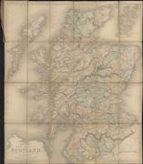
| Name: | Betts, John, active 1844-1863 | |
| Title: | Betts's new map of Scotland, embracing all the principal objects of interest to the tourist, and shewing the various lines of railroad, the turnpike and principal cross roads, canals, lakes, rivers, &c. &c. | |
| Imprint: | London : John Bett's, [1850?] | |
| Zoom Into Map: | Click on the map to view in greater detail. | |
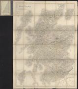
| Name: | Adam and Charles Black (Firm) | |
| Title: | Scotland. / engraved by S. Hall. | |
| Imprint: | Edinburgh : A & C Black, [ca. 1850] | |
| Zoom Into Map: | Click on the map to view in greater detail. | |
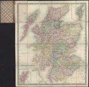
| Title: | Scotland. | |
| Imprint: | Edinburgh : W & AK Johnston &c, [ca. 1850] | |
| Zoom Into Map: | Click on the map to view in greater detail. | |
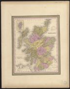
| Name: | Mitchell, Samuel Augustus. | |
| Title: | Scotland / [by S. Augustus Mitchell.] | |
| Imprint: | [Philadelphia : SA Mitchell, 1850] | |
| Zoom Into Map: | Click on the map to view in greater detail. | |
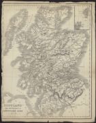
| Title: | Scotland. For Hendersons' conveyance guide. | |
| Date: | 1850 | |
| Zoom Into Map: | Click on the map to view in greater detail. | |
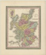
| Title: | Scotland. | |
| Imprint: | [Philadelphia] : Thomas Cowperthwait & Co., 1850 | |
| Zoom Into Map: | Click on the map to view in greater detail. | |
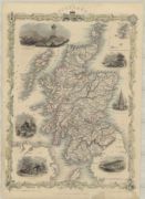
| Name: | Tallis, John & Frederick (fl. ca. 1846-1850) | |
| Title: | Scotland / (drawn & engraved by J. Rapkin.) | |
| Imprint: | London : J. & F. Tallis, [1851] | |
| Zoom Into Map: | Click on the map to view in greater detail. | |
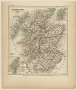
| Title: | Schotland 1849 / bergzeichnung v. Hauptm. Radefield. | |
| Imprint: | Hildburghausen : Stich, Druck und Verlag der geographischen Anstalt des Bibliographischen Instituts, 1852 | |
| Zoom Into Map: | Click on the map to view in greater detail. | |
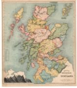
| Name: | Betts, Henry D. | |
| Title: | Betts's improved educational maps: Scotland. | |
| Imprint: | London : Philip, Son & Nephew, 1852. | |
| Zoom Into Map: | Click on the map to view in greater detail. | |
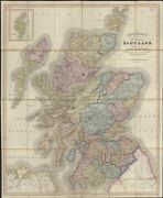
| Name: | Cruchley, G. F. | |
| Title: | Cruchley's - late Cary's - New map of Scotland, showing all the railways, turnpike roads, &c. (Additions to 1852.). | |
| Imprint: | London, [1852] | |
| Zoom Into Map: | Click on the map to view in greater detail. | |
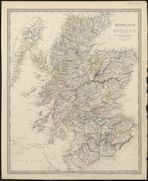
| Name: | J. & C. Walker (Firm) | |
| Title: | Scotland ... / (J. & C. Walker sculpt.). | |
| Imprint: | London : G Cox, 1853. | |
| Zoom Into Map: | Click on the map to view in greater detail. | |
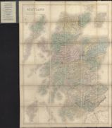
| Name: | Adam and Charles Black (Firm) | |
| Title: | Scotland / engraved by S. Hall. | |
| Imprint: | Edinburgh : A & C Black [1854?] | |
| Zoom Into Map: | Click on the map to view in greater detail. | |
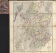
| Name: | Stanford, Edward, 1827-1904. | |
| Title: | Stanford's map of Scotland / (engraved by J. & C. Walker.). | |
| Imprint: | London, [ca. 1854] | |
| Zoom Into Map: | Click on the map to view in greater detail. | |
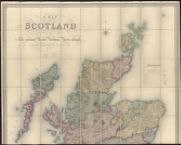
| Name: | Carrington, Frederick Augustus. | |
| Title: | [North] A map of Scotland divided into counties shewing the principal roads, railways, rivers, canals ... / drawn by F.A. Carrington. | |
| Imprint: | London : E Stanford, [1855?] | |
| Zoom Into Map: | Click on the map to view in greater detail. | |
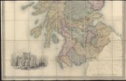
| Title: | [South] A map of Scotland divided into counties shewing the principal roads, railways, rivers, canals ... / drawn by F.A. Carrington. | |
| Imprint: | London : E Stanford, [1855?] | |
| Zoom Into Map: | Click on the map to view in greater detail. | |
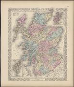
| Name: | Colton, G. Woolworth | |
| Title: | Scotland. | |
| Imprint: | New York : Published by JH Colton & Co, 1855. | |
| Zoom Into Map: | Click on the map to view in greater detail. | |
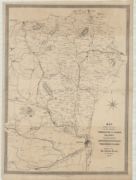
| Name: | Keith and Gibb (lithographers) | |
| Title: | Map shewing the routes of the proposed Formartine & Buchan Railway and the proposed Aberdeen, Peterhead & Fraserburgh Railway / (Keith & Gibb ... lithographers.). | |
| Imprint: | [Aberdeen], 1855 | |
| Zoom Into Map: | Click on the map to view in greater detail. | |
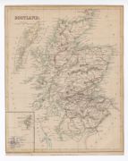
| Name: | Brooks, Vincent | |
| Title: | Scotland / engraved & lithographed by Vincent Brooks. | |
| Imprint: | London : SO Beeton, [1856?] | |
| Zoom Into Map: | Click on the map to view in greater detail. | |
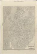
| Title: | Illustrated Times map of Scotland. | |
| Imprint: | London : R Clayton 1858. | |
| Zoom Into Map: | Click on the map to view in greater detail. | |
| Name: | Johnston, Alexander Keith, 1804-1871 | |
| Title: | New travelling map of Scotland / by A. Keith Johnston ... (engraved ... by W. & A.K. Johnston.). | |
| Date: | 1858 | |
| Zoom Into Map: | Click on the map to view in greater detail. | |
| Name: | Stanford, Edward, 1827-1904. | |
| Title: | Stanford's map of Scotland ... / (engraved by J. & C. Walker.). | |
| Imprint: | London, 1858. | |
| Zoom Into Map: | Click on the map to view in greater detail. | |
| Name: | J. & C. Walker (Firm) | |
| Title: | Scotland: coast guard / (engraved by J. & C. Walker.). | |
| Imprint: | London : The Admiralty, 1858 [ie 1866] | |
| Zoom Into Map: | Click on the map to view in greater detail. | |
| Name: | Weller, Edward, d. 1884. | |
| Title: | Scotland / (drawn ... [and] engraved by E. Weller.). | |
| Imprint: | Glasgow : Blackie & Son, [1860] | |
| Zoom Into Map: | Click on the map to view in greater detail. | |
| Title: | Key to outline map of Scotland. | |
| Imprint: | London : J Betts [ca. 1860] | |
| Zoom Into Map: | Click on the map to view in greater detail. | |
| Title: | Scotland with its railways, etc. | |
| Imprint: | London : H.G. Collins, 1860 | |
| Zoom Into Map: | Click on the map to view in greater detail. | |
| Name: | Johnston, Alexander Keith, 1804-1871 | |
| Title: | New travelling map of Scotland / by A. Keith Johnston ... (engraved ... by W. & A.K. Johnston.). | |
| Date: | 1861 | |
| Zoom Into Map: | Click on the map to view in greater detail. | |
| Name: | Cruchley, G. F. | |
| Title: | Cruchley's Scotland ... | |
| Imprint: | [London], 1861 | |
| Zoom Into Map: | Click on the map to view in greater detail. | |
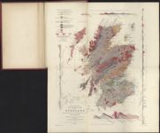
| Name: | Murchison, Roderick Impey | |
| Title: | First sketch of a new geological map of Scotland / by Sir Roderick Murchison ... and Archibald Geikie ... constructed by A. Keith Johnston. | |
| Imprint: | Edinburgh, 1861. | |
| Zoom Into Map: | Click on the map to view in greater detail. | |
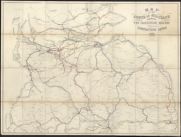
| Name: | Caledonian Railway Company. | |
| Title: | Map of the South of Scotland shewing the Caledonian Railway and connecting lines 1861. | |
| Imprint: | Glasgow : Maclure & Macdonald, 1861. | |
| Zoom Into Map: | Click on the map to view in greater detail. | |
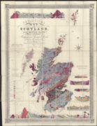
| Name: | Knipe, James A. | |
| Title: | Geological map of Scotland / by J.A. Knipe. | |
| Imprint: | London : E Stanford, 1861. | |
| Zoom Into Map: | Click on the map to view in greater detail. | |
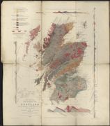
| Name: | Murchison, Roderick Impey | |
| Title: | First sketch of a new geological map of Scotland / by Sir Roderick Murchison ... and Archibald Geikie ... constructed by A. Keith Johnston. | |
| Imprint: | Edinburgh, 1861. | |
| Zoom Into Map: | Click on the map to view in greater detail. | |
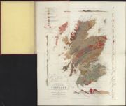
| Name: | Murchison, Roderick Impey | |
| Title: | First sketch of a new geological map of Scotland / by Sir Roderick I. Murchison ... and Archibald Geikie ... constructed by A. Keith Johnston ... 1862. | |
| Imprint: | Edinburgh : W & AK Johnston Blackwood & Sons &c, 1862. | |
| Zoom Into Map: | Click on the map to view in greater detail. | |
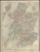
| Name: | Stanford, Edward, 1827-1904. | |
| Title: | Stanford's map of Scotland ... / (engraved by J. & C. Walker.). | |
| Imprint: | London, 1862. | |
| Zoom Into Map: | Click on the map to view in greater detail. | |
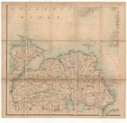
| Name: | Black, Adam, 1784-1874 Black, Charles | |
| Title: | Black's new large map of Scotland. | |
| Imprint: | Edinburgh : A. & C. Black, [1862] | |
| Zoom Into Map: | Click on the map to view in greater detail. | |
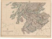
| Name: | Weller, Edward, d. 1884. | |
| Title: | Scotland. | |
| Imprint: | London : Weekly Dispatch Atlas, [1863] | |
| Zoom Into Map: | Click on the map to view in greater detail. | |
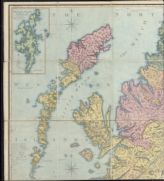
| Name: | Ainslie, John, 1745-1828 | |
| Title: | Scotland ... / by ... John Ainslie with the railways and other additions to 1863. | |
| Imprint: | [Edinburgh : W & AK Johnston, 1863] | |
| Zoom Into Map: | Click on the map to view in greater detail. | |
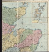
| Title: | Scotland ... / by ... John Ainslie with the railways and other additions to 1863. | |
| Imprint: | [Edinburgh : W & AK Johnston, 1863] | |
| Zoom Into Map: | Click on the map to view in greater detail. | |
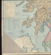
| Title: | Scotland ... / by ... John Ainslie with the railways and other additions to 1863. | |
| Imprint: | [Edinburgh : W & AK Johnston, 1863] | |
| Zoom Into Map: | Click on the map to view in greater detail. | |
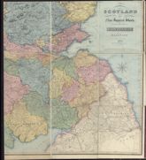
| Title: | Scotland ... / by ... John Ainslie with the railways and other additions to 1863. | |
| Imprint: | [Edinburgh : W & AK Johnston, 1863] | |
| Zoom Into Map: | Click on the map to view in greater detail. | |
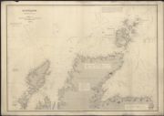
| Title: | Scotland, North Coasts, &c. | |
| Imprint: | London : C Wilson 1863. | |
| Zoom Into Map: | Click on the map to view in greater detail. | |
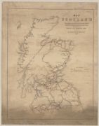
| Name: | Day & Son | |
| Title: | Map of Scotland shewing the lines of railway constructed and in course of construction as well as those proposed by the Bills of Session 1863. | |
| Imprint: | London : Day & Son, 1863. | |
| Zoom Into Map: | Click on the map to view in greater detail. | |
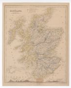
| Name: | Dower, John | |
| Title: | Scotland | |
| Imprint: | London : Orr and Comp., 1864 | |
| Zoom Into Map: | Click on the map to view in greater detail. | |
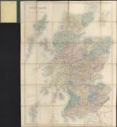
| Name: | Hall, Sidney. | |
| Title: | Scotland / engraved by S. Hall. | |
| Imprint: | Edinburgh, [ca. 1864] | |
| Zoom Into Map: | Click on the map to view in greater detail. | |
| Name: | W. & A.K. Johnston Limited | |
| Title: | Johnston's railway map of Scotland. | |
| Imprint: | Edinburgh : W. & A.K. Johnston, 1865 | |
| Zoom Into Map: | Click on the map to view in greater detail. | |

| Title: | Scotland. | |
| Imprint: | London : T. Nelson and Son, 1865 | |
| Zoom Into Map: | Click on the map to view in greater detail. | |
| Name: | Johnston, Alexander Keith | |
| Title: | Scotland / by A.K. Johnston. | |
| Imprint: | Edinburgh : W & AK Johnston [1868]. | |
| Zoom Into Map: | Click on the map to view in greater detail. | |
| Name: | Adam and Charles Black (Firm) | |
| Title: | Scotland / engraved by S. Hall. | |
| Imprint: | Edinburgh, [ca. 1870] | |
| Zoom Into Map: | Click on the map to view in greater detail. | |
| Name: | Bartholomew, John George, 1860-1920 | |
| Title: | Scotland / by J. Bartholomew. | |
| Imprint: | London : George Philip & Son, [ca. 1870] | |
| Zoom Into Map: | Click on the map to view in greater detail. | |
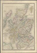
| Name: | Wyld, James, 1790-1836 | |
| Title: | Scotland with its Islands / drawn from the topographical surveys, by James Wyld. | |
| Imprint: | London, [ca. 1870] | |
| Zoom Into Map: | Click on the map to view in greater detail. | |
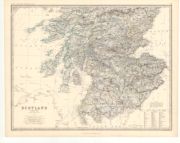
| Name: | Johnston, Alexander Keith, 1804-1871 | |
| Title: | Scotland. | |
| Imprint: | Edinburgh & London : William Blackwood & Sons, 1873. | |
| Zoom Into Map: | Click on the map to view in greater detail. | |
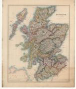
| Name: | Arrowsmith, John, 1790-1873 | |
| Title: | Scotland. | |
| Imprint: | London : E. Stanford, 1875. | |
| Zoom Into Map: | Click on the map to view in greater detail. | |
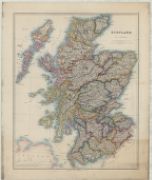
| Name: | Arrowsmith, John, 1790-1873. | |
| Title: | Scotland / by J. Arrowsmith. | |
| Imprint: | London : E. Stanford, 1875 | |
| Zoom Into Map: | Click on the map to view in greater detail. | |
| Name: | Airey, John | |
| Title: | Airey's Railway Map of Scotland. | |
| Imprint: | London : s.n., [1875] | |
| Zoom Into Map: | Click on the map to view in greater detail. | |
| Name: | Airey, John | |
| Title: | Airey's railway map of Scotland / by John Airey, etc. | |
| Imprint: | London, [1875] | |
| Zoom Into Map: | Click on the map to view in greater detail. | |
| Name: | Arrowsmith, John, 1790-1873 | |
| Title: | W. & J. Mutter's map of Scotland / by J. Arrowsmith. | |
| Imprint: | Glasgow : W & J Mutter, [ca. 1875?] | |
| Zoom Into Map: | Click on the map to view in greater detail. | |
| Name: | Faden, William, 1750-1836 | |
| Title: | A map of Scotland : drawn chiefly from the topographical surveys of Mr. John Ainslie and from those of the late General Roy &c. &c. shewing the great and cross roads, and the distances between the towns / by William Faden, Geographer to the King. | |
| Imprint: | London : J Wyld, [ca. 1875]. | |
| Zoom Into Map: | Click on the map to view in greater detail. | |
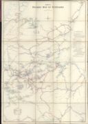
| Name: | Airey, John | |
| Title: | Airey's railway map of Scotland / by John Airey, etc. | |
| Imprint: | London, [1875] | |
| Zoom Into Map: | Click on the map to view in greater detail. | |
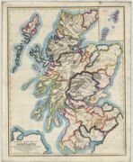
| Name: | Gellatly, John. | |
| Title: | School room map of Scotland by the Scottish School Book Association / (drawn and engraved by J. Gellatly.). | |
| Imprint: | Edinburgh : W. Whyte & Co., 1876 | |
| Zoom Into Map: | Click on the map to view in greater detail. | |
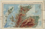
| Name: | Stanford's Geographical Estabt. | |
| Title: | Stanford's orographical map of Scotland. | |
| Imprint: | London : Stanford, 1876 | |
| Zoom Into Map: | Click on the map to view in greater detail. | |
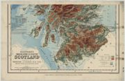
| Title: | Stanford's orographical map of Scotland. | |
| Imprint: | London : Stanford, 1876 | |
| Zoom Into Map: | Click on the map to view in greater detail. | |
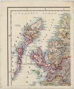
| Title: | Scotland | |
| Imprint: | London : S.P.C.K., 1877 | |
| Zoom Into Map: | Click on the map to view in greater detail. | |
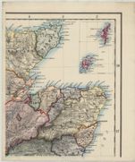
| Title: | Scotland | |
| Imprint: | London : S.P.C.K., 1877 | |
| Zoom Into Map: | Click on the map to view in greater detail. | |
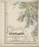
| Title: | Scotland | |
| Imprint: | London : S.P.C.K., 1877 | |
| Zoom Into Map: | Click on the map to view in greater detail. | |
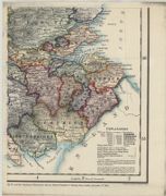
| Title: | Scotland | |
| Imprint: | London : S.P.C.K., 1877 | |
| Zoom Into Map: | Click on the map to view in greater detail. | |
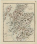
| Title: | Scotland / published under the superintendence of the Society for the Diffusion of Useful Knowledge. | |
| Imprint: | London : Thomas Letts, [1877] | |
| Zoom Into Map: | Click on the map to view in greater detail. | |
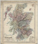
| Title: | Scotland. | |
| Imprint: | London : Published under the direction of ... the Society for Promoting Christian Knowledge and of the National Society, 1879 | |
| Zoom Into Map: | Click on the map to view in greater detail. | |
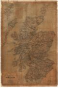
| Name: | Johnston, Alexander Keith, 1804-1871 | |
| Title: | Library or travelling map of Scotland. | |
| Imprint: | Edinburgh : W. & A. K. Johnston, 1879. | |
| Zoom Into Map: | Click on the map to view in greater detail. | |
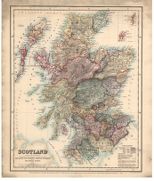
| Name: | Society for Promoting Christian Knowledge. | |
| Title: | Scotland. | |
| Imprint: | London : E. Stanford & S.P.C.K., 1879. | |
| Zoom Into Map: | Click on the map to view in greater detail. | |
| Name: | Lefevre, E. Shaw. | |
| Title: | Political map of Scotland as represented in Parliament March 1879 / by E. Shaw Lefevre. | |
| Imprint: | London : E. Stanford, 1879 | |
| Zoom Into Map: | Click on the map to view in greater detail. | |
| Name: | Lefevre, E. Shaw. | |
| Title: | Political map of Scotland as represented in Parliament March 1879 / by E. Shaw Lefevre. | |
| Date: | 1879 | |
| Zoom Into Map: | Click on the map to view in greater detail. | |
| Name: | W. & A.K. Johnston Limited | |
| Title: | Scotland / constructed & engraved by W. & A.K. Johnston ... | |
| Date: | 1880 | |
| Zoom Into Map: | Click on the map to view in greater detail. | |
| Name: | Bartholomew, John Junior, 1831-1893 | |
| Title: | Scotland / by J. Bartholomew F.R.G.S. | |
| Date: | 1880 | |
| Zoom Into Map: | Click on the map to view in greater detail. | |
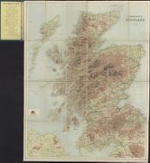
| Name: | Bartholomew, John Junior, 1831-1893 | |
| Title: | Orographical map of Scotland / by John Bartholomew, F.R.G.S. | |
| Date: | 1880 | |
| Zoom Into Map: | Click on the map to view in greater detail. | |
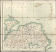
| Name: | Adam and Charles Black (Firm) | |
| Title: | Black's large map of Scotland. | |
| Date: | 1880 | |
| Zoom Into Map: | Click on the map to view in greater detail. | |
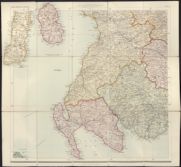
| Name: | Adam and Charles Black (Firm) | |
| Title: | Black's large map of Scotland. | |
| Date: | 1880 | |
| Zoom Into Map: | Click on the map to view in greater detail. | |
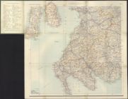
| Name: | Adam and Charles Black (Firm) | |
| Title: | Black's large map of Scotland. | |
| Date: | 1880 | |
| Zoom Into Map: | Click on the map to view in greater detail. | |
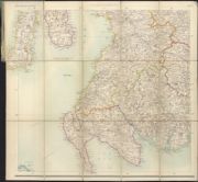
| Name: | Adam and Charles Black (Firm) | |
| Title: | Black's large map of Scotland. | |
| Date: | 1880 | |
| Zoom Into Map: | Click on the map to view in greater detail. | |
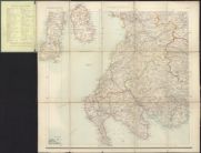
| Name: | Adam and Charles Black (Firm) | |
| Title: | Black's large map of Scotland. | |
| Date: | 1880 | |
| Zoom Into Map: | Click on the map to view in greater detail. | |
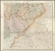
| Name: | Adam and Charles Black (Firm) | |
| Title: | Black's large map of Scotland. | |
| Date: | 1880 | |
| Zoom Into Map: | Click on the map to view in greater detail. | |
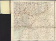
| Name: | Adam and Charles Black (Firm) | |
| Title: | Black's large map of Scotland. | |
| Date: | 1880 | |
| Zoom Into Map: | Click on the map to view in greater detail. | |
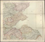
| Name: | Adam and Charles Black (Firm) | |
| Title: | Black's large map of Scotland. | |
| Date: | 1880 | |
| Zoom Into Map: | Click on the map to view in greater detail. | |
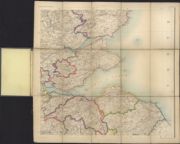
| Name: | Adam and Charles Black (Firm) | |
| Title: | Black's large map of Scotland. | |
| Date: | 1880 | |
| Zoom Into Map: | Click on the map to view in greater detail. | |
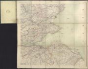
| Name: | Adam and Charles Black (Firm) | |
| Title: | Black's large map of Scotland. | |
| Date: | 1880 | |
| Zoom Into Map: | Click on the map to view in greater detail. | |
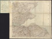
| Name: | Adam and Charles Black (Firm) | |
| Title: | Black's large map of Scotland. | |
| Date: | 1880 | |
| Zoom Into Map: | Click on the map to view in greater detail. | |
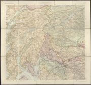
| Name: | Adam and Charles Black (Firm) | |
| Title: | Black's large map of Scotland. | |
| Date: | 1880 | |
| Zoom Into Map: | Click on the map to view in greater detail. | |
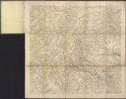
| Name: | Adam and Charles Black (Firm) | |
| Title: | Black's large map of Scotland. | |
| Date: | 1880 | |
| Zoom Into Map: | Click on the map to view in greater detail. | |
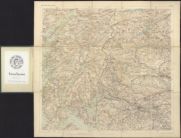
| Name: | Adam and Charles Black (Firm) | |
| Title: | Black's large map of Scotland. | |
| Date: | 1880 | |
| Zoom Into Map: | Click on the map to view in greater detail. | |
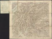
| Name: | Adam and Charles Black (Firm) | |
| Title: | Black's large map of Scotland. | |
| Date: | 1880 | |
| Zoom Into Map: | Click on the map to view in greater detail. | |
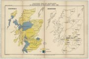
| Name: | Lefevre, E. Shaw. | |
| Title: | Political map of Scotland. Coloured to show respectively the representation in Parliament by counties and boroughs, in April, 1880, and the seats gained / by E. Shaw Lefevre. | |
| Imprint: | London : E. Stanford, 1880 | |
| Zoom Into Map: | Click on the map to view in greater detail. | |
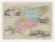
| Title: | Miniature map of Sutherland & Ross by Tuck. | |
| Imprint: | London: Tuck, ca. 1880? | |
| Zoom Into Map: | Click on the map to view in greater detail. | |
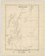
| Name: | Weller, Edward, d. 1884. | |
| Title: | Scotland / ([by] Edwd. Weller.). | |
| Imprint: | London : Longmans & Co., 1882 | |
| Zoom Into Map: | Click on the map to view in greater detail. | |
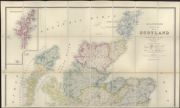
| Name: | Stanford, Edward, 1827-1904. | |
| Title: | Stanford's London atlas map of Scotland ... | |
| Imprint: | London, 1882. | |
| Zoom Into Map: | Click on the map to view in greater detail. | |
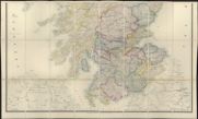
| Title: | Stanford's London atlas map of Scotland ... | |
| Imprint: | London, 1882. | |
| Zoom Into Map: | Click on the map to view in greater detail. | |
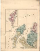
| Name: | Stanford, Edward, 1827-1904. | |
| Title: | Stanford's map of Scotland. | |
| Imprint: | London : E. Stanford, 1882. | |
| Zoom Into Map: | Click on the map to view in greater detail. | |
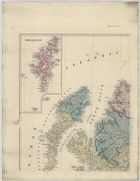
| Name: | Stanford, Edward, 1827-1904. | |
| Title: | Stanford's map of Scotland | |
| Imprint: | London, 1882 | |
| Zoom Into Map: | Click on the map to view in greater detail. | |
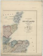
| Title: | Stanford's map of Scotland | |
| Imprint: | London, 1882 | |
| Zoom Into Map: | Click on the map to view in greater detail. | |
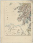
| Title: | Stanford's map of Scotland | |
| Imprint: | London, 1882 | |
| Zoom Into Map: | Click on the map to view in greater detail. | |
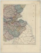
| Title: | Stanford's map of Scotland | |
| Imprint: | London, 1882 | |
| Zoom Into Map: | Click on the map to view in greater detail. | |
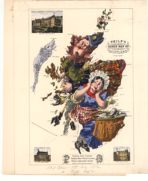
| Title: | Philp's Comic Map of Scotland. | |
| Imprint: | [Edinburgh : J. Bartholomew & Son, 1882] | |
| Zoom Into Map: | Click on the map to view in greater detail. | |
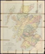
| Name: | W. & A.K. Johnston Limited | |
| Title: | Map of Scotland. Issued with "The Highland Sportsman" ... / (engraved ... by W. & A.K. Johnston.). | |
| Imprint: | London, [1882] | |
| Zoom Into Map: | Click on the map to view in greater detail. | |
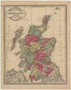
| Name: | Tunison, H.C. | |
| Title: | Tunison's Scotland. | |
| Imprint: | [Jacksonville, IL. : H.C. Tunison, 1883 | |
| Zoom Into Map: | Click on the map to view in greater detail. | |

| Title: | Sectional map of Scotland. (Supplement presented with The Glasgow Weekly Herald.) SW Scotland | |
| Imprint: | Edinburgh : J. Bartholomew, 1885 | |
| Zoom Into Map: | Click on the map to view in greater detail. | |
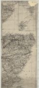
| Title: | Sectional map of Scotland. (Supplement presented with The Glasgow Weekly Herald.) NE Scotland | |
| Imprint: | Edinburgh : J. Bartholomew, 1885 | |
| Zoom Into Map: | Click on the map to view in greater detail. | |
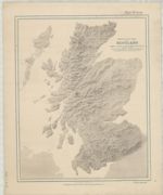
| Name: | Brion, Henry F. | |
| Title: | Photo relief map of Scotland [with no placenames] / by Henry F. Brion and ... Edmund McClure. | |
| Imprint: | London : S.P.C.K., 1885 | |
| Zoom Into Map: | Click on the map to view in greater detail. | |
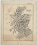
| Name: | Brion, Henry F. | |
| Title: | Photo relief map of Scotland [with placenames] / by Henry F. Brion and ... Edmund McClure. | |
| Imprint: | London : S.P.C.K., 1885 | |
| Zoom Into Map: | Click on the map to view in greater detail. | |
| Name: | Brion, Henry F. | |
| Title: | Photo relief map of Scotland [with placenames and coloured counties] / by Henry F. Brion and ... Edmund McClure. | |
| Imprint: | London : S.P.C.K., 1885 | |
| Zoom Into Map: | Click on the map to view in greater detail. | |
| Name: | Bartholomew, John Junior, 1831-1893 | |
| Title: | Scotland / by John Bartholomew, etc. | |
| Date: | 1885 | |
| Zoom Into Map: | Click on the map to view in greater detail. | |
| Name: | Bartholomew, John Junior, 1831-1893 | |
| Title: | Scotland / by John Bartholomew, etc. | |
| Date: | 1885 | |
| Zoom Into Map: | Click on the map to view in greater detail. | |
| Name: | John Bartholomew & Co. Ltd. | |
| Title: | Orographical map of Scotland / by John Bartholomew. | |
| Date: | 1885 | |
| Zoom Into Map: | Click on the map to view in greater detail. | |
| Name: | Adam and Charles Black (Firm) | |
| Title: | Black's large tourist map of Scotland. Sheet 3 | |
| Imprint: | Edinburgh, [ca. 1888] | |
| Zoom Into Map: | Click on the map to view in greater detail. | |
| Name: | W. & A.K. Johnston Limited | |
| Title: | Johnston's reduced ordnance maps of Scotland. Sheet 10 - Ayr, Kilmarnock and Ardrossan | |
| Imprint: | Edinburgh, 1888-1896 | |
| Zoom Into Map: | Click on the map to view in greater detail. | |
| Name: | W. & A.K. Johnston Limited | |
| Title: | Johnston's reduced ordnance maps of Scotland. Sheet 11 - Sanquhar, Lanark and Hamilton | |
| Imprint: | Edinburgh, 1888-1896 | |
| Zoom Into Map: | Click on the map to view in greater detail. | |
| Name: | John Bartholomew & Co. Ltd. | |
| Title: | Sportsman's & tourist's guide map of Scotland / by John Bartholomew, etc. | |
| Imprint: | Edinburgh : J. Bartholomew & Co., 1889 | |
| Zoom Into Map: | Click on the map to view in greater detail. | |
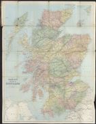
| Name: | Bartholomew, John Junior, 1831-1893 | |
| Title: | Tourist's new map of Scotland / by John Bartholomew, F.R.G.S. | |
| Date: | 1890 | |
| Zoom Into Map: | Click on the map to view in greater detail. | |
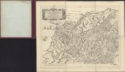
| Name: | Gordon, Robert, 1580-1661 | |
| Title: | Scotiae Provinciae Mediterraneae inter Taum flumen et vararis aestuarium ... / opera Ro. Gordonii a Straloch, &c. | |
| Imprint: | Stirling : RS Shearer & Son, 1891. | |
| Zoom Into Map: | Click on the map to view in greater detail. | |
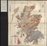
| Name: | Geikie, Archibald, 1835-1924 | |
| Title: | Geological map of Scotland / reduced ... from the ordnance and geological surveys under the direction of Sir Archibald Geikie ... topography by John Bartholomew ... | |
| Imprint: | [Edinburgh] : J Bartholomew & Co, 1892. | |
| Zoom Into Map: | Click on the map to view in greater detail. | |
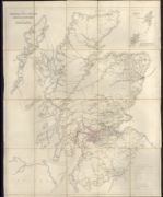
| Name: | Stanford, Edward, 1827-1904. | |
| Title: | General Post Office circulation map for Scotland / (engraved ... by Edward Stanford.). | |
| Imprint: | London : HMSO, 1892. | |
| Zoom Into Map: | Click on the map to view in greater detail. | |
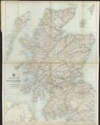
| Name: | John Bartholomew & Co. Ltd. | |
| Title: | Tourist's map of Scotland / by John Bartholomew ... showing the new county boundaries as settled by the Boundary Commissioners. | |
| Date: | 1892 | |
| Zoom Into Map: | Click on the map to view in greater detail. | |
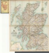
| Name: | Bartholomew, John George, 1860-1920 | |
| Title: | Tourist's map of Scotland... showing the new county boundaries. | |
| Imprint: | Edinburgh : J. Bartholomew & Co., [1892] | |
| Zoom Into Map: | Click on the map to view in greater detail. | |
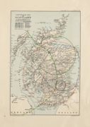
| Name: | Richardson, Ralph (1845-1933) John Bartholomew & Co. Ltd. | |
| Title: | Earthquake Map of Scotland | |
| Imprint: | Edinburgh: Edinburgh Geological Society, 1892 | |
| Zoom Into Map: | Click on the map to view in greater detail. | |
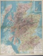
| Name: | Harvie-Brown, J.A. Bartholomew, John G., 1860-1920 | |
| Title: | Naturalist's Map of Scotland. By J.A. Harvie-Brown... and J.G. Bartholomew | |
| Imprint: | [Edinburgh] : J. Bartholomew & Co., 1893 | |
| Zoom Into Map: | Click on the map to view in greater detail. | |
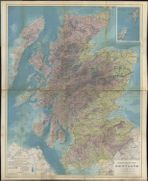
| Name: | Harvie-Brown, J. A. | |
| Title: | Naturalist's map of Scotland / by J.A. Harvie-Brown ... and J.G. Bartholomew. | |
| Date: | 1893 | |
| Zoom Into Map: | Click on the map to view in greater detail. | |
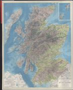
| Name: | Harvie-Brown, J. A. | |
| Title: | Naturalist's map of Scotland / by J.A. Harvie-Brown ... and J.G. Bartholomew. | |
| Date: | 1893 | |
| Zoom Into Map: | Click on the map to view in greater detail. | |
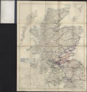
| Name: | John Bartholomew & Co. Ltd. | |
| Title: | [A outline map of Scotland to which railway lines have been added in manuscript.] | |
| Imprint: | Edinburgh : J Bartholomew & Co, [ca. 1893] | |
| Zoom Into Map: | Click on the map to view in greater detail. | |
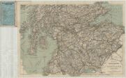
| Name: | G.W. Bacon & Co. | |
| Title: | Bacon's cycling road map of Scotland, etc. | |
| Imprint: | London, 1895 | |
| Zoom Into Map: | Click on the map to view in greater detail. | |
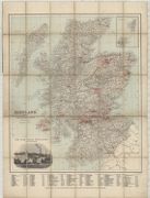
| Name: | George Philip and Son | |
| Title: | Scotland showing the distilleries. | |
| Imprint: | London : G. Philip & Son, 1895 | |
| Zoom Into Map: | Click on the map to view in greater detail. | |
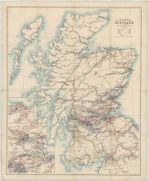
| Name: | W. & A.K. Johnston Limited | |
| Title: | W. & A.K. Johnston's map of the railway systems of Scotland, etc. | |
| Imprint: | Edinburgh, 1896 | |
| Zoom Into Map: | Click on the map to view in greater detail. | |
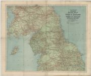
| Name: | W. & A.K. Johnston Limited. | |
| Title: | W. & A.K. Johnston's cyclists' road map of the South of Scotland and North of England, etc. | |
| Imprint: | [Edinburgh, 1896 | |
| Zoom Into Map: | Click on the map to view in greater detail. | |
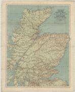
| Name: | W. & A.K. Johnston Limited | |
| Title: | W. & A.K. Johnston's cyclists' road map of the Central & Northern districts of Scotland, etc. | |
| Imprint: | Edinburgh, 1896 | |
| Zoom Into Map: | Click on the map to view in greater detail. | |
| Name: | John Bartholomew & Co. Ltd. | |
| Title: | Tourist's map of Scotland reduced from the Ordnance Survey / by John Bartholomew. | |
| Date: | 1896 | |
| Zoom Into Map: | Click on the map to view in greater detail. | |
| Name: | J. & W. Emslie. | |
| Title: | Official railway map of Scotland. Prepared ... at the Railway Clearing House, London / drawn and engraved by J. & W. Emslie. | |
| Imprint: | London, 1896. | |
| Zoom Into Map: | Click on the map to view in greater detail. | |
| Name: | Moll, Herman, d. 1732 | |
| Title: | The north part of Great Britain called Scotland ... / by Herman Moll. | |
| Imprint: | Stirling : RS Shearer & Son, 1896. | |
| Zoom Into Map: | Click on the map to view in greater detail. | |
| Name: | Moll, Herman, d. 1732 | |
| Title: | The north part of Great Britain called Scotland ... / by Herman Moll. | |
| Imprint: | Stirling : RS Shearer & Son, 1896. | |
| Zoom Into Map: | Click on the map to view in greater detail. | |
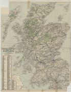
| Name: | John Bartholomew & Co. Ltd. | |
| Title: | Sportsman's & tourist's guide map of Scotland / by John Bartholomew, etc. | |
| Imprint: | Edinburgh : J. Bartholomew & Co., 1897 | |
| Zoom Into Map: | Click on the map to view in greater detail. | |
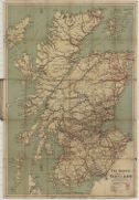
| Name: | Inglis, Harry R. G., d. 1939. | |
| Title: | 'Safety' map of Scotland / edited by H.R.G. Inglis. | |
| Imprint: | Edinburgh : Gall & Inglis, 1898 | |
| Zoom Into Map: | Click on the map to view in greater detail. | |
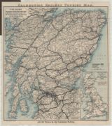
| Name: | Caledonian Railway Company. | |
| Title: | Caledonian Railway tourist map. | |
| Imprint: | Glasgow : Caledonian Railway, 1900 | |
| Zoom Into Map: | Click on the map to view in greater detail. | |
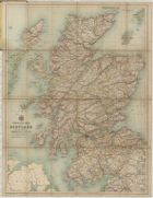
| Name: | John Bartholomew & Co. Ltd. | |
| Title: | Tourist's map of Scotland reduced from the Ordnance survey / by John Bartholomew. | |
| Imprint: | Edinburgh : J. Bartholomew & Co., 1900 | |
| Zoom Into Map: | Click on the map to view in greater detail. | |
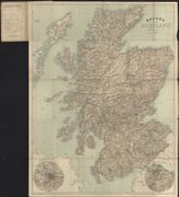
| Name: | G.W. Bacon & Co. | |
| Title: | Bacon's map of Scotland. | |
| Imprint: | London : GW Bacon & Co [ca. 1900] | |
| Zoom Into Map: | Click on the map to view in greater detail. | |
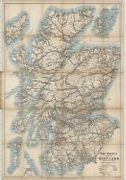
| Name: | Inglis, Harry R. G., d. 1939. | |
| Title: | 'Safety' map of Scotland / edited by H.R.G. Inglis. | |
| Imprint: | Edinburgh : Gall & Inglis, 1901 | |
| Zoom Into Map: | Click on the map to view in greater detail. | |
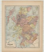
| Title: | Scotland | |
| Imprint: | Springfield (Ohio) : Crowell & Kirkpatrick, 1902 | |
| Zoom Into Map: | Click on the map to view in greater detail. | |
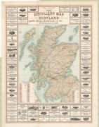
| Name: | Mackinlay, Charles & Co. John Bartholomew & Co. Ltd. | |
| Title: | The distillery map of Scotland | |
| Imprint: | Leith, Edinburgh : Chas. Mackinlay & Co., Bartholomew, 1902 | |
| Zoom Into Map: | Click on the map to view in greater detail. | |
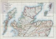
| Name: | W. & A.K. Johnston Limited | |
| Title: | Johnston's touring and motoring map of Scotland : showing the main roads, steamer routes, railways, and all railway stations. | |
| Imprint: | Edinburgh : W. & A.K. Johnston, 1904 | |
| Zoom Into Map: | Click on the map to view in greater detail. | |
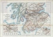
| Title: | Johnston's touring and motoring map of Scotland : showing the main roads, steamer routes, railways, and all railway stations. | |
| Imprint: | Edinburgh : W. & A.K. Johnston, 1904 | |
| Zoom Into Map: | Click on the map to view in greater detail. | |
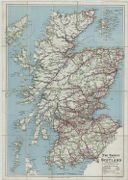
| Name: | Inglis, Harry R. G., d. 1939. | |
| Title: | 'Safety' map of Scotland / edited by H.R.G. Inglis. | |
| Imprint: | Edinburgh : Gall & Inglis, 1905 | |
| Zoom Into Map: | Click on the map to view in greater detail. | |
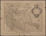
| Name: | Ortelius, Abraham, 1527-1598 | |
| Title: | Scotiae tabula / Abraham Ortelius. | |
| Imprint: | Stirling : RS Shearer & Son 1905. | |
| Zoom Into Map: | Click on the map to view in greater detail. | |
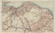
| Name: | Gall & Inglis. | |
| Title: | Gall & Inglis road map of East Lothian and the Tweed Valley. | |
| Imprint: | Edinburgh, 1910 | |
| Zoom Into Map: | Click on the map to view in greater detail. | |
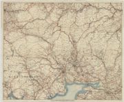
| Name: | Gall & Inglis. | |
| Title: | Gall & Inglis road map of Southern Scotland. | |
| Imprint: | Edinburgh : Gall & Inglis, 1910 | |
| Zoom Into Map: | Click on the map to view in greater detail. | |
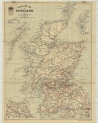
| Name: | Horlick & Co. | |
| Title: | Horlick's motor map of Scotland. | |
| Imprint: | Slough, 1910 | |
| Zoom Into Map: | Click on the map to view in greater detail. | |
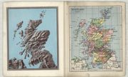
| Name: | Philip, George, 1870-1937. | |
| Title: | Scotland. | |
| Imprint: | London : George Philip & Son, 1910 | |
| Zoom Into Map: | Click on the map to view in greater detail. | |
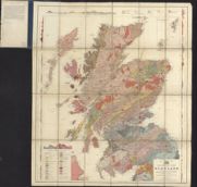
| Name: | Geikie, Archibald, 1835-1924. | |
| Title: | Geological map of Scotland reduced chiefly from the ordnance and geological surveys / under the direction of Sir Archibald Geikie ... topography by John Bartholomew F.R.G.S. | |
| Date: | 1910 | |
| Zoom Into Map: | Click on the map to view in greater detail. | |
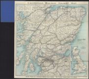
| Name: | Caledonian Railway Company. | |
| Title: | Caledonian railway tourist map. | |
| Date: | 1910 | |
| Zoom Into Map: | Click on the map to view in greater detail. | |
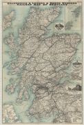
| Name: | Maccorquodale and Company Ltd. | |
| Title: | Caledonian & London & North Western Railway map of Scotland / ([engraved by] McCorquodale & Co. Ltd.). | |
| Imprint: | Glasgow, 1911 | |
| Zoom Into Map: | Click on the map to view in greater detail. | |
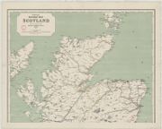
| Name: | J. & W. Emslie. | |
| Title: | Official railway map of Scotland, 1912. | |
| Imprint: | London, 1912 | |
| Zoom Into Map: | Click on the map to view in greater detail. | |
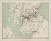
| Title: | Official railway map of Scotland, 1912. | |
| Imprint: | London, 1912 | |
| Zoom Into Map: | Click on the map to view in greater detail. | |
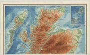
| Name: | W. & A.K. Johnston Limited | |
| Title: | Bathy-orographical map of Scotland. | |
| Imprint: | Edinburgh, 1912 | |
| Zoom Into Map: | Click on the map to view in greater detail. | |
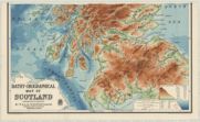
| Title: | Bathy-orographical map of Scotland. | |
| Imprint: | Edinburgh, 1912 | |
| Zoom Into Map: | Click on the map to view in greater detail. | |
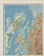
| Name: | G.W. Bacon & Co. | |
| Title: | Bacon's excelsior map of Scotland. | |
| Imprint: | London, 1914 | |
| Zoom Into Map: | Click on the map to view in greater detail. | |
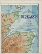
| Title: | Bacon's excelsior map of Scotland. | |
| Imprint: | London, 1914 | |
| Zoom Into Map: | Click on the map to view in greater detail. | |
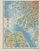
| Title: | Bacon's excelsior map of Scotland. | |
| Imprint: | London, 1914 | |
| Zoom Into Map: | Click on the map to view in greater detail. | |
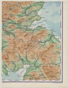
| Title: | Bacon's excelsior map of Scotland. | |
| Imprint: | London, 1914 | |
| Zoom Into Map: | Click on the map to view in greater detail. | |
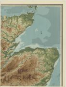
| Name: | Bartholomew, John G., 1860-1920 | |
| Title: | Orographical map of Scotland reduced from the Ordnance Survey by J.G. Bartholomew. North west sheet | |
| Imprint: | Edinburgh : Bartholomew, 1914 | |
| Zoom Into Map: | Click on the map to view in greater detail. | |
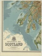
| Name: | Bartholomew, John G., 1860-1920 | |
| Title: | Orographical map of Scotland reduced from the Ordnance Survey by J.G. Bartholomew. North east sheet | |
| Imprint: | Edinburgh : Bartholomew, 1914 | |
| Zoom Into Map: | Click on the map to view in greater detail. | |
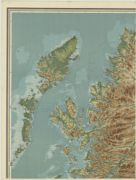
| Name: | Bartholomew, John G., 1860-1920 | |
| Title: | Orographical map of Scotland reduced from the Ordnance Survey by J.G. Bartholomew. South west sheet | |
| Imprint: | Edinburgh : Bartholomew, 1914 | |
| Zoom Into Map: | Click on the map to view in greater detail. | |
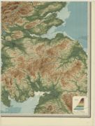
| Name: | Bartholomew, John G., 1860-1920 | |
| Title: | Orographical map of Scotland reduced from the Ordnance Survey by J.G. Bartholomew. South east sheet | |
| Imprint: | Edinburgh : Bartholomew, 1914 | |
| Zoom Into Map: | Click on the map to view in greater detail. | |
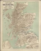
| Name: | Darbishire, Bernhard Vernon. | |
| Title: | Scotland, Mediaeval. Scale 1:500,000 / (drawn by B.V. Darbishire [and] edited by H.W.C. Davis). | |
| Date: | 1915 | |
| Zoom Into Map: | Click on the map to view in greater detail. | |
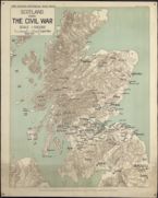
| Name: | Darbishire, Bernhard Vernon. | |
| Title: | Scotland during the Civil War / (drawn by B.V. Darbishire [and] edited by H.W.C. Davis.). | |
| Date: | 1915 | |
| Zoom Into Map: | Click on the map to view in greater detail. | |
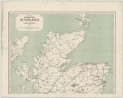
| Name: | J. & W. Emslie. | |
| Title: | Official railway map of Scotland, 1916. | |
| Imprint: | London, 1916 | |
| Zoom Into Map: | Click on the map to view in greater detail. | |
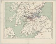
| Title: | Official railway map of Scotland, 1916. | |
| Imprint: | London, 1916 | |
| Zoom Into Map: | Click on the map to view in greater detail. | |
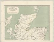
| Name: | J. & W. Emslie. | |
| Title: | Official railway map of Scotland, 1918. | |
| Imprint: | London, 1918 | |
| Zoom Into Map: | Click on the map to view in greater detail. | |
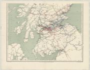
| Title: | Official railway map of Scotland, 1918. | |
| Imprint: | London, 1918 | |
| Zoom Into Map: | Click on the map to view in greater detail. | |
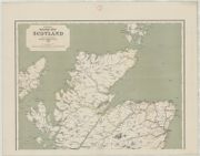
| Name: | J. & W. Emslie. | |
| Title: | Official railway map of Scotland, 1920. | |
| Imprint: | London, 1920 | |
| Zoom Into Map: | Click on the map to view in greater detail. | |
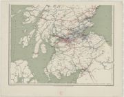
| Title: | Official railway map of Scotland, 1920. | |
| Imprint: | London, 1920 | |
| Zoom Into Map: | Click on the map to view in greater detail. | |
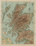
| Name: | John Bartholomew & Co. Ltd. | |
| Title: | Bartholomew's contoured road map of Scotland showing the main roads and railways. | |
| Imprint: | Edinburgh : Bartholomews, 1920 | |
| Zoom Into Map: | Click on the map to view in greater detail. | |
| Title: | Map of Scotland. | |
| Imprint: | Edinburgh : Westfield Autocar Co. Ltd., 1921 | |
| Zoom Into Map: | Click on the map to view in greater detail. | |
| Name: | J. & W. Emslie. | |
| Title: | Official railway map of Scotland. Prepared ... at the Railway Clearing House, London ... / (drawn and engraved by J. & W. Emslie.). | |
| Imprint: | London, 1923 | |
| Zoom Into Map: | Click on the map to view in greater detail. | |
| Title: | Official railway map of Scotland. Prepared ... at the Railway Clearing House, London ... / (drawn and engraved by J. & W. Emslie.). | |
| Imprint: | London, 1923 | |
| Zoom Into Map: | Click on the map to view in greater detail. | |
| Name: | W. & A.K. Johnston Limited | |
| Title: | W. & A.K. Johnston's touring and motoring map of Scotland showing the main roads, steamer routes, railways and all railway stations ... | |
| Date: | 1923 | |
| Zoom Into Map: | Click on the map to view in greater detail. | |
| Title: | Scotland | |
| Imprint: | London, 1923 | |
| Zoom Into Map: | Click on the map to view in greater detail. | |
| Name: | W. & A.K. Johnston Limited | |
| Title: | W. & A.K. Johnston's touring and motoring map of Scotland showing the main roads, steamer routes, railways and all railway stations ... | |
| Date: | 1923 | |
| Zoom Into Map: | Click on the map to view in greater detail. | |
| Name: | W. & A.K. Johnston Limited | |
| Title: | Map of the coalfields of Scotland / constructed and printed by W. & A.K. Johnston. | |
| Imprint: | Edinburgh: London : Johnston; The Colliery Guardian Co., [1923] | |
| Zoom Into Map: | Click on the map to view in greater detail. | |
| Name: | John Bartholomew & Son Ltd | |
| Title: | Bartholomew's contoured road map of Scotland showing the main roads and railways. | |
| Date: | 1924 | |
| Zoom Into Map: | Click on the map to view in greater detail. | |
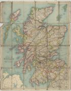
| Name: | John Bartholomew & Co. Ltd. | |
| Title: | Bartholomew's general map of Scotland | |
| Imprint: | Edinburgh: John Bartholomew & Co. , 1924 | |
| Zoom Into Map: | Click on the map to view in greater detail. | |
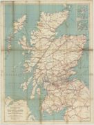
| Title: | Main roads map of Scotland. | |
| Imprint: | London : Geographia Ltd., 1926 | |
| Zoom Into Map: | Click on the map to view in greater detail. | |
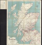
| Title: | Map of Scotland. | |
| Date: | 1926 | |
| Zoom Into Map: | Click on the map to view in greater detail. | |
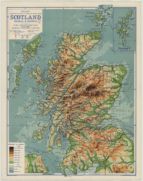
| Name: | Philip, George, 1870-1937. | |
| Title: | Scotland, physical & political. | |
| Imprint: | London : G. Philip & Son Ltd., 1926 | |
| Zoom Into Map: | Click on the map to view in greater detail. | |
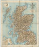
| Title: | Automobile Association touring map of Scotland ... | |
| Imprint: | Edinburgh : J. Bartholomew & Son Ltd., 1927 | |
| Zoom Into Map: | Click on the map to view in greater detail. | |
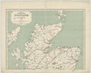
| Name: | J. & W. Emslie. | |
| Title: | Official railway map of Scotland, 1927. | |
| Imprint: | London, 1927 | |
| Zoom Into Map: | Click on the map to view in greater detail. | |
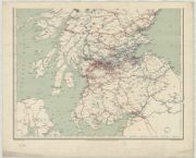
| Title: | Official railway map of Scotland, 1927. | |
| Imprint: | London, 1927 | |
| Zoom Into Map: | Click on the map to view in greater detail. | |
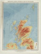
| Name: | Ordnance Survey | |
| Title: | Ordnance Survey physical map of Scotland. | |
| Imprint: | Southampton : Ordnance Survey, 1927 | |
| Zoom Into Map: | Click on the map to view in greater detail. | |
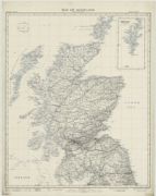
| Name: | Ordnance Survey | |
| Title: | Map of Scotland: Outline edition | |
| Imprint: | Southampton : Ordnance Survey, 1927 | |
| Zoom Into Map: | Click on the map to view in greater detail. | |
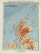
| Name: | Ordnance Survey | |
| Title: | Ordnance Survey physical map of Scotland. Magnetic edition (1933) | |
| Imprint: | Southampton : Ordnance Survey, 1928 | |
| Zoom Into Map: | Click on the map to view in greater detail. | |
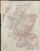
| Title: | Road map of Scotland. Route guide and atlas : No. 5. | |
| Imprint: | London: Geographia, 1929 | |
| Zoom Into Map: | Click on the map to view in greater detail. | |
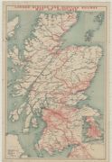
| Title: | London Midland and Scottish Railway map of Scotland. | |
| Imprint: | Edinburgh : John Bartholomew & Son , Ltd., 1930 | |
| Zoom Into Map: | Click on the map to view in greater detail. | |
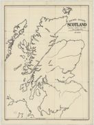
| Name: | G.W. Bacon & Co. | |
| Title: | Bacon's outline Scotland ... | |
| Imprint: | London: Bacon & Co. , 1930 | |
| Zoom Into Map: | Click on the map to view in greater detail. | |
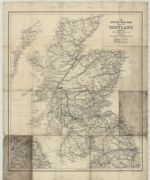
| Title: | Scottish road book map of Scotland ... | |
| Imprint: | Glasgow : Hay Nisbet & Co. Ltd., 1930 | |
| Zoom Into Map: | Click on the map to view in greater detail. | |
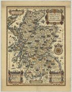
| Name: | Taylor, A. E. (Alfred Edward), 1869-1945. | |
| Title: | Pratts high test plan of Scotland: a curious yet authentic plan setting forth the principal highways and romantic places of the country / [designed by] A.E. Taylor. | |
| Imprint: | [London : Anglo-American Oil, 1931 | |
| Zoom Into Map: | Click on the map to view in greater detail. | |
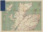
| Title: | Bacon's motor road map [of] Scotland. | |
| Imprint: | London, 1932 | |
| Zoom Into Map: | Click on the map to view in greater detail. | |
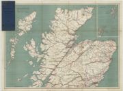
| Name: | G.W. Bacon & Co. | |
| Title: | Bacon's motor road map [of] Scotland. | |
| Imprint: | London, 1932 | |
| Zoom Into Map: | Click on the map to view in greater detail. | |
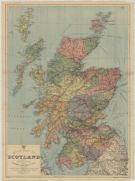
| Name: | Bain, James. | |
| Title: | Road map of Scotland / edited by James Bain ; Issued by Stephen Mitchell & Son, etc. | |
| Imprint: | London : Geographia Ltd., 1932 | |
| Zoom Into Map: | Click on the map to view in greater detail. | |
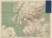
| Name: | G.W. Bacon & Co. | |
| Title: | Bacon's motor road map [of] Scotland. | |
| Imprint: | London, 1932 | |
| Zoom Into Map: | Click on the map to view in greater detail. | |
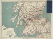
| Title: | Bacon's motor road map [of] Scotland. | |
| Imprint: | London, 1932 | |
| Zoom Into Map: | Click on the map to view in greater detail. | |
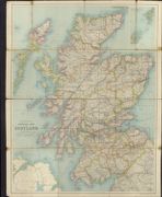
| Name: | John Bartholomew & Co. Ltd. | |
| Title: | Bartholomew's general map of Scotland. | |
| Date: | 1932 | |
| Zoom Into Map: | Click on the map to view in greater detail. | |
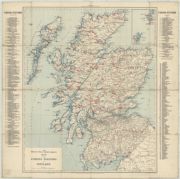
| Title: | British Field Sports Society map of the fishing stations of Scotland. | |
| Imprint: | London, 1933 | |
| Zoom Into Map: | Click on the map to view in greater detail. | |
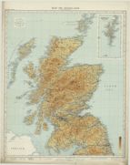
| Name: | Ordnance Survey | |
| Title: | Map of Scotland | |
| Imprint: | Southampton : Ordnance Survey, 1933 | |
| Zoom Into Map: | Click on the map to view in greater detail. | |
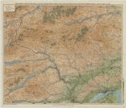
| Name: | Macpherson, Herbert T. | |
| Title: | Macpherson's improved motoring, cycling & touring map of Perth, Angus, South Inverness, the Cairngorms & Deeside (West), &c. | |
| Imprint: | Dunfermline : Herbert T. Macpherson, 1934 | |
| Zoom Into Map: | Click on the map to view in greater detail. | |
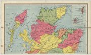
| Name: | W. & A.K. Johnston Limited. | |
| Title: | Scotland / constructed by W. & A.K. Johnston ... | |
| Imprint: | Edinburgh, 1934 | |
| Zoom Into Map: | Click on the map to view in greater detail. | |
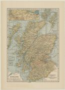
| Title: | Scotland. | |
| Imprint: | New York : C.S. Hammond & Co., [1936] | |
| Zoom Into Map: | Click on the map to view in greater detail. | |
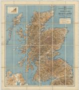
| Title: | Automobile Association touring map of Scotland ... | |
| Imprint: | Edinburgh : J. Bartholomew & Son Ltd., 1936 | |
| Zoom Into Map: | Click on the map to view in greater detail. | |
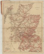
| Title: | Road map of Scotland. | |
| Imprint: | London : Geographia, 1936 | |
| Zoom Into Map: | Click on the map to view in greater detail. | |
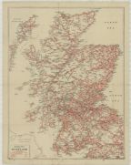
| Title: | Road map of Scotland. | |
| Imprint: | London : Geographia, 1936 | |
| Zoom Into Map: | Click on the map to view in greater detail. | |
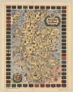
| Title: | The story map of Scotland. | |
| Date: | 1936 | |
| Zoom Into Map: | Click on the map to view in greater detail. | |
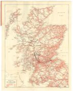
| Title: | Road map of Scotland. | |
| Imprint: | London : Geographia Ltd., 1937 | |
| Zoom Into Map: | Click on the map to view in greater detail. | |
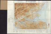
| Title: | Scotland in Roman times. | |
| Date: | 1939 | |
| Zoom Into Map: | Click on the map to view in greater detail. | |
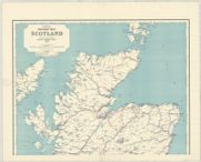
| Name: | J. & W. Emslie. | |
| Title: | Official railway map of Scotland. | |
| Imprint: | London, 1941 | |
| Zoom Into Map: | Click on the map to view in greater detail. | |
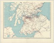
| Title: | Official railway map of Scotland. | |
| Imprint: | London, 1941 | |
| Zoom Into Map: | Click on the map to view in greater detail. | |
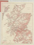
| Title: | Road map of Scotland. | |
| Imprint: | London : Geographia Ltd., 1942 | |
| Zoom Into Map: | Click on the map to view in greater detail. | |
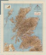
| Name: | Scottish Youth Hostels Association. | |
| Title: | Scottish Youth Hostels Association touring map of Scotland. | |
| Imprint: | Edinburgh, 1944 | |
| Zoom Into Map: | Click on the map to view in greater detail. | |
| Name: | W. & A.K. Johnston Limited | |
| Title: | W. & A.K. Johnston's touring and motoring map of Scotland showing the main roads, railways & steamer routes ... | |
| Date: | 1944 | |
| Zoom Into Map: | Click on the map to view in greater detail. | |
| Name: | John Bartholomew & Co. Ltd. | |
| Title: | Bartholomew's general map of Scotland. | |
| Imprint: | Edinburgh : J. Bartholomew & Son Ltd., 1946 | |
| Zoom Into Map: | Click on the map to view in greater detail. | |
| Title: | Main roads map of Scotland. | |
| Imprint: | London : Geographica, 1947 | |
| Zoom Into Map: | Click on the map to view in greater detail. | |
| Name: | W. & A.K. Johnston Limited | |
| Title: | W. & A.K. Johnston's touring and motoring map of Scotland showing the main roads, railways & steamer routes ... | |
| Date: | 1948 | |
| Zoom Into Map: | Click on the map to view in greater detail. | |
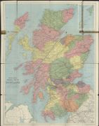
| Name: | John Bartholomew & Co. Ltd. | |
| Title: | Bartholomew's general map of Scotland. | |
| Date: | 1949 | |
| Zoom Into Map: | Click on the map to view in greater detail. | |
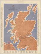
| Name: | Commercial Bank of Scotland. | |
| Title: | The Commercial Bank of Scotland Limited, sketch touring map of Scotland ... April, 1951. | |
| Imprint: | [Edinburgh : Lorimer & Chalmers Ltd.], 1951. | |
| Zoom Into Map: | Click on the map to view in greater detail. | |
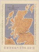
| Name: | Commercial Bank of Scotland. | |
| Title: | The Commercial Bank of Scotland Limited, sketch touring map of Scotland ... July, 1951. | |
| Imprint: | Edinburgh : Lorimer & Chalmers Ltd., 1951. | |
| Zoom Into Map: | Click on the map to view in greater detail. | |
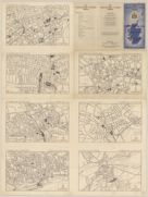
| Name: | Commercial Bank of Scotland. | |
| Title: | The Commercial Bank of Scotland Limited, sketch touring map of Scotland ... July, 1951. | |
| Imprint: | Edinburgh : Lorimer & Chalmers Ltd., 1951. | |
| Zoom Into Map: | Click on the map to view in greater detail. | |
| Name: | John Bartholomew and Son | |
| Title: | Bartholomew's general map of Scotland. | |
| Imprint: | Edinburgh : John Bartholomew & Son, [1952] | |
| Zoom Into Map: | Click on the map to view in greater detail. | |
| Name: | Scottish Tourist Board. | |
| Title: | The Scottish Tourist Board's map of Scotland. | |
| Imprint: | Edinburgh : John Bartholomew & Son Ltd, [1963] | |
| Zoom Into Map: | Click on the map to view in greater detail. | |