Estate Maps, 1750s-1900s
| Name: | Pearson and Lobban. |
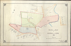
| Title: | Feuing plan of Avendale Glebe, 1914 / ([drawn by] Pearson & Lobban ... Kilmarnock). |
| Imprint: | Drawn 1914. |
| Pagination: | 1 map ; 556 x 908 mm |
| Shelfmark: | EMS.s.380 |
| Zoom Into Map: | Click on the map to view in greater detail. |