Estate Maps, 1750s-1900s
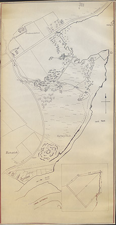

| Title: | [Fort Augustus ] |
| Imprint: | 1910s ? |
| Pagination: | 1 map; 100 x 52 cm. |
| Shelfmark: | Lovat383-1 |
| Notes: | . (4 cm = 260' ). One of two maps, showing Bunoich, Inchnacardoch and Fort Augustus, with a focus on Fort Point jutting into the southern aspect of Loch Ness. This first map is uncoloured. . Courtesy of Lovat Highland Estates and the North of Scotland Archaeological Society. View Lovat Highland Estates mapping |
| Zoom Into Map: | Click on the map to view in greater detail. |