Estate Maps, 1750s-1900s
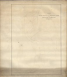

| Title: | Plan of the River Beauly & Adjacent Lands from Beauly Village to Beauly Castle. With reference to accompanying sections, 1857 |
| Imprint: | 1857 |
| Pagination: | 1 map; 115 x 100 cm. |
| Shelfmark: | Lovat343 |
| Notes: | 1:3960. (50 chains = 10" ). A sketch plan, rather than a detailed map. Courtesy of Lovat Highland Estates and the North of Scotland Archaeological Society. View Lovat Highland Estates mapping |
| Zoom Into Map: | Click on the map to view in greater detail. |