Estate Maps, 1750s-1900s
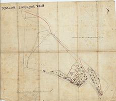

| Title: | Part of Fort Augustus Vil. |
| Imprint: | 1890s ? |
| Pagination: | 1 manuscript map: col.; 38 x 43 cm. |
| Shelfmark: | Lovat329 |
| Notes: | 1:1609. (8 chains = 10 cm ). An undated, unsigned map showing part of Fort Augustus. Looks 19th century. Courtesy of Lovat Highland Estates and the North of Scotland Archaeological Society. View Lovat Highland Estates mapping |
| Zoom Into Map: | Click on the map to view in greater detail. |