Estate Maps, 1750s-1900s
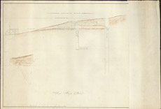

| Title: | Struy Mining Works |
| Imprint: | 1845 |
| Pagination: | 1 map: col.; 56 x 82 cm. |
| Shelfmark: | Lovat282 |
| Notes: | Looks like re-drawing of an original plan, "The Mining Works at Struy", Lovat267 Scale 1:150. (100' = 8" ). Courtesy of Lovat Highland Estates and the North of Scotland Archaeological Society. View Lovat Highland Estates mapping |
| Zoom Into Map: | Click on the map to view in greater detail. |