Estate Maps, 1750s-1900s
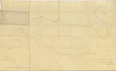

| Title: | Inchberry Pasturage |
| Imprint: | 1859 |
| Pagination: | 1 map; 53 x 87 cm. |
| Shelfmark: | Lovat232 |
| Notes: | A simple sketch map of the hill ground above Inchberry Scale 1:3168. (20 chains = 5" ). Courtesy of Lovat Highland Estates and the North of Scotland Archaeological Society. View Lovat Highland Estates mapping |
| Zoom Into Map: | Click on the map to view in greater detail. |