Estate Maps, 1750s-1900s
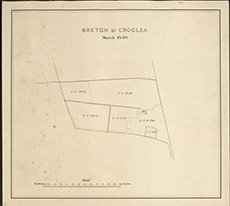

| Title: | Sketch of Croclea March 1858 (near Eskadale). |
| Imprint: | 1858 |
| Pagination: | 1 map; 29 x 32 cm. |
| Shelfmark: | Lovat194 |
| Notes: | A small map centring on one homestead near Eskedale Scale 1:2376. (12 chains = 4" ). Courtesy of Lovat Highland Estates and the North of Scotland Archaeological Society. View Lovat Highland Estates mapping |
| Zoom Into Map: | Click on the map to view in greater detail. |