Estate Maps, 1750s-1900s
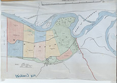

| Title: | [Mid Crochiel] |
| Imprint: | 1940s ? |
| Pagination: | 1 map: col.; 35 x 52 cm. |
| Shelfmark: | Lovat183 |
| Notes: | Shows in colour, fields at Mid Crochiel Scale 1:6600. (20 chains = 5" ). Courtesy of Lovat Highland Estates and the North of Scotland Archaeological Society. View Lovat Highland Estates mapping |
| Zoom Into Map: | Click on the map to view in greater detail. |