Estate Maps, 1750s-1900s
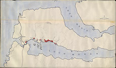

| Title: | [Morar] |
| Imprint: | 1960s ? |
| Pagination: | 1 map: col.; 101 x 172 cm. |
| Shelfmark: | Lovat070 |
| Notes: | Large, large-scale map. Roughly drawn, little detail. Possibly constructed from OS maps, and to be hung upon a wall Scale 1:10560. (6" = 1 mile ). Courtesy of Lovat Highland Estates and the North of Scotland Archaeological Society. View Lovat Highland Estates mapping |
| Zoom Into Map: | Click on the map to view in greater detail. |