Estate Maps, 1750s-1900s
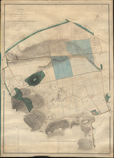

| Title: | Plan of the Lands of Meikle-Phoenas, Balchragan etc, situated in Kiltarlity Parish and of Conon-Bank, Moniack, Cabrach, etc in the Parish of Kirkhill |
| Imprint: | 1850 |
| Pagination: | 1 manuscript map: col.; 148 x 109 cm. |
| Shelfmark: | Lovat057 |
| Notes: | 1:2437. (10 chains = 3¼" ). Courtesy of Lovat Highland Estates and the North of Scotland Archaeological Society. View Lovat Highland Estates mapping |
| Zoom Into Map: | Click on the map to view in greater detail. |