Estate Maps, 1750s-1900s
| Name: | Ordnance Survey |
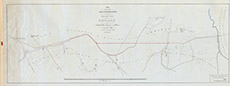
| Title: | Plan of part of the Lovat and Belladrum Estates showing March between the Lands of the Right Honourable Lord Lovat and Archibald William Merry Esq of Belladrum as arranged in 1880. |
| Imprint: | ca. 1904 |
| Pagination: | 1 map: col.; 45 x 117 cm. |
| Shelfmark: | Belladrum09 |
| Notes: | Scale 1:2,500. (1:2500 ). Courtesy of the North of Scotland Archaeological Society and Belladrum Estate. . |
| Zoom Into Map: | Click on the map to view in greater detail. |