Your subject search for River returned 254 records.
Ordered chronologically (undated items first).
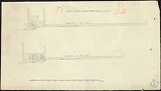
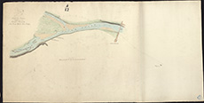
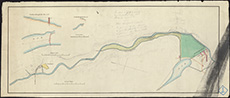
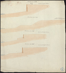
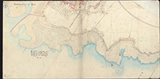
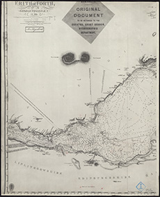
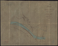
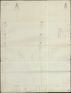
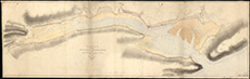
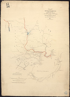
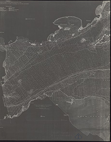
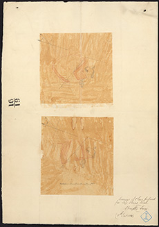
| Description: | Aberdeen. Spill Water Channel for R. Dee - sections | |
| Place: | Aberdeen | |
| County: | Aberdeen | |
| Subject: | River | |
| Inventory: | Drawing | |
| Colour: | Colour | |
| Media: | Hand coloured; Ink | |
| Object: | Folded | |
| Physical: | Paper | |
| Size: | 165 mm x 2060 mm | |
| Shelfmark: | MS.5844, 12 | |
| Show location on map ? | ||
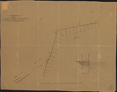
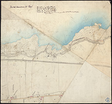
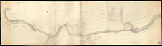
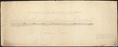
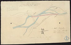
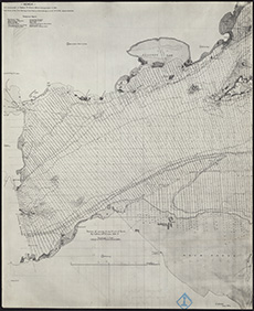
| Description: | Aberdeen. Spill Water Channel for R. Dee - sections | |
| Place: | Aberdeen | |
| County: | Aberdeen | |
| Subject: | River | |
| Inventory: | Drawing | |
| Colour: | Colour | |
| Media: | Graphite; Hand coloured; Ink | |
| Object: | Folded | |
| Physical: | Paper | |
| Size: | 130 mm x 1940 mm | |
| Shelfmark: | MS.5844, 13 | |
| Show location on map ? | ||
 | ||
| Zoom Into Map: | Click on the map to view in greater detail. | |
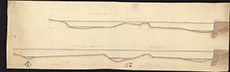
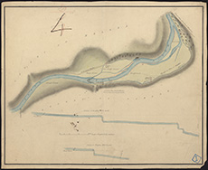
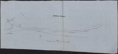
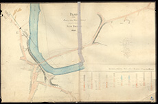
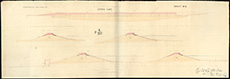
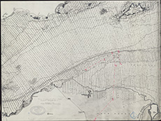
| Description: | Aberdeen. Spill Water Channel for R. Dee - sections | |
| Place: | Aberdeen | |
| County: | Aberdeen | |
| Subject: | River | |
| Inventory: | Drawing | |
| Colour: | Colour | |
| Media: | Hand coloured; Ink | |
| Object: | Flat | |
| Physical: | Paper | |
| Size: | 330 mm x 1040 mm | |
| Shelfmark: | MS.5844, 14 | |
| Show location on map ? | ||
 | ||
| Zoom Into Map: | Click on the map to view in greater detail. | |
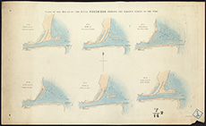
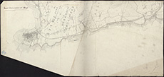
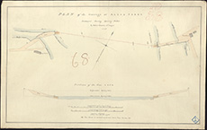
| Description: | Aberdeen. Spill Water Channel for R. Dee - sections | |
| Place: | Aberdeen | |
| County: | Aberdeen | |
| Subject: | River | |
| Inventory: | Drawing | |
| Colour: | Colour | |
| Media: | Graphite; Hand coloured; Ink | |
| Object: | Flat | |
| Physical: | Paper | |
| Size: | 330 mm x 1040 mm | |
| Shelfmark: | MS.5844, 15 | |
| Show location on map ? | ||
 | ||
| Zoom Into Map: | Click on the map to view in greater detail. | |
| Description: | Aberdeen. Spill Water Channel for R. Dee - sections | |
| Place: | Aberdeen | |
| County: | Aberdeen | |
| Subject: | River | |
| Inventory: | Drawing | |
| Colour: | Colour | |
| Media: | Hand coloured; Ink | |
| Object: | Flat | |
| Physical: | Paper | |
| Size: | 300 mm x 980 mm | |
| Shelfmark: | MS.5844, 16 | |
| Show location on map ? | ||
 | ||
| Zoom Into Map: | Click on the map to view in greater detail. | |
| Name: | Stevenson, David, 1815-1886 ; Stevenson, Thomas, 1818-1887 | |
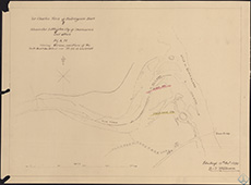
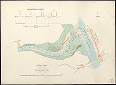
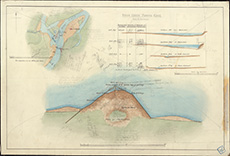
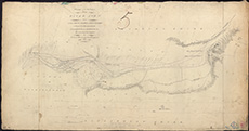
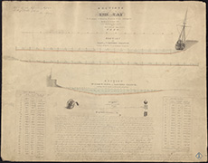
| Description: | Carron River. Junction with Kyle of Sutherland showing South Bark and Bed of Carron | |
| Place: | Bonarbridge | |
| County: | Ross And Cromarty | |
| Subject: | River | |
| Inventory: | Drawing | |
| Colour: | B&W | |
| Media: | Facsimile | |
| Object: | Flat | |
| Physical: | Paper | |
| Size: | 465 mm x 623 mm | |
| Shelfmark: | MS.5846, 36 | |
| Show location on map ? | ||
 | ||
| Zoom Into Map: | Click on the map to view in greater detail. | |
| Name: | Stevenson, David, 1815-1886 ; Stevenson, Thomas, 1818-1887 | |
| Description: | Carron River. Junction of river and Kyle of Sutherland | |
| Place: | Bonarbridge | |
| County: | Ross And Cromarty | |
| Subject: | River | |
| Inventory: | Drawing & Lithograph by W & AK Johnston | |
| Colour: | Colour | |
| Media: | Hand coloured; Printed | |
| Object: | Flat | |
| Physical: | Paper | |
| Size: | 510 mm x 695 mm | |
| Shelfmark: | MS.5846, 37 | |
| Show location on map ? | ||
 | ||
| Zoom Into Map: | Click on the map to view in greater detail. | |
| Name: | Stevenson, David, 1815-1886 ; Stevenson, Thomas, 1818-1887 | |
| Description: | Carron River. Junction of river and Kyle of Sutherland | |
| Place: | Bonarbridge | |
| County: | Ross And Cromarty | |
| Subject: | River | |
| Inventory: | Drawing & Lithograph by W & AK Johnston | |
| Colour: | Colour | |
| Media: | Graphite; Hand coloured; Ink | |
| Object: | Flat | |
| Physical: | Paper | |
| Size: | 687 mm x 1023 mm | |
| Shelfmark: | MS.5846, 38 | |
| Show location on map ? | ||
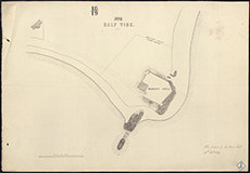
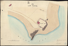
| Description: | Beil Water. Section south of Railway Bridge | |
| County: | East Lothian | |
| Subject: | River | |
| Inventory: | Drawing | |
| Colour: | B&W | |
| Media: | Graphite; Ink | |
| Object: | Folded | |
| Physical: | Paper | |
| Size: | 343 mm x 1003 mm | |
| Shelfmark: | MS.5845, 25 | |
| Show location on map ? | ||
 | ||
| Zoom Into Map: | Click on the map to view in greater detail. | |
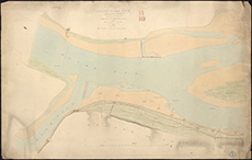
| Description: | Cart, River. Plan of River from Seedhill Craigs to Hawkhead Mills | |
| Place: | Seedhill | |
| County: | Renfrew | |
| Subject: | River | |
| Inventory: | Series of five drawings | |
| Colour: | Colour | |
| Media: | Hand coloured; Ink | |
| Object: | Flat | |
| Physical: | Paper | |
| Size: | 495 mm x 620 mm | |
| Shelfmark: | MS.5846, 8 | |
| Show location on map ? | ||
| Description: | Cart, River. Plan of River from Seedhill Craigs to Hawkhead Mills | |
| Place: | Seedhill | |
| County: | Renfrew | |
| Subject: | River | |
| Inventory: | Series of five drawings | |
| Colour: | Colour | |
| Media: | Hand coloured; Ink | |
| Object: | Flat | |
| Physical: | Paper | |
| Size: | 500 mm x 620 mm | |
| Shelfmark: | MS.5846, 9 | |
| Show location on map ? | ||
| Description: | Cart, River. Plan of River from Seedhill Craigs to Hawkhead Mills | |
| Place: | Seedhill | |
| County: | Renfrew | |
| Subject: | River | |
| Inventory: | Series of five drawings | |
| Colour: | Colour | |
| Media: | Hand coloured; Ink | |
| Object: | Flat | |
| Physical: | Paper | |
| Size: | 300 mm x 532 mm | |
| Shelfmark: | MS.5846, 10 | |
| Show location on map ? | ||
 | ||
| Zoom Into Map: | Click on the map to view in greater detail. | |
| Description: | Cart, River. Plan of River from Seedhill Craigs to Hawkhead Mills | |
| Place: | Seedhill | |
| County: | Renfrew | |
| Subject: | River | |
| Inventory: | Series of five drawings | |
| Colour: | Colour | |
| Media: | Hand coloured; Ink | |
| Object: | Flat | |
| Physical: | Paper | |
| Size: | 250 mm x 620 mm | |
| Shelfmark: | MS.5846, 11 | |
| Show location on map ? | ||
 | ||
| Zoom Into Map: | Click on the map to view in greater detail. | |
| Description: | Cart, River. Plan of River from Seedhill Craigs to Hawkhead Mills | |
| Place: | Seedhill | |
| County: | Renfrew | |
| Subject: | River | |
| Inventory: | Series of five drawings | |
| Colour: | Colour | |
| Media: | Hand coloured; Ink | |
| Object: | Flat | |
| Physical: | Paper | |
| Size: | 295 mm x 870 mm | |
| Shelfmark: | MS.5846, 12 | |
| Show location on map ? | ||
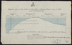
| Description: | Almond Water. Section from New Calder Paper Mill to the Reservoir Dam above West Mill | |
| County: | Edinburgh | |
| Subject: | River | |
| Inventory: | Drawing | |
| Colour: | Colour | |
| Media: | Graphite; Hand coloured; Ink | |
| Object: | Folded | |
| Physical: | Paper | |
| Size: | 252 mm x 1420 mm | |
| Shelfmark: | MS.5844, 68 | |
| Show location on map ? | ||
 | ||
| Zoom Into Map: | Click on the map to view in greater detail. | |
| Description: | Clyde, River. Clyde Navigation | |
| County: | Dunbarton ; Renfrew | |
| Subject: | River | |
| Inventory: | ||
| Colour: | Colour | |
| Media: | Ink; Printed | |
| Object: | Folded | |
| Physical: | Paper | |
| Size: | 680 mm x 1935 mm | |
| Shelfmark: | MS.5846, 74 | |
| Show location on map ? | ||
| Description: | Cobbinshaw. Sections of sluice at reservoir | |
| Place: | Cobbinshaw | |
| County: | Edinburgh | |
| Subject: | River | |
| Inventory: | Drawing | |
| Colour: | Colour | |
| Media: | Hand coloured; Ink | |
| Object: | Flat | |
| Physical: | Paper | |
| Size: | 610 mm x 882 mm | |
| Shelfmark: | MS.5846, 77 | |
| Show location on map ? | ||
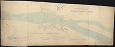
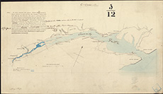
| Description: | Conon, River. Sketch plan from Cruive Dyke to Conon Bridge | |
| County: | Ross And Cromarty | |
| Subject: | River | |
| Inventory: | Drawing | |
| Colour: | Colour | |
| Media: | Graphite; Hand coloured; Ink | |
| Object: | Folded | |
| Physical: | Paper | |
| Size: | 550 mm x 1095 mm | |
| Shelfmark: | MS.5846, 97 | |
| Show location on map ? | ||
 | ||
| Zoom Into Map: | Click on the map to view in greater detail. | |
| Description: | Conon River. Sections, showing jetty | |
| County: | Ross And Cromarty | |
| Subject: | River | |
| Inventory: | Tracing | |
| Colour: | B&W | |
| Media: | Ink | |
| Object: | Flat | |
| Physical: | Transparent paper | |
| Size: | 460 mm x 590 mm | |
| Shelfmark: | MS.5846, 102 | |
 | ||
| Zoom Into Map: | Click on the map to view in greater detail. | |
| Description: | Conon River. Sections of river | |
| County: | Ross And Cromarty | |
| Subject: | River | |
| Inventory: | Drawing | |
| Colour: | Colour | |
| Media: | Graphite; Hand coloured; Ink | |
| Object: | Flat | |
| Physical: | Paper/Linen/Cloth | |
| Size: | 512 mm x 757 mm | |
| Shelfmark: | MS.5846, 103 | |
| Show location on map ? | ||
 | ||
| Zoom Into Map: | Click on the map to view in greater detail. | |
| Description: | Don, River. Sketch of river | |
| County: | Aberdeen | |
| Subject: | River | |
| Inventory: | ||
| Colour: | Colour | |
| Media: | Hand coloured; Printed | |
| Object: | Folded | |
| Physical: | Paper | |
| Size: | 532 mm x 1480 mm | |
| Shelfmark: | MS.5847, 21 | |
| Show location on map ? | ||
| Description: | Edinburgh, Leith, Water of. Sketch of river & adjacent properties from Colt Bridge to Canon Mills | |
| County: | Edinburgh | |
| Subject: | River | |
| Inventory: | Printes by Robertson & Ballantine | |
| Colour: | Colour | |
| Media: | Hand coloured; Ink | |
| Object: | Flat | |
| Physical: | Paper | |
| Size: | 415 mm x 1010 mm | |
| Shelfmark: | MS.5848, 104 | |
| Show location on map ? | ||
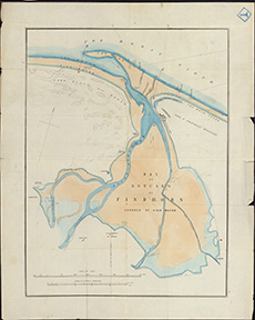
| Description: | Findhorn, River. Plan of river in Hogarth v. Grant case | |
| County: | Elgin | |
| Subject: | River | |
| Inventory: | Drawing | |
| Colour: | Colour | |
| Media: | Hand coloured; Ink | |
| Object: | Flat | |
| Physical: | Paper | |
| Size: | 900 mm x 685 mm | |
| Shelfmark: | MS.5850, 9 | |
| Show location on map ? | ||
| Description: | Findhorn, River. Estuary | |
| County: | Elgin | |
| Subject: | River | |
| Inventory: | Series of 2 prints | |
| Colour: | Colour | |
| Media: | Hand coloured; Printed | |
| Object: | Flat | |
| Physical: | Paper | |
| Size: | 633 mm x 506 mm | |
| Shelfmark: | MS.5850, 10 | |
| Show location on map ? | ||
| Description: | Findhorn, River. Estuary | |
| County: | Elgin | |
| Subject: | River | |
| Inventory: | Series of 2 prints | |
| Colour: | Colour | |
| Media: | Hand coloured; Printed | |
| Object: | Flat | |
| Physical: | Paper | |
| Size: | 633 mm x 507 mm | |
| Shelfmark: | MS.5850, 11 | |
| Show location on map ? | ||
 | ||
| Zoom Into Map: | Click on the map to view in greater detail. | |
| Description: | Duncow. Plan of burn from Glencarrick distillery to Duncow Mills | |
| Place: | Duncow | |
| County: | Dumfries | |
| Subject: | River | |
| Inventory: | Drawing | |
| Colour: | Colour | |
| Media: | Graphite; Hand coloured; Printed | |
| Object: | Flat | |
| Physical: | Paper | |
| Size: | 280 mm x 670 mm | |
| Shelfmark: | MS.5847, 65 | |
| Show location on map ? | ||
 | ||
| Zoom Into Map: | Click on the map to view in greater detail. | |
| Description: | Edinburgh: Comely Gardens. Sections of low line of river | |
| Place: | Edinburgh, Comely Gardens | |
| County: | Edinburgh | |
| Subject: | River | |
| Inventory: | Drawing | |
| Colour: | Colour | |
| Media: | Hand coloured; Ink | |
| Object: | Folded | |
| Physical: | Paper | |
| Size: | 388 mm x 1322 mm | |
| Shelfmark: | MS.5848, 27 | |
| Show location on map ? | ||
 | ||
| Zoom Into Map: | Click on the map to view in greater detail. | |
| Description: | Esk, River, North. Plan of river | |
| County: | Forfar ; Kincardine | |
| Subject: | River | |
| Inventory: | Drawing | |
| Colour: | Colour | |
| Media: | Hand coloured; Ink | |
| Object: | Flat | |
| Physical: | Paper | |
| Size: | 505 mm x 620 mm | |
| Shelfmark: | MS.5849, 127 | |
| Show location on map ? | ||
 | ||
| Zoom Into Map: | Click on the map to view in greater detail. | |
| Description: | Esk, River, South. Mouth of river, showing tide | |
| Place: | Ferryden | |
| County: | Forfar | |
| Subject: | River | |
| Inventory: | Print by W.H. Lizars | |
| Colour: | Colour | |
| Media: | Hand coloured; Printed | |
| Object: | Flat | |
| Physical: | Paper | |
| Size: | 346 mm x 571 mm | |
| Shelfmark: | MS.5849, 138 | |
| Show location on map ? | ||
 | ||
| Zoom Into Map: | Click on the map to view in greater detail. | |
| Description: | Glasgow. Sections and levels of Clyde | |
| Place: | Glasgow | |
| County: | Lanark | |
| Subject: | River | |
| Inventory: | Drawing | |
| Colour: | Colour | |
| Media: | Hand coloured; Ink | |
| Object: | Flat | |
| Physical: | Paper | |
| Size: | 505 mm x 460 mm | |
| Shelfmark: | MS.5851, 72 | |
| Show location on map ? | ||
 | ||
| Zoom Into Map: | Click on the map to view in greater detail. | |
| Description: | Glasgow. Level of Clyde during flood, 1831 | |
| Place: | Glasgow | |
| County: | Lanark | |
| Subject: | River | |
| Inventory: | Drawing | |
| Colour: | Colour | |
| Media: | Hand coloured; Ink | |
| Object: | Flat | |
| Physical: | Paper | |
| Size: | 205 mm x 330 mm | |
| Shelfmark: | MS.5851, 77 | |
| Show location on map ? | ||
 | ||
| Zoom Into Map: | Click on the map to view in greater detail. | |
| Description: | Kirktonhill. Course of North Esk | |
| Place: | Kirktonhill | |
| County: | Edinburgh | |
| Subject: | River | |
| Inventory: | Tracing | |
| Colour: | Colour | |
| Media: | Hand coloured; Ink | |
| Object: | Flat | |
| Physical: | Transparent paper | |
| Size: | 280 mm x 505 mm | |
| Shelfmark: | MS.5854, 49 | |
| Show location on map ? | ||
| Description: | Perth. Details of proposed repairs on Dam Dyke at Almond Bank | |
| Place: | Perth | |
| County: | Perth | |
| Subject: | River | |
| Inventory: | Series of 2 drawings | |
| Colour: | B&W | |
| Media: | Graphite; Ink | |
| Object: | Flat | |
| Physical: | Paper | |
| Size: | 560 mm x 780 mm | |
| Shelfmark: | MS.5859, 38 | |
| Show location on map ? | ||
| Description: | Perth. Details of proposed repairs on Dam Dyke at Almond Bank | |
| Place: | Perth | |
| County: | Perth | |
| Subject: | River | |
| Inventory: | Series of 2 drawings | |
| Colour: | Colour | |
| Media: | Graphite; Hand coloured; Ink | |
| Object: | Flat | |
| Physical: | Paper | |
| Size: | 560 mm x 780 mm | |
| Shelfmark: | MS.5859, 39 | |
| Show location on map ? | ||
| Description: | Perth. River at Perth, with surroundings | |
| Place: | Perth | |
| County: | Perth | |
| Subject: | River | |
| Inventory: | Drawing | |
| Colour: | Colour | |
| Media: | None | |
| Object: | Folded | |
| Physical: | Paper | |
| Size: | 1600 x 1000 mm | |
| Shelfmark: | MS.5859, 44 | |
| Show location on map ? | ||
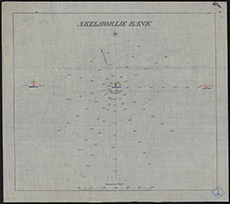
| Description: | Skelmorlie. Bank and soundings | |
| Place: | Skelmorlie | |
| County: | Ayr ; Renfrew | |
| Subject: | River | |
| Inventory: | Tracing | |
| Colour: | Colour | |
| Media: | None | |
| Object: | Flat | |
| Physical: | Oil cloth | |
| Size: | 430 x 480 mm | |
| Shelfmark: | MS.5862, 93 | |
| Show location on map ? | ||
 | ||
| Zoom Into Map: | Click on the map to view in greater detail. | |
| Name: | Stevenson, David, 1815-1886 ; Stevenson, Thomas, 1818-1887 | |
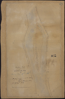
| Description: | Tay, River. Part of River referred to by Perth Harbour Commission | |
| County: | Perth | |
| Subject: | River | |
| Inventory: | Drawing | |
| Colour: | Colour | |
| Media: | None | |
| Object: | Flat | |
| Physical: | Card | |
| Size: | 670 x 1000 mm | |
| Shelfmark: | MS.5863, 80 | |
| Show location on map ? | ||
| Description: | Tay, River. Soundings near Dundee | |
| Place: | Dundee | |
| County: | Forfar | |
| Subject: | River | |
| Inventory: | Drawing | |
| Colour: | Colour | |
| Media: | Linen/Cloth | |
| Object: | Folded | |
| Physical: | Card | |
| Size: | 675 x 2300 mm | |
| Shelfmark: | MS.5863, 90 | |
| Show location on map ? | ||
 | ||
| Zoom Into Map: | Click on the map to view in greater detail. | |
| Description: | Tweed, River. Tweed fishings | |
| County: | Berwick | |
| Subject: | River | |
| Inventory: | Series of 2 prints | |
| Colour: | Colour | |
| Media: | Linen/Cloth | |
| Object: | Folded | |
| Physical: | Card | |
| Size: | 570 x 1140 mm | |
| Shelfmark: | MS.5863, 117 | |
| Show location on map ? | ||
 | ||
| Zoom Into Map: | Click on the map to view in greater detail. | |
| Description: | Tweed, River. Tweed fishings | |
| County: | Berwick | |
| Subject: | River | |
| Inventory: | Series of 2 prints | |
| Colour: | Colour | |
| Media: | None | |
| Object: | Folded | |
| Physical: | Oil cloth | |
| Size: | 465 x 2400 mm | |
| Shelfmark: | MS.5863, 118 | |
| Show location on map ? | ||
| Description: | Tweed, River. Tweed fishings | |
| County: | Berwick | |
| Subject: | River | |
| Inventory: | ||
| Colour: | Colour | |
| Media: | Linen/Cloth | |
| Object: | Flat | |
| Physical: | Card | |
| Size: | 570 x 615 mm | |
| Shelfmark: | MS.5863, 119 | |
| Show location on map ? | ||
 | ||
| Zoom Into Map: | Click on the map to view in greater detail. | |
| Description: | Tweed, River. Berwick Fisheries | |
| County: | Berwick | |
| Subject: | River | |
| Inventory: | Tracing | |
| Colour: | B&W | |
| Media: | None | |
| Object: | Folded | |
| Physical: | Oil cloth | |
| Size: | 450 x 1030 mm | |
| Shelfmark: | MS.5863, 114 | |
| Show location on map ? | ||
 | ||
| Zoom Into Map: | Click on the map to view in greater detail. | |
| Description: | Tweed, River. Berwick Fisheries | |
| County: | Berwick | |
| Subject: | River | |
| Inventory: | ||
| Colour: | B&W | |
| Media: | None | |
| Object: | Folded | |
| Physical: | Card | |
| Size: | 510 x 1090 mm | |
| Shelfmark: | MS.5863, 115 | |
| Show location on map ? | ||
 | ||
| Zoom Into Map: | Click on the map to view in greater detail. | |
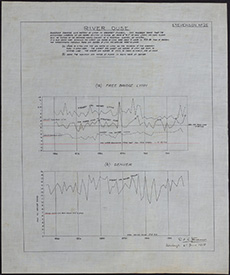
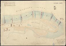
| Description: | River Ouse. Diagram showing low waters at Lynn in greatest floods. | |
| Subject: | River | |
| Colour: | Colour | |
| Media: | None | |
| Object: | Flat | |
| Physical: | Oil cloth | |
| Size: | 750 x 635 mm | |
| Shelfmark: | Acc.10706, 644 | |
 | ||
| Zoom Into Map: | Click on the map to view in greater detail. | |
| Description: | Reservoir Embankments | |
| County: | Stirling | |
| Subject: | River | |
| Shelfmark: | MS.5888, 4 | |
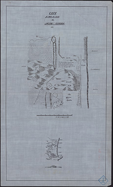
| Name: | Gordon, James, 1615?-1686 | |
| Description: | Don, River. Course of river | |
| Year: | 1661 | |
| County: | Aberdeen | |
| Subject: | River | |
| Inventory: | Tracing | |
| Colour: | B&W | |
| Media: | Ink | |
| Object: | Flat | |
| Physical: | Oil cloth | |
| Size: | 551 mm x 331 mm | |
| Shelfmark: | MS.5847, 11 | |
| Show location on map ? | ||
 | ||
| Zoom Into Map: | Click on the map to view in greater detail. | |
| Name: | Marr, John | |
| Description: | Doveran, River. Sketch of Cruive Dam | |
| Year: | 1776 | |
| County: | Banff | |
| Subject: | River | |
| Inventory: | Drawing | |
| Colour: | B&W | |
| Media: | Ink | |
| Object: | Flat | |
| Physical: | Paper | |
| Size: | 565 mm x 390 mm | |
| Shelfmark: | MS.5847, 29 | |
| Show location on map ? | ||
 | ||
| Zoom Into Map: | Click on the map to view in greater detail. | |
| Name: | Fleming, S | |
| Description: | Glasgow. Plan and section of Clyde opposite Water Works | |
| Year: | 1809 | |
| Place: | Glasgow | |
| County: | Lanark | |
| Subject: | River | |
| Inventory: | Drawing | |
| Colour: | Colour | |
| Media: | Graphite; Hand coloured; Ink | |
| Object: | Flat | |
| Physical: | Paper | |
| Size: | 540 mm x 745 mm | |
| Shelfmark: | MS.5851, 10 | |
| Show location on map ? | ||
| Name: | Bell, John | |
| Description: | Tay, River. Plan of river from Stormontfield | |
| Year: | 1809 | |
| County: | Fife ; Forfar ; Perth | |
| Subject: | River | |
| Inventory: | Copy of original | |
| Colour: | B&W | |
| Media: | Linen/Cloth | |
| Object: | Folded | |
| Physical: | Transparent paper | |
| Size: | 515 x 1250 mm | |
| Shelfmark: | MS.5863, 6 | |
| Show location on map ? | ||
| Name: | Stevenson, Robert, 1772-1850 | |
| Description: | Esk, River, North. Parts of river, and dams of Mills of Kinnaber & Morphie | |
| Year: | 1814 | |
| County: | Forfar ; Kincardine | |
| Subject: | River | |
| Inventory: | Drawing | |
| Colour: | B&W | |
| Media: | Graphite; Hand coloured; Ink | |
| Object: | Flat | |
| Physical: | Paper | |
| Size: | 560 mm x 975 mm | |
| Shelfmark: | MS.5849, 118 | |
| Show location on map ? | ||
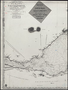
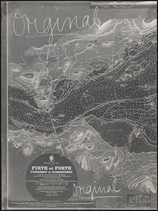
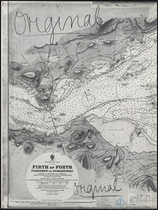
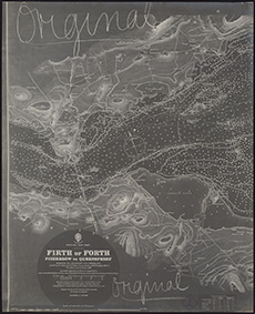
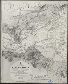
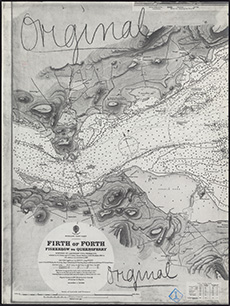
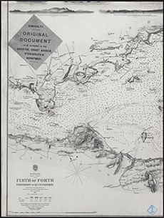
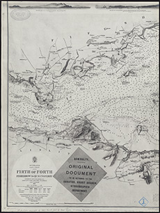
| Name: | Thomson, George | |
| Description: | Forth, Firth of. Survey with soundings | |
| Year: | 1815 | |
| County: | Clackmannan ; East Lothian ; Edinburgh ; Fife ; Kinross ; Perth ; West Lothian | |
| Subject: | River | |
| Inventory: | 2 photographs with Admiralty Charts | |
| Colour: | B&W | |
| Media: | Photographic process | |
| Object: | Flat | |
| Physical: | Paper | |
| Size: | 455 mm x 606 mm | |
| Shelfmark: | MS.5850, 33 | |
| Show location on map ? | ||
 | ||
| Zoom Into Map: | Click on the map to view in greater detail. | |
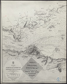
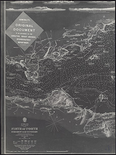
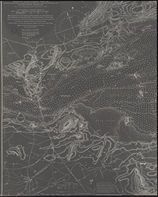
| Name: | Thomson, George | |
| Description: | Forth, Firth of. Survey with soundings | |
| Year: | 1815 | |
| County: | East Lothian ; Edinburgh ; Fife ; Kinross ; Perth ; West Lothian | |
| Subject: | River | |
| Inventory: | 3 photographs with Admiralty Charts | |
| Colour: | B&W | |
| Media: | Photographic process | |
| Object: | Flat | |
| Physical: | Paper | |
| Size: | 561 mm x 455 mm | |
| Shelfmark: | MS.5850, 34 | |
| Show location on map ? | ||
 | ||
| Zoom Into Map: | Click on the map to view in greater detail. | |
| Name: | Mitchell, John | |
| Description: | Crawford. Plan of River | |
| Year: | 1816 | |
| Place: | Crawford | |
| County: | Lanark | |
| Subject: | River | |
| Inventory: | Drawing | |
| Colour: | Colour | |
| Media: | Hand coloured; Ink | |
| Object: | Flat | |
| Physical: | Paper | |
| Size: | 650 mm x 520 mm | |
| Shelfmark: | MS.5846, 121 | |
| Show location on map ? | ||
| Name: | Stevenson, Robert, 1772-1850 | |
| Description: | Avon River. Survey from Linlithgow Bridge to Emanuel Abbey | |
| Year: | 1816 | |
| County: | Stirling ; West Lothian | |
| Subject: | River | |
| Inventory: | Drawing | |
| Colour: | B&W | |
| Media: | Graphite; Hand coloured; Ink | |
| Object: | Flat | |
| Physical: | Paper | |
| Size: | 557 mm x 1066 mm | |
| Shelfmark: | MS.5844, 142 | |
| Show location on map ? | ||
 | ||
| Zoom Into Map: | Click on the map to view in greater detail. | |
| Name: | Stevenson, Robert, 1772-1850; Steedman, John | |
| Description: | Tay, River. Part of Firth-Ferry between Fife and Forfar | |
| Year: | 1816 | |
| County: | Fife ; Forfar | |
| Subject: | River | |
| Inventory: | Series of 2 prints by J & G Menzies | |
| Colour: | B&W | |
| Media: | None | |
| Object: | Flat | |
| Physical: | Card | |
| Size: | 555 x 750 mm | |
| Shelfmark: | MS.5863, 17 | |
| Show location on map ? | ||
 | ||
| Zoom Into Map: | Click on the map to view in greater detail. | |
| Name: | Stevenson, Robert, 1772-1850; Steedman, John | |
| Description: | Tay, River. Part of Firth-Ferry between Fife and Forfar | |
| Year: | 1816 | |
| County: | Fife ; Forfar | |
| Subject: | River | |
| Inventory: | Series of 2 prints by J & G Menzies | |
| Colour: | Colour | |
| Media: | None | |
| Object: | Flat | |
| Physical: | Card | |
| Size: | 365 x 735 mm | |
| Shelfmark: | MS.5863, 18 | |
| Show location on map ? | ||
| Description: | Tay, River. Part of River and Perth | |
| Year: | 1818 | |
| County: | Perth | |
| Subject: | River | |
| Inventory: | Drawing | |
| Colour: | Colour | |
| Media: | None | |
| Object: | Flat | |
| Physical: | Card | |
| Size: | 360 x 1000 mm | |
| Shelfmark: | MS.5863, 19 | |
| Show location on map ? | ||
 | ||
| Zoom Into Map: | Click on the map to view in greater detail. | |
| Description: | Tay, River. River from Perth and Newburgh | |
| Year: | 1818 | |
| County: | Fife ; Perth | |
| Subject: | River | |
| Inventory: | Drawing | |
| Colour: | B&W | |
| Media: | None | |
| Object: | Flat | |
| Physical: | Card | |
| Size: | 645 x 1010 mm | |
| Shelfmark: | MS.5863, 20 | |
| Show location on map ? | ||
| Name: | Robertson, George | |
| Description: | Esk, River, North. Sketch taken from plan of Kirkton Hill | |
| Year: | 1818 | |
| Place: | Kirktonhill | |
| County: | Berwick | |
| Subject: | River | |
| Inventory: | Tracing | |
| Colour: | Colour | |
| Media: | Hand coloured; Ink | |
| Object: | Flat | |
| Physical: | Transparent paper | |
| Size: | 370 mm x 475 mm | |
| Shelfmark: | MS.5849, 119 | |
| Show location on map ? | ||
 | ||
| Zoom Into Map: | Click on the map to view in greater detail. | |
| Name: | Grainger, Thomas, 1794-1852 | |
| Description: | Almond Water. Course of river from Hallyards Steps to Nether Leny with proposed water course | |
| Year: | 1819 | |
| County: | Edinburgh ; West Lothian | |
| Subject: | River | |
| Inventory: | Drawing | |
| Colour: | Colour | |
| Media: | Graphite; Hand coloured; Ink | |
| Object: | Folded | |
| Physical: | Paper | |
| Size: | 477 mm x 2010 mm | |
| Shelfmark: | MS.5844, 66 | |
| Show location on map ? | ||
| Name: | Grainger, Thomas, 1794-1852 ; Shortreed, Robert | |
| Description: | Almond Water. Copy of No. 66 | |
| Year: | 1819 | |
| County: | Edinburgh ; West Lothian | |
| Subject: | River | |
| Inventory: | Drawing | |
| Colour: | Colour | |
| Media: | Hand coloured; Ink | |
| Object: | Folded | |
| Physical: | Paper | |
| Size: | 517 mm x 1863 mm | |
| Shelfmark: | MS.5844, 67 | |
| Show location on map ? | ||
 | ||
| Zoom Into Map: | Click on the map to view in greater detail. | |
| Name: | Stevenson, Robert, 1772-1850 | |
| Description: | Annan. Sections of Town and River | |
| Year: | 1824 | |
| Place: | Annan | |
| County: | Dumfries | |
| Subject: | River | |
| Inventory: | Drawing | |
| Colour: | Colour | |
| Media: | Graphite; Hand coloured; Ink | |
| Object: | Flat | |
| Physical: | Paper | |
| Size: | 845 mm x 1292 mm | |
| Shelfmark: | MS.5844, 93 | |
| Show location on map ? | ||
 | ||
| Zoom Into Map: | Click on the map to view in greater detail. | |
| Name: | Stevenson, Robert, 1772-1850 | |
| Description: | Figgat Burn. Plan and sections | |
| Year: | 1825 | |
| County: | Edinburgh | |
| Subject: | River | |
| Inventory: | Drawing | |
| Colour: | Colour | |
| Media: | Hand coloured; Ink | |
| Object: | Folded | |
| Physical: | Paper | |
| Size: | 850 mm x 1050 mm | |
| Shelfmark: | MS.5850, 4 | |
| Show location on map ? | ||
| Name: | Maxton, Robert | |
| Description: | Alloa. Ferry passage | |
| Year: | 1825 | |
| Place: | Alloa | |
| County: | Clackmannan | |
| Subject: | River | |
| Inventory: | Drawing | |
| Colour: | Colour | |
| Media: | Hand coloured; Ink | |
| Object: | Flat | |
| Physical: | Paper | |
| Size: | 520 mm x 824 mm | |
| Shelfmark: | MS.5844, 58 | |
| Show location on map ? | ||
 | ||
| Zoom Into Map: | Click on the map to view in greater detail. | |
| Description: | Forth, River. Survey of river between Alloa and Stirling | |
| Year: | 1826-7 | |
| County: | Clackmannan ; Stirling | |
| Subject: | River | |
| Inventory: | Manuscript (Large Roll) | |
| Shelfmark: | MS.5850, 57 - Map.Rol.d.10 | |
| Show location on map ? | ||
| Name: | Buchanan, George, 1790?-1853 | |
| Description: | Esk, River, South. Lower Part of S. Esk and Arnot Bank | |
| Year: | 1827 | |
| County: | Forfar | |
| Subject: | River | |
| Inventory: | Print by W.H. Lizars | |
| Colour: | Colour | |
| Media: | Hand coloured; Printed | |
| Object: | Flat | |
| Physical: | Paper | |
| Size: | 370 mm x 490 mm | |
| Shelfmark: | MS.5849, 129 | |
| Show location on map ? | ||
| Name: | Stevenson, Robert, 1772-1850 | |
| Description: | Edinburgh, Leith. Water of. Course of River in reference to Clermont Cresc. and Clerks Mill Bleachfield | |
| Year: | 1827 | |
| County: | Edinburgh | |
| Subject: | River | |
| Inventory: | Drawing. 2 Copies | |
| Colour: | Colour | |
| Media: | Hand coloured; Ink | |
| Object: | Flat | |
| Physical: | Card | |
| Size: | 500 mm x 670 mm | |
| Shelfmark: | MS.5848, 98 - 99 | |
| Show location on map ? | ||
| Name: | Stevenson (unspecified) | |
| Description: | Glasgow. Plan of property of Water Works Co., & part of river | |
| Year: | 1827 | |
| Place: | Glasgow | |
| County: | Lanark | |
| Subject: | River | |
| Inventory: | Drawing | |
| Colour: | Colour | |
| Media: | Hand coloured; Ink | |
| Object: | Folded | |
| Physical: | Paper | |
| Size: | 680 mm x 990 mm | |
| Shelfmark: | MS.5851, 14 | |
| Show location on map ? | ||
| Description: | Glasgow. Plan of Clyde from Broomielaw to Hutcheson's Bridge | |
| Year: | 1829 | |
| Place: | Glasgow | |
| County: | Lanark | |
| Subject: | River | |
| Inventory: | Series of 2 drawings | |
| Colour: | Colour | |
| Media: | Ink | |
| Object: | Folded | |
| Physical: | Paper | |
| Size: | 365 mm x 955 mm | |
| Shelfmark: | MS.5851, 27 | |
| Show location on map ? | ||
| Name: | Stevenson (unspecified) | |
| Description: | Glasgow. Plan of Clyde from Broomielaw to Hutcheson's Bridge | |
| Year: | 1829 | |
| Place: | Glasgow | |
| County: | Lanark | |
| Subject: | River | |
| Inventory: | Series of 2 drawings | |
| Colour: | Colour | |
| Media: | Graphite; Hand coloured; Ink | |
| Object: | Folded | |
| Physical: | Paper | |
| Size: | 325 mm x 1043 mm | |
| Shelfmark: | MS.5851, 28 | |
| Show location on map ? | ||
| Name: | Stevenson (unspecified) | |
| Description: | Glasgow. Sections of Clyde from Broomielaw to Hutcheson's Bridge | |
| Year: | 1829 | |
| Place: | Glasgow | |
| County: | Lanark | |
| Subject: | River | |
| Inventory: | Drawing | |
| Colour: | B&W | |
| Media: | Ink | |
| Object: | Folded | |
| Physical: | Paper | |
| Size: | 280 mm x 1660 mm | |
| Shelfmark: | MS.5851, 29 | |
| Show location on map ? | ||
| Description: | Forth, River. Report on navigation from Stirling to Blackdub | |
| Year: | 1829 | |
| County: | Perth ; Stirling | |
| Subject: | River | |
| Object: | Flat | |
| Shelfmark: | MS.20997, - Map.Rol.c.42 | |
| Show location on map ? | ||
| Name: | Stevenson, Robert, 1772-1850 | |
| Description: | Esk, River, North. Survey of part of the river | |
| Year: | 1829 | |
| County: | Edinburgh | |
| Subject: | River | |
| Inventory: | Drawing | |
| Colour: | Colour | |
| Media: | Hand coloured; Ink | |
| Object: | Flat | |
| Physical: | Paper | |
| Size: | 280 mm x 450 mm | |
| Shelfmark: | MS.5849, 120 | |
| Show location on map ? | ||
| Name: | Innes, John | |
| Description: | Don, River. Part of Don, comprehending Nether Don and Cruive Fishings | |
| Year: | 1829 | |
| County: | Aberdeen | |
| Subject: | River | |
| Inventory: | Lithograph by A. Forrester | |
| Colour: | Colour | |
| Media: | Hand coloured; Ink | |
| Object: | Folded | |
| Physical: | Paper | |
| Size: | 576 mm x 1516 mm | |
| Shelfmark: | MS.5847, 13 | |
| Show location on map ? | ||
| Description: | Don, River. Bag Nets at river | |
| Year: | 1830 | |
| County: | Aberdeen | |
| Subject: | River | |
| Inventory: | Drawing | |
| Colour: | B&W | |
| Media: | Ink | |
| Object: | Folded | |
| Physical: | Paper | |
| Size: | 968 mm x 745 mm | |
| Shelfmark: | MS.5847, 14 | |
 | ||
| Zoom Into Map: | Click on the map to view in greater detail. | |
| Name: | Stevenson, Robert, 1772-1850 | |
| Description: | Edinburgh, Leith, Water of. Sections at St.Marks Place | |
| Year: | 1831 | |
| County: | Edinburgh | |
| Subject: | River | |
| Inventory: | Drawing | |
| Colour: | Colour | |
| Media: | Graphite; Hand coloured; Ink | |
| Object: | Flat | |
| Physical: | Paper | |
| Size: | 595 mm x 812 mm | |
| Shelfmark: | MS.5848, 100 | |
| Show location on map ? | ||
| Name: | Anderson, Adam | |
| Description: | Tay, River. Sections to determine the quantity of water discharged | |
| Year: | 1831 | |
| County: | Perth | |
| Subject: | River | |
| Inventory: | Series of 2 drawings | |
| Colour: | Colour | |
| Media: | Linen/Cloth | |
| Object: | Flat | |
| Physical: | Paper | |
| Size: | 645 x 840 mm | |
| Shelfmark: | MS.5863, 22 | |
 | ||
| Zoom Into Map: | Click on the map to view in greater detail. | |
| Name: | Anderson, Adam | |
| Description: | Tay, River. Sections to determine the quantity of water discharged | |
| Year: | 1831 | |
| County: | Perth | |
| Subject: | River | |
| Inventory: | Series of 2 drawings | |
| Colour: | Colour | |
| Media: | None | |
| Object: | Flat | |
| Physical: | Card | |
| Size: | 670 x 1010 mm | |
| Shelfmark: | MS.5863, 23 | |
| Name: | Jardine, James | |
| Description: | Conon, River. Port of River | |
| Year: | 1832 | |
| County: | Ross And Cromarty | |
| Subject: | River | |
| Inventory: | Print by R. Scott | |
| Colour: | Colour | |
| Media: | Hand coloured; Ink | |
| Object: | Flat | |
| Physical: | Paper | |
| Size: | 614 mm x 873 mm | |
| Shelfmark: | MS.5846, 98 | |
| Show location on map ? | ||
| Name: | Stevenson, Robert, 1772-1850 | |
| Description: | Duncow. Plan of burn from Glencarrick distillery to Duncow Mills | |
| Year: | 1833 | |
| Place: | Duncow | |
| County: | Dumfries | |
| Subject: | River | |
| Inventory: | Drawing | |
| Colour: | Colour | |
| Media: | Graphite; Hand coloured; Ink | |
| Object: | Flat | |
| Physical: | Paper | |
| Size: | 795 mm x 560 mm | |
| Shelfmark: | MS.5847, 64 | |
| Show location on map ? | ||
| Name: | Stevenson, Robert, 1772-1850 ; Stevenson, Alan, 1807-1865 | |
| Description: | Tay, River. Survey from Perth to Invergowie | |
| Year: | 1833 | |
| County: | Fife ; Forfar ; Perth | |
| Subject: | River | |
| Inventory: | 6 prints by WH Lizars | |
| Colour: | Colour | |
| Media: | None | |
| Object: | Flat | |
| Physical: | Paper | |
| Size: | 550 x 900 mm | |
| Shelfmark: | MS.5863, 24 | |
| Show location on map ? | ||
| Name: | Stevenson, Robert, 1772-1850 ; Stevenson, Alan, 1807-1865 | |
| Description: | Tay, River. Survey from Perth to Invergowie | |
| Year: | 1833 | |
| County: | Fife ; Forfar ; Perth | |
| Subject: | River | |
| Inventory: | 6 prints by WH Lizars | |
| Colour: | Colour | |
| Media: | None | |
| Object: | Flat | |
| Physical: | Paper | |
| Size: | 460 x 860 mm | |
| Shelfmark: | MS.5863, 25 | |
| Show location on map ? | ||
| Name: | Stevenson, Robert, 1772-1850 ; Stevenson, Alan, 1807-1865 | |
| Description: | Tay, River. Survey from Perth to Invergowie | |
| Year: | 1833 | |
| County: | Fife ; Forfar ; Perth | |
| Subject: | River | |
| Inventory: | 6 prints by WH Lizars | |
| Colour: | Colour | |
| Media: | None | |
| Object: | Flat | |
| Physical: | Card | |
| Size: | 510 x 890 mm | |
| Shelfmark: | MS.5863, 26 | |
| Show location on map ? | ||
| Name: | Stevenson, Robert, 1772-1850 ; Stevenson, Alan, 1807-1865 | |
| Description: | Tay, River. Survey from Perth to Invergowie | |
| Year: | 1833 | |
| County: | Fife ; Forfar ; Perth | |
| Subject: | River | |
| Inventory: | 6 prints by WH Lizars | |
| Colour: | B&W | |
| Media: | None | |
| Object: | Flat | |
| Physical: | Card | |
| Size: | 500 x 880 mm | |
| Shelfmark: | MS.5863, 27 | |
| Show location on map ? | ||
| Name: | Stevenson, Robert, 1772-1850 ; Stevenson, Alan, 1807-1865 | |
| Description: | Tay, River. Survey from Perth to Invergowie | |
| Year: | 1833 | |
| County: | Fife ; Forfar ; Perth | |
| Subject: | River | |
| Inventory: | 6 prints by WH Lizars | |
| Colour: | Colour | |
| Media: | None | |
| Object: | Flat | |
| Physical: | Paper | |
| Size: | 545 x 900 mm | |
| Shelfmark: | MS.5863, 28 | |
| Show location on map ? | ||
| Name: | Stevenson, Robert, 1772-1850 ; Stevenson, Alan, 1807-1865 | |
| Description: | Tay, River. Survey from Perth to Invergowie | |
| Year: | 1833 | |
| County: | Fife ; Forfar ; Perth | |
| Subject: | River | |
| Inventory: | 6 prints by WH Lizars | |
| Colour: | Colour | |
| Media: | None | |
| Object: | Flat | |
| Physical: | Card | |
| Size: | 465 x 870 mm | |
| Shelfmark: | MS.5863, 29 | |
| Show location on map ? | ||
| Name: | Slater, Commander | |
| Description: | Tay, River. Survey and soundings | |
| Year: | 1833 | |
| County: | Perth | |
| Subject: | River | |
| Inventory: | 6 Admiralty Plans | |
| Colour: | Colour | |
| Media: | Linen/Cloth | |
| Object: | Flat | |
| Physical: | Paper | |
| Size: | 660 x 990 mm | |
| Shelfmark: | MS.5863, 30 - Adm. Ch | |
| Show location on map ? | ||
| Name: | Slater, Commander | |
| Description: | Tay, River. Survey and soundings | |
| Year: | 1833 | |
| County: | Perth | |
| Subject: | River | |
| Inventory: | 6 Admiralty Plans | |
| Colour: | B&W | |
| Media: | None | |
| Object: | Flat | |
| Physical: | Card | |
| Size: | 660 x 1010 mm | |
| Shelfmark: | MS.5863, 31 - Adm. Ch | |
| Show location on map ? | ||
| Name: | Slater, Commander | |
| Description: | Tay, River. Survey and soundings | |
| Year: | 1833 | |
| County: | Perth | |
| Subject: | River | |
| Inventory: | 6 Admiralty Plans | |
| Colour: | B&W | |
| Media: | None | |
| Object: | Flat | |
| Physical: | Card | |
| Size: | 690 x 1010 mm | |
| Shelfmark: | MS.5863, 32 - Adm. Ch | |
| Show location on map ? | ||
| Name: | Slater, Commander | |
| Description: | Tay, River. Survey and soundings | |
| Year: | 1833 | |
| County: | Perth | |
| Subject: | River | |
| Inventory: | 6 Admiralty Plans | |
| Colour: | B&W | |
| Media: | None | |
| Object: | Folded | |
| Physical: | Card | |
| Size: | 690 x 1010 mm | |
| Shelfmark: | MS.5863, 33 - Adm. Ch | |
| Show location on map ? | ||
| Name: | Slater, Commander | |
| Description: | Tay, River. Survey and soundings | |
| Year: | 1833 | |
| County: | Perth | |
| Subject: | River | |
| Inventory: | 6 Admiralty Plans | |
| Colour: | B&W | |
| Media: | None | |
| Object: | Flat | |
| Physical: | Card | |
| Size: | 700 x 1000 mm | |
| Shelfmark: | MS.5863, 34 - Adm. Ch | |
| Show location on map ? | ||
| Name: | Slater, Commander | |
| Description: | Tay, River. Survey and soundings | |
| Year: | 1833 | |
| County: | Perth | |
| Subject: | River | |
| Inventory: | 6 Admiralty Plans | |
| Colour: | B&W | |
| Media: | None | |
| Object: | Flat | |
| Physical: | Card | |
| Size: | 690 x 1010 mm | |
| Shelfmark: | MS.5863, 35 - Adm. Ch | |
| Show location on map ? | ||
| Name: | Stevenson, Robert, 1772-1850 ; Stevenson, Alan, 1807-1865 | |
| Description: | Forth, Firth of. Survey from Queensferry to Inchkeith shwoing proposed harbour at Granton | |
| Year: | 1834 | |
| Subject: | River | |
| Inventory: | ||
| Colour: | B&W | |
| Media: | Ink; Printed | |
| Object: | Flat | |
| Physical: | Paper | |
| Size: | 715 mm x 962 mm | |
| Shelfmark: | MS.5850, 35 | |
| Show location on map ? | ||
| Name: | Stevenson, Robert, 1772-1850 ; Ritson, James | |
| Description: | Esk, River, South. Survey of mouth at Musselburgh | |
| Year: | 1835 | |
| Place: | Musselburgh | |
| County: | Edinburgh | |
| Subject: | River | |
| Inventory: | Drawing | |
| Colour: | Colour | |
| Media: | Hand coloured; Ink | |
| Object: | Folded | |
| Physical: | Paper/Linen/Cloth | |
| Size: | 730 mm x 1280 mm | |
| Shelfmark: | MS.5849, 134 | |
| Show location on map ? | ||
| Name: | Stevenson, Robert, 1772-1850 | |
| Description: | Lamington. Part of estate, and sections of embankment | |
| Year: | 1835 | |
| Place: | Lamington | |
| County: | Lanark | |
| Subject: | River | |
| Inventory: | Drawing | |
| Colour: | Colour | |
| Media: | Hand coloured; Ink | |
| Object: | Flat | |
| Physical: | Paper | |
| Size: | 670 mm x 1005 mm | |
| Shelfmark: | MS.5855, 1 | |
| Show location on map ? | ||
| Description: | Clyde, River. Comparative sections of Clyde, opposite Estates of Erskine | |
| Year: | 1835 and 1880 | |
| County: | Dunbarton ; Renfrew | |
| Subject: | River | |
| Inventory: | Drawing | |
| Colour: | Colour | |
| Media: | Hand coloured; Ink | |
| Object: | Flat | |
| Physical: | Transparent paper/Linen/Cloth | |
| Size: | 325 mm x 785 mm | |
| Shelfmark: | MS.5846, 72 | |
| Show location on map ? | ||
 | ||
| Zoom Into Map: | Click on the map to view in greater detail. | |
| Name: | Buchanan, George, 1790?-1852 | |
| Description: | Cromarty, Firth. From Conon Bridge to Moray Firth | |
| Year: | 1836 | |
| County: | Ross And Cromarty | |
| Subject: | River | |
| Inventory: | Print by J. Gellatly | |
| Colour: | Colour | |
| Media: | Hand coloured; Printed | |
| Object: | Flat | |
| Physical: | Paper | |
| Size: | 450 mm x 930 mm | |
| Shelfmark: | MS.5846, 124 | |
| Show location on map ? | ||
| Name: | Buchanan, George, 1790?-1853 | |
| Description: | Cromarty, Firth. Conon Bridge to Moray Firth | |
| Year: | 1836 | |
| County: | Ross And Cromarty | |
| Subject: | River | |
| Inventory: | Drawing | |
| Colour: | Colour | |
| Media: | Hand coloured; Ink | |
| Object: | Folded | |
| Physical: | Transparent paper/Paper | |
| Size: | 700 mm x 1960 mm | |
| Shelfmark: | MS.5846, 125 | |
| Show location on map ? | ||
| Description: | Cromarty, Firth. Estuary | |
| Year: | 1837 | |
| County: | Ross And Cromarty | |
| Subject: | River | |
| Inventory: | Series of two prints | |
| Colour: | Colour | |
| Media: | Hand coloured; Ink | |
| Object: | Flat | |
| Physical: | Paper | |
| Size: | 295 mm x 510 mm | |
| Shelfmark: | MS.5846, 126 | |
| Show location on map ? | ||
 | ||
| Zoom Into Map: | Click on the map to view in greater detail. | |
| Description: | Cromarty, Firth. Estuary | |
| Year: | 1837 | |
| County: | Ross And Cromarty | |
| Subject: | River | |
| Inventory: | Series of two prints | |
| Colour: | Colour | |
| Media: | Hand coloured; Printed | |
| Object: | Flat | |
| Physical: | Paper | |
| Size: | 257 mm x 460 mm | |
| Shelfmark: | MS.5846, 127 | |
| Show location on map ? | ||
| Name: | Stevenson, Robert, 1772-1850 ; Stevenson, Alan, 1807-1865 | |
| Description: | Cromarty, Firth. Firth and part of River Conon | |
| Year: | 1837-8 | |
| County: | Ross And Cromarty | |
| Subject: | River | |
| Inventory: | Drawing | |
| Colour: | Colour | |
| Media: | Hand coloured; Ink | |
| Object: | Folded | |
| Physical: | Paper/Linen/Cloth | |
| Size: | 654 mm x 2090 mm | |
| Shelfmark: | MS.5846, 128 | |
| Show location on map ? | ||
 | ||
| Zoom Into Map: | Click on the map to view in greater detail. | |
| Description: | Cromarty, Firth. Soundings | |
| Year: | 1837 | |
| County: | Ross And Cromarty | |
| Subject: | River | |
| Inventory: | Series of two drawings | |
| Colour: | Colour | |
| Media: | Hand coloured; Ink | |
| Object: | Folded | |
| Physical: | Paper | |
| Size: | 550 mm x 1845 mm | |
| Shelfmark: | MS.5846, 129 | |
| Show location on map ? | ||
| Description: | Cromarty, Firth. Soundings | |
| Year: | 1837 | |
| County: | Ross And Cromarty | |
| Subject: | River | |
| Inventory: | Series of two drawings | |
| Colour: | Colour | |
| Media: | Hand coloured; Ink | |
| Object: | Flat | |
| Physical: | Paper | |
| Size: | 344 mm x 1015 mm | |
| Shelfmark: | MS.5846, 130 | |
| Show location on map ? | ||
| Name: | Blackadder, William | |
| Description: | Tay, River. Coast of Tay from Newport Ferry Pier to Scotscraig March | |
| Year: | 1837 | |
| County: | Fife | |
| Subject: | River | |
| Inventory: | ||
| Colour: | Colour | |
| Media: | None | |
| Object: | Folded | |
| Physical: | Paper | |
| Size: | 430 x 1030 mm | |
| Shelfmark: | MS.5863, 37 | |
| Show location on map ? | ||
| Description: | Tay, River. Friarton to Newburgh | |
| Year: | 1838 | |
| County: | Fife ; Perth | |
| Subject: | River | |
| Inventory: | Drawing | |
| Colour: | Colour | |
| Media: | None | |
| Object: | Flat | |
| Physical: | Card | |
| Size: | 345 x 870 mm | |
| Shelfmark: | MS.5863, 38 | |
| Show location on map ? | ||
 | ||
| Zoom Into Map: | Click on the map to view in greater detail. | |
| Name: | Leslie, James, 1801-1889 | |
| Description: | Tay, River. Newburgh to Balmerino with jetties | |
| Year: | 1838 | |
| County: | Fife ; Perth | |
| Subject: | River | |
| Inventory: | Tracing | |
| Colour: | Colour | |
| Media: | None | |
| Object: | Folded | |
| Physical: | Transparent paper | |
| Size: | 355 x 1460 mm | |
| Shelfmark: | MS.5863, 39 | |
| Show location on map ? | ||
| Name: | Stevenson, Robert, 1772-1850 | |
| Description: | Tay, River. Tay near Dorry Island | |
| Year: | 1839 | |
| County: | Perth | |
| Subject: | River | |
| Inventory: | Drawing | |
| Colour: | Colour | |
| Media: | Paper | |
| Object: | Flat | |
| Physical: | Transparent paper | |
| Size: | 760 x 500 mm | |
| Shelfmark: | MS.5863, 40 | |
| Show location on map ? | ||
 | ||
| Zoom Into Map: | Click on the map to view in greater detail. | |
| Description: | Clyde, River. Duncan to Port Glasgow | |
| Year: | 1839 | |
| County: | Argyll ; Dunbarton ; Renfrew | |
| Subject: | River | |
| Inventory: | Print (Admiralty) | |
| Colour: | B&W | |
| Media: | Printed | |
| Object: | Flat | |
| Physical: | Paper | |
| Size: | 710 mm x 1154 mm | |
| Shelfmark: | MS.5846, 69 - Adm. Ch | |
| Show location on map ? | ||
| Name: | Stevenson, Robert, 1772-1850 | |
| Description: | Greenock. Part of West Burn with ship building yard of J. Scott | |
| Year: | 1839 | |
| Place: | Greenock | |
| County: | Renfrew | |
| Subject: | River | |
| Inventory: | ||
| Colour: | Colour | |
| Media: | Hand coloured; Printed | |
| Object: | Flat | |
| Physical: | Paper | |
| Size: | 450 mm x 565 mm | |
| Shelfmark: | MS.5851, 116 | |
| Show location on map ? | ||
| Name: | Stevenson, Robert, 1772-1850 | |
| Description: | Edinburgh, Leith, Water of. Position of weir proposes to be constructed near St. Bernards Well | |
| Year: | 1839 | |
| Place: | Edinburgh, Leith, Water of | |
| County: | Edinburgh | |
| Subject: | River | |
| Inventory: | Series of 3 drawings | |
| Colour: | Colour | |
| Media: | Graphite; Hand coloured; Ink | |
| Object: | Folded | |
| Physical: | Paper | |
| Size: | 680 mm x 920 mm | |
| Shelfmark: | MS.5848, 101-103 | |
| Show location on map ? | ||
| Name: | Stevenson, Robert, 1772-1850 | |
| Description: | Tay, River. Cutting at Sand Island | |
| Year: | 1840 | |
| County: | Perth | |
| Subject: | River | |
| Inventory: | Drawing | |
| Colour: | Colour | |
| Media: | None | |
| Object: | Flat | |
| Physical: | Card | |
| Size: | 670 x 1000 mm | |
| Shelfmark: | MS.5863, 41 | |
| Show location on map ? | ||
| Description: | Tay, River. South Shore showing proposed work on jetties | |
| Year: | 1840 | |
| County: | Fife | |
| Subject: | River | |
| Inventory: | Tracing | |
| Colour: | Colour | |
| Media: | None | |
| Object: | Folded | |
| Physical: | Transparent paper | |
| Size: | 320 x 1600 mm | |
| Shelfmark: | MS.5863, 42 | |
| Show location on map ? | ||
| Name: | Stevenson, Robert, 1772-1850 | |
| Description: | Tay, River. Shore at Carpon showing line of proposed embankment | |
| Year: | 1842 | |
| Place: | Carpow | |
| County: | Perth | |
| Subject: | River | |
| Inventory: | Drawing | |
| Colour: | Colour | |
| Media: | None | |
| Object: | Flat | |
| Physical: | Card | |
| Size: | 620 x 970 mm | |
| Shelfmark: | MS.5863, 43 | |
| Show location on map ? | ||
 | ||
| Zoom Into Map: | Click on the map to view in greater detail. | |
| Name: | Grainger, Thomas, 1794-1852 ; Miller, John, 1805-1883 | |
| Description: | Esk, River, North. Plan of proposed reservoirs | |
| Year: | 1842 | |
| County: | Edinburgh ; Peebles | |
| Subject: | River | |
| Inventory: | ||
| Colour: | Colour | |
| Media: | Ink; Printed | |
| Object: | Flat | |
| Physical: | Paper | |
| Size: | 555 mm x 760 mm | |
| Shelfmark: | MS.5849, 121 | |
| Show location on map ? | ||
 | ||
| Zoom Into Map: | Click on the map to view in greater detail. | |
| Name: | Stevenson, Robert, 1772-1850 | |
| Description: | Tay, River. Newburgh to Flisk Point with jetties | |
| Year: | 1843 | |
| County: | Fife | |
| Subject: | River | |
| Inventory: | Series of 3 prints | |
| Colour: | Colour | |
| Media: | None | |
| Object: | Flat | |
| Physical: | Card | |
| Size: | 480 x 960 mm | |
| Shelfmark: | MS.5863, 44 | |
| Show location on map ? | ||
| Name: | Stevenson, Robert, 1772-1850 | |
| Description: | Tay, River. Newburgh to Flisk Point with jetties | |
| Year: | 1843 | |
| County: | Fife | |
| Subject: | River | |
| Inventory: | Series of 3 prints | |
| Colour: | Colour | |
| Media: | None | |
| Object: | Flat | |
| Physical: | Card | |
| Size: | 470 x 980 mm | |
| Shelfmark: | MS.5863, 45 | |
| Show location on map ? | ||
| Name: | Stevenson, Robert, 1772-1850 | |
| Description: | Tay, River. Newburgh to Flisk Point with jetties | |
| Year: | 1843 | |
| County: | Fife | |
| Subject: | River | |
| Inventory: | Series of 3 prints | |
| Colour: | Colour | |
| Media: | None | |
| Object: | Flat | |
| Physical: | Card | |
| Size: | 470 x 990 mm | |
| Shelfmark: | MS.5863, 46 | |
| Show location on map ? | ||
| Description: | Tay, River. Elevation of jetties on Tay | |
| Year: | 1843 | |
| County: | Fife ; Perth | |
| Subject: | River | |
| Inventory: | ||
| Colour: | Colour | |
| Media: | None | |
| Object: | Flat | |
| Physical: | Card | |
| Size: | 470 x 1000 mm | |
| Shelfmark: | MS.5863, 47 | |
| Show location on map ? | ||
| Description: | Nith. Navigation Channel | |
| Year: | 1844 | |
| Place: | Nith | |
| County: | Dumfries | |
| Subject: | River | |
| Inventory: | Drawing. Corrected to 1844' | |
| Colour: | Colour | |
| Media: | Hand coloured; Ink | |
| Object: | Flat | |
| Physical: | Paper | |
| Size: | 240 mm x 390 mm | |
| Shelfmark: | MS.5857, 21 | |
| Show location on map ? | ||
 | ||
| Zoom Into Map: | Click on the map to view in greater detail. | |
| Name: | Grainger, Thomas, 1794-1852 | |
| Description: | Tay, River. Proposed piers for improvement of Ferry | |
| Year: | 1846 | |
| County: | Fife ; Forfar | |
| Subject: | River | |
| Inventory: | Drawing | |
| Colour: | Colour | |
| Media: | Linen/Cloth | |
| Object: | Folded | |
| Physical: | Transparent paper | |
| Size: | 990 x 640 mm | |
| Shelfmark: | MS.5863, 54 | |
| Show location on map ? | ||
| Name: | Newall, Walter | |
| Description: | Nith. Section from Southerness to Dumfries | |
| Year: | 1847 | |
| Place: | Nith | |
| County: | Dumfries | |
| Subject: | River | |
| Inventory: | Drawing | |
| Colour: | B&W | |
| Media: | Ink | |
| Object: | Folded | |
| Physical: | Transparent paper/Linen/Cloth | |
| Size: | 145 mm x 2400 mm | |
| Shelfmark: | MS.5857, 22 | |
| Show location on map ? | ||
 | ||
| Zoom Into Map: | Click on the map to view in greater detail. | |
| Name: | Stevenson (unspecified) | |
| Description: | Esk, River, North. Survey of river from Marykirk Bridge to Kinnairdy Pool | |
| Year: | 1847 | |
| County: | Forfar ; Kincardine | |
| Subject: | River | |
| Inventory: | Drawing | |
| Colour: | Colour | |
| Media: | Graphite; Hand coloured; Ink | |
| Object: | Flat | |
| Physical: | Paper | |
| Size: | 660 mm x 772 mm | |
| Shelfmark: | MS.5849, 122 | |
| Show location on map ? | ||
| Name: | Stevenson, David, 1815-1886 ; Grainger, Thomas, 1794-1852 | |
| Description: | Cobbinshaw. Embarkment, sections | |
| Year: | 1848 | |
| Place: | Cobbinshaw | |
| County: | Edinburgh | |
| Subject: | River | |
| Inventory: | Drawing | |
| Colour: | Colour | |
| Media: | Hand coloured; Ink | |
| Object: | Folded | |
| Physical: | Paper | |
| Size: | 490 mm x 1446 mm | |
| Shelfmark: | MS.5846, 76 | |
| Show location on map ? | ||
 | ||
| Zoom Into Map: | Click on the map to view in greater detail. | |
| Name: | Stevenson (unspecified) | |
| Description: | Kinnel, River. Plan and sections of proposed diversion | |
| Year: | 1848-9 | |
| County: | Dumfries | |
| Subject: | River | |
| Inventory: | Series of 2 drawings | |
| Colour: | Colour | |
| Media: | Graphite; Hand coloured; Ink | |
| Object: | Flat | |
| Physical: | Paper | |
| Size: | 685 mm x 1015 mm | |
| Shelfmark: | MS.5854, 16 | |
| Show location on map ? | ||
| Name: | Stevenson (unspecified) | |
| Description: | Kinnel, River. Plan and sections of proposed diversion | |
| Year: | 1848-9 | |
| County: | Dumfries | |
| Subject: | River | |
| Inventory: | Series of 2 drawings | |
| Colour: | Colour | |
| Media: | Graphite; Hand coloured; Ink | |
| Object: | Flat | |
| Physical: | Paper | |
| Size: | 685 mm x 1015 mm | |
| Shelfmark: | MS.5854, 17 | |
| Show location on map ? | ||
| Name: | Stevenson, David, 1815-1886 | |
| Description: | Tay, River. Section with Sand Island | |
| Year: | 1848 | |
| County: | Perth | |
| Subject: | River | |
| Inventory: | Drawing | |
| Colour: | Colour | |
| Media: | None | |
| Physical: | Card | |
| Size: | 465 x 670 mm | |
| Shelfmark: | MS.5863, 55 | |
| Show location on map ? | ||
 | ||
| Zoom Into Map: | Click on the map to view in greater detail. | |
| Name: | Leslie, James, 1801-1889 | |
| Description: | Tay, River. Landing places from Ferry Port on Craig to Balmerino | |
| Year: | 1849 | |
| County: | Fife ; Forfar | |
| Subject: | River | |
| Inventory: | Print by James Turner | |
| Colour: | Colour | |
| Media: | None | |
| Object: | Flat | |
| Physical: | Card | |
| Size: | 730 x 630 mm | |
| Shelfmark: | MS.5863, 56 | |
| Show location on map ? | ||
| Name: | Shaughnessy, John | |
| Description: | Nith. Plan of portion of river to Glencaple | |
| Year: | 1850 | |
| Place: | Nith | |
| County: | Dumfries | |
| Subject: | River | |
| Inventory: | Drawing | |
| Colour: | Colour | |
| Media: | Hand coloured; Ink | |
| Object: | Folded | |
| Physical: | Paper | |
| Size: | 1250 mm x 670 mm | |
| Shelfmark: | MS.5857, 23 | |
| Show location on map ? | ||
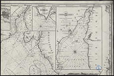
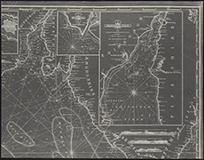
| Name: | Thomas, F.W., Lieut. | |
| Description: | Forth, Firth of. Fisherrow to Queensferry | |
| Year: | 1850-4 | |
| Subject: | River | |
| Inventory: | Series of 15 photographs of Admiralty Charts (parts of) | |
| Colour: | B&W | |
| Media: | Photographic process | |
| Object: | Flat | |
| Physical: | Paper | |
| Size: | 608 mm x 455 mm | |
| Shelfmark: | MS.5850, 36 | |
| Show location on map ? | ||
 | ||
| Zoom Into Map: | Click on the map to view in greater detail. | |
| Name: | Thomas, F.W., Lieut. | |
| Description: | Forth, Firth of. Fisherrow to Queensferry | |
| Year: | 1850-4 | |
| Subject: | River | |
| Inventory: | Series of 15 photographs of Admiralty Charts (parts of) | |
| Colour: | B&W | |
| Media: | Photographic process | |
| Object: | Flat | |
| Physical: | Paper | |
| Size: | 606 mm x 450 mm | |
| Shelfmark: | MS.5850, 37 | |
| Show location on map ? | ||
 | ||
| Zoom Into Map: | Click on the map to view in greater detail. | |
| Name: | Thomas, F.W., Lieut. | |
| Description: | Forth, Firth of. Fisherrow to Queensferry | |
| Year: | 1850-4 | |
| Subject: | River | |
| Inventory: | Series of 15 photographs of Admiralty Charts (parts of) | |
| Colour: | B&W | |
| Media: | Photographic process | |
| Object: | Flat | |
| Physical: | Paper | |
| Size: | 560 mm x 455 mm | |
| Shelfmark: | MS.5850, 38 | |
| Show location on map ? | ||
 | ||
| Zoom Into Map: | Click on the map to view in greater detail. | |
| Name: | Thomas, F.W., Lieut. | |
| Description: | Forth, Firth of. Fisherrow to Queensferry | |
| Year: | 1850-4 | |
| Subject: | River | |
| Inventory: | Series of 15 photographs of Admiralty Charts (parts of) | |
| Colour: | B&W | |
| Media: | Photographic process | |
| Object: | Flat | |
| Physical: | Paper | |
| Size: | 555 mm x 450 mm | |
| Shelfmark: | MS.5850, 39 | |
| Show location on map ? | ||
 | ||
| Zoom Into Map: | Click on the map to view in greater detail. | |
| Name: | Thomas, F.W., Lieut. | |
| Description: | Forth, Firth of. Fisherrow to Queensferry | |
| Year: | 1850-4 | |
| Subject: | River | |
| Inventory: | Series of 15 photographs of Admiralty Charts (parts of) | |
| Colour: | B&W | |
| Media: | Photographic process | |
| Object: | Flat | |
| Physical: | Paper | |
| Size: | 607 mm x 455 mm | |
| Shelfmark: | MS.5850, 40 | |
| Show location on map ? | ||
 | ||
| Zoom Into Map: | Click on the map to view in greater detail. | |
| Name: | Thomas, F.W., Lieut. | |
| Description: | Forth, Firth of. Fisherrow to Queensferry | |
| Year: | 1850-4 | |
| Subject: | River | |
| Inventory: | Series of 15 photographs of Admiralty Charts (parts of) | |
| Colour: | B&W | |
| Media: | Photographic process | |
| Object: | Flat | |
| Physical: | Paper | |
| Size: | 563 mm x 450 mm | |
| Shelfmark: | MS.5850, 41 | |
| Show location on map ? | ||
 | ||
| Zoom Into Map: | Click on the map to view in greater detail. | |
| Name: | Thomas, F.W., Lieut. | |
| Description: | Forth, Firth of. Fisherrow to Queensferry | |
| Year: | 1850-4 | |
| Subject: | River | |
| Inventory: | Series of 15 photographs of Admiralty Charts (parts of) | |
| Colour: | B&W | |
| Media: | Photographic process | |
| Object: | Flat | |
| Physical: | Paper | |
| Size: | 545 mm x 360 mm | |
| Shelfmark: | MS.5850, 42 | |
| Show location on map ? | ||
 | ||
| Zoom Into Map: | Click on the map to view in greater detail. | |
| Name: | Thomas, F.W., Lieut. | |
| Description: | Forth, Firth of. Fisherrow to Queensferry | |
| Year: | 1850-4 | |
| Subject: | River | |
| Inventory: | Series of 15 photographs of Admiralty Charts (parts of) | |
| Colour: | B&W | |
| Media: | Photographic process | |
| Object: | Flat | |
| Physical: | Paper | |
| Size: | 548 mm x 425 mm | |
| Shelfmark: | MS.5850, 43 | |
| Show location on map ? | ||
 | ||
| Zoom Into Map: | Click on the map to view in greater detail. | |
| Name: | Thomas, F.W., Lieut. | |
| Description: | Forth, Firth of. Fisherrow to Queensferry | |
| Year: | 1850-4 | |
| Subject: | River | |
| Inventory: | Series of 15 photographs of Admiralty Charts (parts of) | |
| Colour: | B&W | |
| Media: | Photographic process | |
| Object: | Flat | |
| Physical: | Paper | |
| Size: | 607 mm x 455 mm | |
| Shelfmark: | MS.5850, 44 | |
| Show location on map ? | ||
 | ||
| Zoom Into Map: | Click on the map to view in greater detail. | |
| Name: | Thomas, F.W., Lieut. | |
| Description: | Forth, Firth of. Fisherrow to Queensferry | |
| Year: | 1850-4 | |
| Subject: | River | |
| Inventory: | Series of 15 photographs of Admiralty Charts (parts of) | |
| Colour: | B&W | |
| Media: | Photographic process | |
| Object: | Flat | |
| Physical: | Paper | |
| Size: | 608 mm x 455 mm | |
| Shelfmark: | MS.5850, 45 | |
| Show location on map ? | ||
 | ||
| Zoom Into Map: | Click on the map to view in greater detail. | |
| Name: | Thomas, F.W., Lieut. | |
| Description: | Forth, Firth of. Fisherrow to Queensferry | |
| Year: | 1850-4 | |
| Subject: | River | |
| Inventory: | Series of 15 photographs of Admiralty Charts (parts of) | |
| Colour: | B&W | |
| Media: | Photographic process | |
| Object: | Flat | |
| Physical: | Paper | |
| Size: | 607 mm x 455 mm | |
| Shelfmark: | MS.5850, 46 | |
| Show location on map ? | ||
 | ||
| Zoom Into Map: | Click on the map to view in greater detail. | |
| Name: | Thomas, F.W., Lieut. | |
| Description: | Forth, Firth of. Fisherrow to Queensferry | |
| Year: | 1850-4 | |
| Subject: | River | |
| Inventory: | Series of 15 photographs of Admiralty Charts (parts of) | |
| Colour: | B&W | |
| Media: | Photographic process | |
| Object: | Flat | |
| Physical: | Paper | |
| Size: | 558 mm x 455 mm | |
| Shelfmark: | MS.5850, 47 | |
| Show location on map ? | ||
 | ||
| Zoom Into Map: | Click on the map to view in greater detail. | |
| Name: | Thomas, F.W., Lieut. | |
| Description: | Forth, Firth of. Fisherrow to Queensferry | |
| Year: | 1850-4 | |
| Subject: | River | |
| Inventory: | Series of 15 photographs of Admiralty Charts (parts of) | |
| Colour: | B&W | |
| Media: | Photographic process | |
| Object: | Flat | |
| Physical: | Paper | |
| Size: | 507 mm x 455 mm | |
| Shelfmark: | MS.5850, 48 | |
| Show location on map ? | ||
 | ||
| Zoom Into Map: | Click on the map to view in greater detail. | |
| Name: | Thomas, F.W., Lieut. | |
| Description: | Forth, Firth of. Fisherrow to Queensferry | |
| Year: | 1850-4 | |
| Subject: | River | |
| Inventory: | Series of 15 photographs of Admiralty Charts (parts of) | |
| Colour: | B&W | |
| Media: | Photographic process | |
| Object: | Flat | |
| Physical: | Paper | |
| Size: | 557 mm x 455 mm | |
| Shelfmark: | MS.5850, 49 | |
| Show location on map ? | ||
 | ||
| Zoom Into Map: | Click on the map to view in greater detail. | |
| Name: | Thomas, F.W., Lieut. | |
| Description: | Forth, Firth of. Fisherrow to Queensferry | |
| Year: | 1850-4 | |
| County: | Fife ; West Lothian | |
| Subject: | River | |
| Inventory: | Series of 15 photographs of Admiralty Charts (parts of) | |
| Colour: | B&W | |
| Media: | Photographic process | |
| Object: | Flat | |
| Physical: | Paper | |
| Size: | 605 mm x 455 mm | |
| Shelfmark: | MS.5850, 50 | |
| Show location on map ? | ||
 | ||
| Zoom Into Map: | Click on the map to view in greater detail. | |
| Name: | Stevenson, Thomas, 1818-1887 | |
| Description: | Esk, River, North. Section of rain Gauge for North Esk Reservoir | |
| Year: | 1850 | |
| Place: | North Esk Reservoir | |
| County: | Edinburgh ; Peebles | |
| Subject: | River | |
| Inventory: | Drawing | |
| Colour: | B&W | |
| Media: | Graphite; Hand coloured; Ink | |
| Object: | Flat | |
| Physical: | Paper | |
| Size: | 500 mm x 680 mm | |
| Shelfmark: | MS.5849, 123 | |
| Show location on map ? | ||
 | ||
| Zoom Into Map: | Click on the map to view in greater detail. | |
| Name: | Robinson, Captain | |
| Description: | Clyde, River. From Greenock to Dumbarton | |
| Year: | 1850 | |
| Subject: | River | |
| Inventory: | Print by J & C Walker published in 1852 | |
| Colour: | Colour | |
| Media: | Hand coloured; Ink; Printed | |
| Object: | Folded | |
| Physical: | Paper/Linen/Cloth | |
| Size: | 652 mm x 985 mm | |
| Shelfmark: | MS.5846, 50 - Adm. Ch | |
| Show location on map ? | ||
| Name: | Sutton & Clifton | |
| Description: | Forth, Firth of. St Abbs Head to Forth Bridge | |
| Year: | 1852-6 | |
| County: | Berwick ; East Lothian ; Edinburgh ; Fife ; Kinross ; Perth ; West Lothian | |
| Subject: | River | |
| Inventory: | Printed | |
| Colour: | B&W | |
| Media: | Printed | |
| Object: | Folded | |
| Physical: | Paper | |
| Size: | 700 mm x 1163 mm | |
| Shelfmark: | MS.5850, 52 - Adm. Ch | |
| Show location on map ? | ||
| Description: | Greenock. Section of West Burn | |
| Year: | 1852 | |
| Place: | Greenock | |
| County: | Renfrew | |
| Subject: | River | |
| Inventory: | Print J.M Menzies | |
| Colour: | Colour | |
| Media: | Hand coloured; Printed | |
| Object: | Flat | |
| Physical: | Paper | |
| Size: | 683 mm x 555 mm | |
| Shelfmark: | MS.5851, 118 | |
| Show location on map ? | ||
| Description: | Tay, River. Tay Ferries Trial | |
| Year: | 1852 | |
| County: | Fife ; Forfar | |
| Subject: | River | |
| Inventory: | Series of 6 drawings | |
| Colour: | Colour | |
| Media: | Card | |
| Object: | Flat | |
| Physical: | Transparent paper | |
| Size: | 550 x 380 mm | |
| Shelfmark: | MS.5863, 57 | |
| Show location on map ? | ||
 | ||
| Zoom Into Map: | Click on the map to view in greater detail. | |
| Description: | Tay, River. Tay Ferries Trial | |
| Year: | 1852 | |
| County: | Fife ; Forfar | |
| Subject: | River | |
| Inventory: | Series of 6 drawings | |
| Colour: | Colour | |
| Media: | None | |
| Object: | Flat | |
| Physical: | Transparent paper | |
| Size: | 550 x 355 mm | |
| Shelfmark: | MS.5863, 58 | |
| Show location on map ? | ||
 | ||
| Zoom Into Map: | Click on the map to view in greater detail. | |
| Description: | Tay, River. Tay Ferries Trial | |
| Year: | 1852 | |
| County: | Fife ; Forfar | |
| Subject: | River | |
| Inventory: | Series of 6 drawings | |
| Colour: | B&W | |
| Media: | None | |
| Object: | Flat | |
| Physical: | Card | |
| Size: | 505 x 685 mm | |
| Shelfmark: | MS.5863, 59 | |
| Show location on map ? | ||
 | ||
| Zoom Into Map: | Click on the map to view in greater detail. | |
| Description: | Tay, River. Tay Ferries Trial | |
| Year: | 1852 | |
| County: | Fife ; Forfar | |
| Subject: | River | |
| Inventory: | Series of 6 drawings | |
| Colour: | Colour | |
| Media: | None | |
| Object: | Flat | |
| Physical: | Card | |
| Size: | 500 x 755 mm | |
| Shelfmark: | MS.5863, 60 | |
| Show location on map ? | ||
 | ||
| Zoom Into Map: | Click on the map to view in greater detail. | |
| Description: | Tay, River. Tay Ferries Trial | |
| Year: | 1852 | |
| County: | Fife ; Forfar | |
| Subject: | River | |
| Inventory: | Series of 6 drawings | |
| Colour: | B&W | |
| Media: | None | |
| Object: | Flat | |
| Physical: | Card | |
| Size: | 520 x 750 mm | |
| Shelfmark: | MS.5863, 61 | |
| Show location on map ? | ||
 | ||
| Zoom Into Map: | Click on the map to view in greater detail. | |
| Description: | Tay, River. Tay Ferries Trial | |
| Year: | 1852 | |
| County: | Fife ; Forfar | |
| Subject: | River | |
| Inventory: | Series of 6 drawings | |
| Colour: | Colour | |
| Media: | None | |
| Object: | Flat | |
| Physical: | Card | |
| Size: | 495 x 760 mm | |
| Shelfmark: | MS.5863, 62 | |
| Show location on map ? | ||
 | ||
| Zoom Into Map: | Click on the map to view in greater detail. | |
| Name: | Stevenson, David, 1815-1886 ; Stevenson, Thomas, 1818-1887 ; Stevenson, Alan, 1807-1865 | |
| Description: | River Wear. Plan for the improvement of the navigation of the River Wear ..., as proposed by Thomas Meek, Engineer to the Commissioners of the River Wear and reported on by Messrs Stevenson's Civil Engineers, Edinburgh 1852. Printed | |
| Year: | 1852 | |
| Subject: | River | |
| Colour: | Colour | |
| Media: | None | |
| Object: | Flat | |
| Physical: | Paper | |
| Size: | 338 x 868 mm | |
| Shelfmark: | Acc.10706, 285 | |
 | ||
| Zoom Into Map: | Click on the map to view in greater detail. | |
| Description: | Teith, River. Bank near Blackdub Farmhouse | |
| Year: | 1853 | |
| County: | Perth ; Stirling | |
| Subject: | River | |
| Inventory: | Drawing | |
| Colour: | Colour | |
| Media: | None | |
| Object: | Flat | |
| Physical: | Card | |
| Size: | 555 x 765 mm | |
| Shelfmark: | MS.5863, 91 | |
| Show location on map ? | ||
 | ||
| Zoom Into Map: | Click on the map to view in greater detail. | |
| Name: | Stevenson, David, 1815-1886 ; Stevenson, Thomas, 1818-1887 | |
| Description: | Teith, River. Method of bank repairs | |
| Year: | 1853 | |
| County: | Perth ; Stirling | |
| Subject: | River | |
| Inventory: | Drawing | |
| Colour: | Colour | |
| Media: | None | |
| Object: | Flat | |
| Physical: | Card | |
| Size: | 670 x 980 mm | |
| Shelfmark: | MS.5863, 92 | |
| Show location on map ? | ||
| Description: | Slitrig Water. Part of river at Hawick | |
| Year: | 1854 | |
| Place: | Hawick | |
| County: | Roxburgh | |
| Subject: | River | |
| Inventory: | Series of 3 drawings | |
| Colour: | Colour | |
| Media: | None | |
| Object: | Folded | |
| Physical: | Card | |
| Size: | 850 x 1220 mm | |
| Shelfmark: | MS.5862, 98 | |
| Show location on map ? | ||
| Description: | Slitrig Water. Part of river at Hawick | |
| Year: | 1854 | |
| Place: | Hawick | |
| County: | Roxburgh | |
| Subject: | River | |
| Inventory: | Series of 3 drawings | |
| Colour: | Colour | |
| Media: | None | |
| Object: | Flat | |
| Physical: | Paper | |
| Size: | 565 x 740 mm | |
| Shelfmark: | MS.5862, 99 | |
| Show location on map ? | ||
| Description: | Slitrig Water. Part of river at Hawick | |
| Year: | 1854 | |
| Place: | Hawick | |
| County: | Roxburgh | |
| Subject: | River | |
| Inventory: | Series of 3 drawings | |
| Colour: | Colour | |
| Media: | None | |
| Object: | Flat | |
| Physical: | Card | |
| Size: | 545 x 745 mm | |
| Shelfmark: | MS.5862, 100 | |
| Show location on map ? | ||
| Name: | Andrews, James | |
| Description: | Tay, River. Firth of Tay with soundings | |
| Year: | 1858 | |
| County: | Perth | |
| Subject: | River | |
| Inventory: | Print by W & AK Johnston | |
| Colour: | Colour | |
| Media: | None | |
| Object: | Flat | |
| Physical: | Card | |
| Size: | 645 x 1000 mm | |
| Shelfmark: | MS.5863, 63 | |
| Show location on map ? | ||
| Description: | Findhorn, River. Estuary | |
| Year: | 1859 | |
| County: | Elgin | |
| Subject: | River | |
| Inventory: | Series of 2 drawings | |
| Colour: | B&W | |
| Media: | Hand coloured; Ink | |
| Object: | Folded | |
| Physical: | Paper | |
| Size: | 555 mm x 765 mm | |
| Shelfmark: | MS.5850, 5 | |
| Show location on map ? | ||
| Description: | Findhorn, River. Estuary | |
| Year: | 1859 | |
| County: | Elgin | |
| Subject: | River | |
| Inventory: | Series of 2 drawings | |
| Colour: | Colour | |
| Media: | Hand coloured; Ink | |
| Object: | Folded | |
| Physical: | Transparent paper/Linen/Cloth | |
| Size: | 991 mm x 890 mm | |
| Shelfmark: | MS.5850, 6 | |
| Show location on map ? | ||
| Name: | Stevenson, David, 1815-1886 ; Stevenson, Thomas, 1818-1887 | |
| Description: | Nith. Section referred to by the Nith Navigation | |
| Year: | 1860 | |
| Place: | Nith | |
| County: | Dumfries | |
| Subject: | River | |
| Inventory: | Drawing and Tracing | |
| Colour: | Colour | |
| Media: | Graphite; Hand coloured; Ink | |
| Object: | Folded | |
| Physical: | Paper/Linen/Cloth | |
| Size: | 740 mm x 2000 mm | |
| Shelfmark: | MS.5857, 24 | |
| Show location on map ? | ||
| Name: | Robinson, C. G., Commander ; Calver, Edward K., Captain. | |
| Description: | Clyde, River. From Greenock to Dumbarton to show points at issue with Clyde Lighthouse Trustees | |
| Year: | 1860 | |
| Subject: | River | |
| Inventory: | Print by J & C Walker | |
| Colour: | Colour | |
| Media: | Hand coloured; Ink; Printed | |
| Object: | Flat | |
| Physical: | Paper/Linen/Cloth | |
| Size: | 660 mm x 997 mm | |
| Shelfmark: | MS.5846, 51 - Adm. Ch | |
| Show location on map ? | ||
| Description: | Beauly River. Sketch of part from Kilmorack to Beauly Firth | |
| Year: | 1860 | |
| County: | Inverness ; Ross And Cromarty | |
| Subject: | River | |
| Inventory: | Drawing | |
| Colour: | Colour | |
| Media: | Graphite; Hand coloured; Ink | |
| Object: | Flat | |
| Physical: | Paper/Linen/Cloth | |
| Size: | 398 mm x 847 mm | |
| Shelfmark: | MS.5845, 21 | |
| Show location on map ? | ||
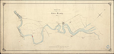 | ||
| Zoom Into Map: | Click on the map to view in greater detail. | |
| Name: | Stevenson, David, 1815-1886 ; Stevenson, Thomas, 1818-1887 | |
| Description: | Nith. Section referred to by the Nith Navigation | |
| Year: | 1861 | |
| Place: | Nith | |
| County: | Dumfries | |
| Subject: | River | |
| Inventory: | Drawing and Tracing | |
| Colour: | Colour | |
| Media: | Graphite; Hand coloured; Ink | |
| Object: | Folded | |
| Physical: | Transparent paper/Linen/Cloth | |
| Size: | 740 mm x 1700 mm | |
| Shelfmark: | MS.5857, 25 | |
| Show location on map ? | ||
| Description: | Nith. Longitudinal section on the line of the western Training wall | |
| Year: | 1861 | |
| Place: | Nith | |
| County: | Dumfries | |
| Subject: | River | |
| Inventory: | Drawing | |
| Colour: | Colour | |
| Media: | Graphite; Hand coloured; Ink | |
| Object: | Folded | |
| Physical: | Paper | |
| Size: | 320 mm x 1300 mm | |
| Shelfmark: | MS.5857, 26 | |
| Show location on map ? | ||
| Name: | Stevenson, David, 1815-1886 ; Stevenson, Thomas, 1818-1887 | |
| Description: | Nith. Working drawing of extension of wall to opposite Conheath | |
| Year: | 1861 | |
| Place: | Nith | |
| County: | Dumfries | |
| Subject: | River | |
| Inventory: | Drawing | |
| Colour: | Colour | |
| Media: | Graphite; Hand coloured; Ink | |
| Object: | Flat | |
| Physical: | Paper | |
| Size: | 570 mm x 730 mm | |
| Shelfmark: | MS.5857, 27 | |
| Show location on map ? | ||
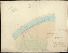 | ||
| Zoom Into Map: | Click on the map to view in greater detail. | |
| Name: | Stevenson, David, 1815-1886 ; Stevenson, Thomas, 1818-1887 | |
| Description: | Nith. Working drawing of proposed training wall | |
| Year: | 1861 | |
| Place: | Nith | |
| County: | Dumfries | |
| Subject: | River | |
| Inventory: | Drawing | |
| Colour: | Colour | |
| Media: | Hand coloured; Ink; Printed | |
| Object: | Folded | |
| Physical: | Transparent paper/Linen/Cloth | |
| Size: | 470 mm x 1500 mm | |
| Shelfmark: | MS.5857, 28 | |
| Show location on map ? | ||
| Name: | Stevenson, David, 1815-1886 | |
| Description: | Rothesay. Kirk Dam Embankment | |
| Year: | 1861-2 | |
| Place: | Rothesay | |
| County: | Bute | |
| Subject: | River | |
| Inventory: | Drawing | |
| Colour: | Colour | |
| Media: | Paper | |
| Object: | Flat | |
| Physical: | Card | |
| Size: | 565 x 1050 mm | |
| Shelfmark: | MS.5861, 10 | |
| Show location on map ? | ||
| Name: | Stevenson, David, 1815-1886 ; Stevenson, Thomas, 1818-1887 | |
| Description: | Nith. Working drawing of West wall | |
| Year: | 1862 | |
| Place: | Nith | |
| County: | Dumfries | |
| Subject: | River | |
| Inventory: | Drawing | |
| Colour: | Colour | |
| Media: | Hand coloured; Ink; Printed | |
| Object: | Folded | |
| Physical: | Paper/Linen/Cloth | |
| Size: | 530 mm x 1500 mm | |
| Shelfmark: | MS.5857, 29 | |
| Show location on map ? | ||
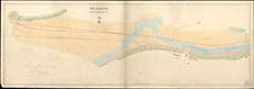 | ||
| Zoom Into Map: | Click on the map to view in greater detail. | |
| Name: | Stevenson, David, 1815-1886 ; Stevenson, Thomas, 1818-1887 | |
| Description: | Nith. Section of proposed extension of river wall near Crook's Pow | |
| Year: | 1863 | |
| Place: | Nith | |
| County: | Dumfries | |
| Subject: | River | |
| Inventory: | Tracing | |
| Colour: | Colour | |
| Media: | Graphite; Hand coloured; Ink | |
| Object: | Flat | |
| Physical: | Transparent paper | |
| Size: | 320 mm x 510 mm | |
| Shelfmark: | MS.5857, 30 | |
| Show location on map ? | ||
| Name: | Stevenson, David, 1815-1886 ; Stevenson, Thomas, 1818-1887 | |
| Description: | Nith. Plan and section of wall near Crook's Pow | |
| Year: | 1863 | |
| Place: | Nith | |
| County: | Dumfries | |
| Subject: | River | |
| Inventory: | Drawing | |
| Colour: | Colour | |
| Media: | Hand coloured; Ink | |
| Object: | Flat | |
| Physical: | Paper | |
| Size: | 690 mm x 1020 mm | |
| Shelfmark: | MS.5857, 31 | |
| Show location on map ? | ||
| Name: | Stevenson, David, 1815-1886 ; Stevenson, Thomas, 1818-1887 | |
| Description: | Nith. Charts showing different lines of Channel in 1812, 1844, 1849, and 1860 | |
| Year: | 1863 | |
| Place: | Nith | |
| County: | Dumfries | |
| Subject: | River | |
| Inventory: | Tracing | |
| Colour: | Colour | |
| Media: | Hand coloured; Ink | |
| Object: | Flat | |
| Physical: | Transparent paper | |
| Size: | 660 mm x 440 mm | |
| Shelfmark: | MS.5857, 32 | |
| Show location on map ? | ||
| Name: | Stevenson, David, 1815-1886 ; Stevenson, Thomas, 1818-1887 | |
| Description: | River Ae. Sections of Embankment | |
| Year: | 1863 | |
| County: | Dumfries | |
| Subject: | River | |
| Inventory: | Drawing | |
| Colour: | Colour | |
| Media: | Hand coloured; Ink | |
| Object: | Flat | |
| Physical: | Transparent paper/Linen/Cloth | |
| Size: | 540 mm x 765 mm | |
| Shelfmark: | MS.5844, 30 | |
| Show location on map ? | ||
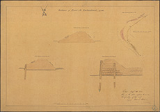 | ||
| Zoom Into Map: | Click on the map to view in greater detail. | |
| Name: | Stevenson, David, 1815-1886 ; Stevenson, Thomas, 1818-1887 | |
| Description: | River Ae. Junction with the Kirkburn for proposed Flood Bank | |
| Year: | 1863 | |
| County: | Dumfries | |
| Subject: | River | |
| Inventory: | Drawing | |
| Colour: | Colour | |
| Media: | Hand coloured; Ink | |
| Object: | Flat | |
| Physical: | Transparent paper/Linen/Cloth | |
| Size: | 705 mm x 974 mm | |
| Shelfmark: | MS.5844, 31 | |
| Show location on map ? | ||
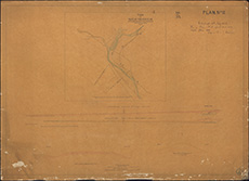 | ||
| Zoom Into Map: | Click on the map to view in greater detail. | |
| Name: | Andrews, James | |
| Description: | Tay, River. Firth of Tay with soundings | |
| Year: | 1863 | |
| County: | Perth | |
| Subject: | River | |
| Inventory: | Print by W & AK Johnston | |
| Colour: | B&W | |
| Media: | None | |
| Object: | Flat | |
| Physical: | Card | |
| Size: | 670 x 1010 mm | |
| Shelfmark: | MS.5863, 64 | |
| Show location on map ? | ||
| Name: | Stevenson, David, 1815-1886 ; Stevenson, Thomas, 1818-1887 | |
| Description: | Tay, River. Part of River | |
| Year: | 1863 | |
| County: | Perth | |
| Subject: | River | |
| Inventory: | Drawing | |
| Colour: | Colour | |
| Media: | None | |
| Object: | Flat | |
| Physical: | Card | |
| Size: | 545 x 700 mm | |
| Shelfmark: | MS.5863, 65 | |
| Show location on map ? | ||
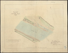 | ||
| Zoom Into Map: | Click on the map to view in greater detail. | |
| Description: | Tay, River. Nautical Guide to Forth & Tay | |
| Year: | 1863 | |
| Place: | Firth of Forth | |
| County: | Perth | |
| Subject: | River | |
| Inventory: | ||
| Colour: | Colour | |
| Media: | Linen/Cloth | |
| Object: | Flat | |
| Physical: | Paper | |
| Size: | 660 x 1050 mm | |
| Shelfmark: | MS.5863, 66 | |
| Show location on map ? | ||
| Description: | Tay, River. Balmbriech Castle to Dominie Lodge | |
| Year: | 1865 | |
| County: | Fife | |
| Subject: | River | |
| Inventory: | Series of 2 drawings | |
| Colour: | Colour | |
| Media: | None | |
| Object: | Flat | |
| Physical: | Card | |
| Size: | 555 x 770 mm | |
| Shelfmark: | MS.5863, 67 | |
| Show location on map ? | ||
| Description: | Tay, River. Balmbriech Castle to Dominie Lodge | |
| Year: | 1865 | |
| County: | Fife ; Perth | |
| Subject: | River | |
| Inventory: | Series of 2 drawings | |
| Colour: | Colour | |
| Media: | Card | |
| Physical: | Transparent paper | |
| Size: | 545 x 675 mm | |
| Shelfmark: | MS.5863, 68 | |
| Show location on map ? | ||
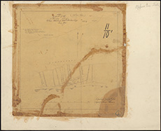 | ||
| Zoom Into Map: | Click on the map to view in greater detail. | |
| Name: | Calver, Edward K., Captain. | |
| Description: | Tay, River. Entrance with soundings | |
| Year: | 1866 | |
| County: | Fife ; Forfar | |
| Subject: | River | |
| Inventory: | Series of 2 prints | |
| Colour: | B&W | |
| Media: | None | |
| Object: | Flat | |
| Physical: | Card | |
| Size: | 570 x 450 mm | |
| Shelfmark: | MS.5863, 69 | |
| Show location on map ? | ||
| Name: | Calver, Edward K., Captain. | |
| Description: | Tay, River. Entrance with soundings | |
| Year: | 1866 | |
| County: | Fife ; Forfar | |
| Subject: | River | |
| Inventory: | Series of 2 prints | |
| Colour: | B&W | |
| Media: | None | |
| Object: | Flat | |
| Physical: | Card | |
| Size: | 570 x 445 mm | |
| Shelfmark: | MS.5863, 70 | |
| Show location on map ? | ||
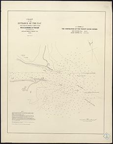 | ||
| Zoom Into Map: | Click on the map to view in greater detail. | |
| Description: | Tulliallan. Portion of S. Ferry Pier | |
| Year: | 1868 | |
| Place: | Tulliallan | |
| County: | Fife | |
| Subject: | River | |
| Inventory: | Drawing | |
| Colour: | Colour | |
| Media: | None | |
| Object: | Flat | |
| Physical: | Card | |
| Size: | 560 x 780 mm | |
| Shelfmark: | MS.5863, 105 | |
| Show location on map ? | ||
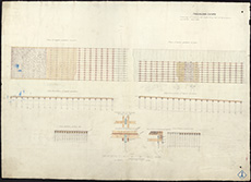 | ||
| Zoom Into Map: | Click on the map to view in greater detail. | |
| Description: | Tulliallan. Parts of embankment (enlarged) | |
| Year: | 1868 | |
| Place: | Tulliallan | |
| County: | Fife | |
| Subject: | River | |
| Inventory: | Drawing | |
| Colour: | Colour | |
| Media: | None | |
| Object: | Flat | |
| Physical: | Card | |
| Size: | 560 x 780 mm | |
| Shelfmark: | MS.5863, 106 | |
| Show location on map ? | ||
 | ||
| Zoom Into Map: | Click on the map to view in greater detail. | |
| Description: | Kelvin River. Section of Bed of River from Garscube Bridge to Buchles Ford | |
| Year: | 1868 | |
| County: | Dunbarton ; Lanark ; Stirling | |
| Subject: | River | |
| Inventory: | Tracing | |
| Colour: | Colour | |
| Media: | Ink | |
| Object: | Flat | |
| Physical: | Transparent paper/Paper | |
| Size: | 365 mm x 820 mm | |
| Shelfmark: | MS.5854, 9 | |
| Show location on map ? | ||
| Description: | Beauly River. Sections | |
| Year: | 1868 | |
| County: | Inverness ; Ross And Cromarty | |
| Subject: | River | |
| Inventory: | Drawing. 2 sheets | |
| Colour: | Colour | |
| Media: | Graphite; Hand coloured; Ink | |
| Object: | Flat | |
| Physical: | Paper | |
| Size: | 687 mm x 1104 mm | |
| Shelfmark: | MS.5845, 22 | |
| Show location on map ? | ||
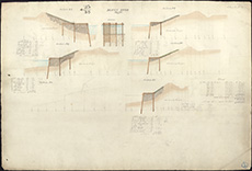 | ||
| Zoom Into Map: | Click on the map to view in greater detail. | |
| Description: | Beauly River. Sections | |
| Year: | 1868 | |
| County: | Inverness ; Ross And Cromarty | |
| Subject: | River | |
| Inventory: | Drawing. 2 sheets | |
| Colour: | Colour | |
| Media: | Graphite; Hand coloured; Ink | |
| Object: | Flat | |
| Physical: | Paper | |
| Size: | 691 mm x 1023 mm | |
| Shelfmark: | MS.5845, 23 | |
| Show location on map ? | ||
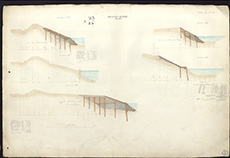 | ||
| Zoom Into Map: | Click on the map to view in greater detail. | |
| Name: | Stevenson, David, 1815-1886 ; Stevenson, Thomas, 1818-1887 | |
| Description: | Beauly River. Plan showing proposed embankments | |
| Year: | 1868 | |
| Subject: | River | |
| Inventory: | Drawing | |
| Colour: | Colour | |
| Media: | Hand coloured; Ink | |
| Object: | Flat | |
| Physical: | Transparent paper/Linen/Cloth | |
| Size: | 868 mm x 650 mm | |
| Shelfmark: | MS.5845, 24 | |
| Show location on map ? | ||
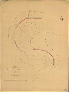 | ||
| Zoom Into Map: | Click on the map to view in greater detail. | |
| Name: | Stevenson, David, 1815-1886 ; Stevenson, Thomas, 1818-1887 | |
| Description: | Awe River. Survey from Inverawe to Brander | |
| Year: | 1868 | |
| County: | Argyll | |
| Subject: | River | |
| Inventory: | Drawing | |
| Colour: | Colour | |
| Media: | Graphite; Hand coloured; Ink | |
| Object: | Flat | |
| Physical: | Paper/Linen/Cloth | |
| Size: | 695 mm x 3000 mm | |
| Shelfmark: | MS.5844, 143 | |
| Show location on map ? | ||
| Name: | Stevenson, David, 1815-1886 ; Stevenson, Thomas, 1818-1887 | |
| Description: | Awe River. Survey from Inverawe to Bridge of Awe | |
| Year: | 1868 | |
| County: | Argyll | |
| Subject: | River | |
| Inventory: | Photostat of part of original survey. 2 copies | |
| Colour: | Colour | |
| Media: | Hand coloured; Printed | |
| Object: | Folded | |
| Physical: | Paper | |
| Size: | 761 mm x 1350 mm | |
| Shelfmark: | MS.5844, 144 | |
| Show location on map ? | ||
| Name: | Stevenson, David, 1815-1886 ; Stevenson, Thomas, 1818-1887 | |
| Description: | Awe River. Survey from Inverawe to Bridge of Awe | |
| Year: | 1868 | |
| County: | Argyll | |
| Subject: | River | |
| Inventory: | Photostat of part of original survey. 2 copies | |
| Colour: | B&W | |
| Media: | Photographic process | |
| Object: | Flat | |
| Physical: | Photographic process | |
| Size: | 481 mm x 823 mm | |
| Shelfmark: | MS.5844, 145 | |
| Show location on map ? | ||
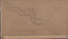 | ||
| Zoom Into Map: | Click on the map to view in greater detail. | |
| Name: | Stevenson, David, 1815-1886 ; Stevenson, Thomas, 1818-1887 | |
| Description: | Awe River. Survey from Inverawe to Bridge of Awe | |
| Year: | 1868 | |
| County: | Argyll | |
| Subject: | River | |
| Inventory: | Tracing of part of original survey | |
| Colour: | B&W | |
| Media: | Graphite; Ink | |
| Object: | Flat | |
| Physical: | Transparent paper | |
| Size: | 469 mm x 838 mm | |
| Shelfmark: | MS.5844, 146 | |
| Show location on map ? | ||
| Description: | Tay, River. Dundee Ferry Harbour and portion of bed of river | |
| Year: | 1869 | |
| Place: | Dundee | |
| County: | Forfar | |
| Subject: | River | |
| Colour: | Colour | |
| Media: | None | |
| Object: | Flat | |
| Physical: | Card | |
| Size: | 715 x 1000 mm | |
| Shelfmark: | MS.5863, 71 | |
| Show location on map ? | ||
| Description: | Tay, River. Dundee Ferry Harbour and portion of bed of river | |
| Year: | 1869 | |
| Place: | Dundee | |
| County: | Forfar | |
| Subject: | River | |
| Colour: | Colour | |
| Media: | Linen/Cloth | |
| Object: | Flat | |
| Physical: | Card | |
| Size: | 710 x 1010 mm | |
| Shelfmark: | MS.5863, 72 | |
| Show location on map ? | ||
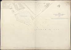 | ||
| Zoom Into Map: | Click on the map to view in greater detail. | |
| Description: | Esk, River, North. Salmon Pass at Morphie/Goyle at Meikle Mill Dam, Brechin | |
| Year: | 1870 | |
| Place: | Morphie | |
| County: | Forfar | |
| Subject: | River | |
| Inventory: | Drawing | |
| Colour: | B&W | |
| Media: | Ink | |
| Object: | Flat | |
| Physical: | Paper | |
| Size: | 680 mm x 1010 mm | |
| Shelfmark: | MS.5849, 124 | |
| Show location on map ? | ||
| Name: | Stevenson, Thomas, 1818-1887 | |
| Description: | Craigo. Dam and Salmon Pass | |
| Year: | 1870 | |
| Place: | Craigo | |
| County: | Forfar ; Kincardine | |
| Subject: | River | |
| Inventory: | Drawing | |
| Colour: | Colour | |
| Media: | Hand coloured; Ink | |
| Object: | Flat | |
| Physical: | Transparent paper/Linen/Cloth | |
| Size: | 660 mm x 821 mm | |
| Shelfmark: | MS.5846, 114 | |
| Show location on map ? | ||
| Name: | Stevenson, Thomas, 1818-1887 | |
| Description: | Craigo. Dam and Salmon Pass | |
| Year: | 1870 | |
| Place: | Craigo | |
| County: | Forfar ; Kincardine | |
| Subject: | River | |
| Inventory: | Tracing | |
| Colour: | Colour | |
| Media: | Hand coloured; Ink | |
| Physical: | Oil cloth | |
| Size: | 427 mm x 787 mm | |
| Shelfmark: | MS.5846, 115 | |
| Show location on map ? | ||
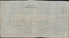 | ||
| Zoom Into Map: | Click on the map to view in greater detail. | |
| Description: | Tay, River. Landing platform for Ferry | |
| Year: | 1871 | |
| County: | Perth | |
| Subject: | River | |
| Inventory: | Drawing | |
| Colour: | Colour | |
| Media: | None | |
| Object: | Flat | |
| Physical: | Card | |
| Size: | 390 x 565 mm | |
| Shelfmark: | MS.5863, 73 | |
| Name: | Leslie, James, 1801-1889 ; Leslie, Alexander, 1844-1893 | |
| Description: | Tay, River. Newburgh to Balnbreich Castle | |
| Year: | 1871 | |
| County: | Fife ; Perth | |
| Subject: | River | |
| Inventory: | 2 prints by D & A Nimmo | |
| Colour: | Colour | |
| Media: | None | |
| Object: | Flat | |
| Physical: | Card | |
| Size: | 390 x 505 mm | |
| Shelfmark: | MS.5863, 74 | |
| Show location on map ? | ||
| Name: | Leslie, James, 1801-1889 ; Leslie, Alexander, 1844-1893 | |
| Description: | Tay, River. Newburgh to Balnbreich Castle | |
| Year: | 1871 | |
| County: | Fife ; Perth | |
| Subject: | River | |
| Inventory: | 2 prints by D & A Nimmo | |
| Colour: | Colour | |
| Media: | Linen/Cloth | |
| Object: | Flat | |
| Physical: | Card | |
| Size: | 390 x 500 mm | |
| Shelfmark: | MS.5863, 75 | |
| Show location on map ? | ||
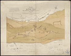 | ||
| Zoom Into Map: | Click on the map to view in greater detail. | |
| Name: | Stevenson, David, 1815-1886 ; Stevenson, Thomas, 1818-1887 | |
| Description: | Skelmorlie. Survey of Bank, with soundings | |
| Year: | 1873 | |
| Place: | Skelmorlie | |
| County: | Ayr ; Renfrew | |
| Subject: | River | |
| Inventory: | Drawing | |
| Colour: | Colour | |
| Media: | Card | |
| Object: | Flat | |
| Physical: | Transparent paper | |
| Size: | 500 x 600 mm | |
| Shelfmark: | MS.5862, 92 | |
| Show location on map ? | ||
| Name: | Stevenson, Thomas, 1818-1887 | |
| Description: | Craigo. Dam and Salmon Pass showing proposed alterations at bottom of pass | |
| Year: | 1875 | |
| Place: | Craigo | |
| County: | Forfar ; Kincardine | |
| Subject: | River | |
| Inventory: | Drawing | |
| Colour: | B&W | |
| Media: | Ink | |
| Object: | Flat | |
| Physical: | Transparent paper/Linen/Cloth | |
| Size: | 334 mm x 685 mm | |
| Shelfmark: | MS.5846, 116 | |
| Show location on map ? | ||
| Description: | Carron River. Junction of river and Kyle of Sutherland | |
| Year: | 1875 | |
| Place: | Bonarbridge | |
| County: | Ross And Cromarty | |
| Subject: | River | |
| Inventory: | Print- Ordnance Survey Map | |
| Colour: | Colour | |
| Media: | Hand coloured; Printed | |
| Object: | Flat | |
| Physical: | Paper | |
| Size: | 510 mm x 695 mm | |
| Shelfmark: | MS.5846, 35 | |
| Show location on map ? | ||
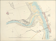 | ||
| Zoom Into Map: | Click on the map to view in greater detail. | |
| Name: | Kyle, Dennison & Frew ; Stevenson (unspecified) | |
| Description: | Glasgow. Sections & soundings of Clyde | |
| Year: | 1875-6 | |
| Place: | Glasgow | |
| County: | Lanark | |
| Subject: | River | |
| Inventory: | Series of 11 drawings and tracings | |
| Colour: | Colour | |
| Media: | Hand coloured; Ink | |
| Object: | Flat | |
| Physical: | Oil cloth | |
| Size: | 375 mm x 380 mm | |
| Shelfmark: | MS.5851, 56 | |
| Show location on map ? | ||
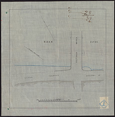 | ||
| Zoom Into Map: | Click on the map to view in greater detail. | |
| Name: | Kyle, Dennison & Frew ; Stevenson (unspecified) | |
| Description: | Glasgow. Sections & soundings of Clyde | |
| Year: | 1875-6 | |
| Place: | Glasgow | |
| County: | Lanark | |
| Subject: | River | |
| Inventory: | Series of 11 drawings and tracings | |
| Colour: | Colour | |
| Media: | Hand coloured; Ink | |
| Object: | Flat | |
| Physical: | Oil cloth | |
| Size: | 740 mm x 1220 mm | |
| Shelfmark: | MS.5851, 57 | |
| Show location on map ? | ||
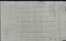 | ||
| Zoom Into Map: | Click on the map to view in greater detail. | |
| Name: | Kyle, Dennison & Frew ; Stevenson (unspecified) | |
| Description: | Glasgow. Sections & soundings of Clyde | |
| Year: | 1875-6 | |
| Place: | Glasgow | |
| County: | Lanark | |
| Subject: | River | |
| Inventory: | Series of 11 drawings and tracings | |
| Colour: | Colour | |
| Media: | Hand coloured; Ink | |
| Object: | Flat | |
| Physical: | Oil cloth | |
| Size: | 645 mm x 1000 mm | |
| Shelfmark: | MS.5851, 58 | |
| Show location on map ? | ||
| Name: | Kyle, Dennison & Frew ; Stevenson (unspecified) | |
| Description: | Glasgow. Sections & soundings of Clyde | |
| Year: | 1875-6 | |
| Place: | Glasgow | |
| County: | Lanark | |
| Subject: | River | |
| Inventory: | Series of 11 drawings and tracings | |
| Colour: | Colour | |
| Media: | Hand coloured; Ink | |
| Object: | Folded | |
| Physical: | Oil cloth | |
| Size: | 740 mm x 1031 mm | |
| Shelfmark: | MS.5851, 59 | |
| Show location on map ? | ||
| Name: | Kyle, Dennison & Frew ; Stevenson (unspecified) | |
| Description: | Glasgow. Sections & soundings of Clyde | |
| Year: | 1875-6 | |
| Place: | Glasgow | |
| County: | Lanark | |
| Subject: | River | |
| Inventory: | Series of 11 drawings and tracings | |
| Colour: | Colour | |
| Media: | Hand coloured; Ink | |
| Object: | Flat | |
| Physical: | Oil cloth | |
| Size: | 642 mm x 705 mm | |
| Shelfmark: | MS.5851, 60 | |
| Show location on map ? | ||
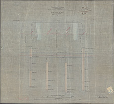 | ||
| Zoom Into Map: | Click on the map to view in greater detail. | |
| Name: | Kyle, Dennison & Frew ; Stevenson (unspecified) | |
| Description: | Glasgow. Sections & soundings of Clyde | |
| Year: | 1875-6 | |
| Place: | Glasgow | |
| County: | Lanark | |
| Subject: | River | |
| Inventory: | Series of 11 drawings and tracings | |
| Colour: | Colour | |
| Media: | Hand coloured; Ink | |
| Object: | Flat | |
| Physical: | Oil cloth | |
| Size: | 513 mm x 955 mm | |
| Shelfmark: | MS.5851, 61 | |
| Show location on map ? | ||
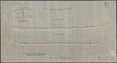 | ||
| Zoom Into Map: | Click on the map to view in greater detail. | |
| Name: | Kyle, Dennison & Frew ; Stevenson (unspecified) | |
| Description: | Glasgow. Sections & soundings of Clyde | |
| Year: | 1875-6 | |
| Place: | Glasgow | |
| County: | Lanark | |
| Subject: | River | |
| Inventory: | Series of 11 drawings and tracings | |
| Colour: | Colour | |
| Media: | Hand coloured; Ink | |
| Object: | Folded | |
| Physical: | Transparent paper | |
| Size: | 660 mm x 1790 mm | |
| Shelfmark: | MS.5851, 62 | |
| Show location on map ? | ||
| Name: | Kyle, Dennison & Frew ; Stevenson (unspecified) | |
| Description: | Glasgow. Sections & soundings of Clyde | |
| Year: | 1875-6 | |
| Place: | Glasgow | |
| County: | Lanark | |
| Subject: | River | |
| Inventory: | Series of 11 drawings and tracings | |
| Colour: | Colour | |
| Media: | Hand coloured; Ink | |
| Object: | Flat | |
| Physical: | Transparent paper | |
| Size: | 624 mm x 910 mm | |
| Shelfmark: | MS.5851, 63 | |
| Show location on map ? | ||
| Name: | Kyle, Dennison & Frew ; Stevenson (unspecified) | |
| Description: | Glasgow. Sections & soundings of Clyde | |
| Year: | 1875-6 | |
| Place: | Glasgow | |
| County: | Lanark | |
| Subject: | River | |
| Inventory: | Series of 11 drawings and tracings | |
| Colour: | B&W | |
| Media: | Ink | |
| Object: | Flat | |
| Physical: | Transparent paper | |
| Size: | 563 mm x 710 mm | |
| Shelfmark: | MS.5851, 64 | |
| Show location on map ? | ||
| Name: | Kyle, Dennison & Frew ; Stevenson (unspecified) | |
| Description: | Glasgow. Sections & soundings of Clyde | |
| Year: | 1875-6 | |
| Place: | Glasgow | |
| County: | Lanark | |
| Subject: | River | |
| Inventory: | Series of 11 drawings and tracings | |
| Colour: | B&W | |
| Media: | Ink | |
| Object: | Flat | |
| Physical: | Transparent paper/Linen/Cloth | |
| Size: | 670 mm x 1015 mm | |
| Shelfmark: | MS.5851, 65 | |
| Show location on map ? | ||
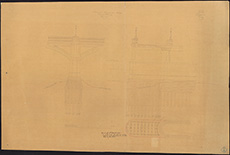 | ||
| Zoom Into Map: | Click on the map to view in greater detail. | |
| Name: | Kyle, Dennison & Frew ; Stevenson (unspecified) | |
| Description: | Glasgow. Sections & soundings of Clyde | |
| Year: | 1875-6 | |
| Place: | Glasgow | |
| County: | Lanark | |
| Subject: | River | |
| Inventory: | Series of 11 drawings and tracings | |
| Colour: | Colour | |
| Media: | Hand coloured; Ink | |
| Object: | Folded | |
| Physical: | Transparent paper/Linen/Cloth | |
| Size: | 750 mm x 2260 mm | |
| Shelfmark: | MS.5851, 66 | |
| Show location on map ? | ||
| Name: | Stevenson, Thomas, 1818-1887 | |
| Description: | Craigo. Dam & proposed alterations | |
| Year: | 1876 | |
| Place: | Craigo | |
| County: | Forfar ; Kincardine | |
| Subject: | River | |
| Inventory: | Drawing | |
| Colour: | Colour | |
| Media: | Graphite; Hand coloured; Ink | |
| Object: | Flat | |
| Physical: | Paper | |
| Size: | 544 mm x 765 mm | |
| Shelfmark: | MS.5846, 117 | |
| Show location on map ? | ||
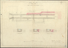 | ||
| Zoom Into Map: | Click on the map to view in greater detail. | |
| Name: | Stevenson, David, 1815-1886 ; Stevenson, Thomas, 1818-1887 | |
| Description: | Clyde, River. Limits of jurisdiction of Clyde Lighthouse Trust | |
| Year: | 1877 | |
| County: | Dunbarton ; Renfrew | |
| Subject: | River | |
| Inventory: | Print with drawings super-inscribed | |
| Colour: | Colour | |
| Media: | Hand coloured; Ink; Printed | |
| Object: | Flat | |
| Physical: | Paper/Linen/Cloth | |
| Size: | 675 mm x 1002 mm | |
| Shelfmark: | MS.5846, 73 - Adm. Ch | |
| Show location on map ? | ||
| Name: | Stevenson, David, 1815-1886 ; Stevenson, Thomas, 1818-1887 | |
| Description: | Tay, River. Tay Bridge Navigation Spans | |
| Year: | 1879 | |
| County: | Fife ; Forfar | |
| Subject: | River | |
| Inventory: | Series of 2 tracings | |
| Colour: | Colour | |
| Media: | None | |
| Object: | Folded | |
| Physical: | Oil cloth | |
| Size: | 455 x 2800 mm | |
| Shelfmark: | MS.5863, 76 | |
| Show location on map ? | ||
| Name: | Stevenson, David, 1815-1886 ; Stevenson, Thomas, 1818-1887 | |
| Description: | Tay, River. Tay Bridge Navigation Spans | |
| Year: | 1879 | |
| County: | Fife ; Forfar | |
| Subject: | River | |
| Inventory: | Series of 2 tracings | |
| Colour: | Colour | |
| Media: | None | |
| Object: | Folded | |
| Physical: | Oil cloth | |
| Size: | 435 x 2800 mm | |
| Shelfmark: | MS.5863, 77 | |
| Show location on map ? | ||
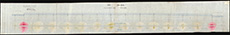 | ||
| Zoom Into Map: | Click on the map to view in greater detail. | |
| Name: | Ellis, J. H. | |
| Description: | Clyde, River. Greenock to Dumbarton | |
| Year: | 1880 | |
| Subject: | River | |
| Inventory: | Printed by Edward Weller. Two copies, one showing position of buoys | |
| Colour: | Colour | |
| Media: | Hand coloured; Printed | |
| Object: | Flat | |
| Physical: | Paper | |
| Size: | 687 mm x 1003 mm | |
| Shelfmark: | MS.5846, 59 - Adm. Ch | |
| Show location on map ? | ||
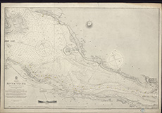 | ||
| Zoom Into Map: | Click on the map to view in greater detail. | |
| Name: | Ellis, J. H. | |
| Description: | Clyde, River. Greenock to Dumbarton | |
| Year: | 1881 | |
| Subject: | River | |
| Inventory: | Printed by Edward Weller. Two copies, one showing position of buoys | |
| Colour: | B&W | |
| Media: | Ink; Printed | |
| Object: | Flat | |
| Physical: | Paper/Linen/Cloth | |
| Size: | 645 mm x 994 mm | |
| Shelfmark: | MS.5846, 60 - Adm. Ch | |
| Show location on map ? | ||
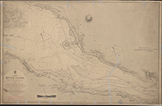 | ||
| Zoom Into Map: | Click on the map to view in greater detail. | |
| Name: | Stevenson, Thomas, 1818-1887 | |
| Description: | Craigo. Dam Dyke repairs | |
| Year: | 1881 | |
| Place: | Craigo | |
| County: | Forfar ; Kincardine | |
| Subject: | River | |
| Inventory: | Drawing | |
| Colour: | Colour | |
| Media: | Graphite; Hand coloured; Ink | |
| Object: | Flat | |
| Physical: | Transparent paper/Linen/Cloth | |
| Size: | 660 mm x 970 mm | |
| Shelfmark: | MS.5846, 118 | |
| Show location on map ? | ||
| Name: | Young, John | |
| Description: | Conon, River. Sections | |
| Year: | 1882 | |
| County: | Ross And Cromarty | |
| Subject: | River | |
| Inventory: | Print by D & D Nimmo | |
| Colour: | Colour | |
| Media: | Hand coloured; Ink | |
| Object: | Flat | |
| Physical: | Paper | |
| Size: | 525 mm x 810 mm | |
| Shelfmark: | MS.5846, 99 | |
| Show location on map ? | ||
| Name: | MacBey, Peter, 1821-1877 ; Gordon, George, 1832-1906 | |
| Description: | Conon, River. Jetty showing march stones | |
| Year: | 1882 | |
| County: | Ross And Cromarty | |
| Subject: | River | |
| Inventory: | Tracing | |
| Colour: | Colour | |
| Media: | Hand coloured; Ink | |
| Object: | Flat | |
| Physical: | Oil cloth | |
| Size: | 550 mm x 705 mm | |
| Shelfmark: | MS.5846, 100 | |
| Show location on map ? | ||
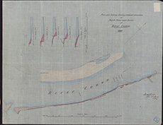 | ||
| Zoom Into Map: | Click on the map to view in greater detail. | |
| Name: | Stevenson, Thomas, 1818-1887 | |
| Description: | Moriston, River. Sketch plan & soundings of junction of river and Loch Ness | |
| Year: | 1882 | |
| County: | Inverness | |
| Subject: | River | |
| Inventory: | Drawing | |
| Colour: | Colour | |
| Media: | Graphite; Hand coloured; Ink | |
| Object: | Flat | |
| Physical: | Paper | |
| Size: | 560 mm x 780 mm | |
| Shelfmark: | MS.5856, 48 | |
| Show location on map ? | ||
 | ||
| Zoom Into Map: | Click on the map to view in greater detail. | |
| Name: | Stevenson, David, 1815-1886 ; Stevenson, Thomas, 1818-1887 | |
| Description: | Findhorn, River. Plan of river in Hogarth v. Grant case | |
| Year: | 1882 | |
| County: | Elgin | |
| Subject: | River | |
| Inventory: | Drawing | |
| Colour: | Colour | |
| Media: | Hand coloured; Ink | |
| Object: | Flat | |
| Physical: | Transparent paper/Linen/Cloth | |
| Size: | 856 mm x 730 mm | |
| Shelfmark: | MS.5850, 7 | |
| Show location on map ? | ||
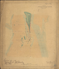 | ||
| Zoom Into Map: | Click on the map to view in greater detail. | |
| Name: | Stevenson, David, 1815-1886 ; Stevenson, Thomas, 1818-1887 | |
| Description: | Tay, River. Repairs to be made on banks of river | |
| Year: | 1882 | |
| County: | Perth | |
| Subject: | River | |
| Inventory: | Drawing | |
| Colour: | Colour | |
| Media: | None | |
| Object: | Flat | |
| Physical: | Card | |
| Size: | 680 x 1020 mm | |
| Shelfmark: | MS.5863, 78 | |
| Show location on map ? | ||
| Name: | Stevenson, David, 1815-1886 ; Stevenson, Thomas, 1818-1887 | |
| Description: | Tay, River. Soundings near Scone Park | |
| Year: | 1882 | |
| Place: | Scone Park | |
| County: | Perth | |
| Subject: | River | |
| Inventory: | Drawing | |
| Colour: | Colour | |
| Media: | None | |
| Object: | Flat | |
| Physical: | Card | |
| Size: | 685 x 1010 mm | |
| Shelfmark: | MS.5863, 79 | |
| Show location on map ? | ||
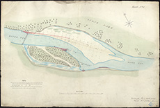 | ||
| Zoom Into Map: | Click on the map to view in greater detail. | |
| Name: | Stevenson, Thomas, 1818-1887 | |
| Description: | Findhorn, River. Moy embankments | |
| Year: | 1883 | |
| Place: | Broom of Moy | |
| County: | Elgin | |
| Subject: | River | |
| Inventory: | Drawing | |
| Colour: | Colour | |
| Media: | Hand coloured; Ink | |
| Object: | Flat | |
| Physical: | Paper | |
| Size: | 510 mm x 690 mm | |
| Shelfmark: | MS.5850, 8 | |
| Show location on map ? | ||
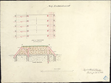 | ||
| Zoom Into Map: | Click on the map to view in greater detail. | |
| Name: | Kyle, Dennison & Frew | |
| Description: | Clyde, River. Carmyle to Gourock | |
| Year: | 1883 | |
| County: | Dunbarton ; Lanark ; Renfrew | |
| Subject: | River | |
| Inventory: | ||
| Colour: | Colour | |
| Media: | Hand coloured; Printed | |
| Object: | Folded | |
| Physical: | Paper | |
| Size: | 589 mm x 1524 mm | |
| Shelfmark: | MS.5846, 61 | |
| Show location on map ? | ||
| Description: | Clyde, River. Channels of deep water near Bishopton | |
| Year: | 1883 | |
| County: | Argyll ; Dunbarton ; Renfrew | |
| Subject: | River | |
| Inventory: | Series of two drawings | |
| Colour: | Colour | |
| Media: | Hand coloured; Ink | |
| Object: | Flat | |
| Physical: | Transparent paper/Linen/Cloth | |
| Size: | 440 mm x 510 mm | |
| Shelfmark: | MS.5846, 70 | |
| Show location on map ? | ||
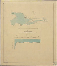 | ||
| Zoom Into Map: | Click on the map to view in greater detail. | |
| Description: | Clyde, River. Channels of deep water near Bishopton | |
| Year: | 1883 | |
| County: | Argyll ; Dunbarton ; Renfrew | |
| Subject: | River | |
| Inventory: | Series of two drawings | |
| Colour: | Colour | |
| Media: | Hand coloured; Ink | |
| Object: | Flat | |
| Physical: | Transparent paper/Linen/Cloth | |
| Size: | 432 mm x 495 mm | |
| Shelfmark: | MS.5846, 71 | |
| Show location on map ? | ||
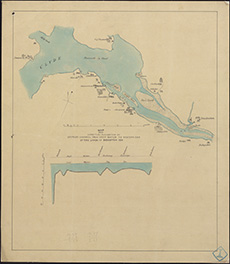 | ||
| Zoom Into Map: | Click on the map to view in greater detail. | |
| Description: | Clyde, River. Rashilee to West Ferry, showing High Water Lines of 1800 and 1884 | |
| Year: | 1884 | |
| County: | Dunbarton ; Renfrew | |
| Subject: | River | |
| Inventory: | Series of two prints by Maclure and Macdonald, Glasgow | |
| Colour: | Colour | |
| Media: | Hand coloured; Printed | |
| Object: | Folded | |
| Physical: | Paper | |
| Size: | 680 mm x 1885 mm | |
| Shelfmark: | MS.5846, 62 | |
| Show location on map ? | ||
| Name: | Stevenson, David, 1815-1886 ; Stevenson, Thomas, 1818-1887 | |
| Description: | Tweed, River. Low water spring tides | |
| Year: | 1884 | |
| County: | Berwick | |
| Subject: | River | |
| Inventory: | Traced from Ordnance Survey | |
| Colour: | Colour | |
| Media: | None | |
| Object: | Flat | |
| Physical: | Oil cloth | |
| Size: | 410 x 740 mm | |
| Shelfmark: | MS.5863, 109 | |
| Show location on map ? | ||
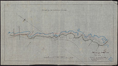 | ||
| Zoom Into Map: | Click on the map to view in greater detail. | |
| Name: | Stevenson, David, 1815-1886 ; Stevenson, Thomas, 1818-1887 | |
| Description: | Tweed, River. Tweed Commission v. Wood | |
| Year: | 1885 | |
| County: | Berwick | |
| Subject: | River | |
| Inventory: | Drawing | |
| Colour: | Colour | |
| Media: | Linen/Cloth | |
| Object: | Flat | |
| Physical: | Oil cloth | |
| Size: | 950 x 500 mm | |
| Shelfmark: | MS.5863, 110 | |
| Show location on map ? | ||
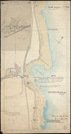 | ||
| Zoom Into Map: | Click on the map to view in greater detail. | |
| Description: | Clyde, River. Rashilee to West Ferry, showing High Water Lines of 1800 and 1885 | |
| Year: | 1885 | |
| County: | Dunbarton ; Renfrew | |
| Subject: | River | |
| Inventory: | Series of two prints by Maclure and Macdonald, Glasgow | |
| Colour: | Colour | |
| Media: | Graphite; Hand coloured; Printed | |
| Object: | Folded | |
| Physical: | Paper | |
| Size: | 685 mm x 1925 mm | |
| Shelfmark: | MS.5846, 63 | |
| Show location on map ? | ||
| Description: | Clyde, River. Firth, Kyles of Bute and Inchmarnock Water | |
| Year: | 1890 | |
| Subject: | River | |
| Inventory: | Admiralty Print | |
| Colour: | B&W | |
| Media: | Printed | |
| Object: | Folded | |
| Physical: | Paper | |
| Size: | 941 mm x 1004 mm | |
| Shelfmark: | MS.5846, 65 - Adm. Ch | |
| Show location on map ? | ||
| Description: | Conon, River. Jetty showing fishing boundary | |
| Year: | 1890 | |
| County: | Ross And Cromarty | |
| Subject: | River | |
| Inventory: | Drawing | |
| Colour: | B&W | |
| Media: | Facsimile | |
| Object: | Flat | |
| Physical: | Paper | |
| Size: | 516 mm x 910 mm | |
| Shelfmark: | MS.5846, 101 | |
| Show location on map ? | ||
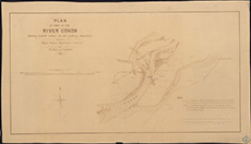 | ||
| Zoom Into Map: | Click on the map to view in greater detail. | |
| Name: | Stevenson, David, 1815-1886 ; Stevenson, Thomas, 1818-1887 | |
| Description: | Awe River. Survey plans for use in process Argyll Lochnell Campbell | |
| Year: | 1891 | |
| County: | Argyll | |
| Subject: | River | |
| Inventory: | Photostats of part of original survey plan, and of part of Ordnance Survey plans for 1870 | |
| Colour: | B&W | |
| Media: | Printed | |
| Object: | Flat | |
| Physical: | Paper | |
| Size: | 424 mm x 497 mm | |
| Shelfmark: | MS.5844, 147 | |
| Show location on map ? | ||
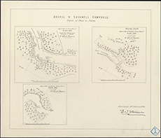 | ||
| Zoom Into Map: | Click on the map to view in greater detail. | |
| Description: | Esk, River, North. Diagram of Falls of Water Wheels and Turbines | |
| Year: | 1892 | |
| County: | Edinburgh | |
| Subject: | River | |
| Inventory: | Series of 2 drawings | |
| Colour: | Colour | |
| Media: | Hand coloured; Ink | |
| Object: | Flat | |
| Physical: | Paper | |
| Size: | 690 mm x 1025 mm | |
| Shelfmark: | MS.5849, 125 | |
| Description: | Esk, River, North. Diagram of Falls of Water Wheels and Turbines | |
| Year: | 1893 | |
| County: | Edinburgh | |
| Subject: | River | |
| Inventory: | Series of 2 drawings | |
| Colour: | Colour | |
| Media: | Graphite; Hand coloured; Ink | |
| Object: | Flat | |
| Physical: | Paper | |
| Size: | 630 mm x 995 mm | |
| Shelfmark: | MS.5849, 126 | |
| Name: | Moore, Usbourne, Captain | |
| Description: | Forth, Firth of. Fisherrow to Port Edgar | |
| Year: | 1897 | |
| County: | Edinburgh ; Fife ; West Lothian | |
| Subject: | River | |
| Inventory: | Printed | |
| Colour: | B&W | |
| Media: | Printed | |
| Object: | Folded | |
| Physical: | Paper | |
| Size: | 700 mm x 1028 mm | |
| Shelfmark: | MS.5850, 51 - Adm. Ch | |
| Show location on map ? | ||
| Name: | Stevenson, David Alan, 1854-1938 | |
| Description: | Keith. Course of river, and proposed new cut | |
| Year: | 1898 | |
| Place: | Keith | |
| County: | Banff | |
| Subject: | River | |
| Inventory: | Traced off copy | |
| Colour: | Colour | |
| Media: | Hand coloured; Photographic process | |
| Object: | Flat | |
| Physical: | Paper | |
| Size: | 335 mm x 734 mm | |
| Shelfmark: | MS.5854, 4 | |
| Show location on map ? | ||
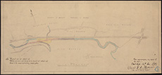 | ||
| Zoom Into Map: | Click on the map to view in greater detail. | |
| Name: | Stevenson, David Alan, 1854-1938 ; Stevenson, Charles Alexander, 1855-1950 ; Handcock & Dykes | |
| Description: | Esk, River, South. Esk Valley Power Gas | |
| Year: | 1904 | |
| County: | Berwick ; East Lothian ; Edinburgh ; Peebles ; Selkirk | |
| Subject: | River | |
| Inventory: | ||
| Colour: | B&W | |
| Media: | Printed | |
| Object: | Bound | |
| Physical: | Paper | |
| Size: | 533 mm x 764 mm | |
| Shelfmark: | MS.5849, 135 | |
| Show location on map ? | ||
| Name: | Stevenson, David Alan, 1854-1938 ; Stevenson, Charles Alexander, 1855-1950 ; Handcock & Dykes | |
| Description: | Esk, River, South. Esk Valley Power Gas | |
| Year: | 1904 | |
| County: | Edinburgh | |
| Subject: | River | |
| Inventory: | Drawing | |
| Colour: | B&W | |
| Media: | Graphite; Ink | |
| Object: | Flat | |
| Physical: | Transparent paper/Linen/Cloth | |
| Size: | 626 mm x 1037 mm | |
| Shelfmark: | MS.5849, 136 | |
| Show location on map ? | ||
| Description: | Aberdeen. Donmouth | |
| Year: | 1909 | |
| Place: | Aberdeen | |
| County: | Aberdeen | |
| Subject: | River | |
| Inventory: | Tracing for Ordnance Survey | |
| Colour: | Colour | |
| Media: | Ink | |
| Object: | Folded | |
| Physical: | Oil cloth | |
| Size: | 695 mm x 1260 mm | |
| Shelfmark: | MS.5844, 25 | |
| Show location on map ? | ||
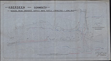 | ||
| Zoom Into Map: | Click on the map to view in greater detail. | |
| Name: | Stevenson, David Alan, 1854-1938 ; Stevenson, Charles Alexander, 1855-1950 | |
| Description: | River Ouse. Diagrams showing the influence of the tides on the occurrence of flooding in the River Ouse, 1918. D & C Stevenson. | |
| Year: | 1918 | |
| Subject: | River | |
| Colour: | Colour | |
| Media: | None | |
| Object: | Folded | |
| Physical: | Oil cloth | |
| Size: | 760 x 970 mm | |
| Shelfmark: | Acc.10706, 643 | |
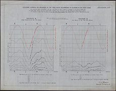 | ||
| Zoom Into Map: | Click on the map to view in greater detail. | |
| Description: | Tweed, River. Tweed fishings | |
| Year: | 1926 | |
| County: | Berwick | |
| Subject: | River | |
| Inventory: | Tracing | |
| Colour: | Colour | |
| Media: | None | |
| Object: | Flat | |
| Physical: | Oil cloth | |
| Size: | 590 x 700 mm | |
| Shelfmark: | MS.5863, 116 | |
| Show location on map ? | ||
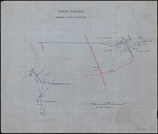 | ||
| Zoom Into Map: | Click on the map to view in greater detail. | |
| Name: | Stevenson, David Alan, 1854-1938 ; Stevenson, Charles Alexander, 1855-1950 | |
| Description: | Tweed, River. River near Cheswick sands | |
| Year: | 1926 | |
| County: | Berwick | |
| Subject: | River | |
| Inventory: | Ordnance Survey map | |
| Colour: | Colour | |
| Media: | None | |
| Object: | Flat | |
| Physical: | Card | |
| Size: | 420 x 565 mm | |
| Shelfmark: | MS.5863, 111 | |
| Show location on map ? | ||
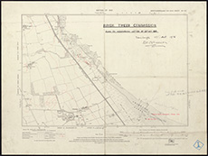 | ||
| Zoom Into Map: | Click on the map to view in greater detail. | |
| Name: | Stevenson, David Alan, 1854-1938 ; Stevenson, Charles Alexander, 1855-1950 | |
| Description: | Tweed, River. Queen Elizabeth's Pier | |
| Year: | 1926 | |
| County: | Berwick | |
| Subject: | River | |
| Inventory: | Series of 2 drawings. Note added in listing: Union Bridge, Berwicks.- see under PAXTON | |
| Colour: | Colour | |
| Media: | None | |
| Object: | Flat | |
| Physical: | Card | |
| Size: | 490 x 370 mm | |
| Shelfmark: | MS.5863, 112 | |
| Show location on map ? | ||
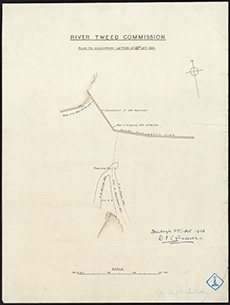 | ||
| Zoom Into Map: | Click on the map to view in greater detail. | |
| Name: | Stevenson, David Alan, 1854-1938 ; Stevenson, Charles Alexander, 1855-1950 | |
| Description: | Tweed, River. Queen Elizabeth's Pier | |
| Year: | 1926 | |
| County: | Berwick | |
| Subject: | River | |
| Inventory: | Series of 2 drawings | |
| Colour: | Colour | |
| Media: | None | |
| Object: | Flat | |
| Physical: | Oil cloth | |
| Size: | 490 x 380 mm | |
| Shelfmark: | MS.5863, 113 | |
| Show location on map ? | ||
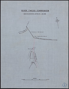 | ||
| Zoom Into Map: | Click on the map to view in greater detail. | |
| Description: | Clyde, River. Gourock to Dumbarton | |
| Year: | 1932; revised 1935, 1936 | |
| County: | Dunbarton ; Renfrew | |
| Subject: | River | |
| Inventory: | ||
| Colour: | B&W | |
| Media: | Hand coloured; Printed | |
| Object: | Flat | |
| Physical: | Paper | |
| Size: | 710 mm x 1165 mm | |
| Shelfmark: | MS.5846, 66 - Adm. Ch. | |
| Show location on map ? | ||
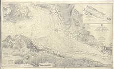 | ||
| Zoom Into Map: | Click on the map to view in greater detail. | |
| Name: | Turner, Lieut. Commander | |
| Description: | Clyde, River. Approach to River | |
| Year: | 1932 | |
| County: | Argyll ; Dunbarton ; Renfrew | |
| Subject: | River | |
| Inventory: | Photosta of Admiralty Plan | |
| Colour: | B&W | |
| Media: | Photographic process | |
| Object: | Flat | |
| Physical: | Photographic process | |
| Size: | 772 mm x 995 mm | |
| Shelfmark: | MS.5846, 67 - Adm. Ch | |
| Show location on map ? | ||
| Name: | Clyde Navigation Trust | |
| Description: | Clyde, River. Dumbarton to Glasgow | |
| Year: | 1936 | |
| Subject: | River | |
| Inventory: | Print (Admiralty) | |
| Object: | Flat | |
| Shelfmark: | MS.5846, 68 - Adm. Ch | |
| Show location on map ? | ||
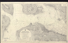 | ||
| Zoom Into Map: | Click on the map to view in greater detail. | |