Ordnance Survey - Quarter Inch to the Mile Maps of England, Scotland and Wales
4th Edition, (with National Grid). War Office Edition, GSGS 4628/4650
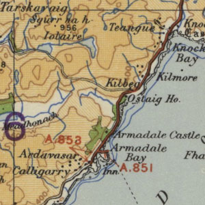
These maps at quarter inch to the mile (1:253,440) were reduced from larger-scale mapping at the half-inch and one-inch to the mile scales. These maps were substantially revised and updated from the third edition maps, particularly with new road and railway information. Their larger sheet size, allowed all of England and Wales to be covered in 12 sheets, and all of Scotland to be covered in nine sheets. The quarter-inch to the mile series provides an overview of significant landscape features, including larger settlements, railways, and roads, and were also of value for air navigation, with the location of aerodromes also shown. This military map series was issued by the War Office and carries their Geographical Section, General Staff (GSGS) numbers, 4628 and 4650. These maps are held at: Map.Area.C18(65B) for Scotland and at Map.Area.C17(67B) for England and Wales.
View other quarter-inch to the mile maps of Scotland or England and Wales.
- View the maps with a graphic index
View sheets covering England and Wales and Scotland.
England and Wales
| Sheet | Date of Revision | Revision details | Date of Publication |
|---|---|---|---|
| Sheet 2 - England, North Central | - | M521 (GSGS:4628), 6th Edition | 1958 |
| Sheet 2 - England, North Central | 1921, with later corrections | GSGS:4628, 5th Edition, War Office Edition | 1948 |
| Sheet 3 - England, North East | 1920, with later corrections | GSGS:4628, 7th Edition, Air info. Air information correct to December 1954 | 1955 |
| Sheet 3 - England, North East | 1920, with later corrections | GSGS:4628, 6th Edition, Air info. Air information correct to April 1952. Isogonals revised 1952 | 1952 |
| Sheet 3 - England, North East | 1920, with later corrections | GSGS:4628, War Office Edition | 1948 |
| Sheet 4 - North Wales & Manchester | 1919, with later corrections | GSGS:4628, 5th Edition. Isogonals revised 1951 | 1951 |
| Sheet 6 - North Midlands and Lincolnshire | 1920, with later corrections | GSGS:4628, 1st Edition | 1948 |
| Sheet 7 - South Wales | 1919, with later corrections | GSGS:4628, 6th Edition, Air info. Air information correct to April 1952. Isogonals revised 1952 | 1953 |
| Sheet 7 - South Wales | 1919, with later corrections | GSGS:4628, 5th Edition. Isogonals revised 1951 | 1951 |
| Sheet 8 - Midlands | 1915, with later corrections | GSGS:4628, 6th Edition, Air info. Air information correct to April 1952. Isogonals revised 1952 | 1952 |
| Sheet 9 - East Anglia | 1930, with later corrections | GSGS:4628, 7th Edition, Air info. Air information correct to December 1954. Isogonals revised 1952 | 1955 |
| Sheet 9 - East Anglia | 1930, with later corrections | GSGS:4628, 6th Edition, Air info. Air information correct to April 1952. Isogonals revised 1952 | 1952 |