Military Maps of Scotland (18th century)
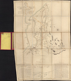
| Title: | Map of Culloden Moor and part of the adjacent country : On which are laid down the different roads leading to the field of battle ... the positions and lines of march of the ... armies. Also ancient tumuli, druidical stone circles ... / by J. Gowie. Engra |
| Name: | Gowie, J. |
| Description: | 1 map ; 683 x 456 mm |
| Original Survey: | 1845 |
| Date on Map: | 1845 |
| Placename: | Culloden |
| Parish: | Inverness, Croy, Daviot and Dunlichity |
| County: | Inverness-shire |
| Shelfmark: | EMS.b.1.21 |
| Zoom Into Map: | Click on the map to view in greater detail. |
All images © National Library of Scotland