Military Maps of Scotland (18th century)
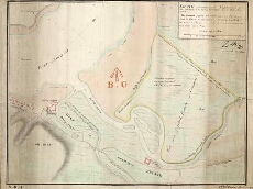
| Title: | Sketch of the Ground in the Neighbourhood of Fort William (in the Shire of Inverness) and the Point of Corpach [copy] |
| Name: | Parish, Henry W. (Draughtsman) |
| Description: | 1 manuscript map ; 349 x 455 mm., on sheet, 374 x 501 mm. |
| Original Survey: | 1782 |
| Date on Map: | 1782 |
| Placename: | Fort William |
| Parish: | Kilmonivaig, Kilmallie |
| County: | Inverness-shire |
| Shelfmark: | MS.1650 Z.46/20 |
| Zoom Into Map: | Click on the map to view in greater detail. |
All images © Crown Copyright and © National Library of Scotland