Military Maps of Scotland (18th century)
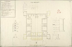
| Title: | Innersnait |
| Name: | Jelfe, Andrews (Architect) |
| Description: | 1 manuscript map ; 472 x 718 mm., on sheet, 489 x 735 mm. |
| Original Survey: | [1719] |
| Date on Map: | [1719] |
| Placename: | Inversnaid |
| Parish: | Buchanan |
| County: | Stirlingshire |
| Shelfmark: | MS.1648 Z.03/17b |
| Zoom Into Map: | Click on the map to view in greater detail. |
All images © Crown Copyright and © National Library of Scotland