Military Maps of Scotland (18th century)
| Names: | Frazer, Andrew |
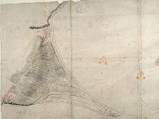
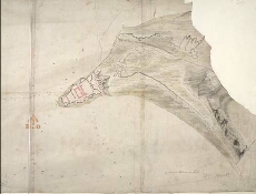
| Title: | [Map of the Moray Firth showing Ardersier Point and Fort George, and Chanonry Point, Fortrose and Rosemarkie] |
| Description: | 1 manuscript map ; 545 x 1264 mm |
| Date: | 1785 |
| Placename: | Fort George (Ardersier) / Chanonry Point, Rosemarkie |
| Parish: | Ardersier / Rosemarkie |
| County: | Inverness-shire / Ross and Cromartyshire |
| Shelfmark: | MS.1650 Z.47/21 |
| Zoom Into Map: | Click on the maps below to order image or view in greater detail. |
All images © Crown Copyright and © National Library of Scotland
Copyright Enquiries & Copies Help