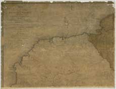
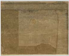
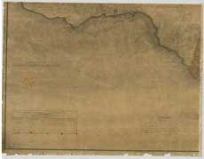
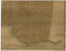
Maps of Jamaica by James Robertson, 1804
| Name: | Robertson, James, ca. 1756-1829 |
| Title: | To His Royal Highness the Prince of Wales, this map of the county of Cornwall, in the island of Jamaica, constructed from actual surveys... |
| Imprint: | London : J. Robertson, 1804. |
| Pagination: | 1 map on 4 sheets : col. ; 130 x 168 cm., sheets 65 x 84 cm. |
| Shelfmark: | EMAM.s.7 |
| Zoom Into Map: | Click on the maps below to order image or view in greater detail. |
| Notes: | View georeferenced map |
 |
 |
 |
 |
Copyright Enquiries & Copies Help