Estate Maps, 1750s-1900s
| Name: | Ordnance Survey |
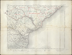
| Title: | Golspie sheet 103. Maps boundaries of shootings: Balncacoil, Sciberscross, Gordonbush, July 1918 (annotated 1 inch OS map) |
| Pagination: | 1 map ; 99 x 90 cm |
| Shelfmark: | Acc.10225/76 |
| Notes: | We are very grateful to Sutherland Estates for permission to display this map on our website. Sutherland Estate mapping home page. |
| Zoom Into Map: | Click on the map to view in greater detail. |