Estate Maps, 1750s-1900s
| Name: | Ordnance Survey |
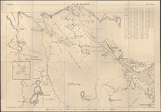
| Title: | 12 inch enlargements of OS map, 1874: 1 Slettel and Torridale |
| Pagination: | 1 map ; 61 x 87 cm |
| Shelfmark: | Acc.10225/287 |
| Notes: | We are very grateful to Sutherland Estates for permission to display this map on our website. Sutherland Estate mapping home page. |
| Zoom Into Map: | Click on the map to view in greater detail. |