Estate Maps, 1750s-1900s
| Name: | Greig, Alfred |
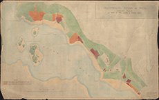
| Title: | Colintraive, Kyles of Bute, feuing plan of part of the lands of South Hall. |
| Imprint: | 1901 |
| Pagination: | 1 map; 75 x 118 cm |
| Shelfmark: | Acc.7978 |
| Zoom Into Map: | Click on the map to view in greater detail. |