Estate Maps, 1750s-1900s

| Name: | Gordon, David, 1820-1893 |
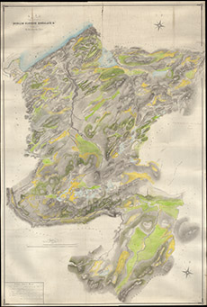
| Title: | Plan of the Lands of Borlum, Glendoe Shellach Etc the property of the Right Hon Lord Lovat 1859 |
| Imprint: | 1859 |
| Pagination: | 1 manuscript map: col.; 237 x 161 cm. |
| Shelfmark: | Lovat320 |
| Notes: | 1:6336. (80 chains = 10" ). A beautifully drawn and coloured map. Handwritten on map: Beauly 27 April 1867 Referred to in agreement of this date Lord Lovat John Jait(?). Courtesy of Lovat Highland Estates and the North of Scotland Archaeological Society. View Lovat Highland Estates mapping |
| Zoom Into Map: | Click on the map to view in greater detail. |