Estate Maps, 1750s-1900s
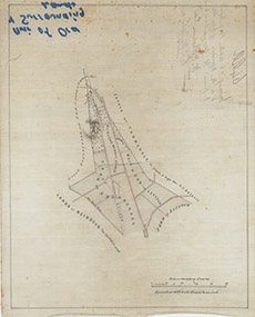

| Title: | [Muir of Ord & Surrounding Lands] |
| Imprint: | 1869 |
| Pagination: | 1 map; 32 x 39 cm. |
| Shelfmark: | Lovat271 |
| Notes: | A simple map showing the farms of Ardnagrask, Muir of Ord & Lettoch . Shows surrounding estates of Tarradale (HJ Baillie), Reindoun (The Chisholm), & Ord (T M Mackenzie). Handwritten on outside: Inverness 26th October 1869 referred to in the deposition of Scale 1:10560. (40 chains = 3" ). Courtesy of Lovat Highland Estates and the North of Scotland Archaeological Society. View Lovat Highland Estates mapping |
| Zoom Into Map: | Click on the map to view in greater detail. |