Estate Maps, 1750s-1900s
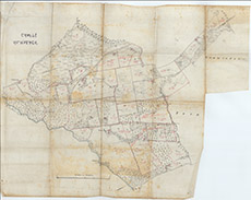

| Title: | [Kilmorack Crofts] |
| Imprint: | 1920s ? |
| Pagination: | 1 manuscript map: col.; 88 x 115 cm. |
| Shelfmark: | Lovat237 |
| Notes: | A 19th century map, showing the delineation and tenancy of the Farley (not Kilmorack) Crofts, precise date unknown. Scale 1:2568. (30 chains = 23.5 cm ). Courtesy of Lovat Highland Estates and the North of Scotland Archaeological Society. View Lovat Highland Estates mapping |
| Zoom Into Map: | Click on the map to view in greater detail. |