Estate Maps, 1750s-1900s
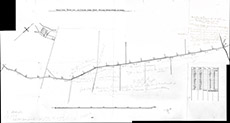

| Title: | Wester Lovat, Easter Lovat & Clunes March Ditch, showing levels every 100 yards |
| Imprint: | 1960s ? |
| Pagination: | 1 map; 40 x 74 cm. |
| Shelfmark: | Lovat227 |
| Notes: | Shows proposed boundary ditch. Much pencil overwriting Scale 1:3556. (2000' = 6.75" ). Courtesy of Lovat Highland Estates and the North of Scotland Archaeological Society. View Lovat Highland Estates mapping |
| Zoom Into Map: | Click on the map to view in greater detail. |