Estate Maps, 1750s-1900s

| Name: | Gordon, David, 1820-1893 |
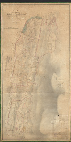
| Title: | Plan of the Lands of Kinneras and Druimnagarrachan, Cruive & Knockvuy Lying in the Parish of Kiltarlity |
| Imprint: | 1841 |
| Pagination: | 1 manuscript map: col.; 125 x 64 cm. |
| Shelfmark: | Lovat180 |
| Notes: | 1:3168. (20 chains = 5" ). Courtesy of Lovat Highland Estates and the North of Scotland Archaeological Society. View Lovat Highland Estates mapping |
| Zoom Into Map: | Click on the map to view in greater detail. |