Estate Maps, 1750s-1900s

| Name: | Boulton, John, 1830-1874 |
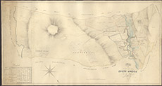
| Title: | Plan of part of the Lovat Estate in the Parish of Kiltarlity |
| Imprint: | 1832 |
| Pagination: | 1 manuscript map: col.; 64 x 120 cm. |
| Shelfmark: | Lovat116 |
| Notes: | Plan of the settlements along Glen Convinth, including Ardendrain, Balantore and Dularich Scale 1:3168. (4 chains = 1" ). Courtesy of Lovat Highland Estates and the North of Scotland Archaeological Society. View Lovat Highland Estates mapping |
| Zoom Into Map: | Click on the map to view in greater detail. |