Estate Maps, 1750s-1900s
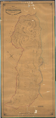

| Title: | Plan of the Lands of Inchnacardoch including Portclair and Auchterawe |
| Imprint: | 1910s ? |
| Pagination: | 1 map: col.; 182 x 86 cm. |
| Shelfmark: | Lovat007 |
| Notes: | A large undated, un-signed map Scale 1:10560. (40 chains = 3" ). Courtesy of Lovat Highland Estates and the North of Scotland Archaeological Society. View Lovat Highland Estates mapping. |
| Zoom Into Map: | Click on the map to view in greater detail. |