Estate Maps, 1750s-1900s
| Name: | Gordon, David, 1820-1893 |
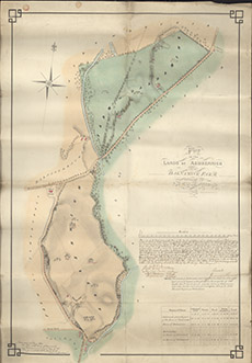
| Title: | Plan of the Lands of Ardrennich and of Dalnamine Farm, situated in parish of Kiltarlity 1852 |
| Imprint: | 1963 |
| Pagination: | 1 map: col.; 73 x 50 cm. |
| Shelfmark: | Belladrum07 |
| Notes: | (20 chains = 7 cm ). Courtesy of the North of Scotland Archaeological Society and Belladrum Estate. |
| Zoom Into Map: | Click on the map to view in greater detail. |