Estate Maps, 1772-1878
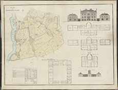
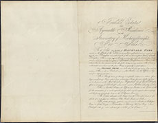
| Title: | Danevale Estate, Crossmichael: Sale Plan Reverse side of map included for information. |
| Imprint: | c. 1834 |
| Pagination: | 1 manuscript map: col.; 62 x 80 cm.; 1 manuscript; 62 x 80 cm. |
| Shelfmark: | GGD631/1 |
| Notes: | Courtesy of Ewart Library through the Dumfries Archival Mapping Project |
| Zoom Into Map: | Click on the maps below to order images or view in greater detail. |
 |
 |