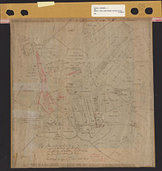
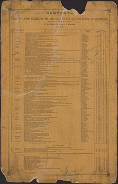
Estate Maps, 1772-1878
| Title: | A Plan of the Lands belonging to and held in feu of the Burgh of Dumfries Contents of a Plan of Lands belonging to and held in feu of the Burgh of Dumfries |
| Imprint: | 1837 |
| Pagination: | 1 manuscript map: col.; 45 x 43 cm.; 1 manuscript; 60 x 38 cm. |
| Shelfmark: | MP197a; MP197b |
| Notes: | Courtesy of Ewart Library through the Dumfries Archival Mapping Project |
| Zoom Into Map: | Click on the maps below to order images or view in greater detail. |
 |
 |