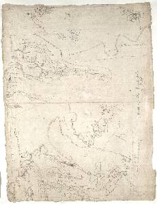
| Notes: | This is the front of the manuscript called Pont 4. Six small maps, known as Pont 4(1) to Pont 4(6) occur on it. The back of the sheet contains a seventh map, Pont 4(7). Pont 4(1) covers an area to the south west of Loch Broom, including Little Loch Broom, Gruinard Bay, Loch na Sealga (meaning 'Loch of the Hunting'), and the valley of the River Lael. Pont 4(2) focuses on L: Carron (Loch Carron) and Glen Carron. Pont 4(3) is a small map of the coast between L. Eu (Loch Ewe) and Loch Torridon. Pont 4(4) contains profiles of several mountains between Loch Torridon and Loch Maree, probably drawn by Pont from their north side. These include Bin cherkyrr (Beinn a' Chearcaill), Bin Eoin (Beinn an E~in), and Bin Wreck (Beinn Bhreac). Pont 4(5) and Pont 4(6) are two small maps of the islands in Loch Maree as indicated by Pont's names yl: Mulruy and y. Mulray (Isle Maree). These islands, situated north of alladale, include Eilean Súbhainn.This very rough sketch map shows mountain profiles of Ben Hee (Bin Hyie) and Carn Dearg (Bin dyrach), as well as the valleys of Glen Golly (Glenghelduy) and Strath More (Vrredell). Pont 4(1) The omission of Cape Wrath probably indicates Pont's limited first-hand experience of the area. However, Pont was not alone in having problems mapping this stretch of coastline. For example, the famous map-maker Mercator had merged Faraid Head with Cape Wrath in his map of Scotia (1564). Joan Blaeu later omitted Cape Wrath from his map Extima Scotiae (1654).
- No other Pont map includes this area.
- The area is included in Robert Gordon's manuscript sheets 2 and 3.
- Joan Blaeu's printed map of Extima Scotiae covers this area, and a small part of his Strath-Navernia is also relevant.
- Pont accurately locates five settlements on the shores of Little Loch Broom and Gruinard Bay: Inchinna (Inchina); Grunord (Gruinard); Mungastell (Mungasdale); Badlonochrach (Balluchrach); and Dyvrynamuck (Durnamuck).
Pont 4(2) - The church at Heglish L: Carron (Loch Carron) (centre) is depicted by one of Pont's typical symbols.
- Eilean Donnan Castle is drawn on the shore of Loch Duich just south of Glen Elchegg (Glen Elchaig). This impressive fortification may have originated as a royal stronghold in the 13th century, possibly as a defence against the last of the Viking incursions. However, the massive tower shown by Pont was probably built by a MacKenzie chief a century later. The castle was blown up during an abortive Jacobite invasion in 1719, and extensively rebuilt between 1913 and 1932.
Pont 4(5) & 4(6) - Neither map marks the chapel dedicated to St Maelrubha (of Applecross) who gave his name to the island and loch.
- Stone (1989) interprets these maps as 'concrete evidence that Pont was recording in great detail, and therefore not from verbal sources'.
View the Pont Maps website. View maps by Blaeu and Robert and James Gordon. |