County maps, 1580s-1950s
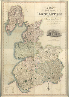
| Name: | Hennet, G. Bingley, Jas. (James) |
| Title: | A map of the County Palatine of Lancaster ... from an accurate survey in the years 1828 and 1829 |
| Imprint: | London : H. Teesdale & Co., 1830 |
| Pagination: | 1 map ; 1528 x 1031 mm. |
| Shelfmark: | EME.b.3.1 |
| Notes: | Scale: 1 1/4 miles to an inch. View georeferenced map. |
| Zoom Into Map: | Click on the map to view in greater detail. |