Town Plans / Views, 1580s-1940s
| Name: | Wood, John, ca. 1780-1847 |
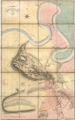
| Title: | Plan of the Town of Stirling from actual survey. |
| Imprint: | Edinburgh : T. Brown, 1820. |
| Pagination: | 1 map : col.; 1044 x 650 mm. |
| Shelfmark: | EMS.b.1.71 |
| Zoom Into Map: | Click on the map to view in greater detail. |
| Notes: | This map shows the jurisdiction of land covered by the Stirling Waterways Act. An uncoloured version of Wood's map of Stirling also exists. |