Ordnance Survey large scale Scottish town plans, 1847-1895

Town Plan of Kirkcaldy       Surveyed: 1894     Scale: 1:500     26 map sheets

View individual sheets using a zoomable map or
Click the graphic index below to view each sheet

You may also view this town plan as a georeferenced overlay on top of modern satellite imagery.
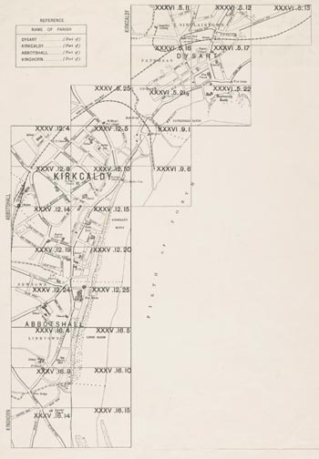
Map

Background Information     Sheet Details     Symbols     Abbreviations

XXXV.8.25 XXXV.12.4 XXXV.12.5 XXXV.12.9 XXXV.12.10 XXXV.12.14 XXXV.12.15 XXXV.12.19 XXXV.12.20 XXXV.12.24 XXXV.12.25 XXXV.16.4 XXXV.16.5 XXXV.16.9 XXXV.16.10 XXXV.16.14 XXXV.16.15 XXXVI.5.11 XXXVI.5.12 XXXVI.5.13 XXXVI.5.16 XXXVI.5.17 XXXVI.5.21 XXXVI.5.22 XXXVI.9.1 XXXVI.9.6