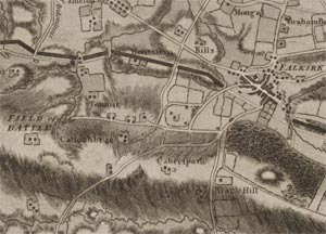
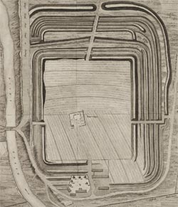
William Roy - Military Antiquities of the Romans in North Britain, 1793
Roman conquests of Scotland and William Roy
Roman conquests of Scotland
About 35 years after the invasion of Britain under the Emperor Claudius in AD 43, Gnaeus Julius Agricola assumed the governorship, and advanced into Scotland with an army of four legions, numbering over 20,000 men. His two likely routes through southern Scotland, a westerly route through Annandale and Clydesdale and an easterly route through the Cheviots, were both supported by Roy's discoveries of temporary camps along these routes. Agricola's third season moved further north to the Tay, and perhaps involved the construction of a chain of 'glen-blocking' forts, such as Dalginross, Fendoch, Cardean, Inverquharity, and Stracathro. Behind these was a second line of forts along the route from Camelon to Doune, then turning north to Bertha on the Tay and on to Cargill. A much larger legionary fortress was built at Inchtuthil in the late first century (mapped in detail by Roy - Plate XVIII) but abandoned before its completion. By AD 83, Agricola conquered tribes as far north as the Highland Line with a victory at Mons Graupius, before tactically retreating.

The Emperor Hadrian visited Britain in AD 122, and is chiefly remembered today for authorising the construction of a stone wall, some 80 miles long, from the Tyne to the Solway. However, within months of the death of Hadrian in AD 138, southern Scotland as far north as the Tay was conquered again, under the Emperorship of Antoninus Pius, and Hadrian's Wall was abandoned for a new frontier. This new frontier, the Antonine Wall, was a turf rampart on a stone base, following good high ground between the Forth and Clyde estuaries. The finest map in the Military Antiquities... is the one of the entire Antonine Wall (Plate XXXV), together with detailed plans of individual forts. (The Antonine Wall is referred to in the Military Antiquities... as 'Grime's Dyke' or 'Graham's Dyke', after Robert Graham who was credited with overrunning it, c. AD 500). An uprising on the northern side of the wall brought the Antonine occupation to an abrupt end in AD 158.
The final major, but brief, invasion of Scotland took place between AD 208 and AD 212, when the armies of Septimus Severus reconquered southern Scotland as far north as the Tay, and occupied sites including Cramond and Carpow. Severus died in 211 at York, and thereafter the Romans withdrew to the Hadrianic frontier, until their withdrawal from Britain in the 4th century.
William Roy
William Roy (1726-1790) was born near Carluke, the son of an estate factor. Although he is better known today for his work on the Military Survey of Scotland (1747-1755), and as the founder of what became the Ordnance Survey of Great Britain, he had a long-term scholarly and personal interest in Roman antiquities. Whilst leading teams of engineers during the Military Survey, he was able to map several Roman sites in southern Scotland (view full list), and in 1755 he compiled a detailed survey and map of the Antonine Wall at a scale of 1:36,000 (Plate XXXV).

Following his active service in Germany during the Seven Years War (1756-63), his interest in Scottish antiquities was rekindled by the discovery of the Agricolan marching camp at Cleghorn in 1764. In 1765 he was appointed to a new post of surveyor-general of the coasts and engineer for making and directing military surveys in Great Britain, which involved considerable travel in Britain and beyond. However, in occasional off-duty visits to Scotland over the next decade, probably also visiting his mother in Lanark, he was able to reconnoitre further marching camps in southern Scotland, including the identification of Trimontium by the Eildon Hills.
By the early 1770s, Roy was able to compile his material on antiquities together, and in 1773 he published his Map of Roman Scotland (Plate I), showing all the sites known to him. However, this was the only map from the Military Antiquities... published in Roy's lifetime. The growing strife in the British colonies in North America, particularly from 1775, absorbed Roy's professional attentions, and when peace was signed in 1783, geodesy and foundation of a national survey were to become higher priorities for him. It was not until after his death in July 1790, that the Society of Antiquaries (to which Roy was elected a fellow in 1776) were bequeathed a manuscript copy of Roy's Military Antiquities..., with the rights to publish it if they so wished.
Further information:
- Introduction
- Roman conquests of Scotland and William Roy
- Plans, chronology of surveying, and publication
