Estate Maps, 1750s-1900s

| Name: | Brown, John, fl. 1803-1832 |
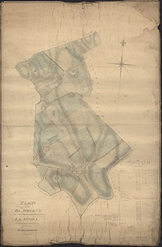
| Title: | Plan of the Lands of Blackerne in the Parish of Cross Michael and of Leaths in the Parish of Buittle |
| Imprint: | July 1814 |
| Pagination: | 1 manuscript map : col.; 114 x 75 cm. |
| Shelfmark: | 146 |
| Notes: | Courtesy of Kirkcudbright Museum through the Dumfries Archival Mapping Project - view futher details. View georeferenced map. |
| Zoom Into Map: | Click on the map to view in greater detail. |