Estate Maps, 1750s-1900s

| Name: | Lewars, John, 1769-1826 |
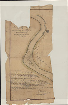
| Title: | Plan of the River Nith by John Lewars (flat map) |
| Imprint: | 1808 |
| Pagination: | 1 manuscript map : col.; 38 x 19 cm. |
| Shelfmark: | Map/B/1/16 |
| Notes: | Courtesy of Dumfries Museum through the Dumfries Archival Mapping Project - view futher details. |
| Zoom Into Map: | Click on the map to view in greater detail. |