Estate Maps, 1750s-1900s

| Name: | (Crawford, William?) |
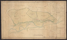
| Title: | Plan of the farm of Watscales in the Parish of Hutton |
| Imprint: | 1821 |
| Pagination: | 1 manuscript map : col.; 29 x 48 cm. |
| Shelfmark: | RHP37764 |
| Notes: | Courtesy of Buccleuch Estates through the Dumfries Archival Mapping Project - view futher details. |
| Zoom Into Map: | Click on the map to view in greater detail. |