Town Plans / Views, 1580s-1940s
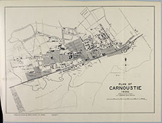
| Name: | Anderson, A. F. (Burgh Surveyor) |
| Title: | Plan of Carnoustie, 1930. |
| Imprint: | [Dundee : Burns & Harris Ltd., 1930] |
| Pagination: | 1 map; 332 x 252 mm. |
| Shelfmark: | Y.54 |
| Zoom Into Map: | Click on the map to view in greater detail. |